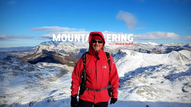
From the Diary of Braco Babić:
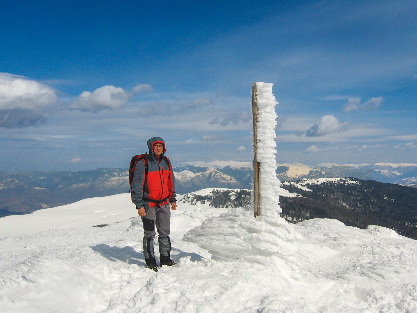
The journey and expedition to the Himalayan summit of Mera Peak (6476 m a.s.l.) in Nepal took place from October 12th to November 4th, 2009.
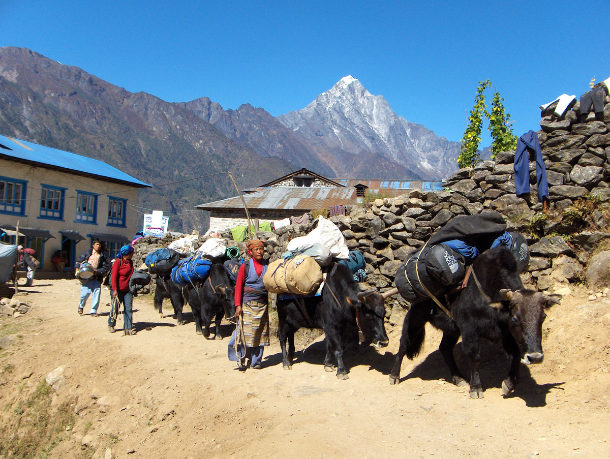
What drew us to Mera Peak was the fact that this is not a standard, mass-frequented route. Unlike the common treks leading toward Everest Base Camp or the summits of Kala Patthar and Island Peak—where numerous lodges line the path and supplies are handled by yaks—our choice was significantly more demanding.
In our case, the load is carried exclusively by the expedition participants with the help of porters (Sherpas). Our ascent was organized in a true expedition style, which implies using tents and mobile kitchens, and carrying all necessary equipment for self-sufficient survival in the wilderness.
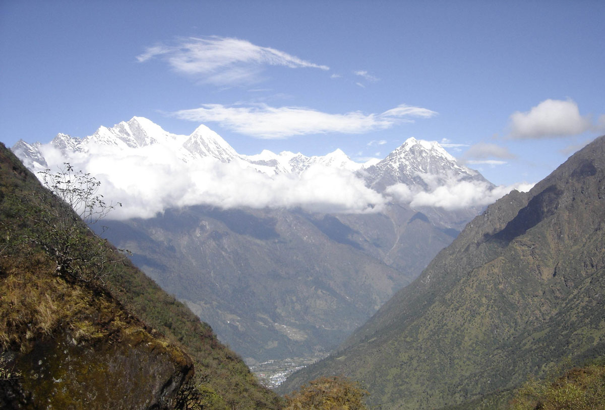
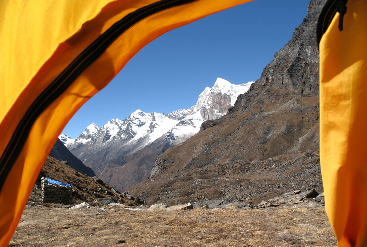
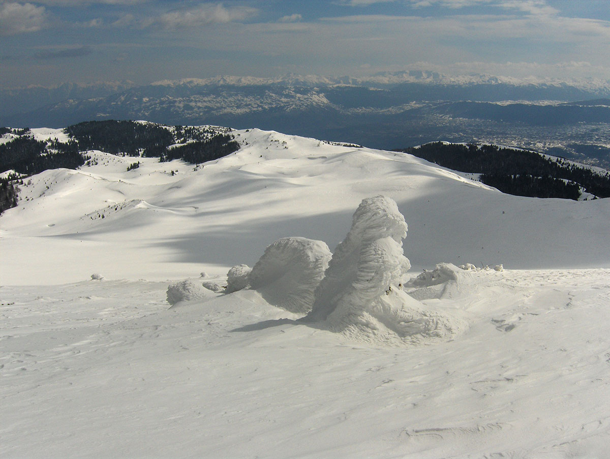
From the highest crest of Mera Peak, a view opens up to five of the world’s fourteen “eight-thousanders”: Mount Everest (8848 m a.s.l.), Kangchenjunga (8586 m a.s.l.), Lhotse (8516 m a.s.l.), Makalu (8485 m a.s.l.), and Cho Oyu (8201 m a.s.l.).
Text and Photography by: Braco Babić
My long-held desire to visit the Kingdom of Nepal and trek through the world’s greatest mountain range—the Himalayas—became a reality quite unexpectedly. Shortly after returning from Turkey and summiting Ararat (5137 m a.s.l.) on August 30, 2009, I arrived home in Sarajevo and immediately applied for the expedition to Mera Peak (6476 m a.s.l.).
Joining me from Bosnia and Herzegovina were four fellow mountaineers: Jovo Elčić, Bobana Petrović, Redžep Grabus, and Sanja Mitrović.
The expedition was organized by the “Extreme Summit Team” (EST) from Belgrade. In recent years, EST has sparked a true renaissance in regional mountaineering, leading many climbers from BiH to world-renowned peaks such as Island Peak (6189 m a.s.l.), Ama Dablam (6856 m a.s.l.), Aconcagua (6962 m a.s.l.), Cho Oyu (8201 m a.s.l.), Manaslu (8163 m a.s.l.), and Mount Everest (8848 m a.s.l.).
The Path Less Traveled
What drew us to Mera Peak was the departure from the standard, mass-market trekking rutes. Unlike the popular trails toward Everest Base Camp, Kala Patthar, or Island Peak—where hikers stay in lodges and yaks transport supplies—our route was significantly more demanding.
We operated in expedition style: we slept in tents, managed our own mobile kitchen, and relied on the strength of the participants and our Sherpa porters rather than pack animals. While the classic ascent from the north side is primarily a high-altitude glacier trek, the southern and western approaches are technically much more challenging.
The Mystery of the Summit Height
An interesting detail for any cartography enthusiast is the discrepancy in official measurements for Mera Peak. According to the Nepal Mountaineering Association (NMA), it is the highest peak classified for trekking.
On our official climbing permit and the “Makalu-Barun National Park” map, the elevation is listed as 6654 m a.s.l. * However, on the maps we purchased in Kathmandu, the height is noted as 6476 m a.s.l.
Historical Legacy
The first successful ascent of Mera Peak took place on May 20, 1953, by Colonel Jimmy Roberts and Sen Tenzing. The region was first explored in the early 1950s by legendary British expeditions—the same pioneers who reconnoitered Mount Everest—including Edmund Hillary, Eric Shipton, and George Lowe.
October 12, 2009: Sarajevo – Beograd – London – Delhi
Our journey began in the early morning hours, departing Sarajevo at 04:00 AM for Beograd. By noon, we arrived at the “Nikola Tesla” Airport in Surčin, where we joined the rest of the expedition team.
The full team consisted of: Miloš Ivačković (Expedition Leader), Aleksandar Spasić and Sandra Božić (Beograd), Milan Kurilić and Dragan Malinović (Novi Sad), The five of us from Bosnia and Herzegovina.
In total, there were ten of us who would spend the next 24 days together in far-off Nepal. “Far-off” is perhaps an understatement—as we soon realized just how long the journey truly is. Since there are no direct flights from Europe to Kathmandu, our route took us from Beograd to London (a 3-hour flight), where we boarded our connecting flight to Delhi.
October 13, 2009: Delhi – Kathmandu
After a 12-hour flight, we arrived in Delhi at 06:00 AM. We spent the next six hours in the transit lounge waiting for our connection. The three-hour flight from Delhi to Kathmandu passed quickly, thanks to a bird’s-eye view of the Indian landscape—crisscrossed by mighty rivers and endless green fields—eventually giving way to the snow-capped peaks of the Himalayas.
With great anticipation, we waited to land in the land of the snow leopard, the mysterious Yeti, the red panda, yaks, and the legendary Sherpas, just as the travel guides describe.
Upon arrival in Kathmandu, we were greeted by sweltering heat and long queues for passport control and visas. Despite the exhaustion of the long journey, everyone was in high spirits. We laughed at Redžep’s joke regarding the intricate wood carvings decorating the airport interior: “I guarantee the craftsmen from Konjic carved this!” (referring to the famous woodcarving tradition in Bosnia).
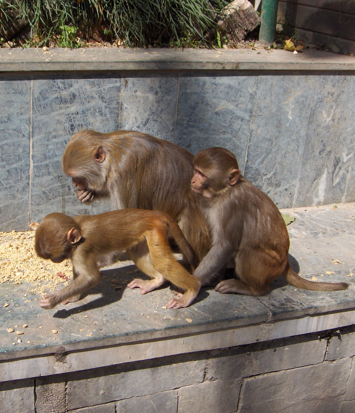
A thirty-minute minibus ride took us from the airport to Hotel Vajra. High walls and lush green vegetation hide the hotel from the outside world; monkeys jump from branch to branch in the hotel park as if in a real jungle. The main building and its annexes are constructed of red brick and carved wood, giving the entire estate the appearance of an old castle. We reached our rooms via stairs, huffing and puffing under the weight of heavy backpacks and transport bags, as the hotel has no elevator.
The Pulse of the Capital
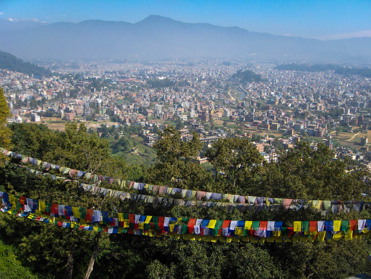
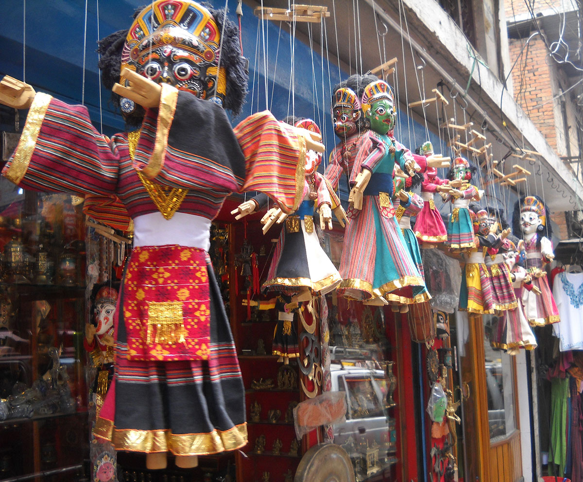
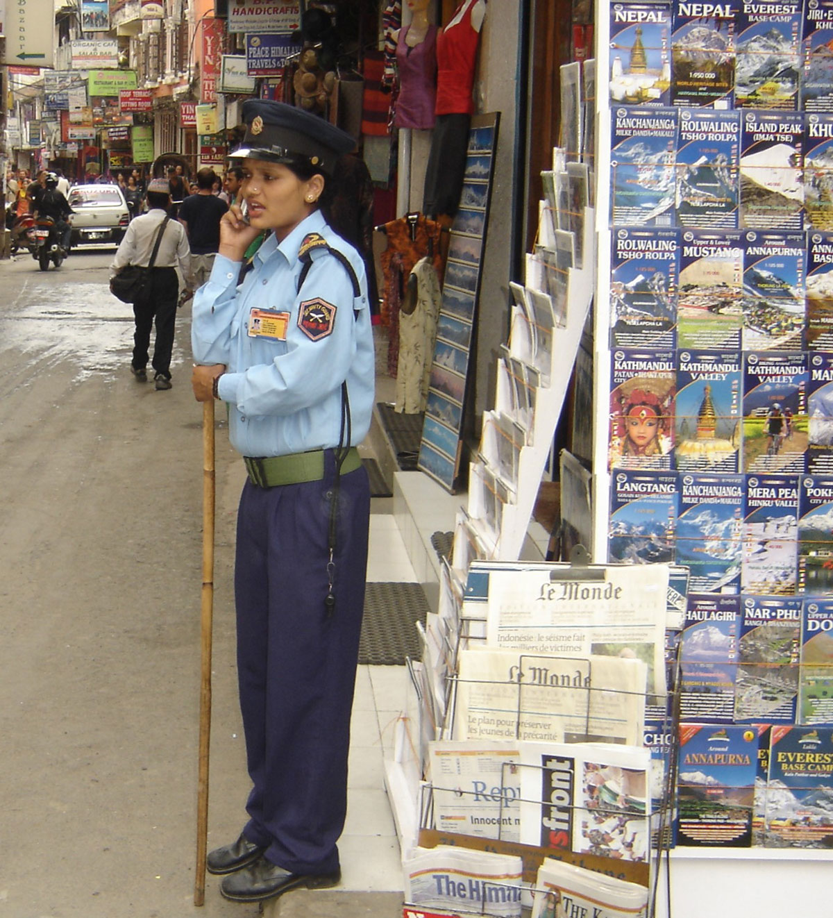
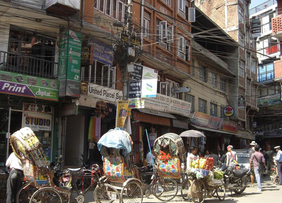
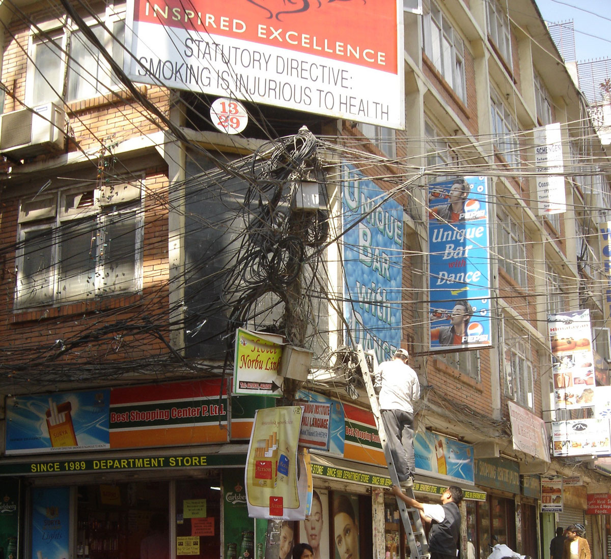
We set out to explore Kathmandu late in the afternoon. Founded in the 13th century, the capital of the Kingdom of Nepal sits at 1300 m a.s.l. in the center of a fertile valley at the confluence of the Baghmati and Bishanmati rivers. Since the 1970s, it has been a major hub for tourism and a pilgrimage center for Hindus and Buddhists. With nearly one million residents (double that including the suburbs), it unfortunately sits on the list of the ten most polluted cities in the world.
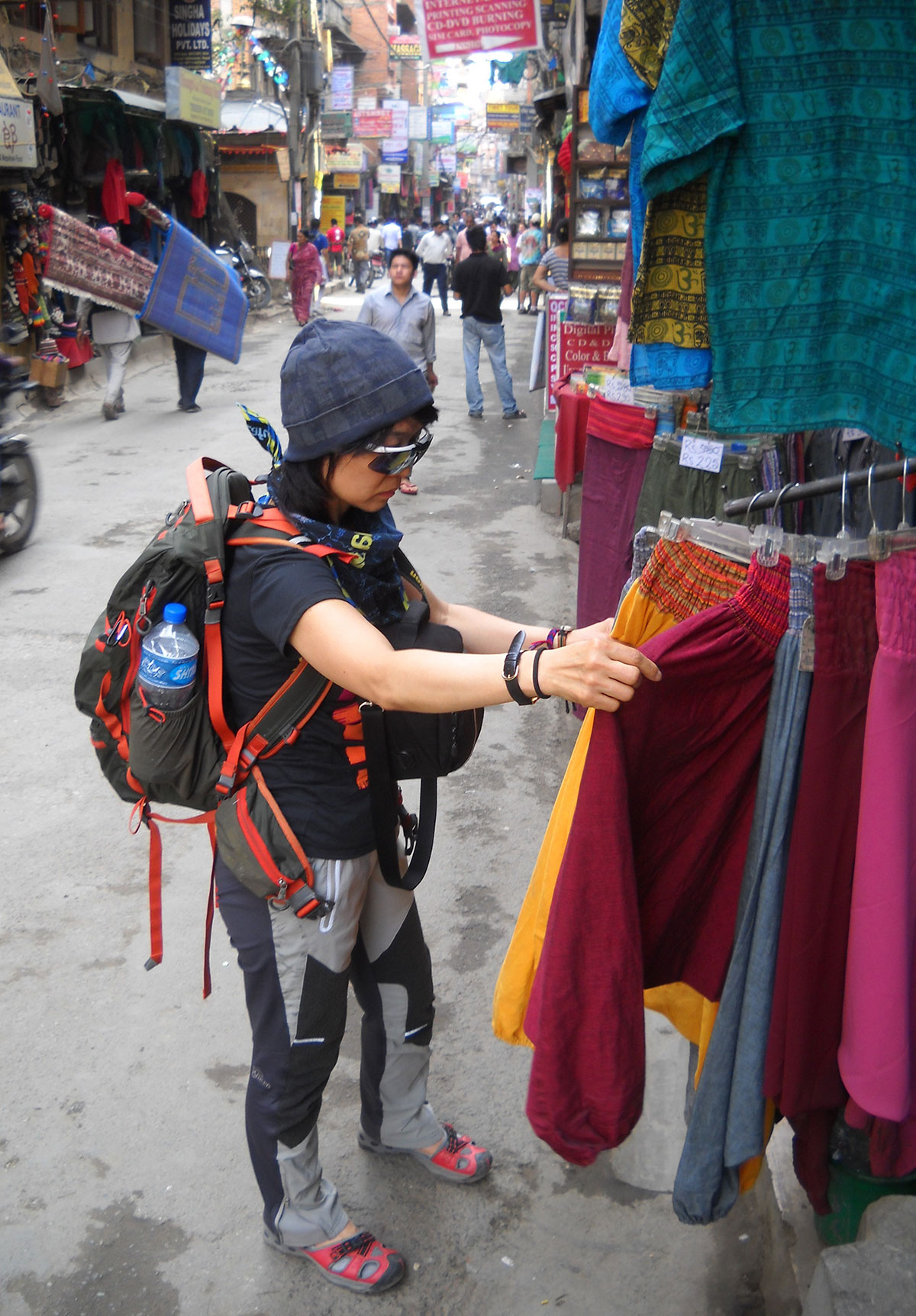
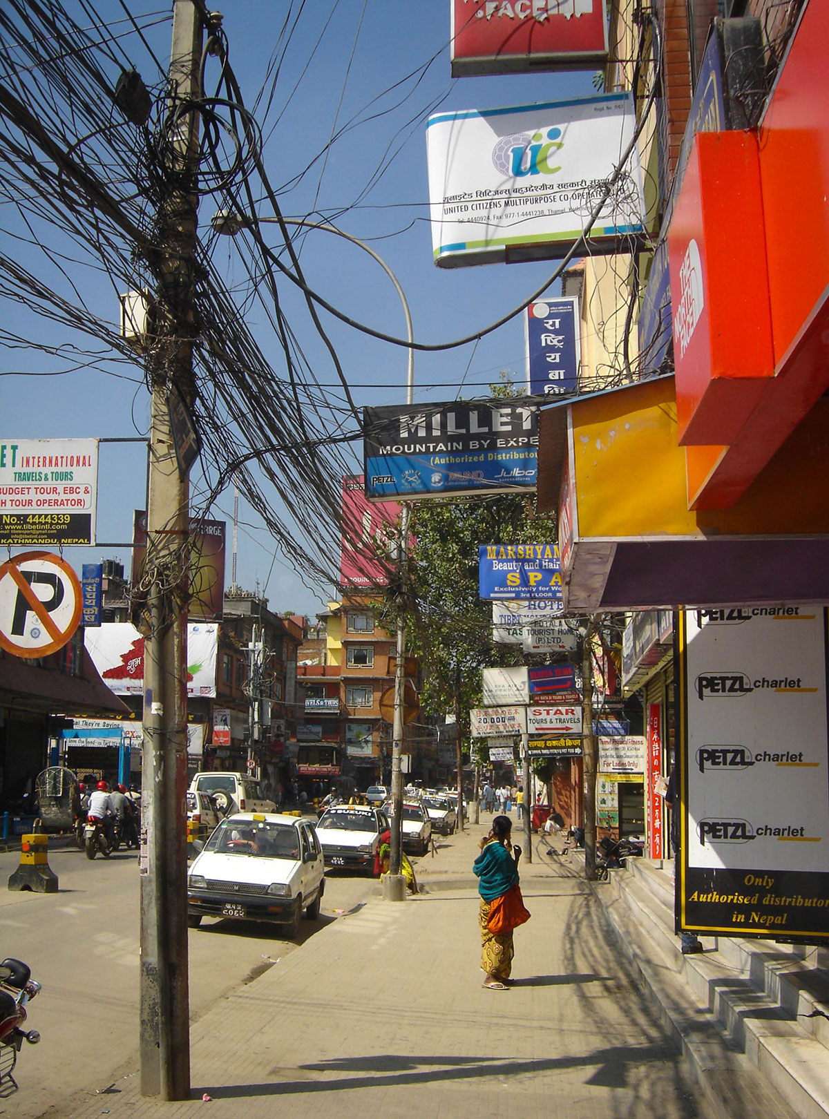
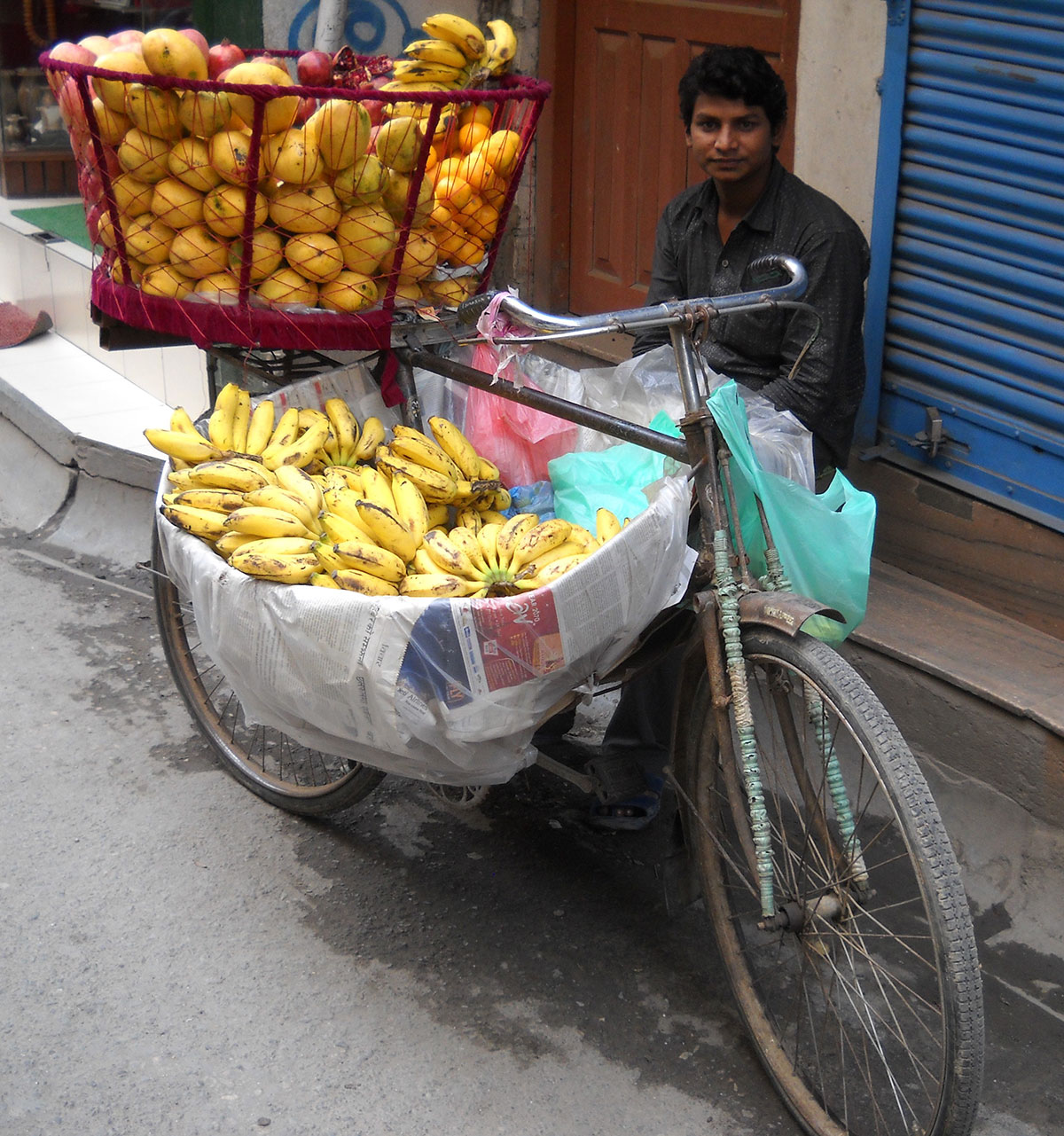
We reached Thamel, the popular tourist and commercial district, via dusty streets cluttered with piles of trash. The streets have no sidewalks, so pedestrians move alongside cars, motorcycles, cyclists, and rickshaws in a chaotic flow of traffic from both directions. To avoid being hit, our reflexes had to be as sharp as a cat’s. Surprisingly, despite the chaos, there were no accidents; everyone—drivers and pedestrians alike—was smiling, with no signs of anger or quarreling.
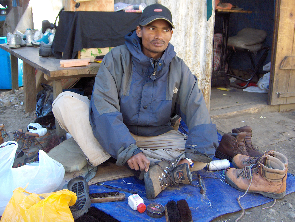
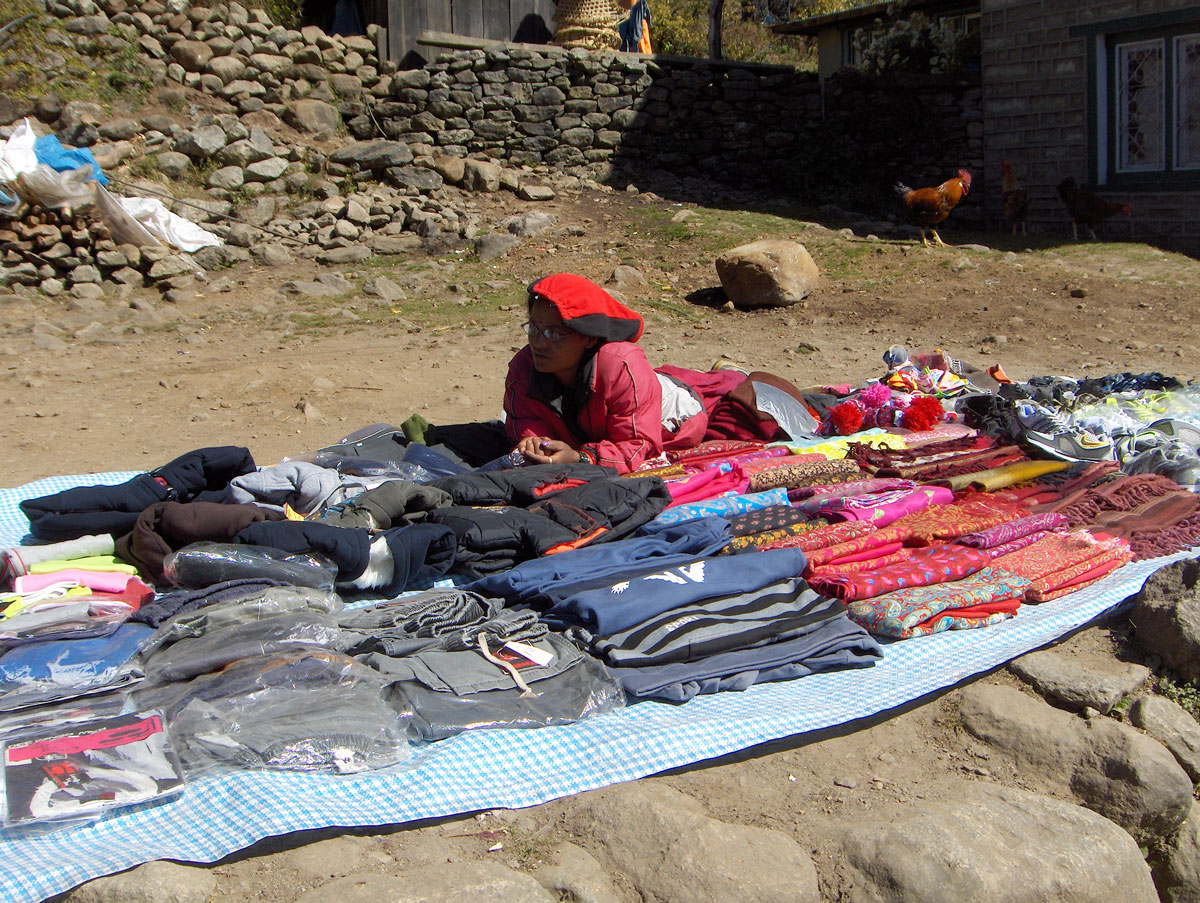
With Miloš, who had visited Kathmandu several times before, we toured the mountaineering and alpinism equipment shops. The selection is massive, ranging from stores selling original global brands to shops with skillfully made local copies. The prices for originals are the same as in Europe with no room for bargaining, whereas the prices for the “knock-offs” can be negotiated significantly. This first tour was purely informational; we saved the serious shopping for tomorrow.
A Birthday in the Dark
We had dinner at “Helena’s,” a restaurant in the heart of Thamel located in a building that towers over the rest of the city. We ate in the rooftop garden, which offers a wide selection of both national and European dishes.
In the middle of dinner, the power went out. The fairytale image of the city, illuminated by thousands of colorful lights, instantly vanished into darkness. Kathmandu has long suffered from electricity and water shortages, with sudden, unannounced reductions. The staff didn't miss a beat, quickly firing up the restaurant’s generator.
During dinner, I received a birthday message from my wife. I must admit, celebrating a birthday in the middle of Kathmandu isn't a cheap affair when it comes to treating your friends, but it’s a rare occasion that deserves a proper celebration!
Back at the hotel, we went to bed early, exhausted by the travel and the sensory overload of the shops. By morning, we finally understood why the local dogs spend the entire day napping in the sun on the streets: they didn't close their mouths all night, barking incessantly until dawn.
October 14, 2009: Kathmandu
We spent the day purchasing the final pieces of mountaineering equipment we were missing. Upon returning to the hotel in the evening, we were occupied with packing until the late hours. The weight of our transport bags had to be limited to 20 kg, while our backpacks were kept to 10 kg. We double-checked the weight on the hotel scale to ensure we met the strict baggage allowance for the flight to Lukla. Anything unnecessary for the expedition was stored in the hotel's luggage room for safekeeping until our return.
October 15, 2009: Kathmandu – Lukla
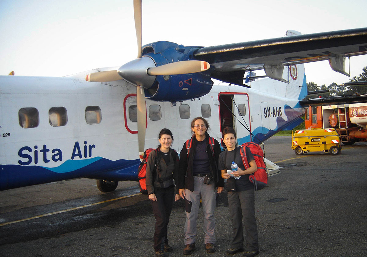
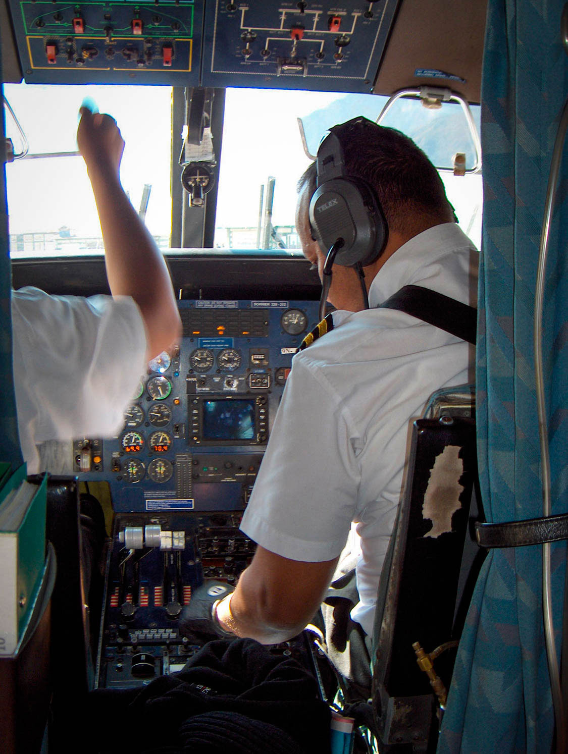
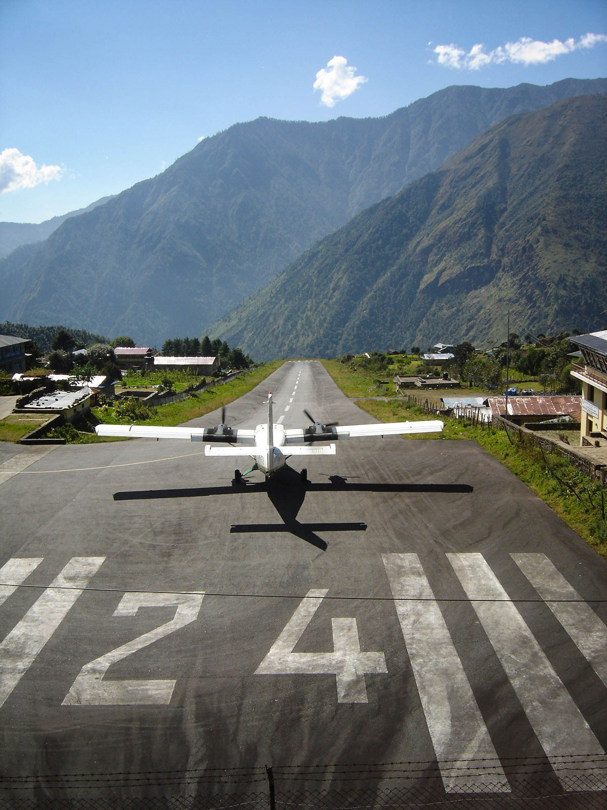
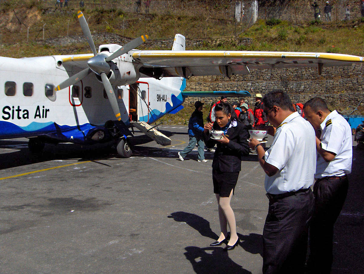
Finally, today we depart for the Himalayas. We rose at 04:00 AM to beat the infamous traffic and reach the airport without delay. At the domestic terminal, we struggled through the crowds, heavily burdened by our expedition gear. After a smooth weigh-in and check-in process, we boarded our flight to Lukla. The aircraft is small, carrying only 15 passengers and 3 crew members. Before takeoff, the flight attendant handed out cotton earplugs and candy, though neither helped much against the deafening roar of the engines.
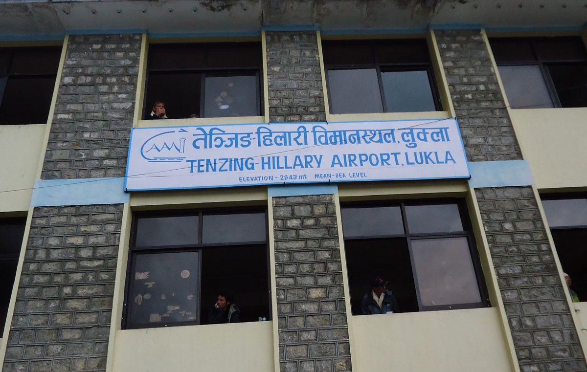
Many stories exist about the flight to Lukla, having long since become part of Himalayan legend. The short runway, only 457 m long and slightly sloped, is tucked between two mountain peaks. It requires pilots to have specialized training: you land “uphill” toward a vertical rock wall and take off “downhill” directly into a deep gorge. Because of this, the “Tenzing-Hillary” Airport (renamed in 2008 after the first conquerors of Mount Everest) is considered the most dangerous airport in the world. A clear morning guaranteed us a magnificent aerial view of the Himalayan giants before landing safely at 07:00 AM.
Life in the “Gateway to the Himalayas”
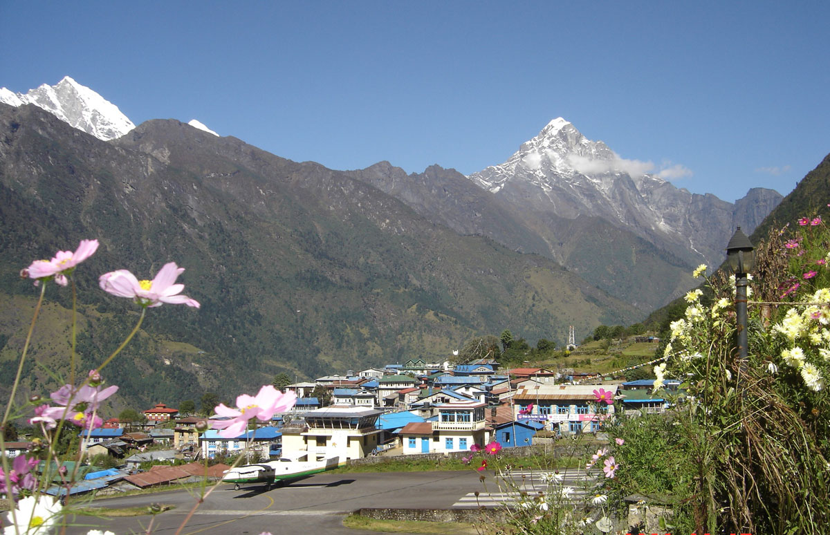
We settled into the “Paradise Lodge,” located right next to the air traffic control tower. Lukla (2843 m a.s.l.) sits east of Kathmandu, consisting of about a hundred stone houses on a narrow plateau. Until 1977, this was a remote outpost, ten days’ walk from the nearest transport. The airport's construction, driven by the initiative of Edmund Hillary and Tenzing Norgay, brought a prosperity that continues today.
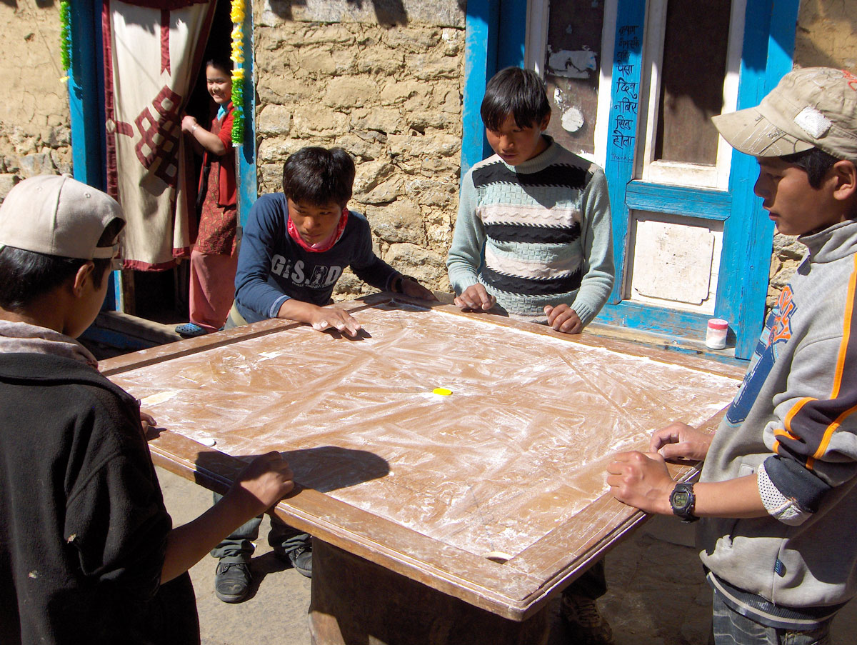
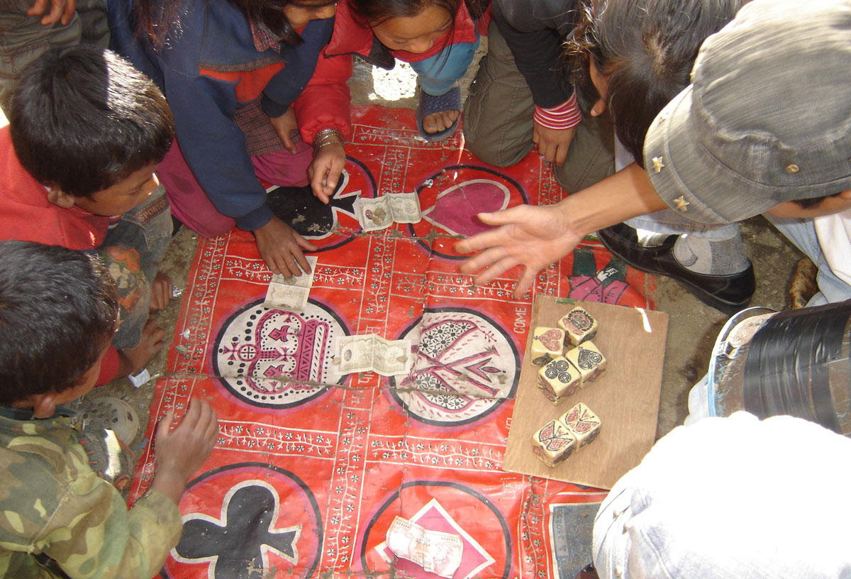
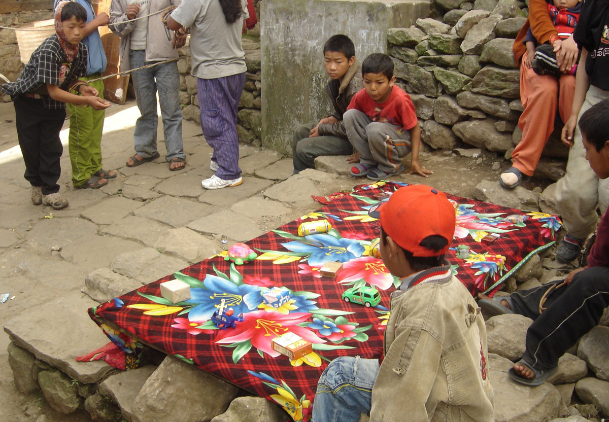
The main street of Lukla hums like a beehive. Porters, loaded livestock, tourists, Buddhist monks, and street musicians all converge here. A unique sight is the outdoor gambling tables where people play a Nepalese version of “barbut” with incredible passion—everyone participates, from the elderly to young children. While the shops offer goods from all over the world, there are few buyers, as most people stock up in Kathmandu where prices are significantly lower.
The Crossroads
Two major paths diverge from Lukla:
- The first leads to Namche Bazar and toward Everest Base Camp.
- The second leads over the Zatrwa La pass toward our objective—Mera Peak.
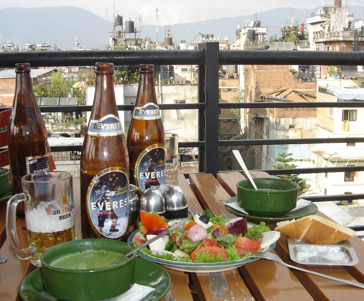
While dining at the lodge, we were surrounded by photos of world-famous climbers who have stayed here. Interestingly, we even spotted a poster of the Serbian singer Vlado Georgiev, who filmed a music video in this region. We ended our day with an “Everest” beer (650 ml), promising to toast here again upon our return, regardless of whether we reach the summit of Mera Peak.
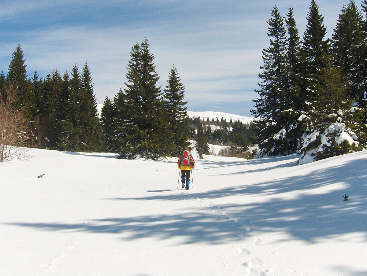
October 16, 2009: Lukla – Chutanga
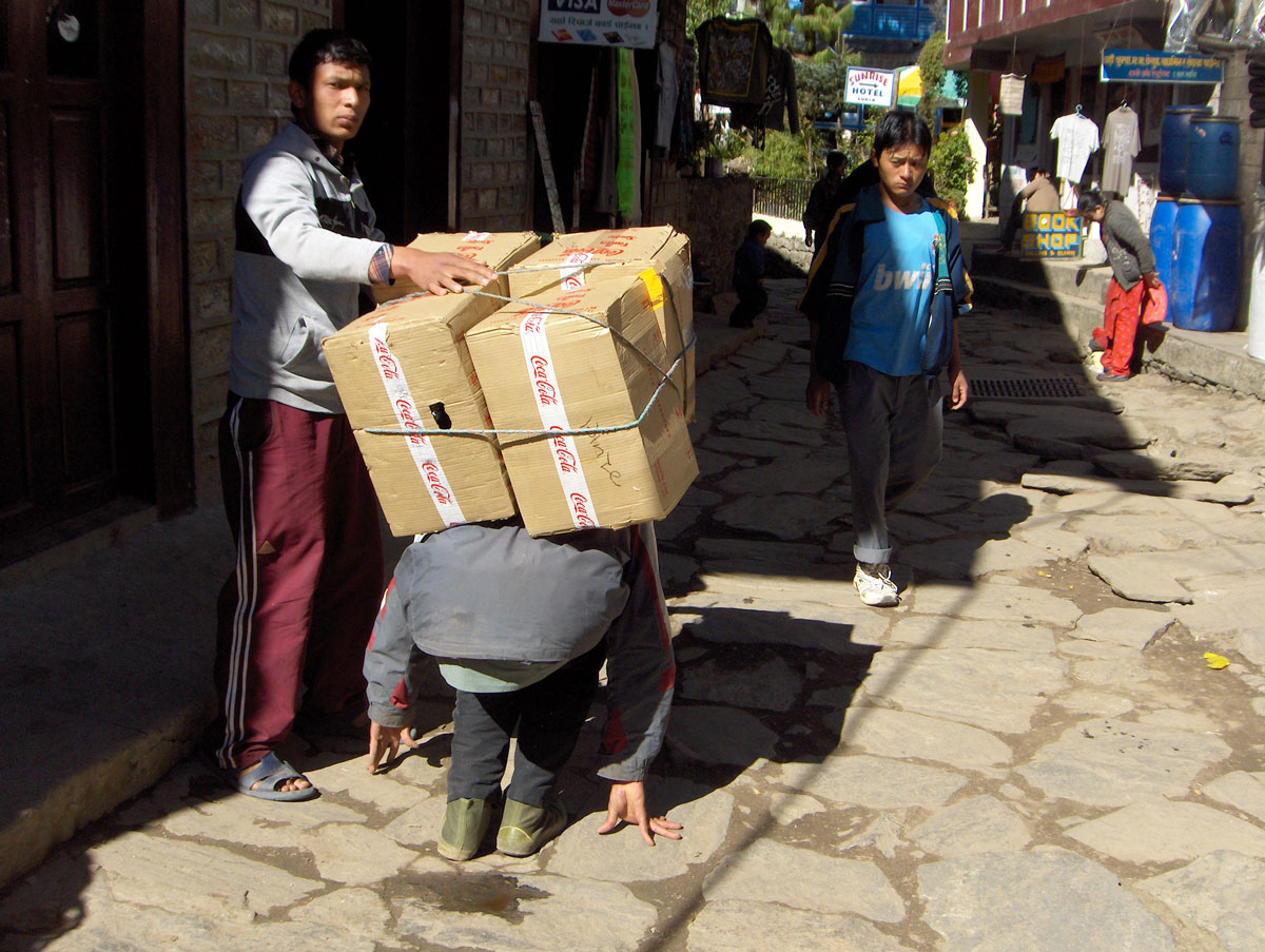
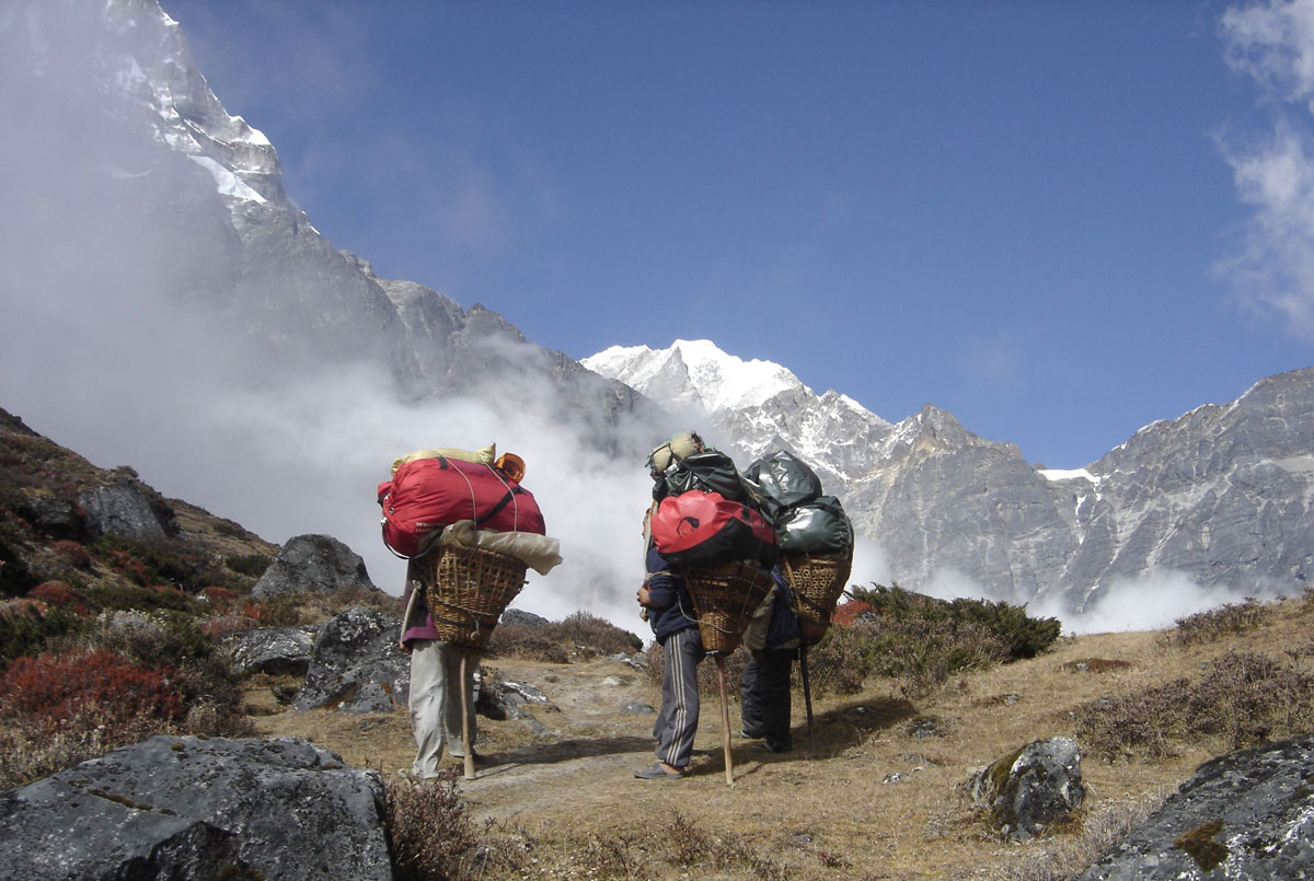
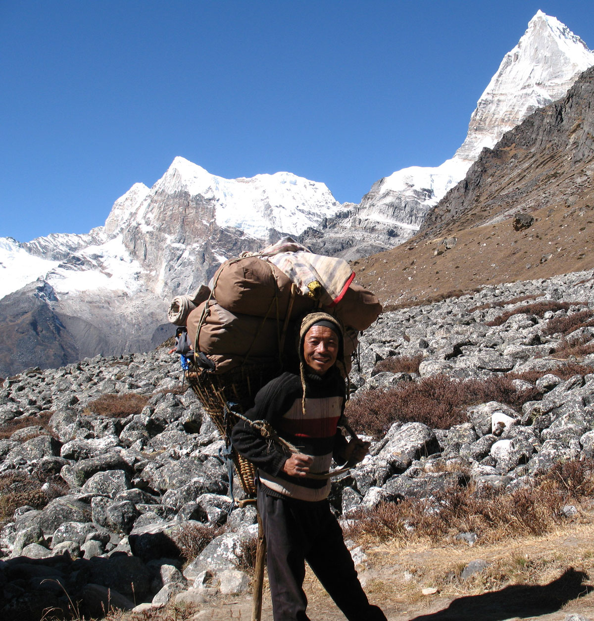
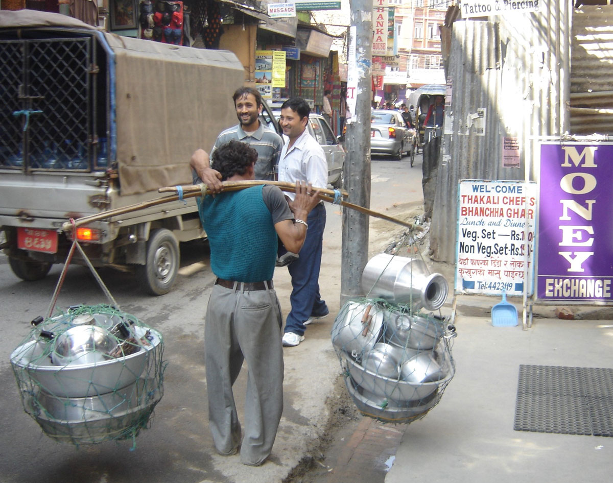
Early in the morning, we were awakened by the commotion of our guides and porters busily preparing for today’s ascent to the village of Chutanga, where we will stay for the next two days and nights for acclimatization. The porters set off before us, heavily burdened with our transport bags, tents, mobile kitchen, dining equipment, food supplies, and camping gear. We were in awe of their strength and endurance; carrying such loads (40–50 kg) on a steep, narrow trail for kilometers is a feat most of us couldn't sustain for even a hundred steps.
We departed Lukla at 09:00 AM, led by Sherpa Angelo Lakpa and Miloš Ivačković. Our path took us past a local hospital and two small hamlets. Outside the stone huts, small children were playing, and we handed out candies and chocolates. During a rest stop, we watched with amazement as one of our young Sherpa porters washed his hair in the ice-cold water of a mountain stream.
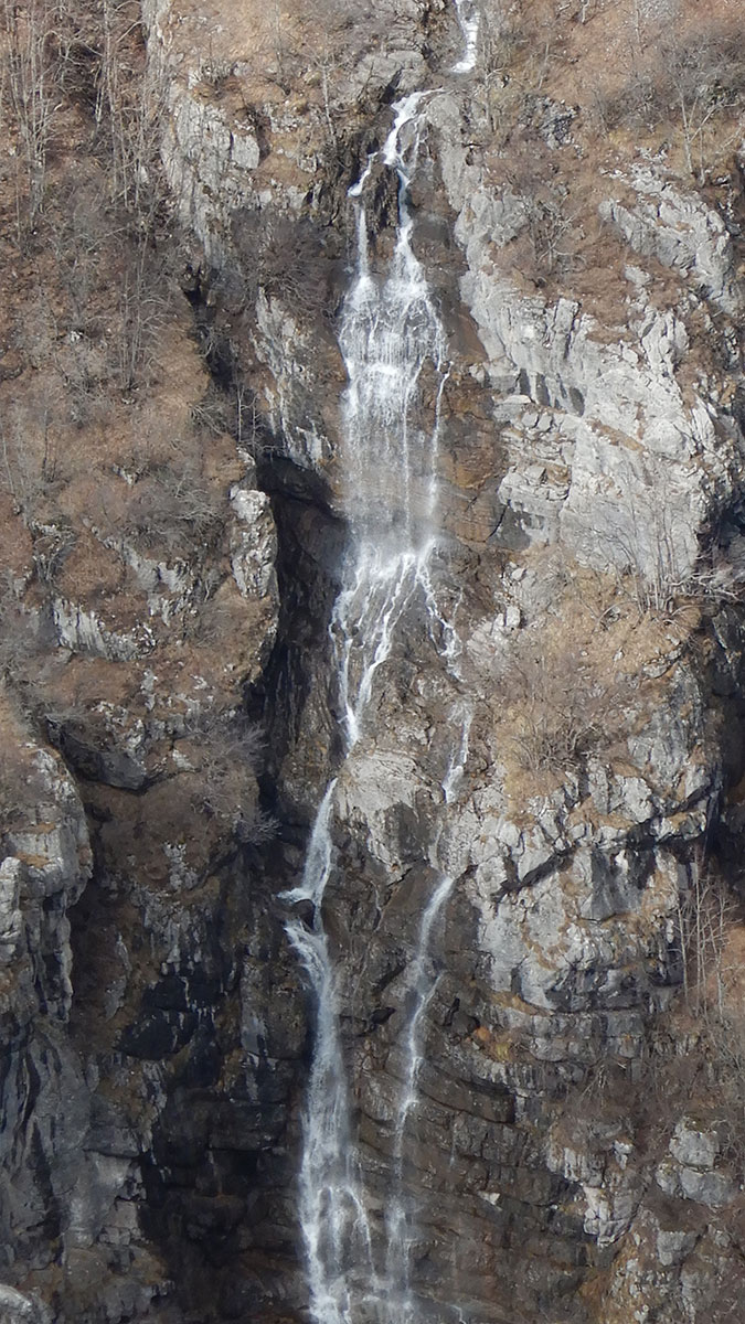
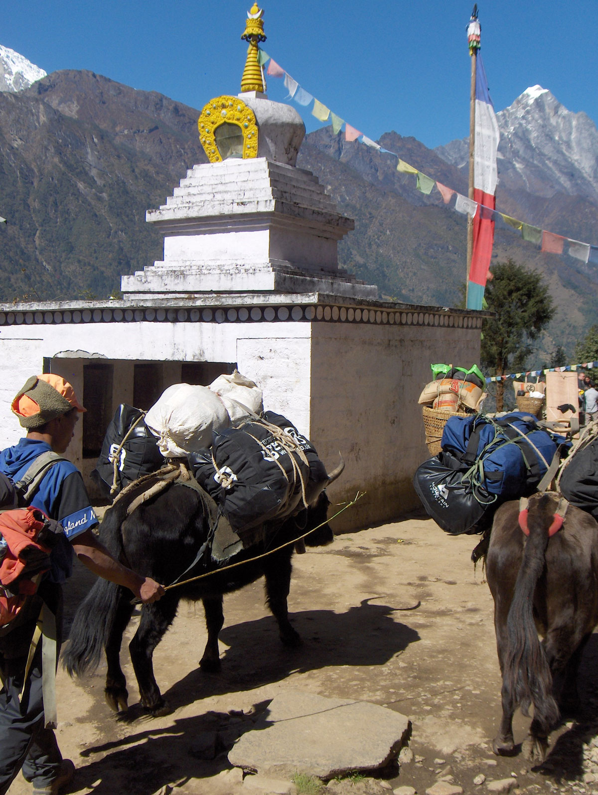
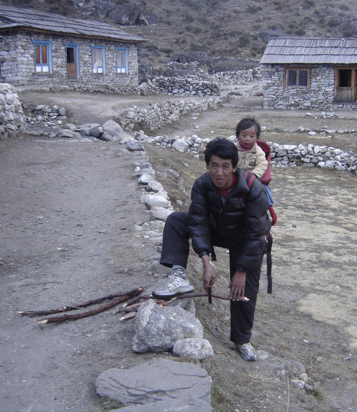
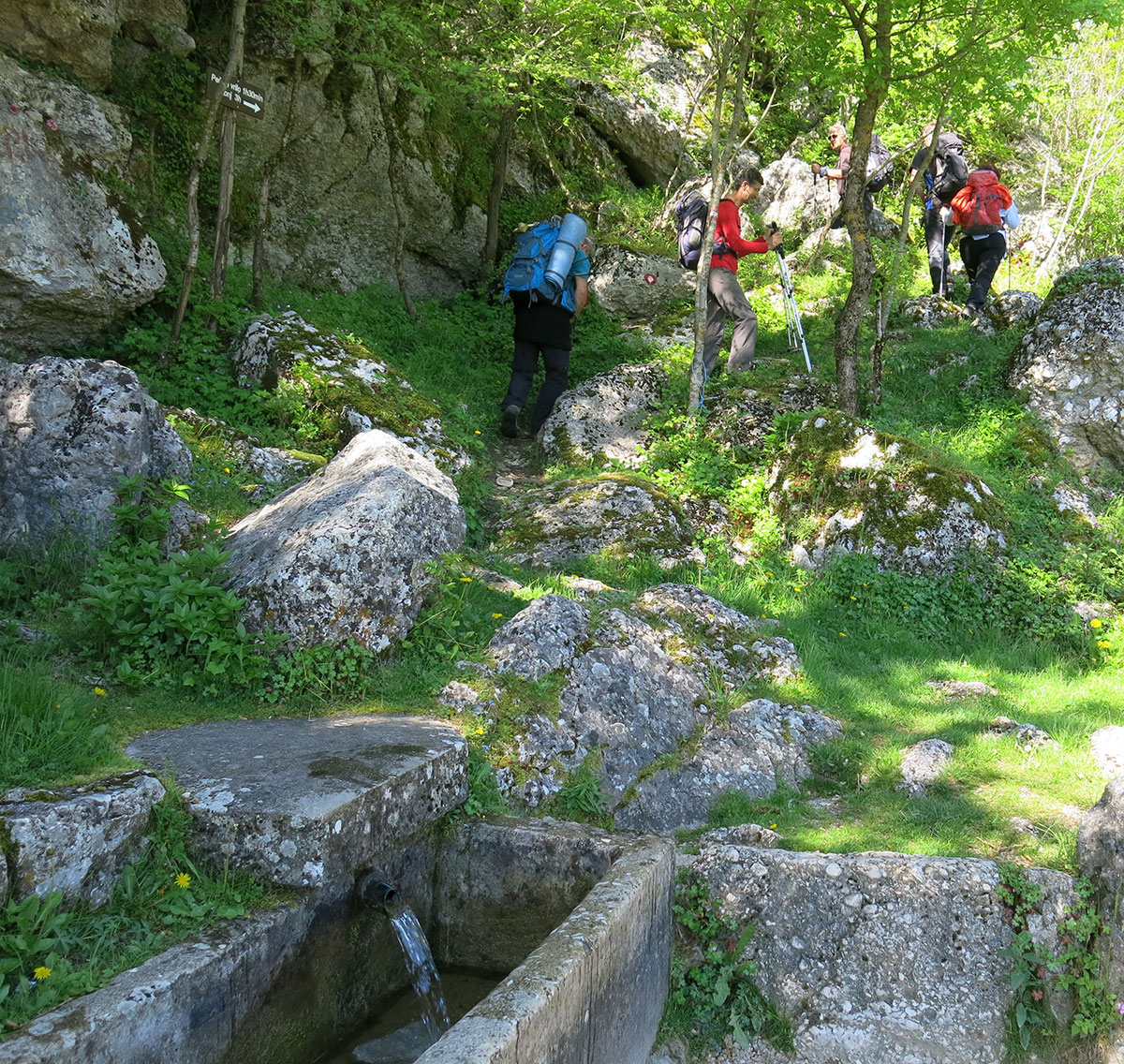
The local dwellings are built of stone with roofs made of stone slabs, bamboo leaves, or reeds. Small, terraced gardens yielded crops of cabbage, potatoes, carrots, turnips, and onions. When not tending to their gardens or livestock on nearby pastures, the villagers sell hot and cold drinks to passersby. Even here, globalization is visible through products like Coca-Cola, Heineken, Marlboro, and Johnnie Walker. As we climbed higher, nature became more bountiful, crossing swift streams and beautiful waterfalls. After nearly four hours of hiking, we reached Chutanga.
Arrival at Chutanga
Chutanga (3450 m a.s.l.) is situated beneath sharp, snow-white peaks that pierce the crystal-blue sky. Several lodges are arranged on terraces, one above the other. They are built of stone, and some even proudly bear the sign “HOTEL” on their facades.
Our porters arrived ahead of us, and soon the pleasant aroma of cooking drifted from our mobile kitchen. The meals were delicious, high in calories, and served in generous portions tailored to our needs. We spent the afternoon resting in our tents.
While for most of the team the Himalayan adventure truly began with the flight to Lukla, mine took a turn at a nearby stream. While washing my socks, I slipped and fell in. Luckily, only my right leg went in up to the knee. I reacted quickly, ran to my tent, and took my wet boot and trousers to a nearby hut, asking the hosts to dry them by their hearth. For the rest of the day, I had to wear one of Mića’s slippers. I must have looked quite strange to the locals and other hikers, as everyone smiled when I walked by—a first lesson for me to be much more careful in the future!
By evening, the wind swept the fog away, and the camp was bathed in soft moonlight. We went to bed early to be rested for the challenges of the next day.
October 17, 2009: Chutanga
In the morning, I visited the hut where I had left my trousers and boot to dry. The trousers were ready, but the boot was still damp. I decided to use a time-tested mountaineering trick: I pulled on double wool socks and wrapped them in plastic bags before sliding them into the boot. Suitably equipped, I joined the rest of the team, and at 10:00 AM, we set off on our first acclimatization climb.
We ascended a steep trail onto a ridge covered with sparse rhododendron forests and shrubs similar to our native mountain pine (klekovina). During the climb, Miloš gave us vital instructions: move slowly, breathe deeply, maintain the group's pace without unnecessary stops, and stay hydrated during rest breaks. As a highly experienced guide—with summits including Mount Everest, Kabru IV, Island Peak, Aconcagua, and Elbrus—we listened to his every word with great care.
Upon clearing the forest, we reached a viewpoint where my altimeter showed we had reached 3850 m a.s.l. From this vantage point, Angelo pointed out the Zatrwa Og pass (4538 m a.s.l.), which we are scheduled to cross tomorrow on our way toward Mera Peak. We returned to camp in the afternoon after 4.5 hours of trekking.
The Expedition Team
Before lunch, our Head Sirdar (lead Sherpa), Nima, introduced the support crew that will be with us for the duration of the expedition: Assistant Guides: Angelo Lakpa, Ramis, and Temba; Kitchen Staff: Head cook Hasta Tamang and his five assistants (Rindži, Navan, Maranč, Purba, and Nima); Porters: 16 high-altitude porters. In total, 26 Sherpas are supporting our team of ten, ensuring every aspect of our survival and progress in the mountains is managed.
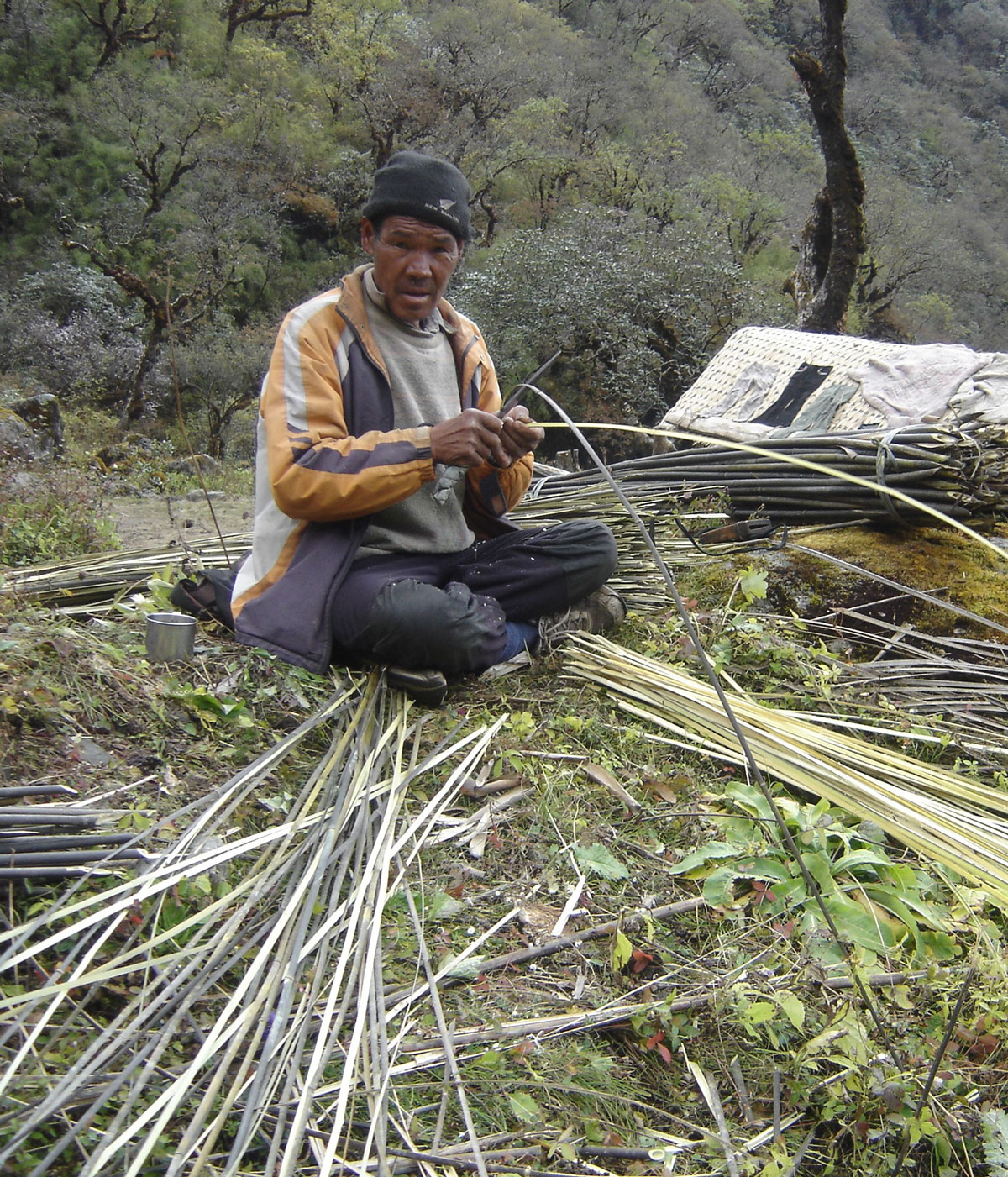
Later in the day, I walked down to the hut by the stream to photograph an elderly local man. He was skillfully slicing bamboo reeds into thin strips with a large knife, weaving them into the traditional baskets used by high-altitude porters. Following dinner, we headed to our tents as soon as darkness fell. Tomorrow promises to be a grueling day.
October 18, 2009: Chutanga – Kharka Teng – Zatrwa Og – Zatrwa La – Thuli Kharka
We rose with the first rays of the sun, feeling well-rested after nearly 12 hours in our tents. Despite it being Sunday, the camp was buzzing with energy as we prepared for today's ascent. At 08:00 AM, we left Chutanga, crossing the shaky little bridge over the stream where I had slipped two days ago—this time with much more caution.
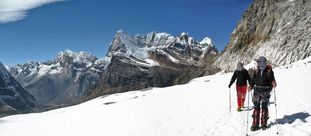
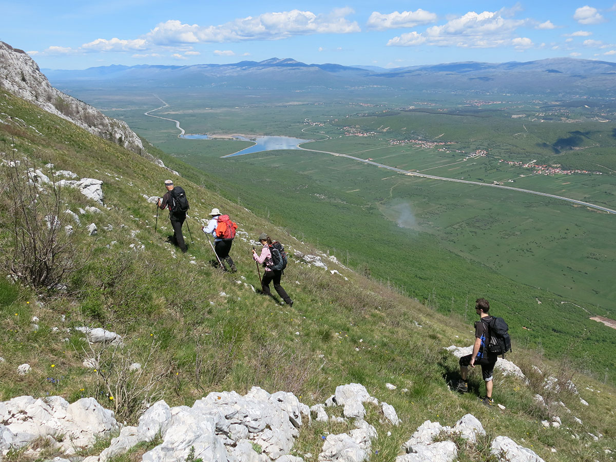
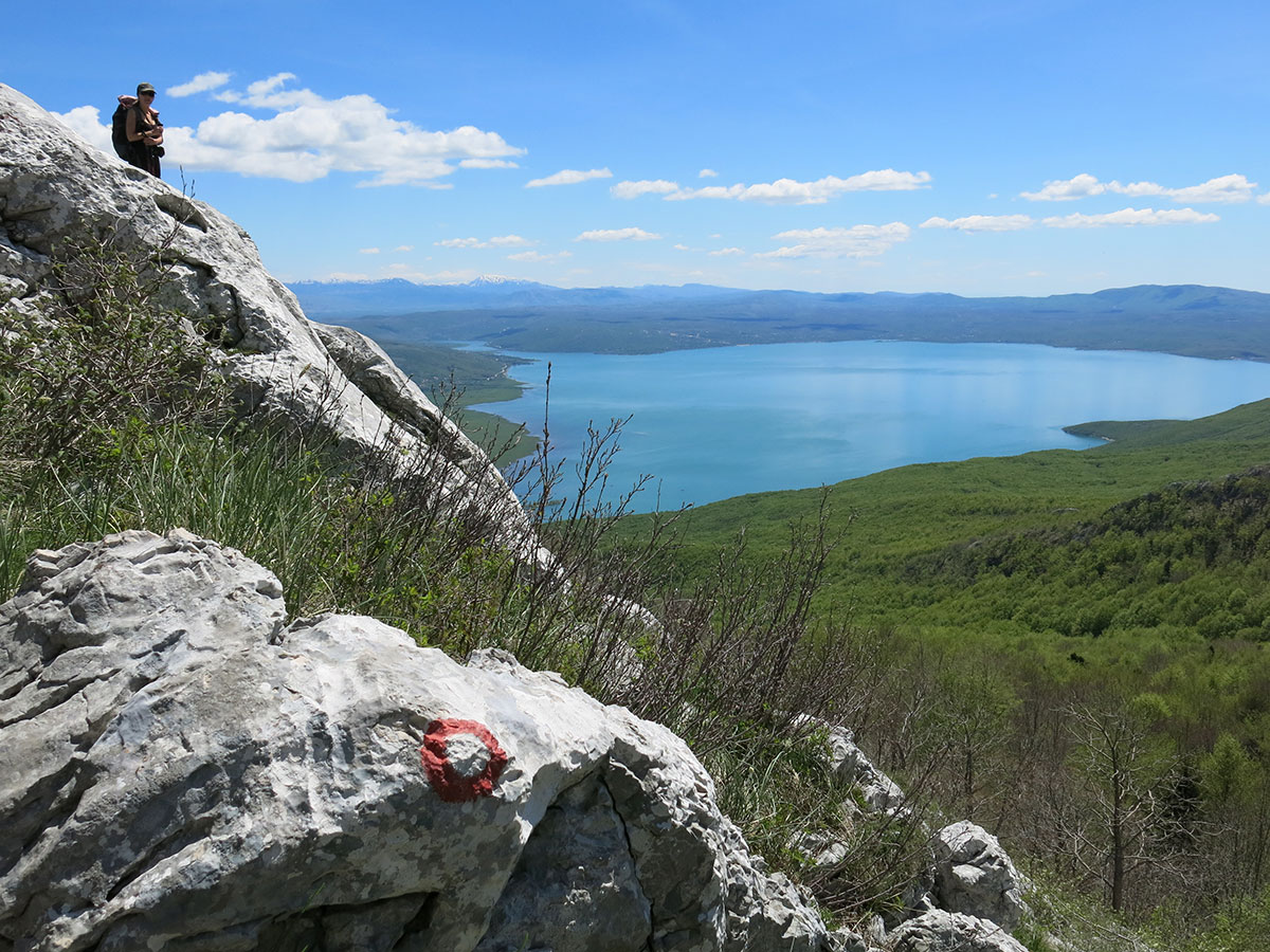
After 2.5 hours of trekking, we reached the huts at Kharka Teng (4020 m a.s.l.). From here, a wide panorama opens up over the valley where Lukla lies. This vantage point also gave us our first clear look at the pass we had to conquer. After a short rest, we continued the climb. The trail reminded us of the Strmenica path on Čvrsnica back home, though this one was significantly longer and steeper.
As we climbed, we encountered porters and trekkers returning to Lukla. When passing them, we carefully stepped aside to give the porters the right of way; a single bump from their large baskets could easily send a climber tumbling down the steep slope.
Crossing the Twin Passes
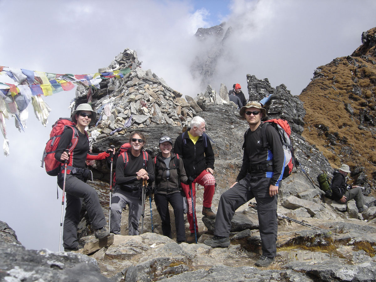
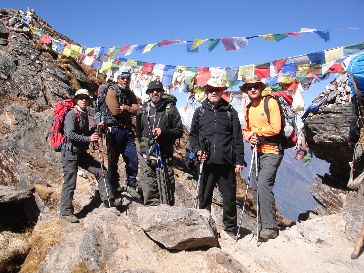
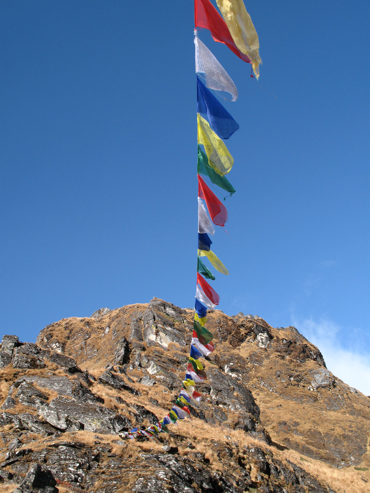
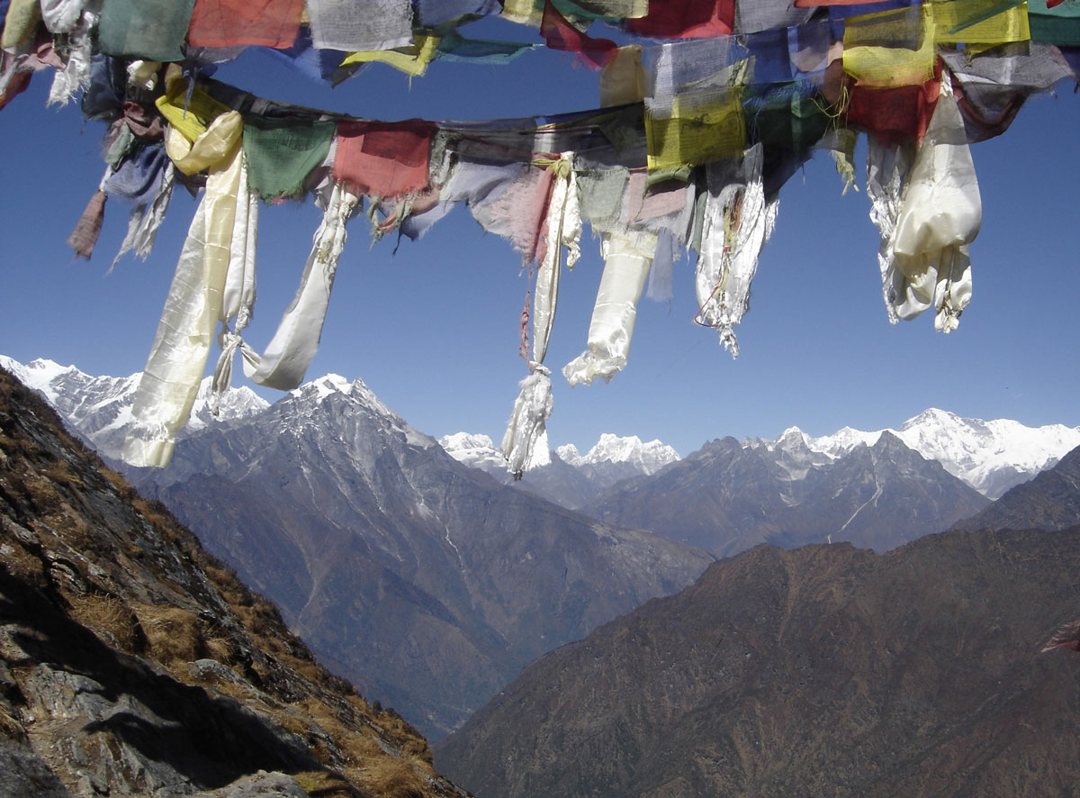
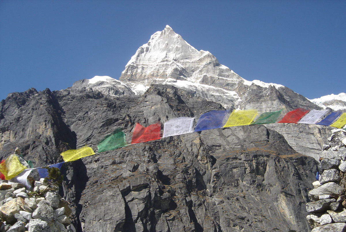
At 12:30 PM, we reached the first pass, Zatrwa Og (4538 m a.s.l.), which was adorned with colorful Buddhist prayer flags. After a long break, we traversed the ridge along the mountainside toward the next pass, Zatrwa La (4613 m a.s.l.). This second pass was also draped in prayer flags fluttering in the wind, making it a perfect subject for our cameras.
The traverse between the two passes took nearly an hour. This divide marks the border between two great valleys: Solo Khumbu and the Hinkhu Valley. Just below the pass sits a small hut with a sign pompously labeled “TEA SHOP.” We stopped in and were welcomed by a bright, smiling young woman. Inside the smoke-filled room, we rested and warmed ourselves with hot tea. We also took a moment to congratulate Saša and Sandra, as this was the highest elevation they had ever reached.
Descent to Thuli Kharka
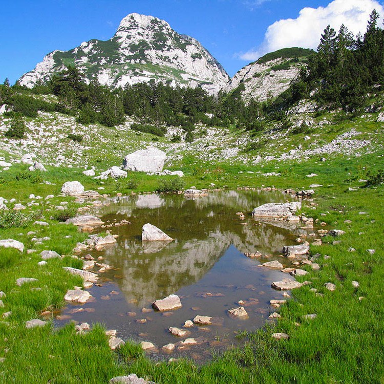
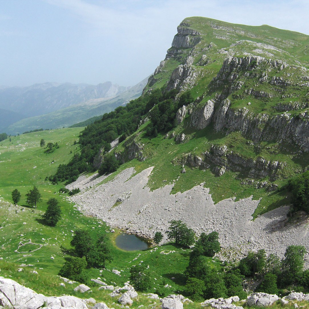
From the pass, we began our descent toward Thuli Kharka (4233 m a.s.l.), a small village nestled on a terraced plateau beneath a giant boulder. At the top of this massive rock is a large hollow filled with water, looking much like a tiny lake. We reached the village in just one hour from the pass.
By early evening, the wind died down, and a thick fog rolled in. Our tents were already pitched on two terraces near a newly built large lodge in the center of the village. Dinner followed shortly, and then we retired to our tents for much-needed sleep.
October 19, 2009: Thuli Kharka – Taktor – Tashing Dingma – Tashing Ongma – Mosom Kharka
Upon waking, we were pleased to find that no one was complaining of headaches. Last night, as a preventative measure for the increasing altitude, we each took an Aspirin (100 mg) before bed. This is a practice we intend to continue until our final summit push.
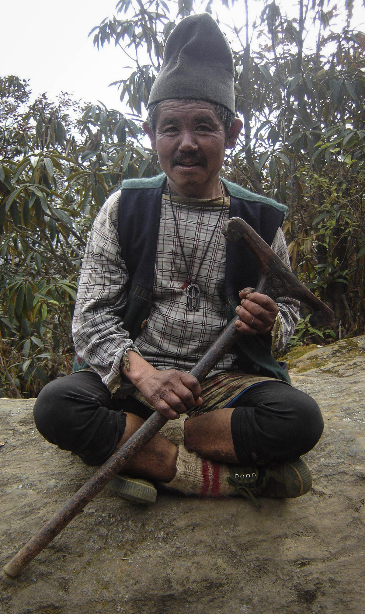
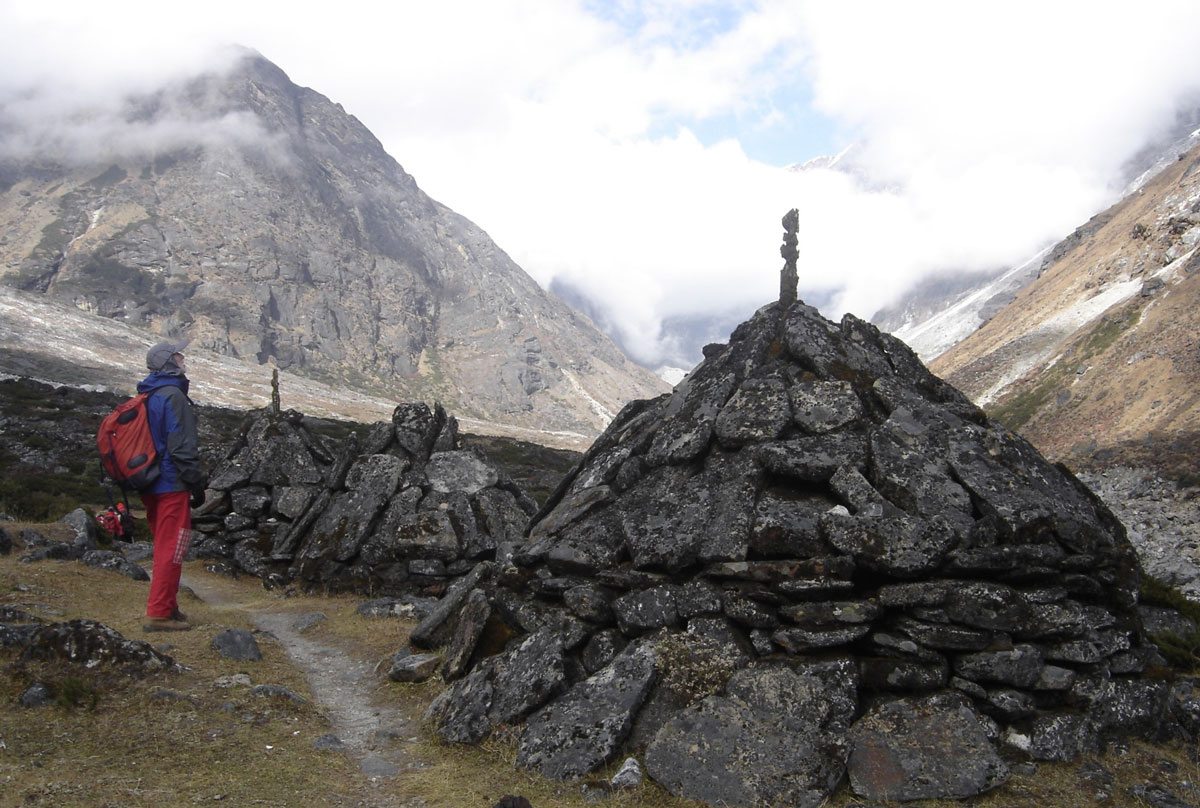
After breakfast, feeling rested and in high spirits, we began our fourth day of trekking. From Thuli Kharka, we traversed a steep slope to reach a pass marked by a stone cairn (pyramid) adorned with prayer flags. We rested there alongside numerous porters who appeared exhausted by their heavy loads. Despite the physical toll, the smiles never left their faces. Most were sparsely dressed, wearing torn sneakers or plastic sandals; some were even barefoot.
Our guides explained the harsh reality of their lives. Trained from childhood to carry loads at high altitudes, many porters turn to energy supplements as their strength wanes with age. The gold-yellow wrappers of these “energizers” are scattered along the trail. The guides warn us that while these offer a temporary boost, they are highly addictive and cause long-term damage to the body. Consequently, most porters are forced to retire by the age of fifty.
The “EKG” Trail
From the pass, we descended a steep path through dense rhododendron forests to the Taktor lodge (3809 m a.s.l.), situated on a terrace near a stream with beautiful waterfalls. This leg took 2.5 hours. After lunch by the water, we continued our descent into a forest of Himalayan pine. In some areas, the forest was so lush it resembled a jungle.
We passed the Tashing Dingma and Tashing Ongma lodges, and after two hours, we reached the high banks of the Inghu Khola river (3442 m a.s.l.). We watched the churning, frothing water as we moved along the right bank. The trail here constantly gains and loses 100–200 meters of elevation—moving “up and down” so frequently that we nicknamed it the “EKG” trail, due to its resemblance to an electrocardiogram readout. We reached our destination, Mosom Kharka, in another hour.
Mosom Kharka and Political Reality
Mosom Kharka (3575 m a.s.l.) serves as the entrance to the Makalu-Barun National Park. Our guides informed us that this small village has become a Maoist stronghold used to monitor the valley's routes. Despite our official government permits, agencies are often forced to pay an additional “tax” to the Maoists for passage. Posters featuring the five-pointed star, the sickle and hammer, and the face of Mao Zedong on lodge facades made their presence very clear.
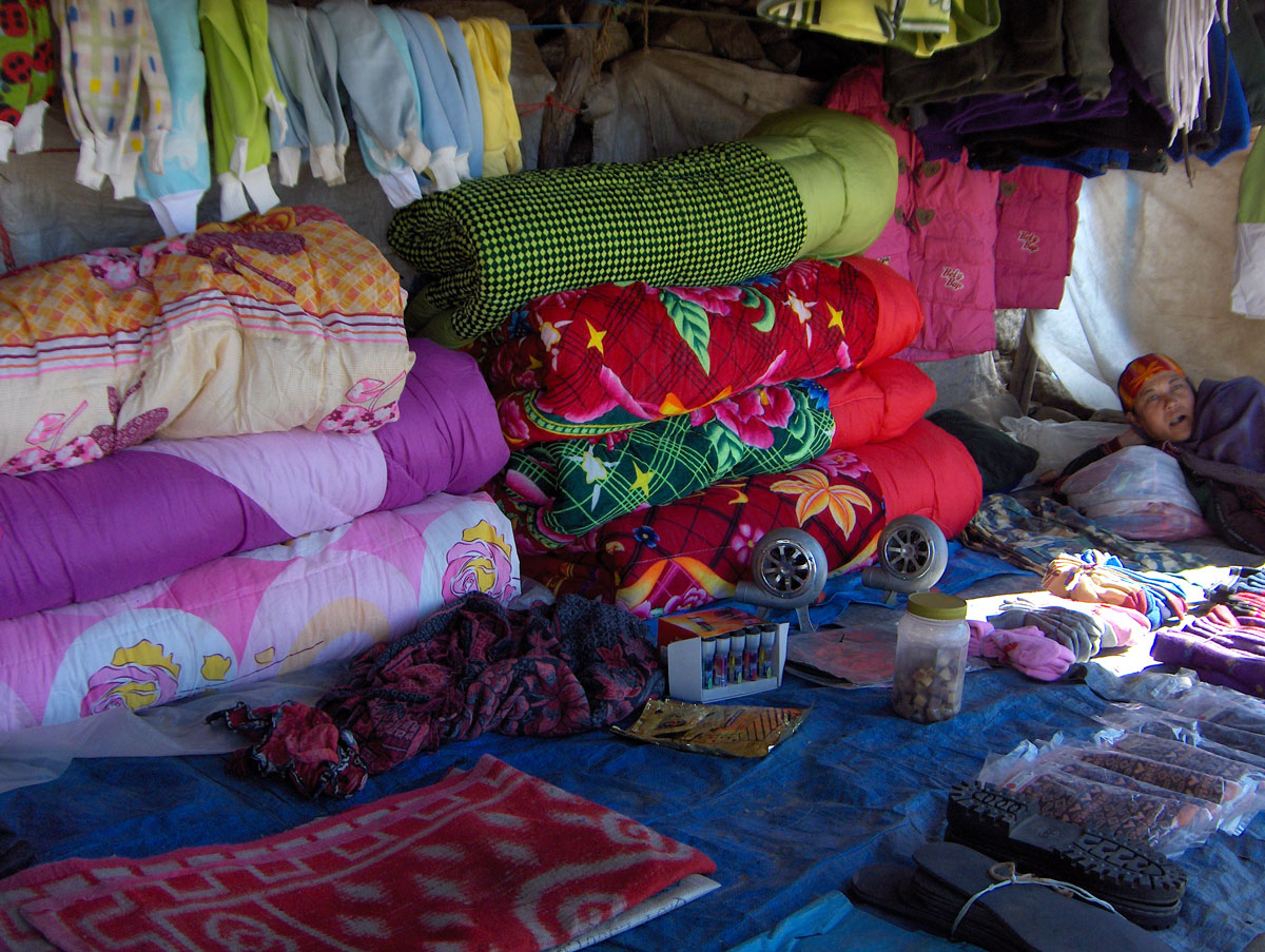
Before dinner, we explored the village, which consists of several lodges and shops. In one shop, you can buy yak meat. Because of the constant cold and lack of insects, the meat can stay “fresh” for weeks without spoiling. Just like in Lukla, gambling is popular here; porters passionately wager their hard-earned money at outdoor tables, though they rarely win. One shop even offered a satellite phone, with the owner determining the price per minute based on his “estimation” of the customer's ability to pay.
As darkness fell, the temperature dropped significantly. We had dinner inside a lodge where we were charged for heating before the stove was even lit. Wood is a scarce and expensive commodity at this altitude, so dried yak dung is often added to the fire to make the logs last longer. After dinner, one of our Sherpas sang while playing the madal—a traditional Nepalese drum similar to a tarabuka. Though the music was beautiful, exhaustion won, and we soon retreated to our tents and warm sleeping bags.
October 20, 2009: Mosom Kharka – Taure – Tangnag
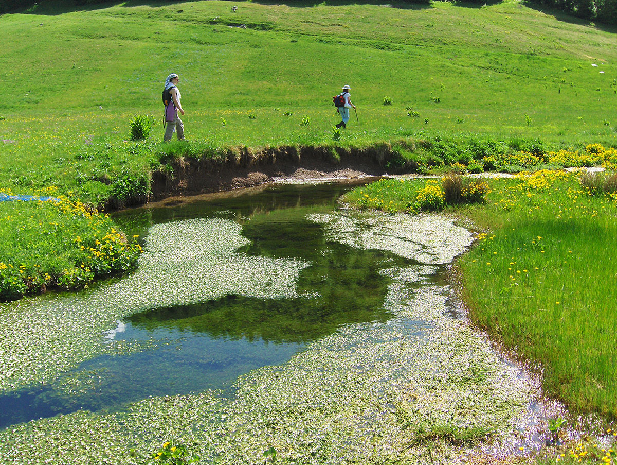
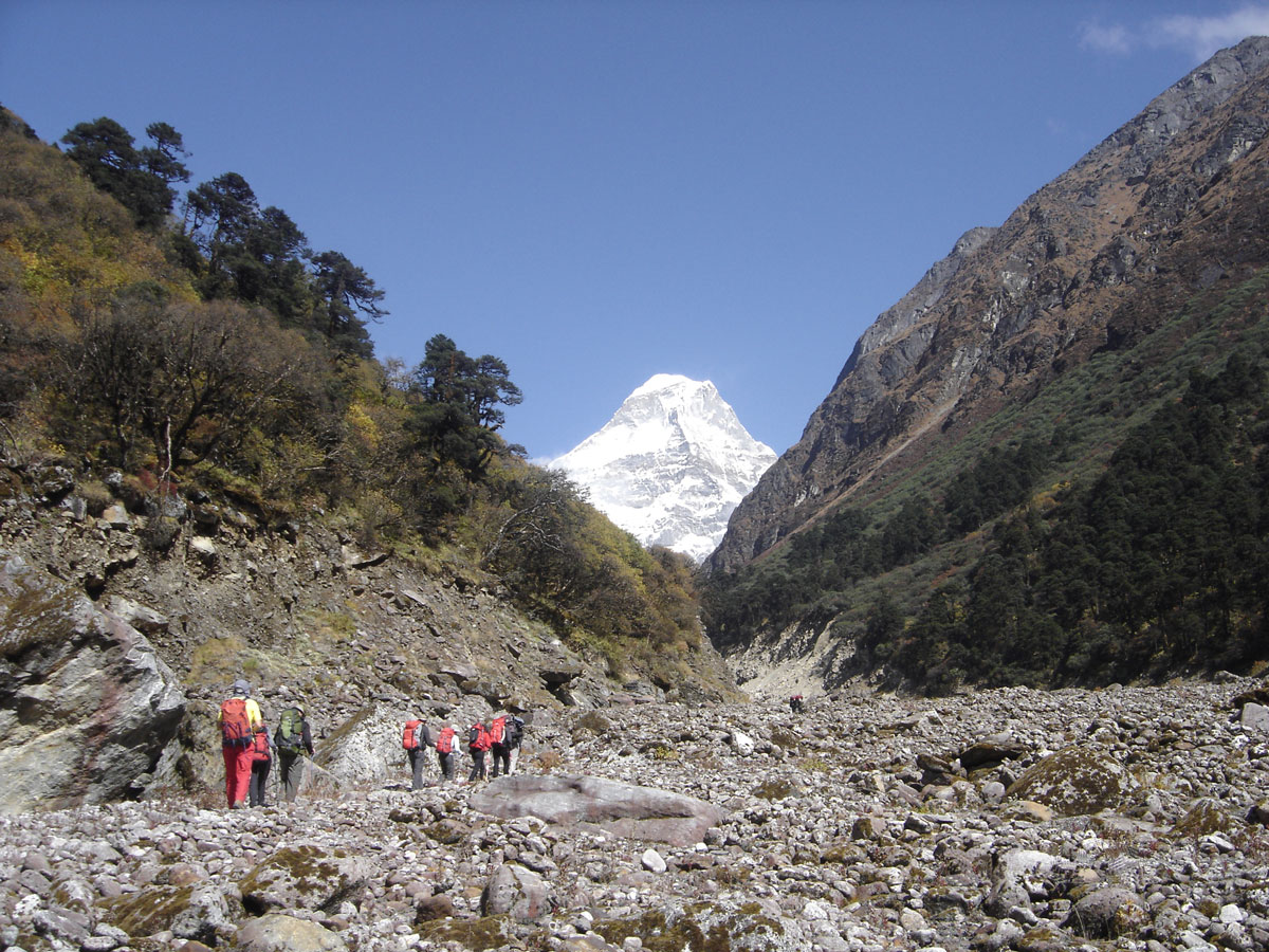
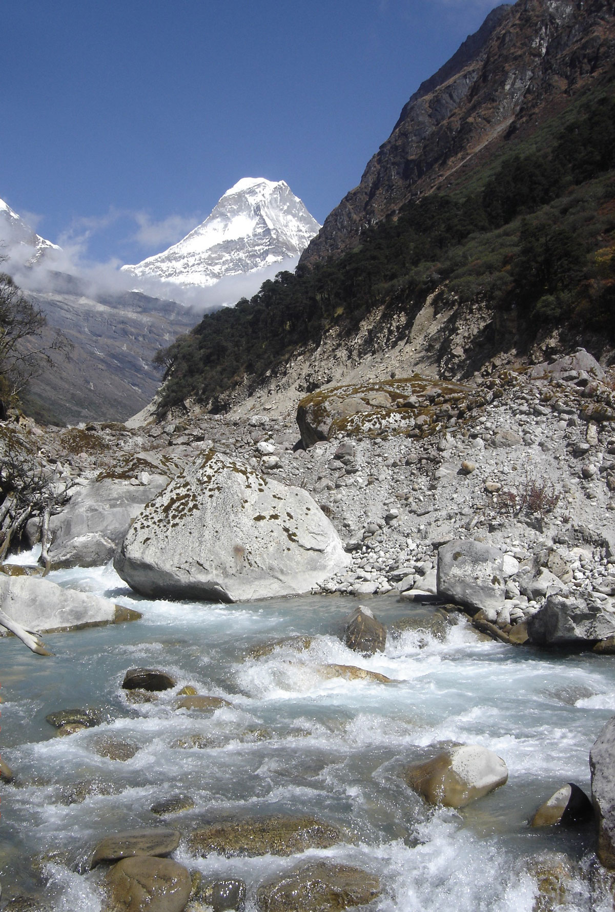
Today we set off at 09:30 AM, slightly later than usual. Our destination is the village of Tangnag, a five-hour trek from Mosom Kharka. The first leg of the journey follows the valley of the Inghu Khola (also known as the Hinku Khola) river. The riverbed is incredibly wide—larger than the river itself. To our left, we are flanked by pine forests, while to our right, the vertical rock walls of Mera Peak tower over us.
We moved along the edge of the riverbed, navigating around massive boulders that had tumbled down from the eroding banks. Every now and then, we looked up with a bit of anxiety at the rocks hanging precariously above our heads, seemingly ready to fall at any moment.
After two hours of hiking, we left the riverbed and ascended onto a plateau of high pastures. Within half an hour, we reached Taure (3990 m a.s.l.). On a dirt terrace in front of one of the three huts that make up this tiny settlement, the Sherpas served us lunch. A cold, biting wind forced us to eat quickly, pack up, and keep moving.
Into the Himalayan Heart
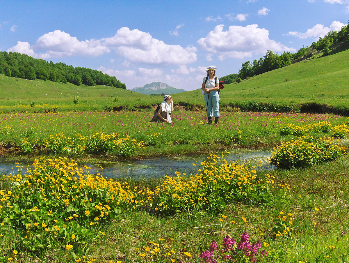
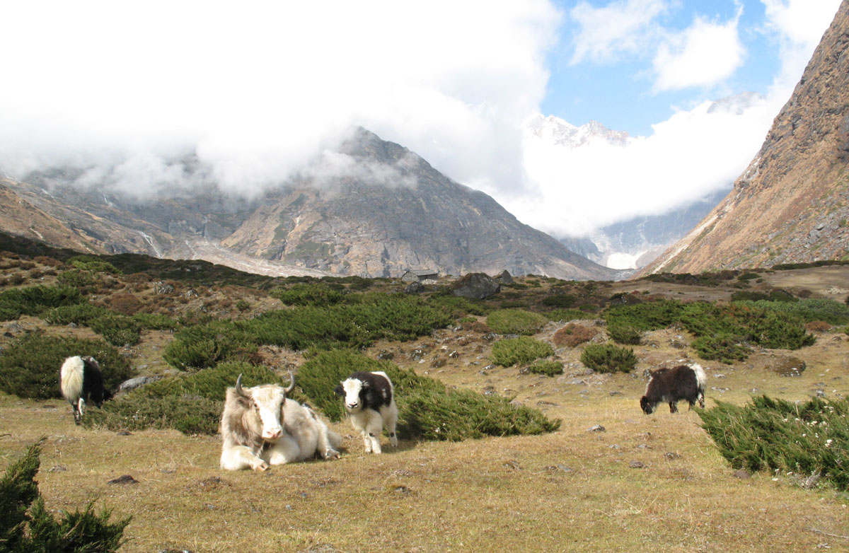
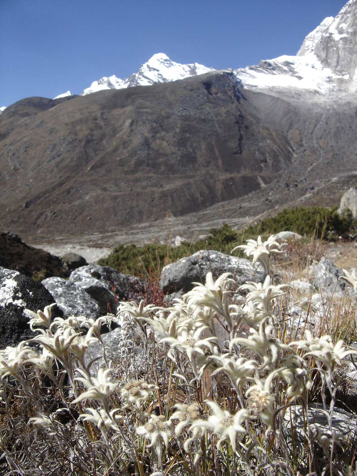
As we continued, we passed three massive trail markers (cairns) made of stacked stones. For the first time on this trek, we encountered a herd of yaks grazing peacefully. This was exactly the experience we had hoped for: fascinating peaks surrounding the valley, streams and waterfalls crashing into the frothing river, and yaks on the pastures. When we suddenly stumbled upon patches of Edelweiss (runolist), we were overjoyed. We were finally in the heart of the true Himalayan wilderness—the very reason we came here.
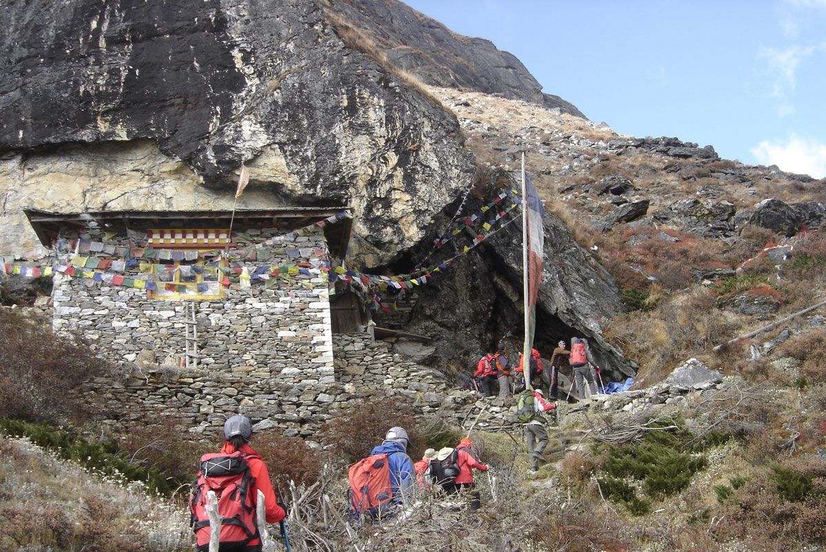
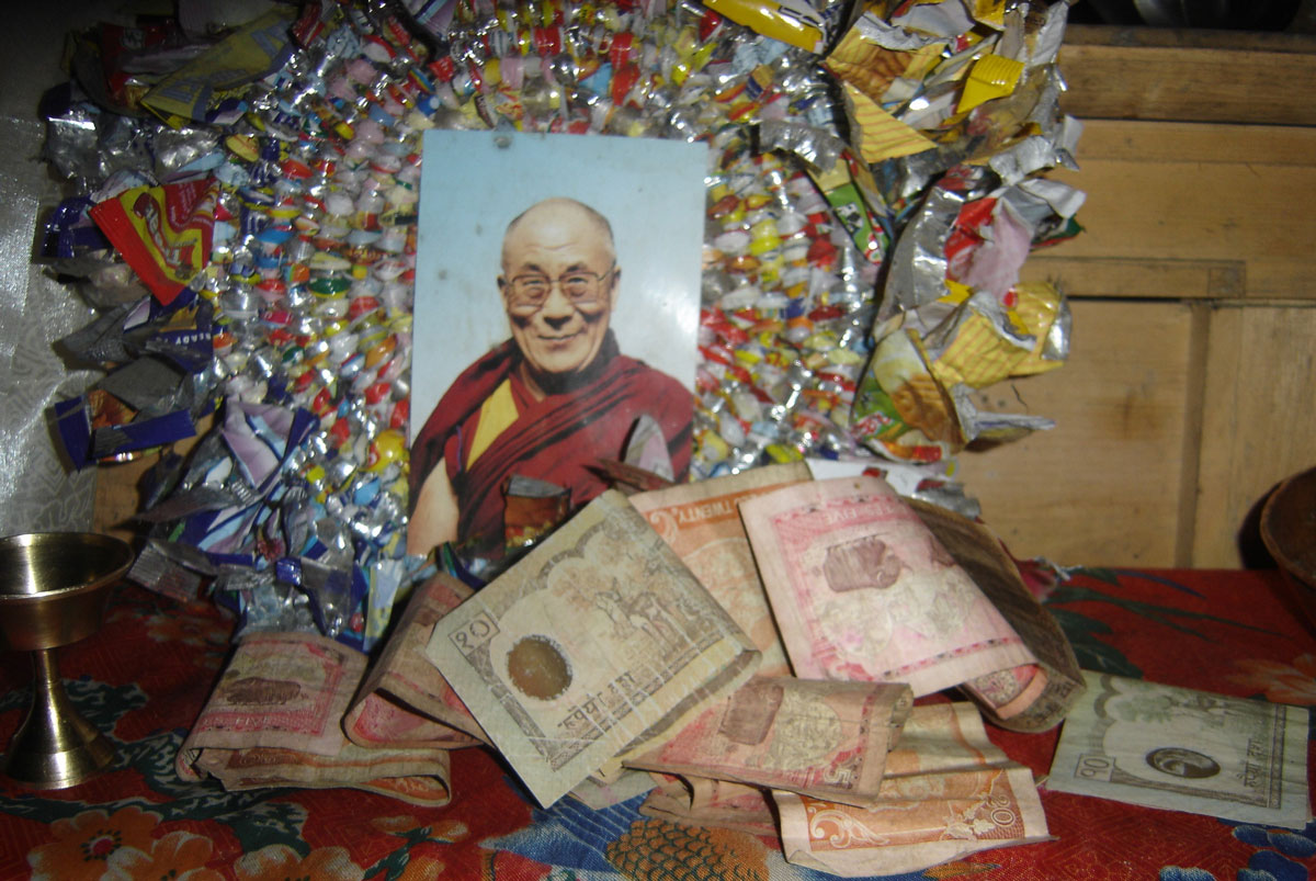
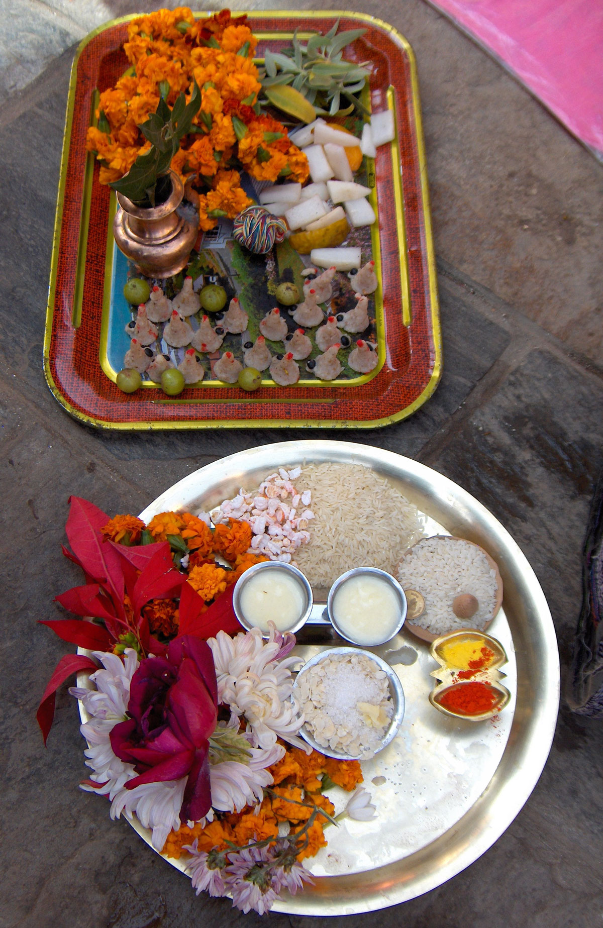
An hour and a half from Taure, we reached a Gompa (a small Buddhist temple) at 4100 m a.s.l. The temple is built directly under a massive overhanging rock, enclosed by wooden boards and stone walls. The rock face inside is painted with motifs from the lives of Buddha and Rinpoche, with a small altar holding a photograph of the Dalai Lama deep within. The ceiling is draped in prayer flags, and a taxidermied eagle hangs from one of the walls.
The resident monk was away due to illness, so our Sirdar, Nima, performed the traditional ceremony. He lit an oil lamp for each of us on the altar to wish us a successful summit. We placed some money into a locked metal box to help maintain this wondrous “temple at the end of the world.”
Arrival at Tangnag
On the final stretch to Tangnag, our eyes were fixed on the stunning peaks of the Kyashar Himal massif—sharp, daring pyramids that looked more challenging and beautiful than the last. We reached Tangnag one hour after leaving the Gompa. We will stay here for the next three days to acclimatize properly and gather strength for the final push.
After dinner, we gathered in the lodge with a group of Italians who were heading to Khare the next day. Unlike the quiet of previous nights, tonight was filled with music. We sang songs from Italy and the former Yugoslavia (from Triglav to Ohrid), including several Bosnian Sevdalinkas. The highlight of the evening was Malina (Dragan), who earned a massive round of applause for his solo performance of the Macedonian classic, “Zajdi, zajdi.” We finally retreated to our tents late in the evening.
October 21, 2009: Tangnag
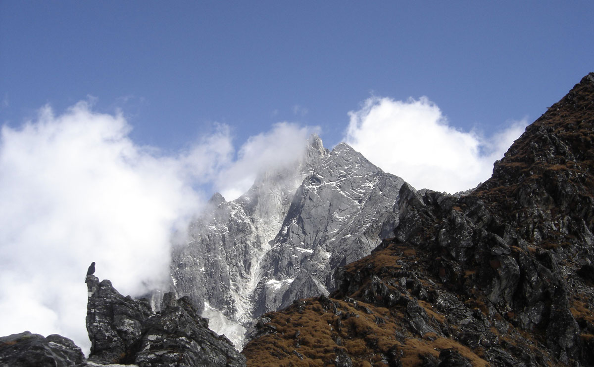
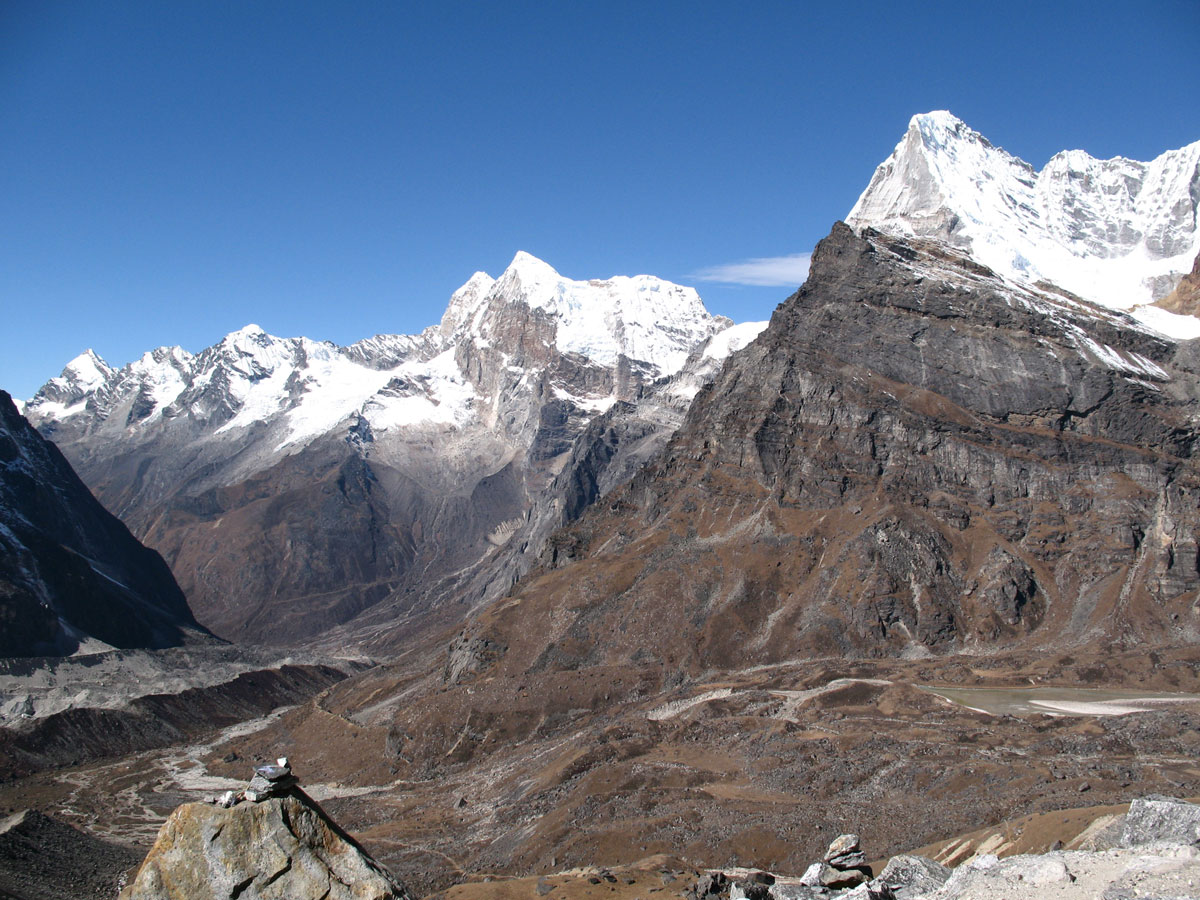
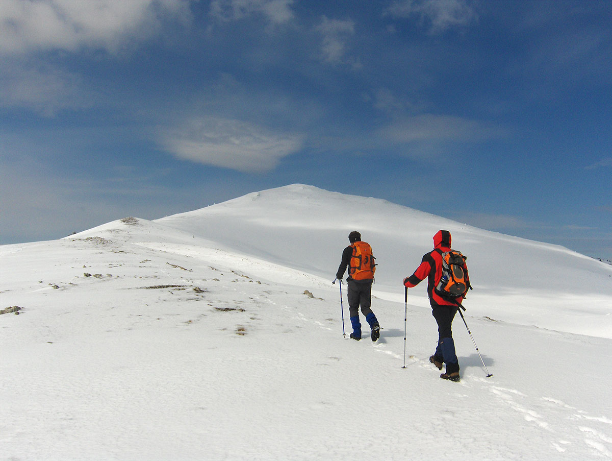
Today was dedicated entirely to acclimatization. We set out from Tangnag (4263 m a.s.l.) under a beautiful, clear sun. As we slowly ascended the steep slopes, our eyes were magnetically drawn to the neighboring peaks of the Kyashar Himal massif: Tangtse (6770 m a.s.l.), East Summit (6373 m a.s.l.), and Cairn (5271 m a.s.l.).
Behind us, on the opposite side of the Hinkhu Valley, the western face of Mera Peak towered into the sky. Every so often, the heavy thunder of avalanches crashing into the valley below echoed through the air. After 3.5 hours of steady hiking, we reached an unnamed ridge point at an elevation of 5067 m a.s.l. We took a brief 30-minute rest at the top before descending back to Tangnag.
By the time we reached camp, we were starving. Miloš told us that a strong appetite is actually one of the primary signs of successful acclimatization. According to him, the most reliable indicators that your body is adapting—besides a good appetite—are sleeping without a headache and maintaining regular digestion.
Songs of the Himalayas
In the evening, we gathered in the lodge with our Sherpas. Accompanied by the rhythmic beat of the madal, they sang traditional Nepalese songs for us. Sherpa Angelo Lakpa translated the lyrics, and we were surprised to find how similar they are to our Bosnian Sevdalinkas—they tell stories of love, unrequited longing, yearning, and solitude. Later, the lodge owner put on some more upbeat music on the cassette player, and the night ended with everyone dancing.
October 22, 2009: Tangnag
The morning began with the rhythmic thumping of helicopter blades. During the day, it intervened twice to rescue climbers whose lives were in danger. Someone needed emergency help in Khare, and later, a helicopter arrived in Tangnag to evacuate a member of the Italian expedition. It was a sobering reminder of how quickly things can change—she had been singing and dancing with us in the lodge just last night but was now showing severe signs of altitude sickness.
We used this day for rest, personal hygiene, and laundry. The lodges here offer stone-walled shower cabins, but they are unheated. I gritted my teeth and stepped into one, but after five minutes of showering, I bolted back to my tent. It was hauntingly cold, and it took me a long time to warm up again. After that “experiment,” I swore off bathing until our return to Kathmandu.
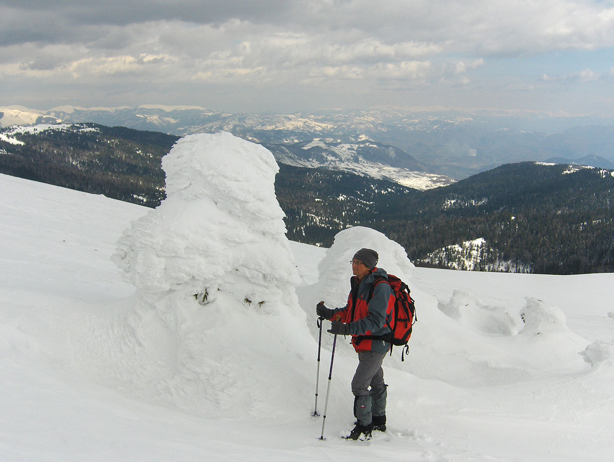
The Ghost of Saba Tsho
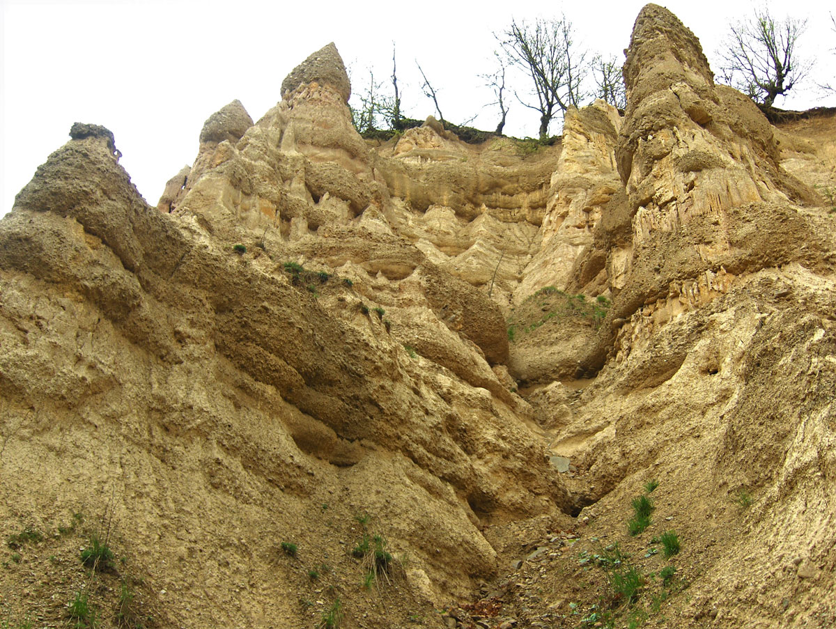
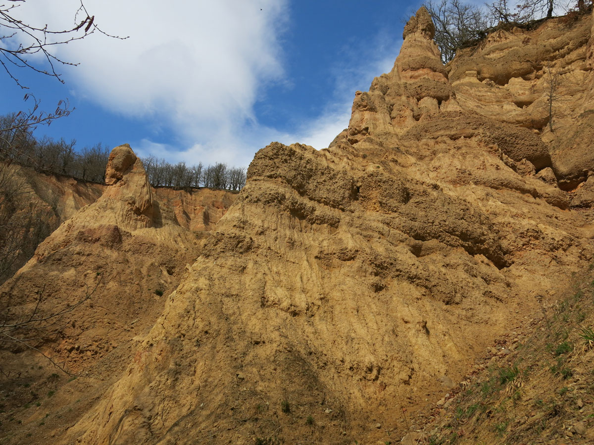
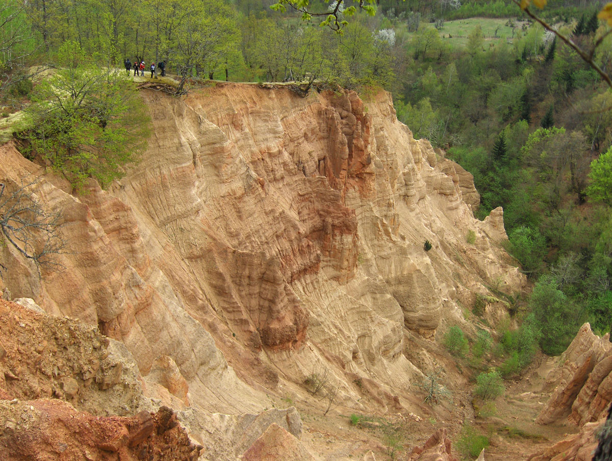
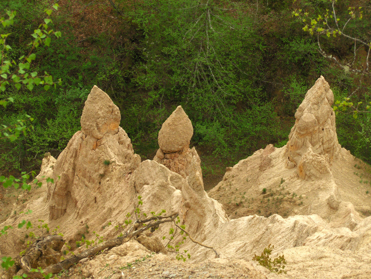
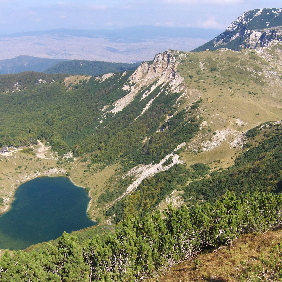
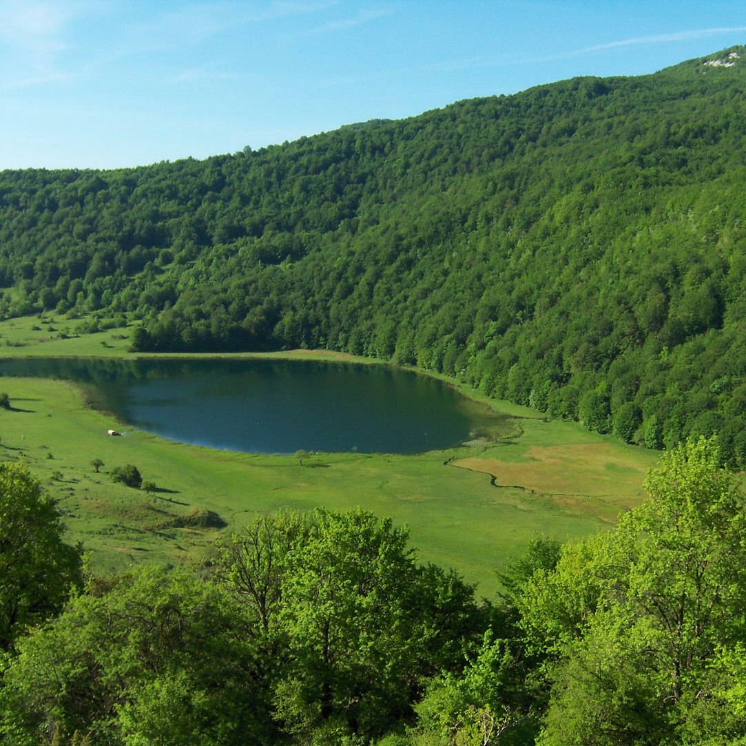
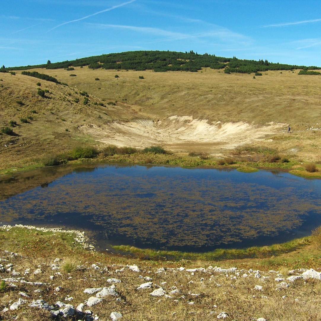
In the afternoon, we went for a walk to explore the surroundings. Tangnag consists of a large number of newly built lodges. Only a few years ago, the settlement was hit by a catastrophe: a massive avalanche plunged into the nearby Saba Tsho lake (4463 m a.s.l.) to the north. The impact created a wall of water so powerful that it breached the moraine wall holding back the lake. The resulting flood completely wiped out the village. Fortunately, there were no casualties, as the disaster occurred outside the climbing season.
We spent the rest of our time before lunch checking our technical climbing gear. By late afternoon, the quiet of the village vanished as a loud and bustling group of Iranians and French climbers arrived.
A Celebration in the Clouds
In the evening, our head cook surprised us with a cake, on which he had written “Mera Peak 2009” in whipped cream. Miloš carefully cut the cake into 36 equal slices so that every member of the expedition—participants and Sherpas alike—could enjoy a sweet treat.
October 23, 2009: Tangnag – Khare
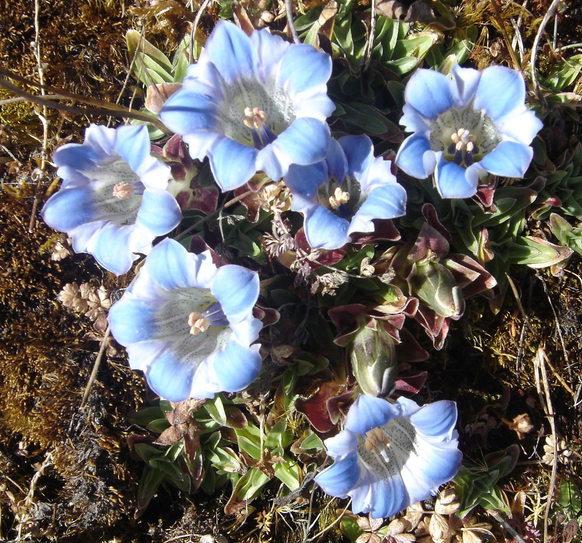
We departed Tangnag around 09:00 AM for Khare, a leg that requires us to gain about 600 meters in elevation. The route continues through the Hinkhu Valley. Once again, we were delighted to see clusters of Edelweiss (runolist) growing along the trail, this time accompanied by a beautiful light-blue flower resembling Koch's Gentian. After leaving the riverbed and crossing the high pastures, we faced a steep and strenuous climb to Khare, arriving after 3.5 hours of trekking.
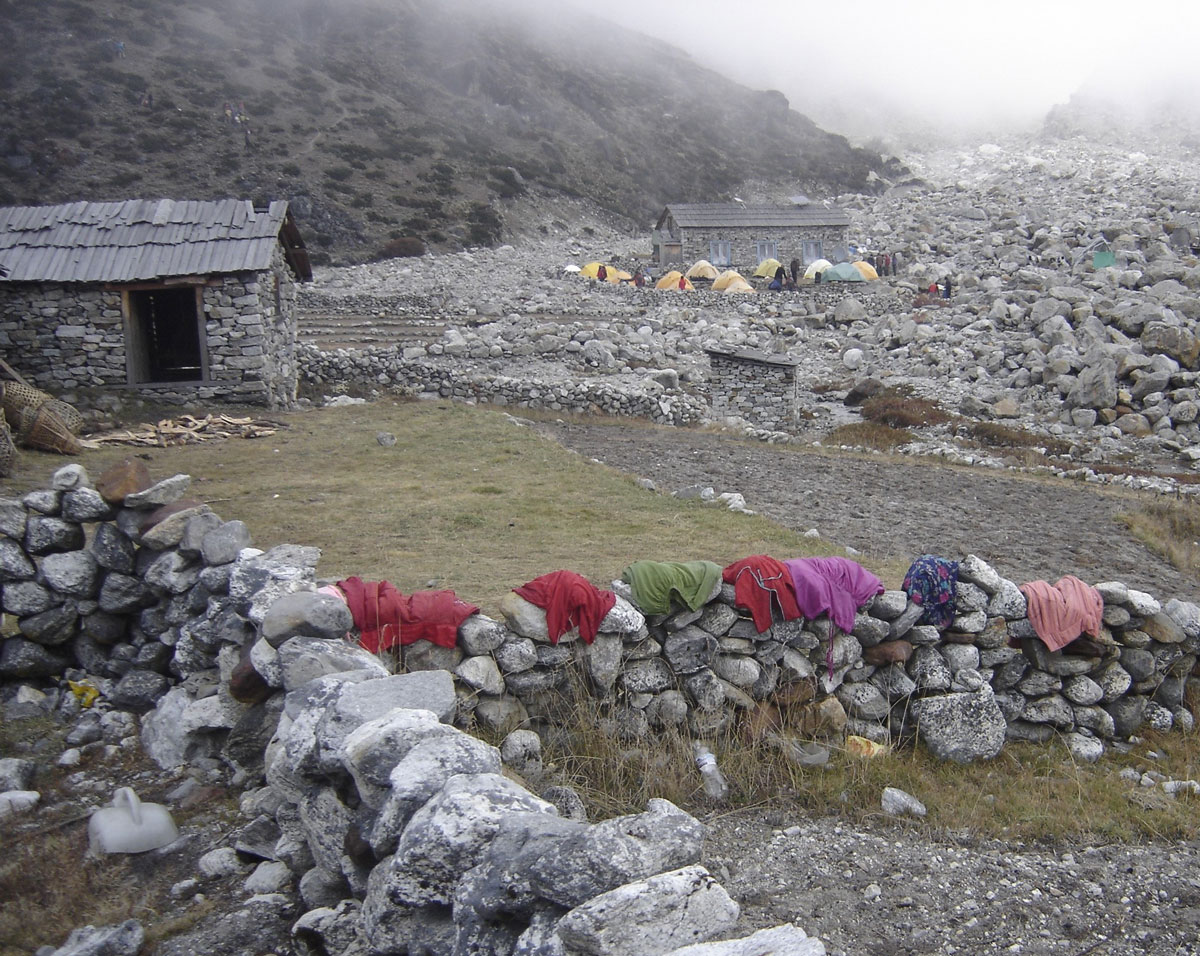
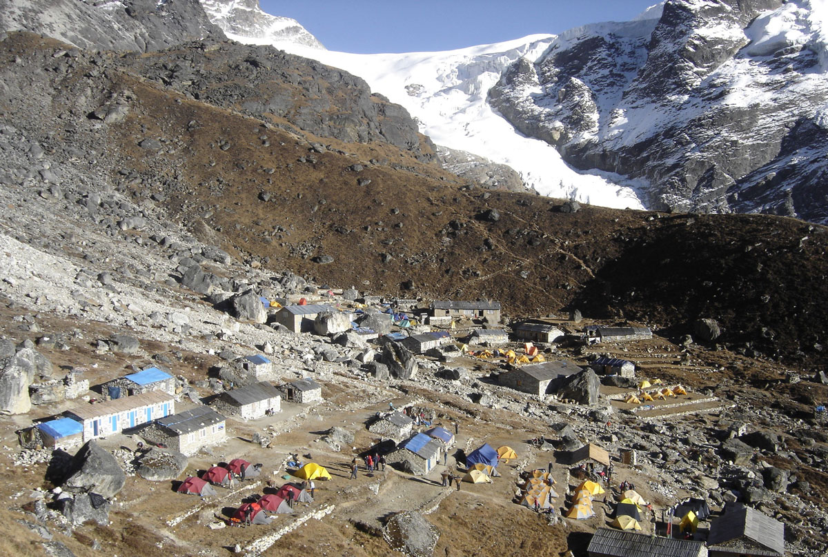
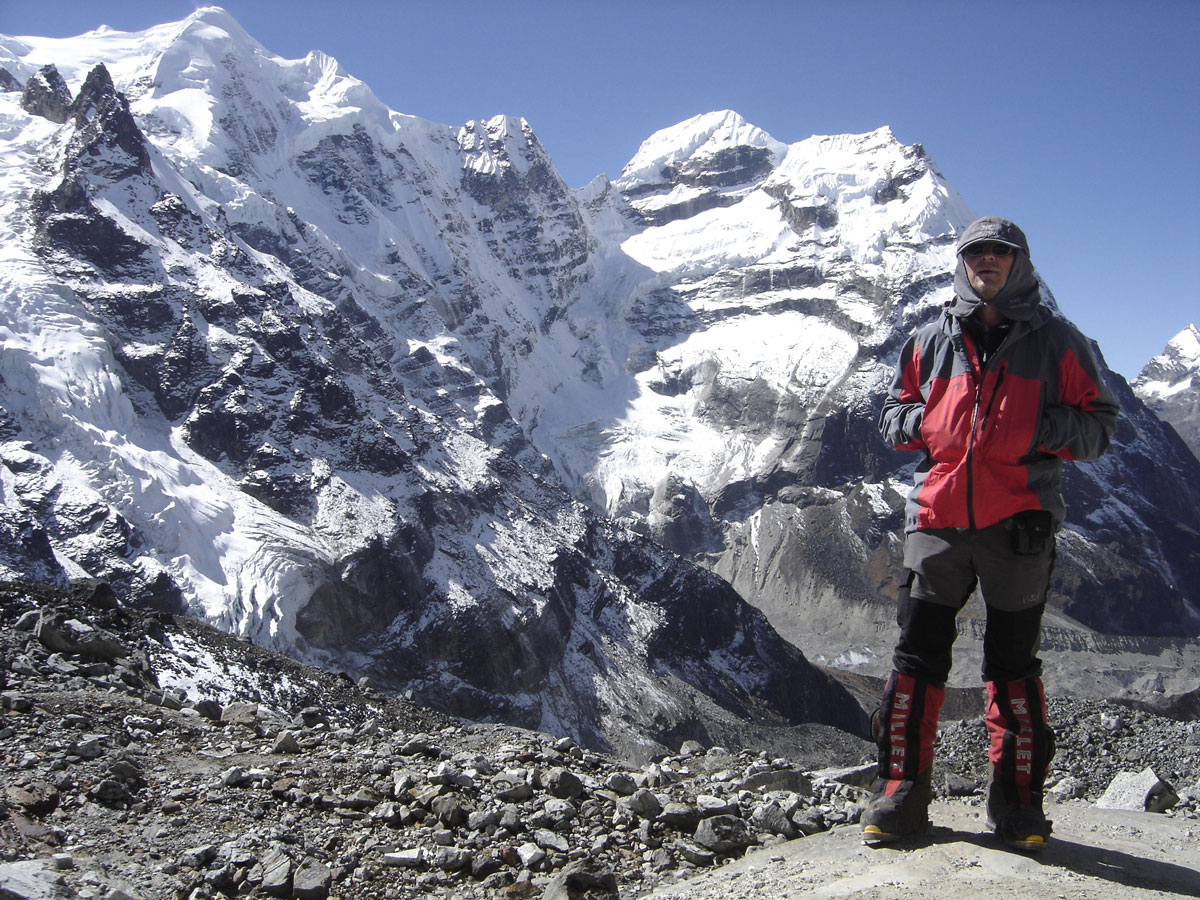
Khare (4890 m a.s.l.) is a proper small settlement, featuring several large lodges and tiny 2×2 meter shops. It is the largest settlement we have visited so far and, in my opinion, the most beautiful due to its location. From the wide, long terraces where about twenty lodges are situated, one can enjoy a magnificent view of the Hinkhu Valley and its surrounding peaks. It is from here that we caught our first glimpse of two of the three highest summits of the massif: Mera Peak Central (6476 m a.s.l.) and Mera Peak North (6347 m a.s.l.).
Pushing Higher
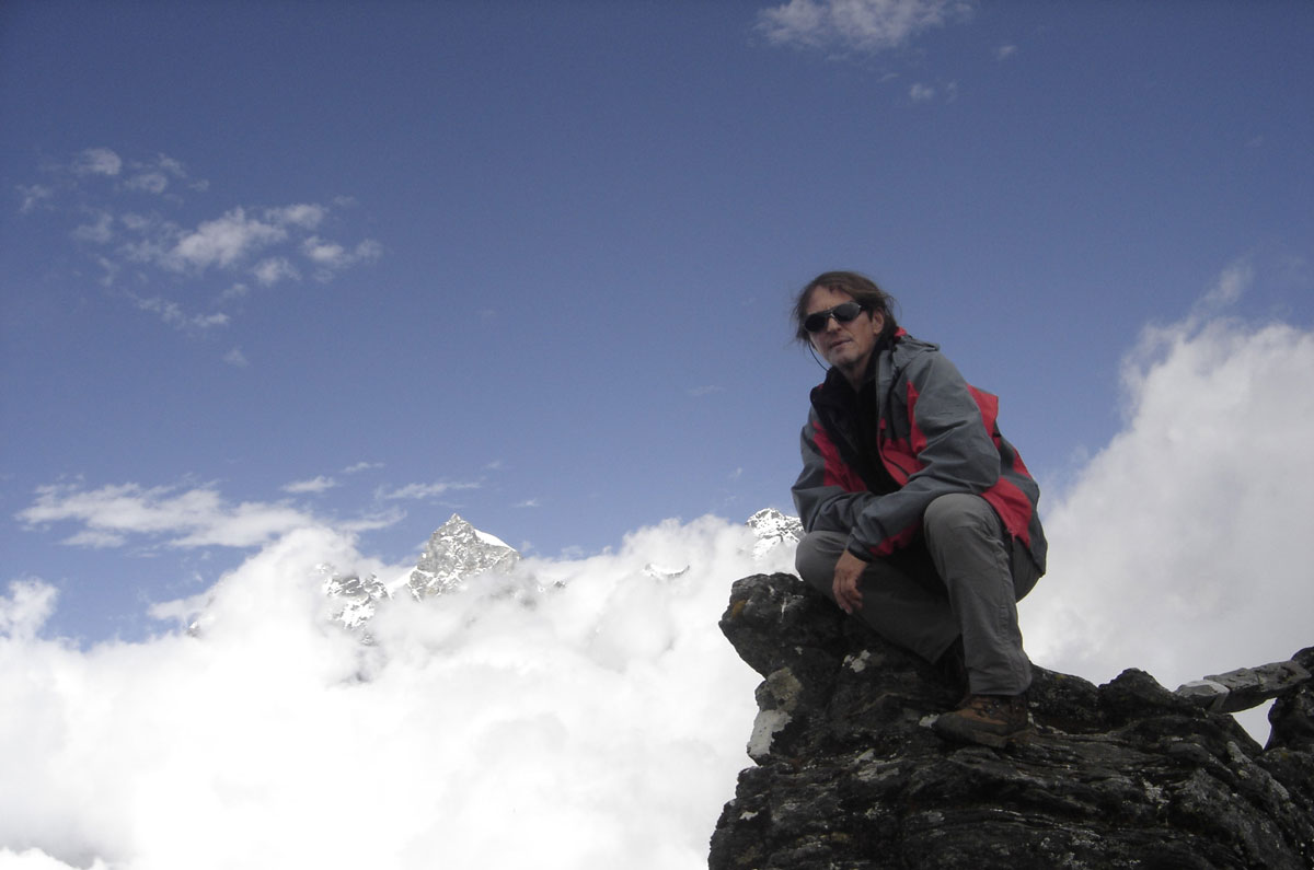
After lunch and a bit of rest, Redžep, Sanja, and I set out for an afternoon acclimatization climb on a nearby ridge, reaching an elevation of 5170 m a.s.l. From this vantage point, we had an extraordinary view of the Mera La pass, which serves as the gateway to the highest peaks of the massif.
Upon returning to Khare, we found the Iranians and French teams busy pitching their tents. At dinner, we sat with a group of climbers from England and Singapore. They were understandably dejected; they were heading home without reaching the summit. They had attempted the climb twice, but fierce winds had blocked their path both times.
October 24, 2009: Khare
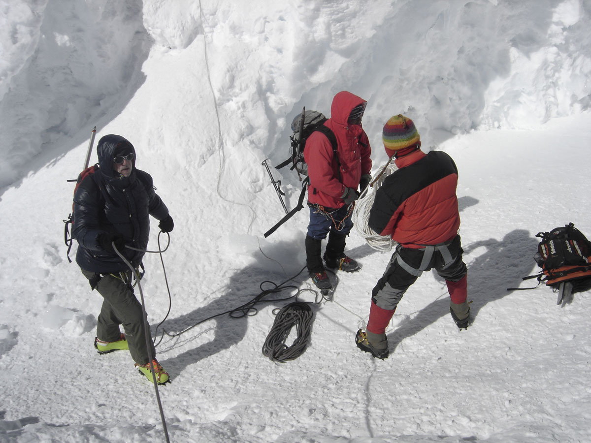
We spent the morning on the ridge above the settlement performing final technical checks on our climbing gear. This involved practicing descents on fixed ropes to ensure everyone was comfortable with the equipment. After lunch and some rest, we began the meticulous process of packing our rucksacks for the coming days.
In the afternoon, Sherpa Ramis, one of our guides, arrived with good news: the team had successfully transported and pitched the tents at High Camp. Everything is now in place for our final summit push on Mera Peak. We spent the evening in the lodge sharing stories with Russian and Czech climbers who, like us, are moving up to High Camp tomorrow.
Before retreating to our tents, we stood for a moment staring at the sky, which was thick with a blanket of stars. We couldn't help but wonder what the weather would hold for us. Sleep was hard to find; the air was thick with anticipation. Tomorrow, the final ascent to the summit of Mera Peak Central begins—the very goal that brought us to Nepal and the Himalayas.
October 25, 2009: Khare – Mera La – High Camp
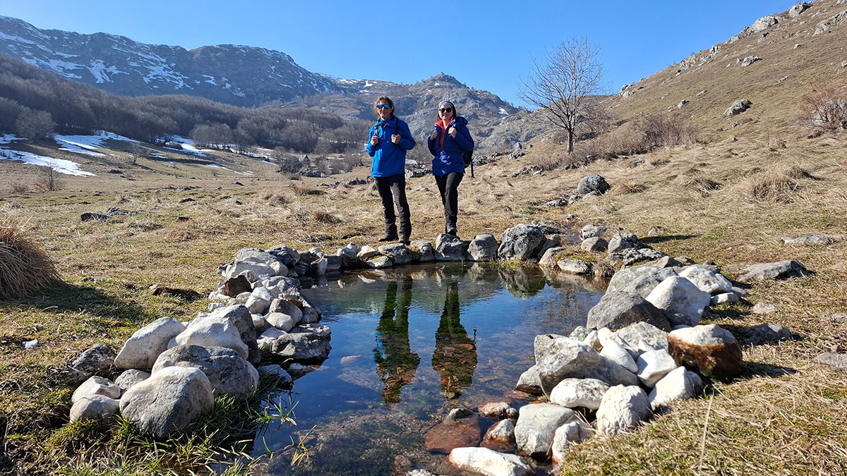
The tenth day of our journey dawned beautiful and sunny. At 09:00 AM, we departed for High Camp. The trail began with a steep climb over sharp, rocky terrain leading to a small hollow with a solitary hut. Just like at the Zatrwa La pass, we were greeted by a cheerful, smiling young woman. I am not sure if a higher tea shop exists in the world, but at 5045 m a.s.l., this is certainly the highest place I have ever sat down for tea.
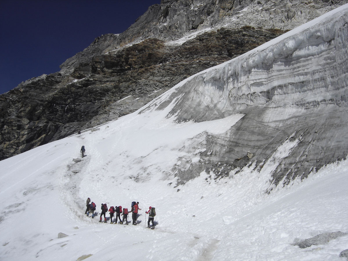
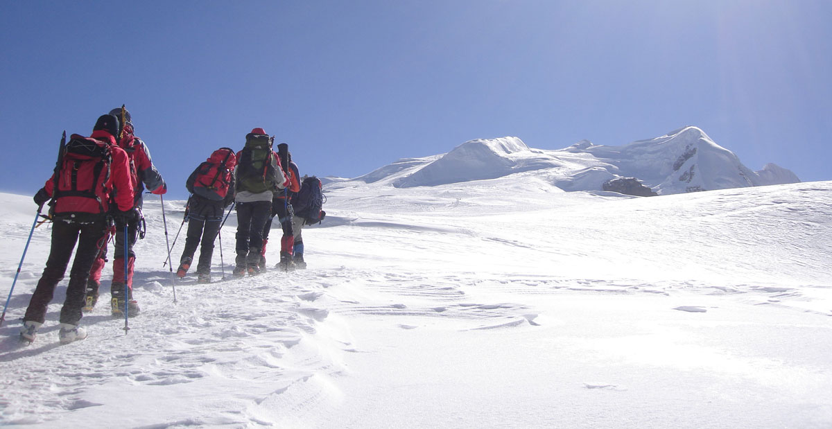
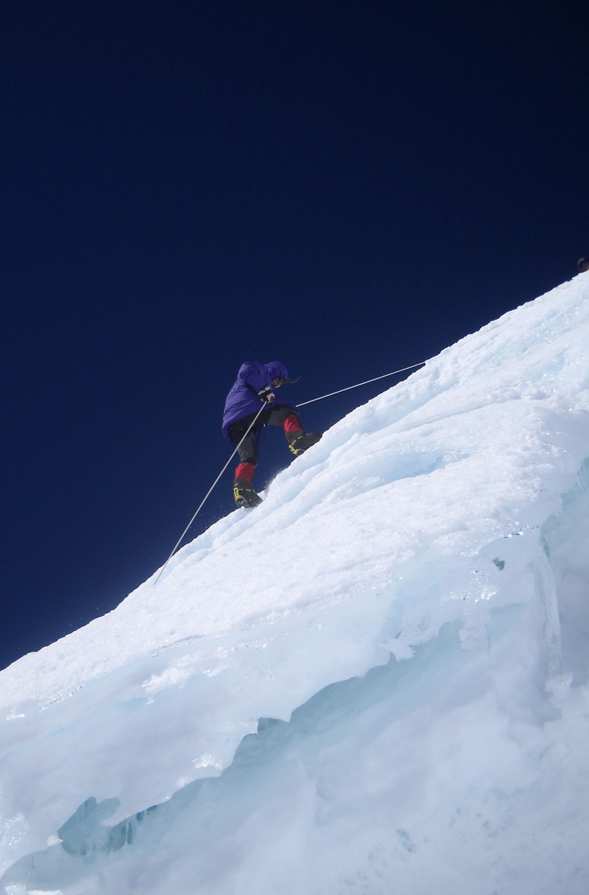
After a short rest, we continued over the rocks and soon reached the glacier at 5100 m a.s.l. We donned our crampons and ascended the frozen slope. The terrain eventually leveled out into a vast, wide plateau with a well-trodden path. Sherpa Angelo Lakpa and Miloš warned us to stay strictly on the trail due to the hidden crevasses scattered across the surrounding ice.
The Gateway to the Summit
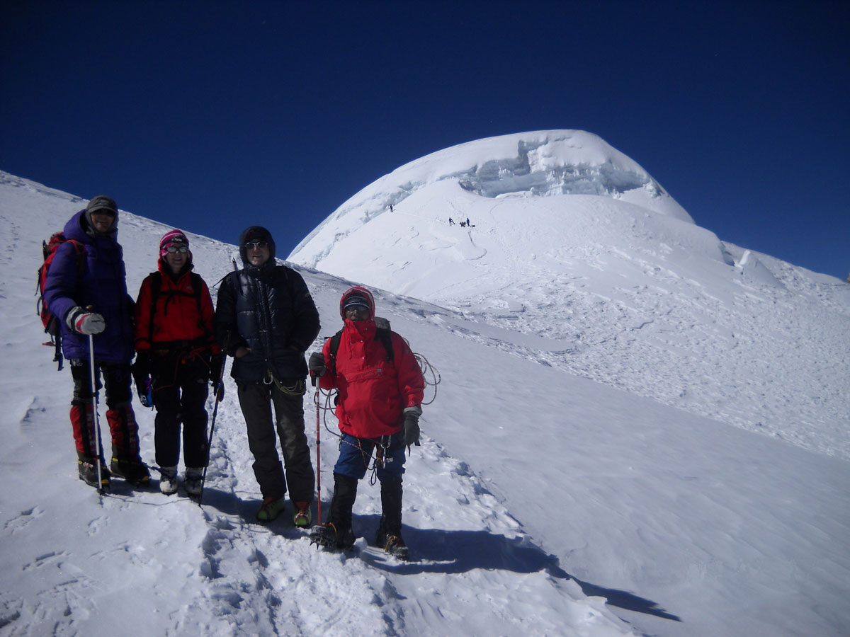
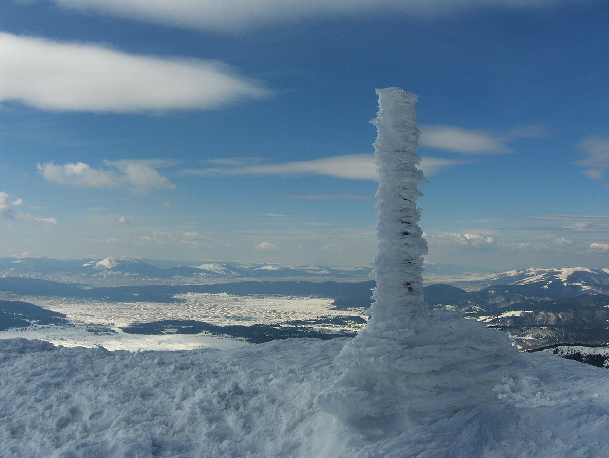
We reached the Mera La pass (5450 m a.s.l.) and took a break for lunch. From the pass looking south, we could clearly see High Camp (5750 m a.s.l.), our target for the day. To the right stood the three snowy pyramids of the Mera Peak massif: Mera South (6064 m a.s.l.), Mera Central (6476 m a.s.l.), and Mera North (6347 m a.s.l.). Slightly below the pass to the east lies Base Camp (5350 m a.s.l.), which serves as the approach for both Mera Peak and the neighboring Baruntse (7129 m a.s.l.).
At this point, Dragan Malinović made the difficult decision to return to Khare. He explained that he was feeling unwell. It was surely a hard moment for him, but his decision was deeply honest—both to himself and the team.
Settling into High Camp
From the pass, we continued the ascent toward a massive rock formation resembling a sea cliff. Our tents were pitched on a narrow ledge in the lee of this rock. We arrived at High Camp after a total of 8 hours of trekking, including four major breaks, having gained 840 meters in elevation today.
As darkness fell, a cold wind began to howl. Before the weather forced us into our tents, Miloš gave us the final instructions: wake-up call at 02:00 AM, followed by the rope-team assignments for the summit push. During the night, our Sherpas brought hot tea and soup to our tents twice. We had very little appetite at this altitude, so the fluids were exactly what we needed.
October 26, 2009: High Camp – Mera Peak Summit – High Camp – Khare
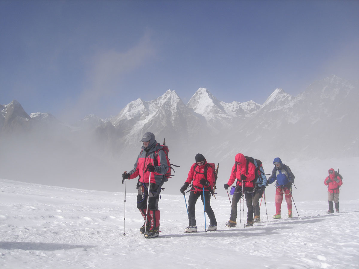
We woke up at 02:00 AM. It was incredibly cold inside the tent, and a freezing wind was howling outside. The hardest part of the morning was forcing ourselves out of the warmth of our sleeping bags. In the cramped space of the tent, Redžep and I struggled to pull on our protective layers, climbing harnesses, and boots with crampons. Our rucksacks were packed with only the essentials: spare gloves, a hat, a thermos of tea, raisins, chocolate, and biscuits.
Outside, we formed two rope teams.
- Team 1: Sherpa Angelo Lakpa, Miloš Ivačković, Aleksandar Spasić, Jovo Elčić, and Bobana Petrović.
- Team 2: Sherpa Nima, Redžep Grabus, Sanja Mitrović, and myself.
Before departing, we joined hands in a circle, wishing each other a safe ascent. Milan Kurilić and Sandra Božić decided to stay behind due to health issues; though we were saddened they couldn't join the final push, we deeply respected their decision—life always comes first.
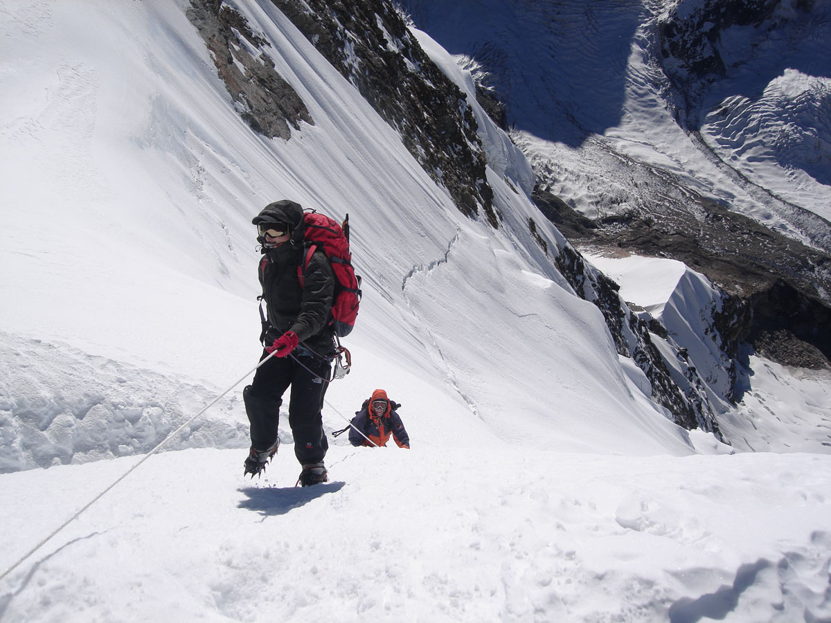
The Ascent into the Light
We set off at exactly 03:00 AM, our headlamps cutting through the darkness to illuminate the trail. We climbed in silence, each of us lost in thought, focusing on the rhythm of our breathing, the beat of our hearts, and constantly moving our fingers and toes to ward off frostbite.
I found myself thinking about the boots I was wearing—they were lent to me by Kenan Muftić, a legendary Bosnian mountaineer. These boots carry their own history, having reached the summits of Ama Dablam, Aconcagua, Mount Everest, and Mount McKinley. They have brought luck and success to everyone who wore them, and I trusted they would do the same for me.
After two hours, the wind died down significantly. We were overjoyed; if the weather held, the summit was “ours.” At dawn, a crimson glow bathed the Himalayan giants—a sight of such profound beauty that it will remain etched in my memory forever. Due to the thin air, our breaks became more frequent. Eventually, we reached a vast plateau where our goal finally came into view. Sherpa Nima told us it was only one hour to the top.
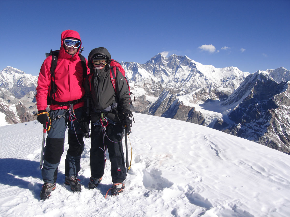
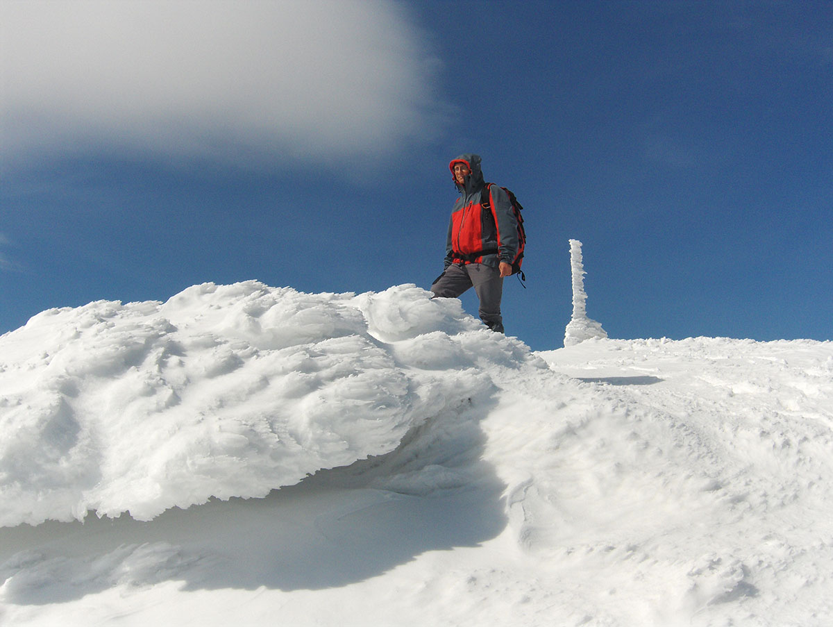
The Summit of Mera Peak Central (6476 m a.s.l.)
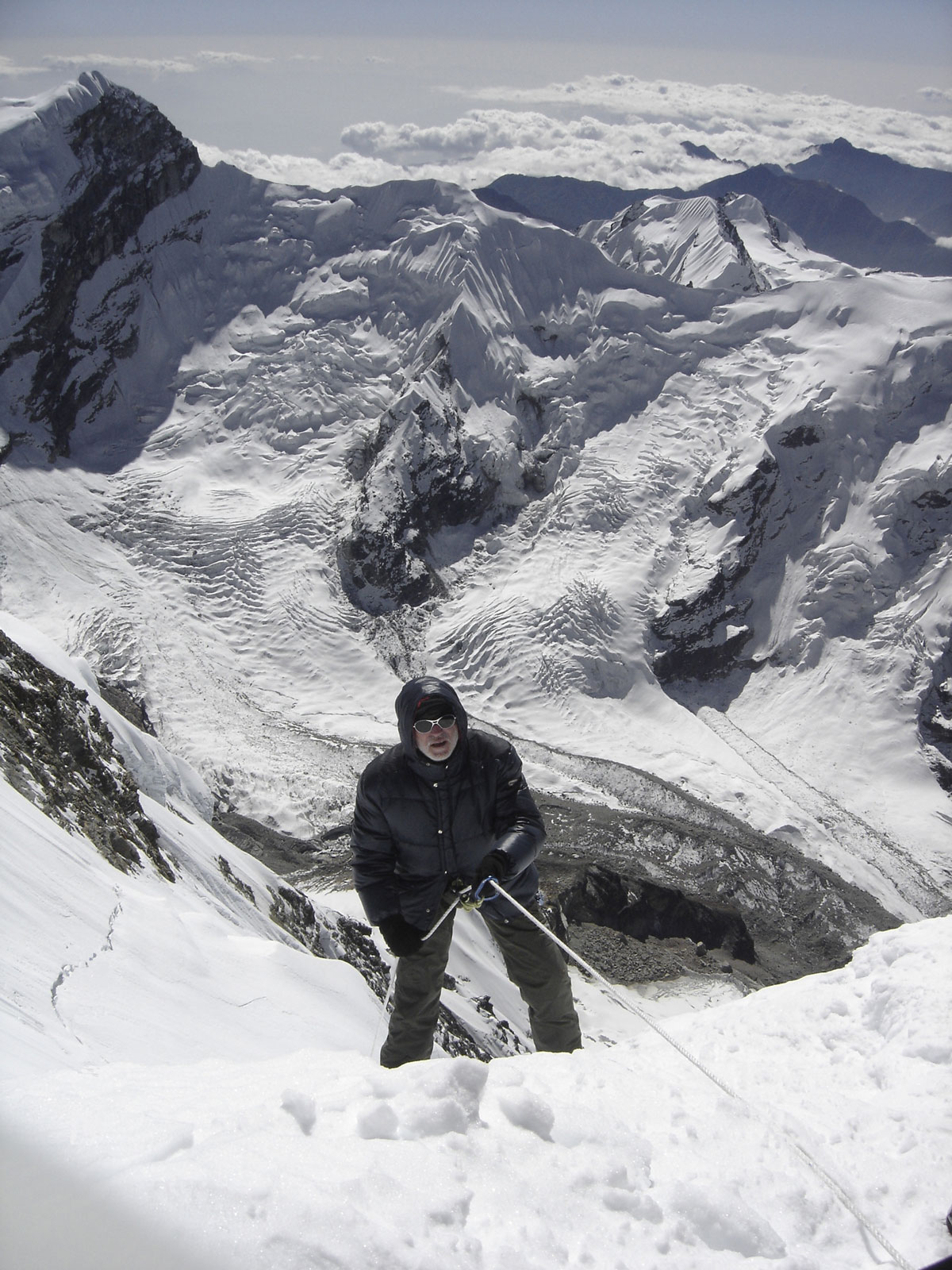
At the base of the final pyramid, we met the first rope team already on their way down. We congratulated them warmly. The final summit pyramid of Mera Peak Central is about 50–60 meters high with a slope of 60–70°. We climbed from a wide crevasse using a fixed rope.
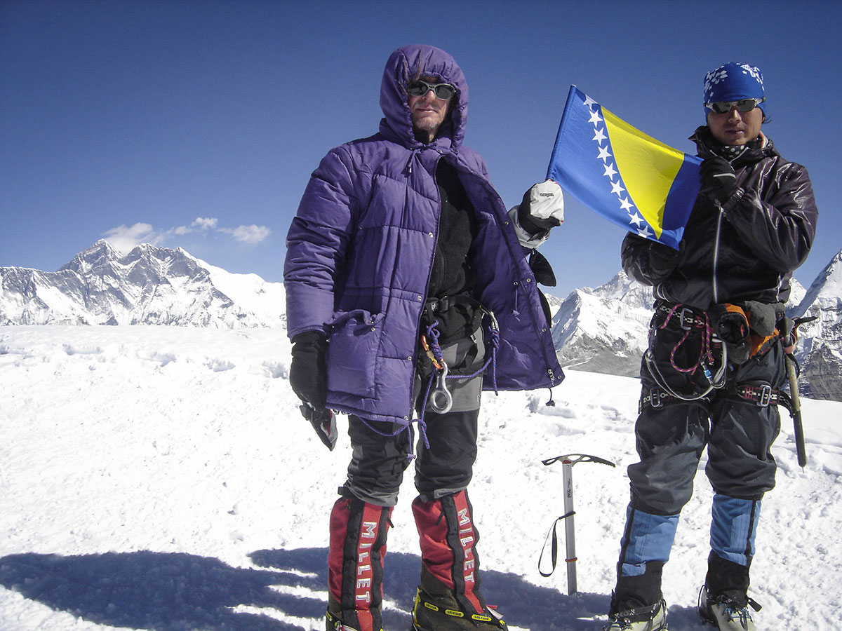
At the top, Sherpa Angelo Lakpa greeted us with a smile. After six hours of climbing, we unfurled the flag of Bosnia and Herzegovina, which fluttered for the first time on the summit of Mera Peak. The wind had stopped completely, and it warmed up enough for us to spend nearly thirty minutes taking in the view.
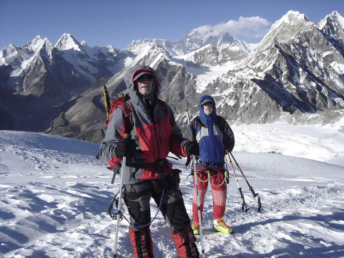
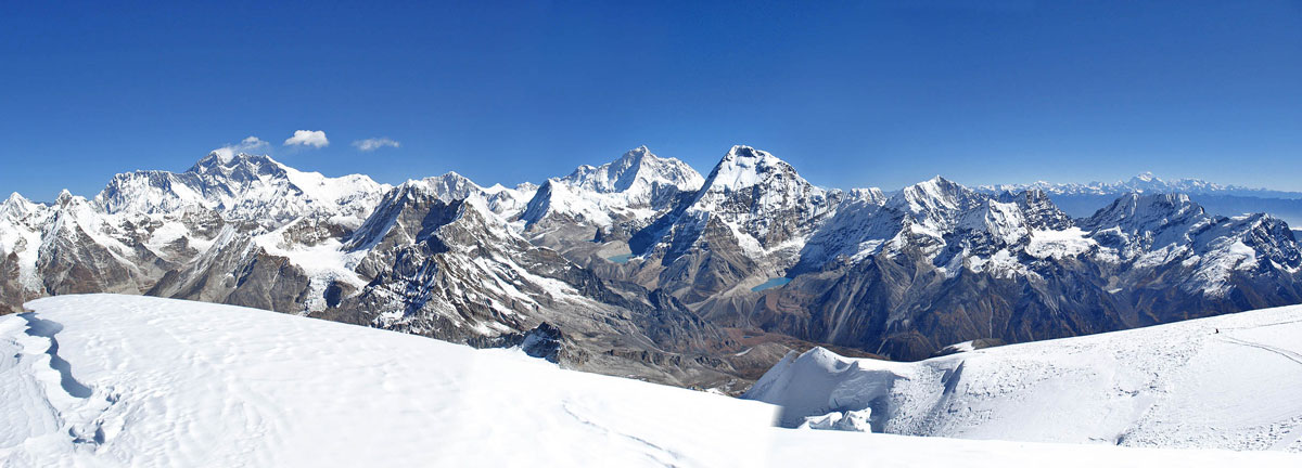
From the highest point, we gazed upon five of the world’s fourteen “eight-thousanders”:
- Mount Everest (8848 m a.s.l.)
- Kangchenjunga (8586 m a.s.l.)
- Lhotse (8516 m a.s.l.)
- Makalu (8485 m a.s.l.)
- Cho Oyu (8201 m a.s.l.)
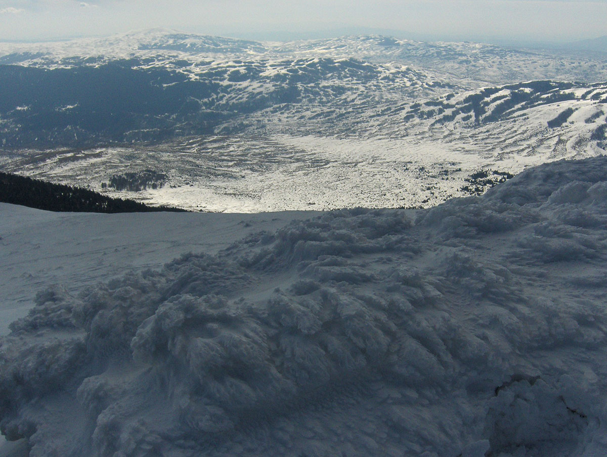
We could also clearly see Gyaching Kang, Pumo Ri, Ama Dablam, Baruntse, and Chamlang. We had suspected that travel agencies might be exaggerating when they praised the view from Mera Peak, but they were right. It is an experience that must be lived to be understood.
The Long Way Down
We descended carefully, knowing that most accidents happen on the return when fatigue sets in and concentration slips. We reached High Camp with Angelo, Nima, and Miloš, where our thoughtful Sherpas greeted us with hot tea.
We finally arrived back in Khare at 17:00 PM, exhausted after 14 hours on the move. That evening, the lodge was alive with celebration as we toasted our success alongside climbers from Russia, France, the Czech Republic, Belgium, and Iran.
October 27, 2009: Khare – Tangnag – Taure – Mosom Kharka
The weather continues to be on our side—every day has been bright and sunny. Today, however, we faced a grueling, long-distance trek back to Mosom Kharka. The pace was significantly faster now that we were descending.
Along the way, we crossed paths with a group of cheerful Scots heading toward Mera Peak. They were eager for details about the ascent and mentioned they were attempting the summit independently, without the assistance of Sherpas. We wished them the best of luck and continued our journey down the Hinkhu Valley. After seven hours of navigating rocky terrain and trekking through the wide riverbed, we finally reached Mosom Kharka.
October 28, 2009: Mosom Kharka – Tashing Ongma – Tashing Dingma – Taktor – Thuli Kharka
From Mosom Kharka, we continued our trek toward Thuli Kharka. We began along the edge of the riverbed before hitting the “EKG” trail—which we remembered vividly from our way up—pushing “up and down” until we reached Tashing Ongma. From there, the trail led uphill through the lush, jungle-like forest to Tashing Dingma. We stopped there for lunch and a well-deserved rest, knowing a constant, taxing ascent still lay ahead of us.
We finally reached Thuli Kharka after 8 hours on the trail, including our lunch break and several shorter rests. We spent the evening in a nearby lodge, enjoying the company of the Iranian climbing team.
October 29, 2009: Thuli Kharka – Zatrwa La – Zatrwa Og – Lukla
Today is the “big push”—we have to cross two high passes and descend all the way back to Lukla. We set out from Thuli Kharka alongside numerous trekkers and expedition members who had also been on Mera Peak. We’ve come to know many of them over the past few days; we stop for photos, exchange emails, and swap phone numbers. Some express a genuine interest in visiting our mountains back home. While I deeply respect the world’s great ranges for their staggering, raw beauty and the challenge of their high peaks, I still believe our mountains are unique—crafted to a human scale, meant for true enjoyment.
For the second time in just ten days, we crossed the Zatrwa La (4613 m a.s.l.) and Zatrwa Og (4538 m a.s.l.) passes. As soon as we cleared the last one, a sense of relief washed over the group; from here on, it’s all downhill to Lukla.
Familiar Faces in Chutanga
By late afternoon, we reached Chutanga. Nothing much had changed during our absence. The elderly man was still there by the stream, skillfully slicing bamboo into strips for porter baskets. The children were playing just as they were on our first day, and the adults were busy with their “hospitality,” offering drinks to passing foreigners. We took a long break for lunch on the dirt terrace above the lodges.
As we continued toward Lukla, we collected small stones of interesting shapes—simple keepsakes to remember our time in the world’s greatest mountain range. We finally reached Lukla after 9 hours of hiking, including our rests and lunch.
A Promise Kept
After resting and having dinner at the “Paradise Lodge,” we kept the promise we made at the start of the journey. We ordered a round of “Everest” beers and toasted our successful ascent of Mera Peak.
October 30, 2009: Lukla
In the morning, following breakfast, we pooled our money to prepare tips for our hardworking porters. In the lodge garden, our Sirdar, Nima, distributed the funds to each porter as they signed the list. It was a moving scene; these men, with their weathered faces, could not hide their emotions and thanked us from the heart for our modest gift. Over the last 14 days, they gave their absolute all to ensure our heavy gear arrived at each camp on time. We are fully aware that without the help of Nima’s team, this journey would have been far more difficult. Meeting and spending time with these wonderful people—who live so simply and find joy in the small things we often overlook in our world—will remain a lasting and cherished memory. Before parting, we took a final group photograph, now standing together as old acquaintances and friends.
Souvenirs and “Chhang”
We spent the afternoon shopping for souvenirs and handicrafts unique to the Solo Khumbu region. After dinner at the lodge, we sat with Nima, Angelo, and the rest of the Sherpa crew, drinking chhang—a traditional local beer. In appearance and texture, it’s similar to boza, but with a notable difference: it definitely has an alcoholic kick. They warn us that if you overdo it, it can take two or three days to fully sober up from its effects!
October 31, 2009: Lukla – Kathmandu
We spent nearly half the day (07:30 AM – 12:30 PM) in the terminal building of the “Tenzing-Hillary” Airport in Lukla, waiting for our flight back to Kathmandu. It was clear there were issues—whether technical or due to the fog, we never found out—but we could see the flight crew was in a massive hurry. While standing on the tarmac next to the plane, they were loudly and hungrily slurping soup delivered to them from the terminal. We were hurried onto the plane and took off immediately. This time, the flight attendant didn't even have a moment to hand out earplugs or candy.
Through the small cabin windows, we took one last look at the Himalayan peaks. Who knows if we will ever return here? But one thing is certain: the Himalayas opened their doors wide and took us into their embrace. Whether we close those doors permanently behind us is entirely up to us.
Back to Civilization
After a smooth 45-minute flight, we landed in Kathmandu. Returning to Hotel Vajra, we immediately surrendered ourselves to the simple luxuries of civilization: a long bath, a shave, a haircut, a massive lunch, and finally—sleeping in a real, honest-to-goodness bed. It’s funny how civilization works; just as we had begun to forget its comforts, it crawled back under our skin in a single afternoon.
November 1, 2009: Kathmandu
We began our morning with a bit of exploration in Thamel, the historic heart of Kathmandu. Since we set out early, the streets were blissfully quiet, free from the usual chaotic crowds. Shopkeepers were just starting to roll up their shutters and open for the day.
Our first stops were the specialized mountaineering shops to browse the latest gear. Afterward, we spent the rest of the morning hunting for gifts and unique souvenirs to bring back home.
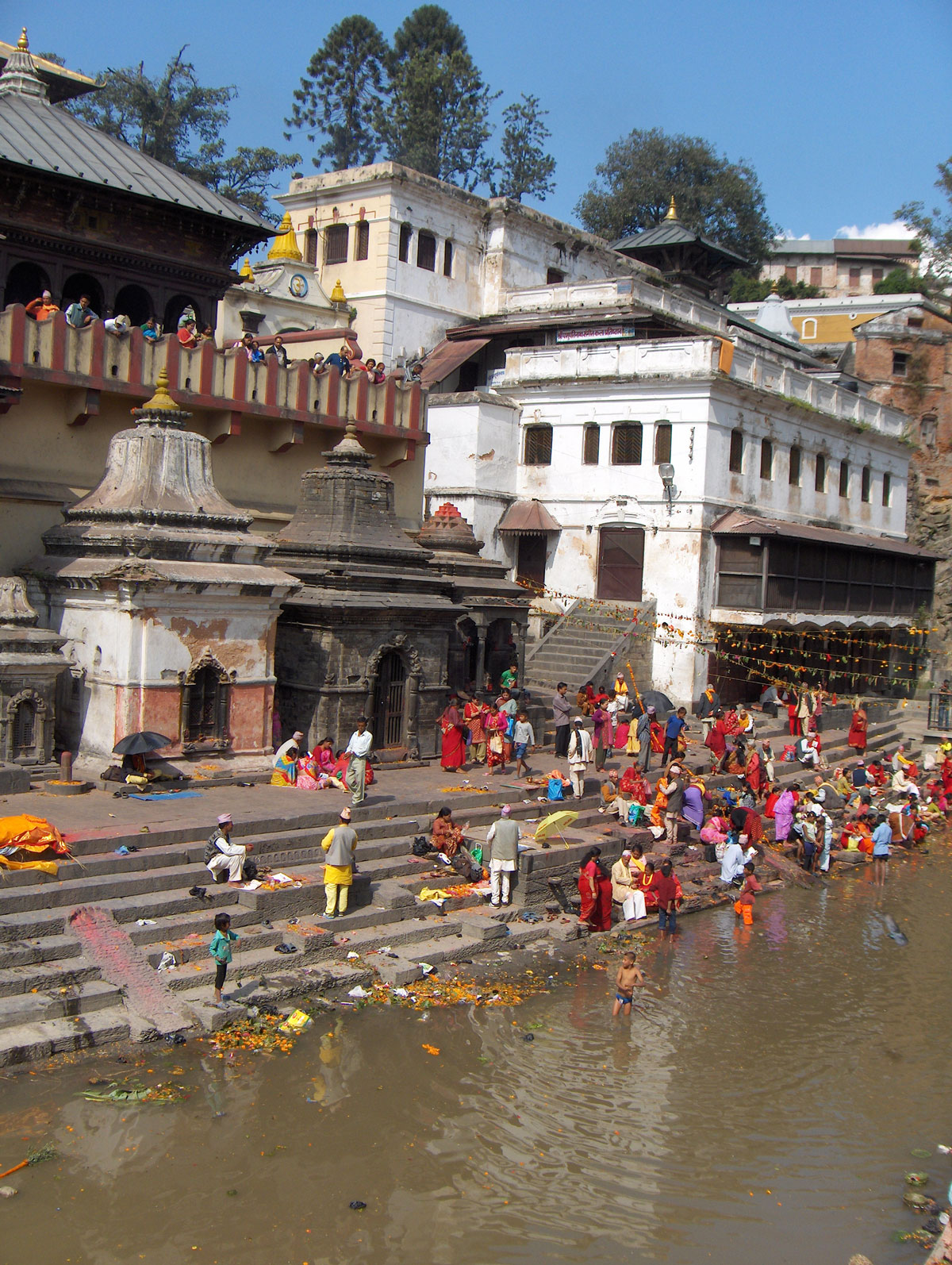
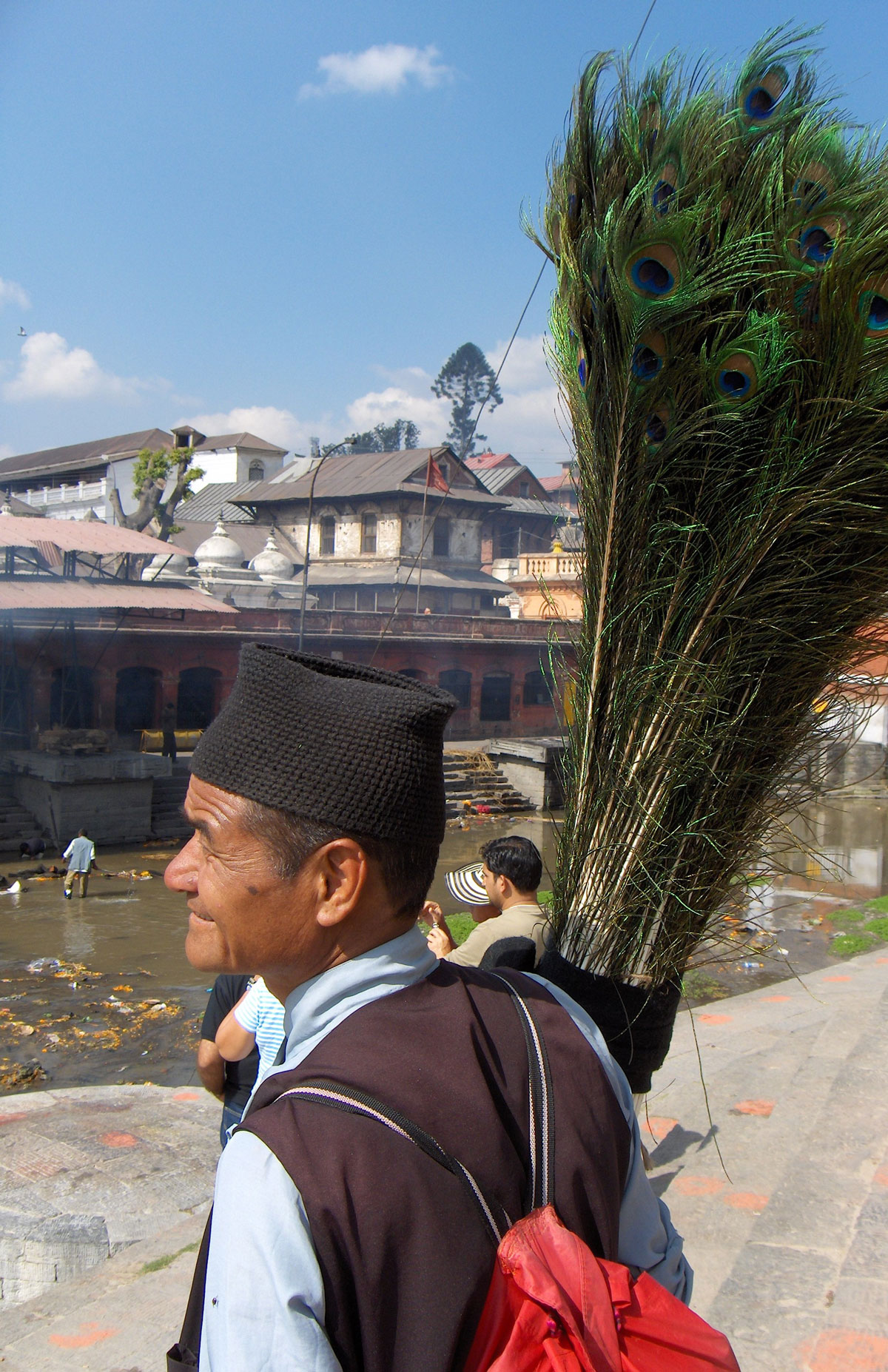
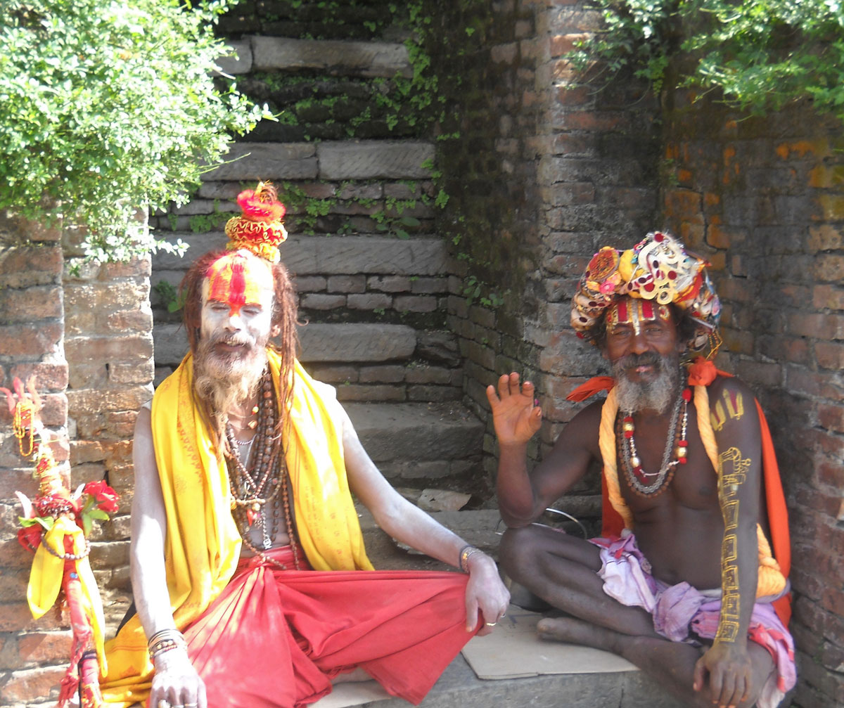
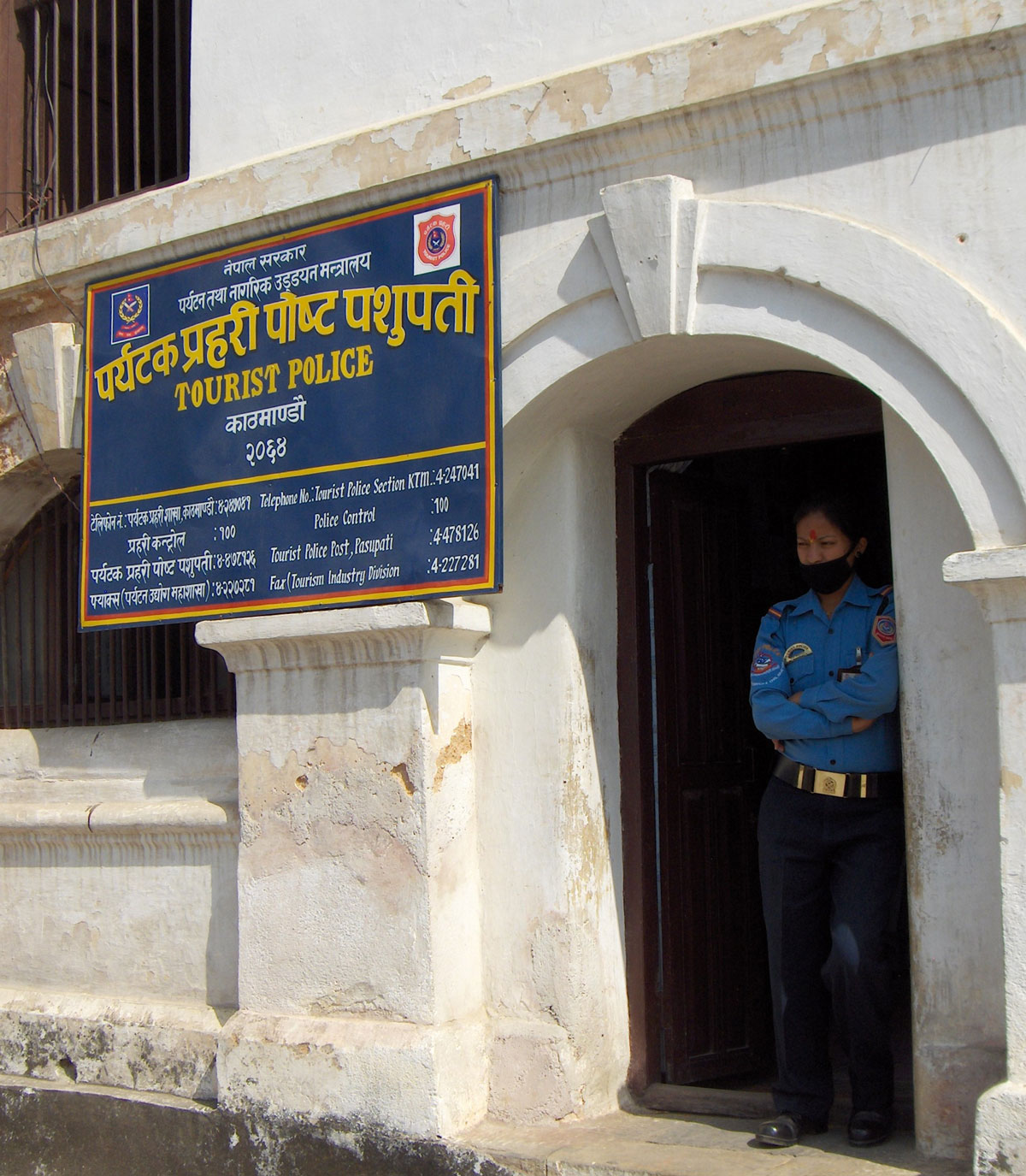
At noon, we headed to the eastern part of the city to visit the Pashupatinath Temple (often referred to as the Temple of the Dead). This is the largest Hindu temple in the world dedicated to the god Shiva, situated on the banks of the Bagmati River. The temple has been a UNESCO World Heritage site since 1979.
On the right bank of the river, directly in front of the temple, the cremation of the deceased takes place. Visitors who are not Hindu are permitted to observe this sacred funerary rite only from the left bank of the river. We were deeply shaken by the sight; for those of us coming from Europe, such an open and direct encounter with death is highly unusual and profound.
According to the latest census, Nepal has a population of 27 million. Of these, 80% are Hindu, 15% are Buddhist, and the remaining 5% consist of Muslim and Christian communities.
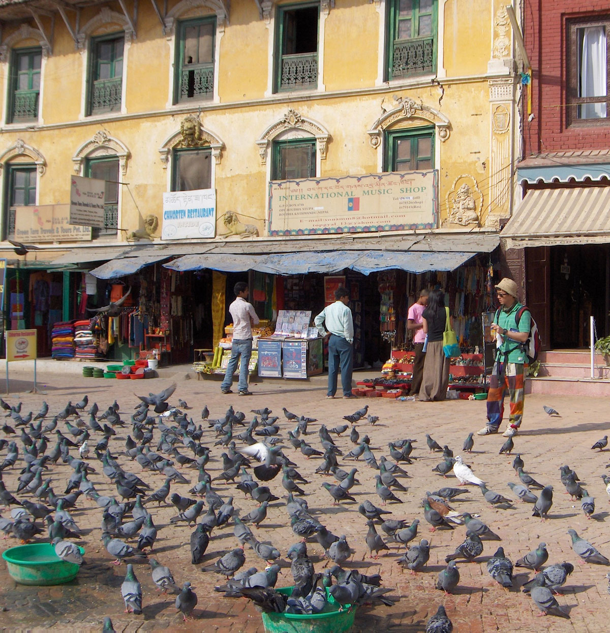
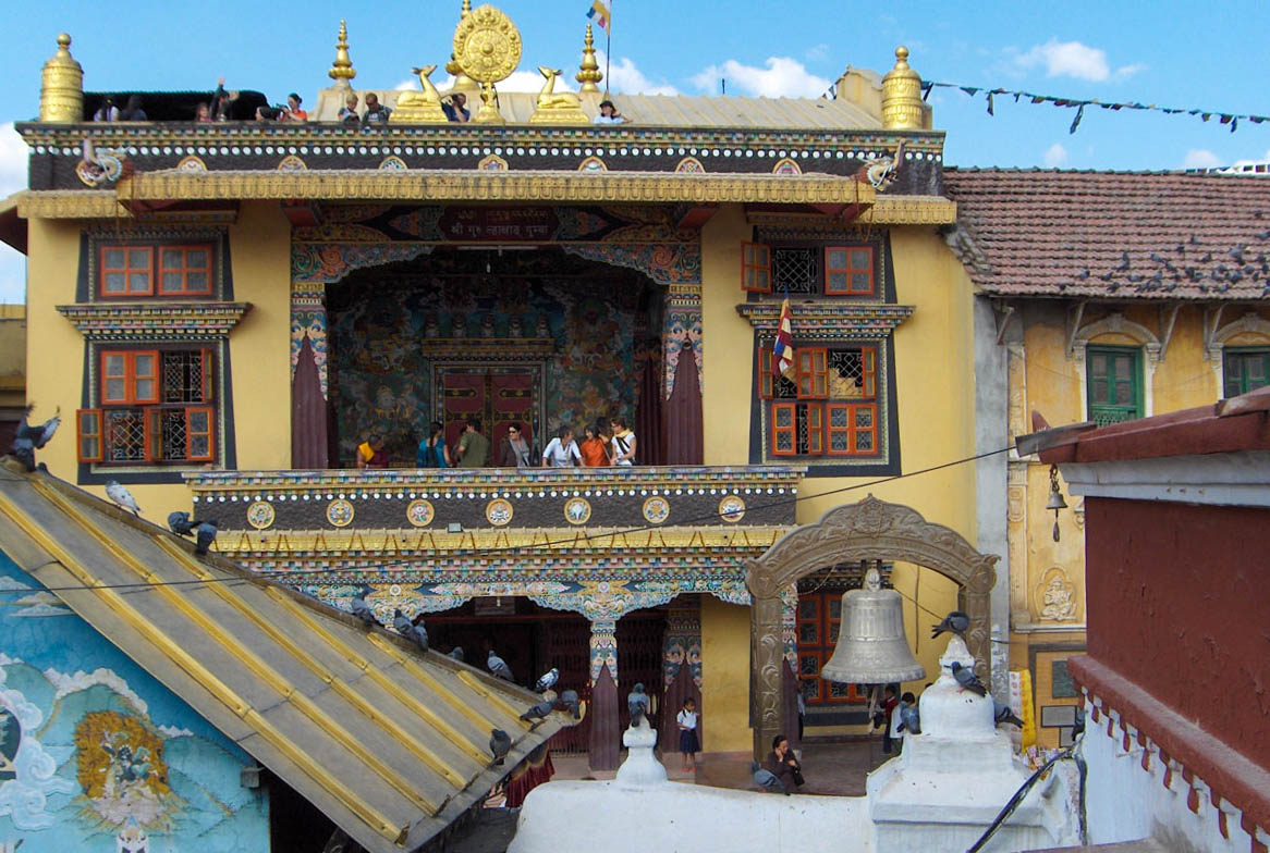
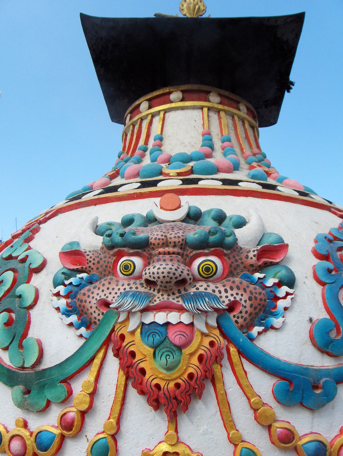
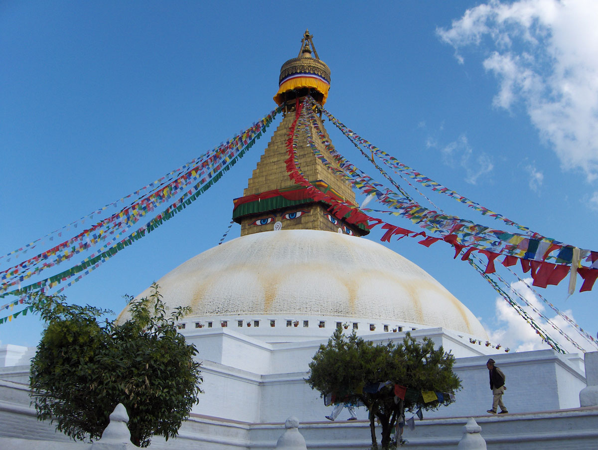
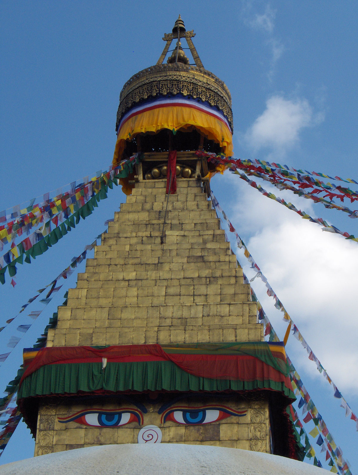
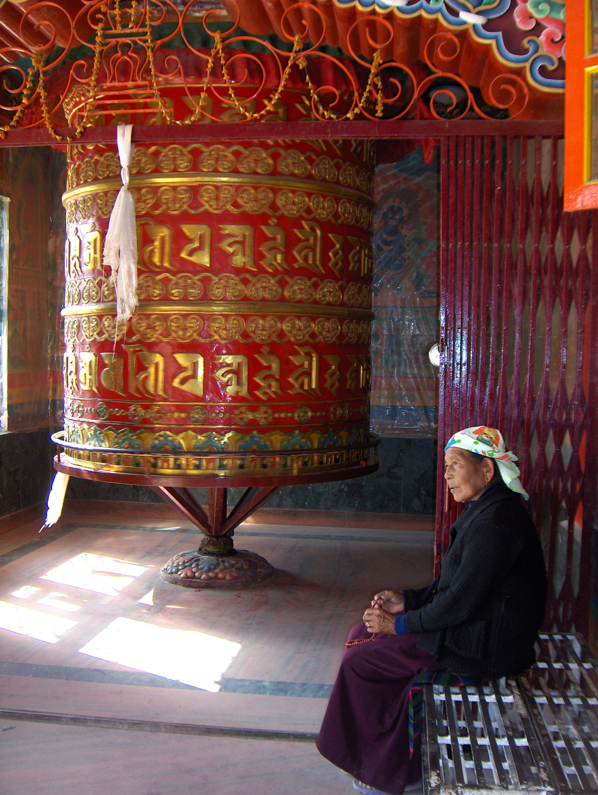
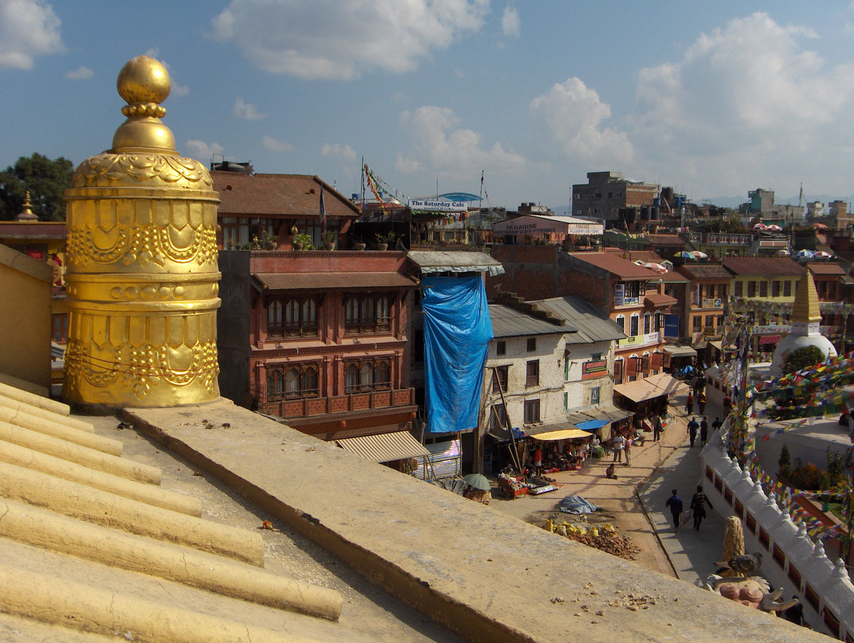
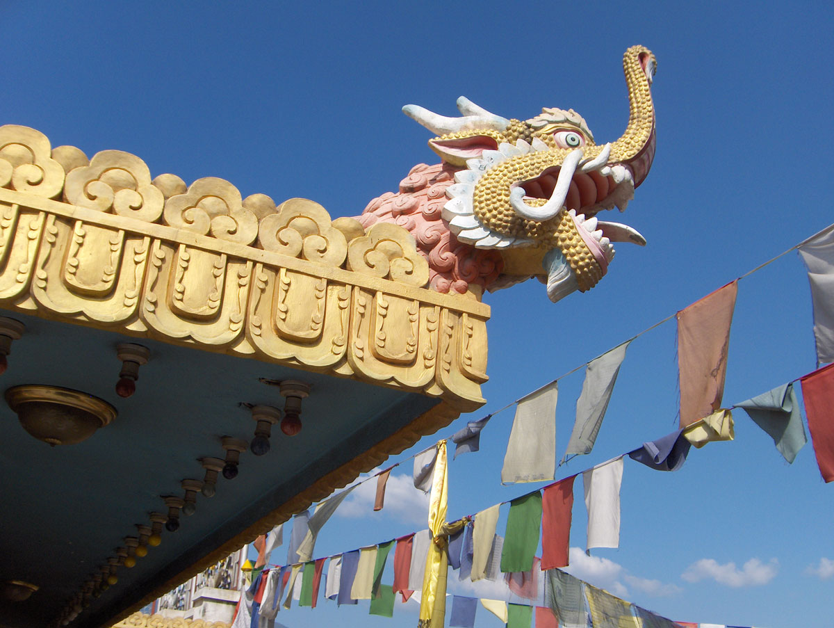
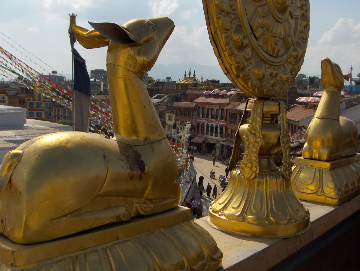
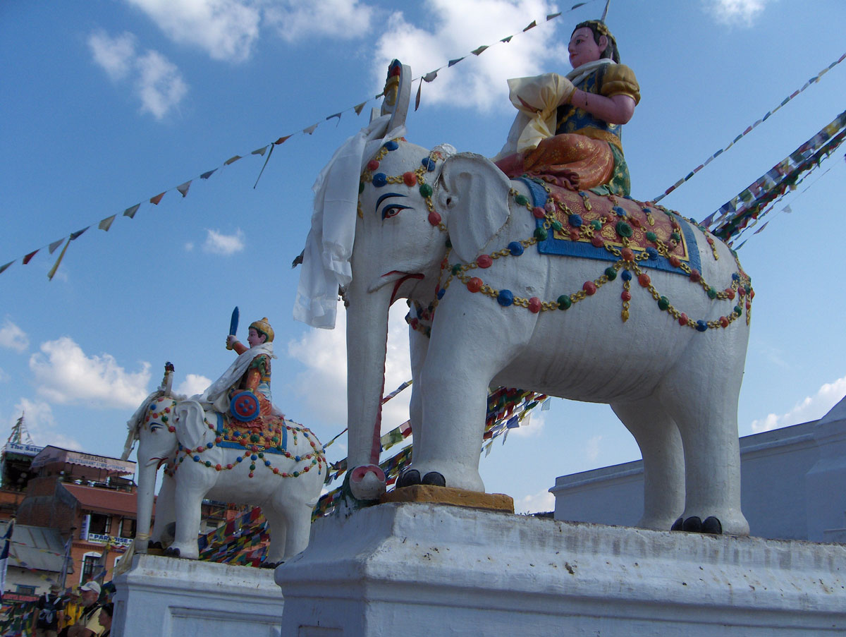
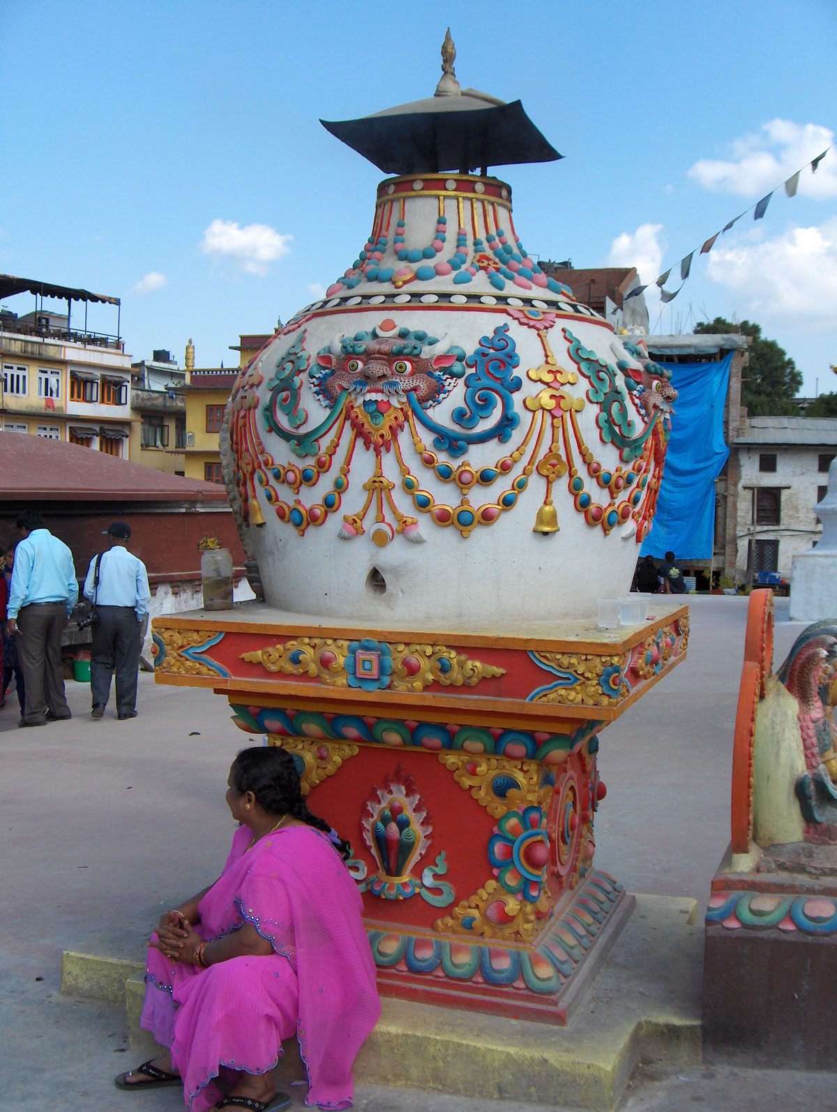
In the afternoon, we headed out to visit the Boudhanath Stupa (Buddhist Temple). This is the largest Buddhist temple in the world dedicated to Siddhartha Gautama, the founder of Buddhism. Located about 11 km from the city center, it is one of Nepal’s most popular tourist destinations and has been on the UNESCO World Heritage list since 1979.
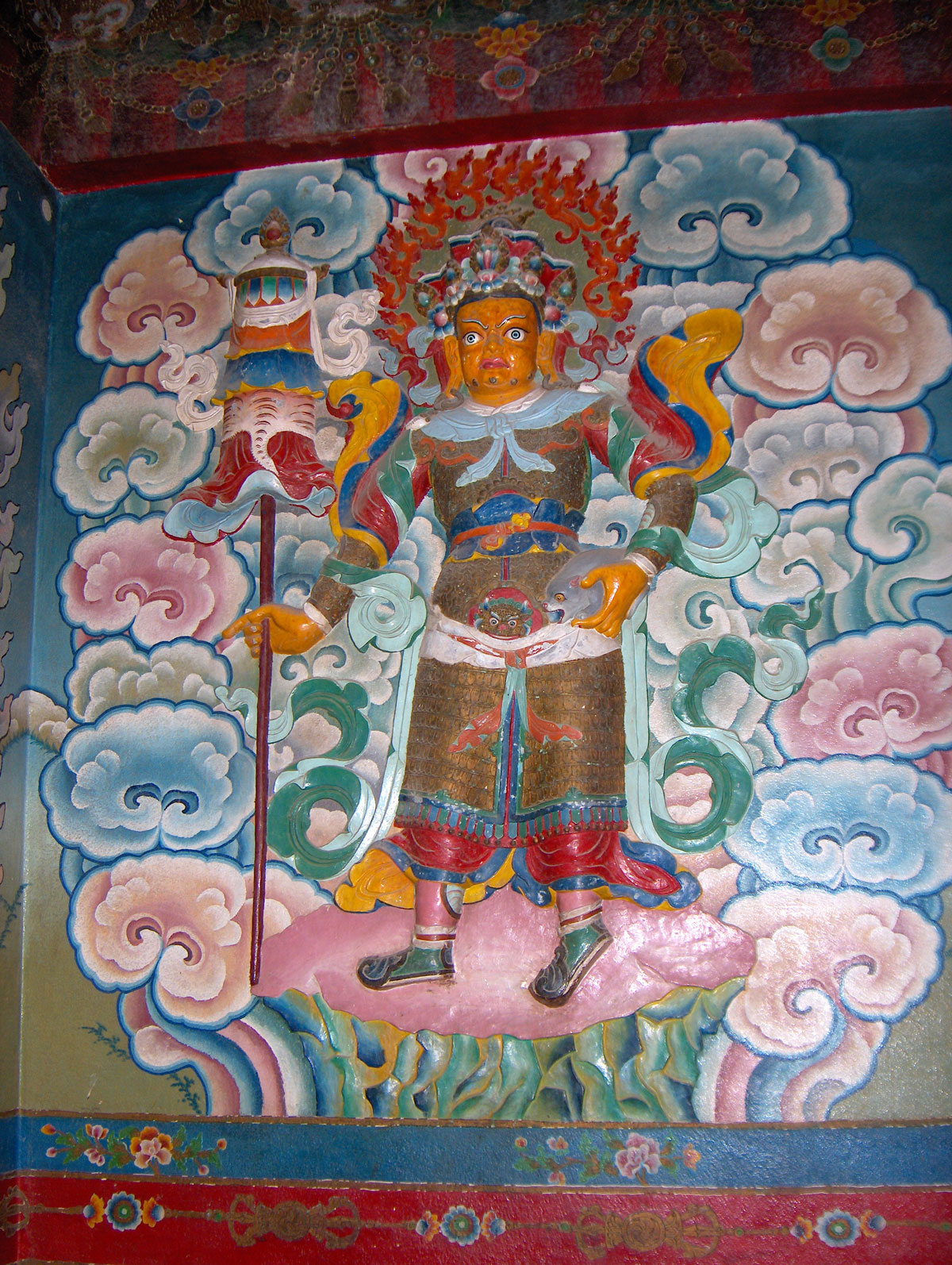
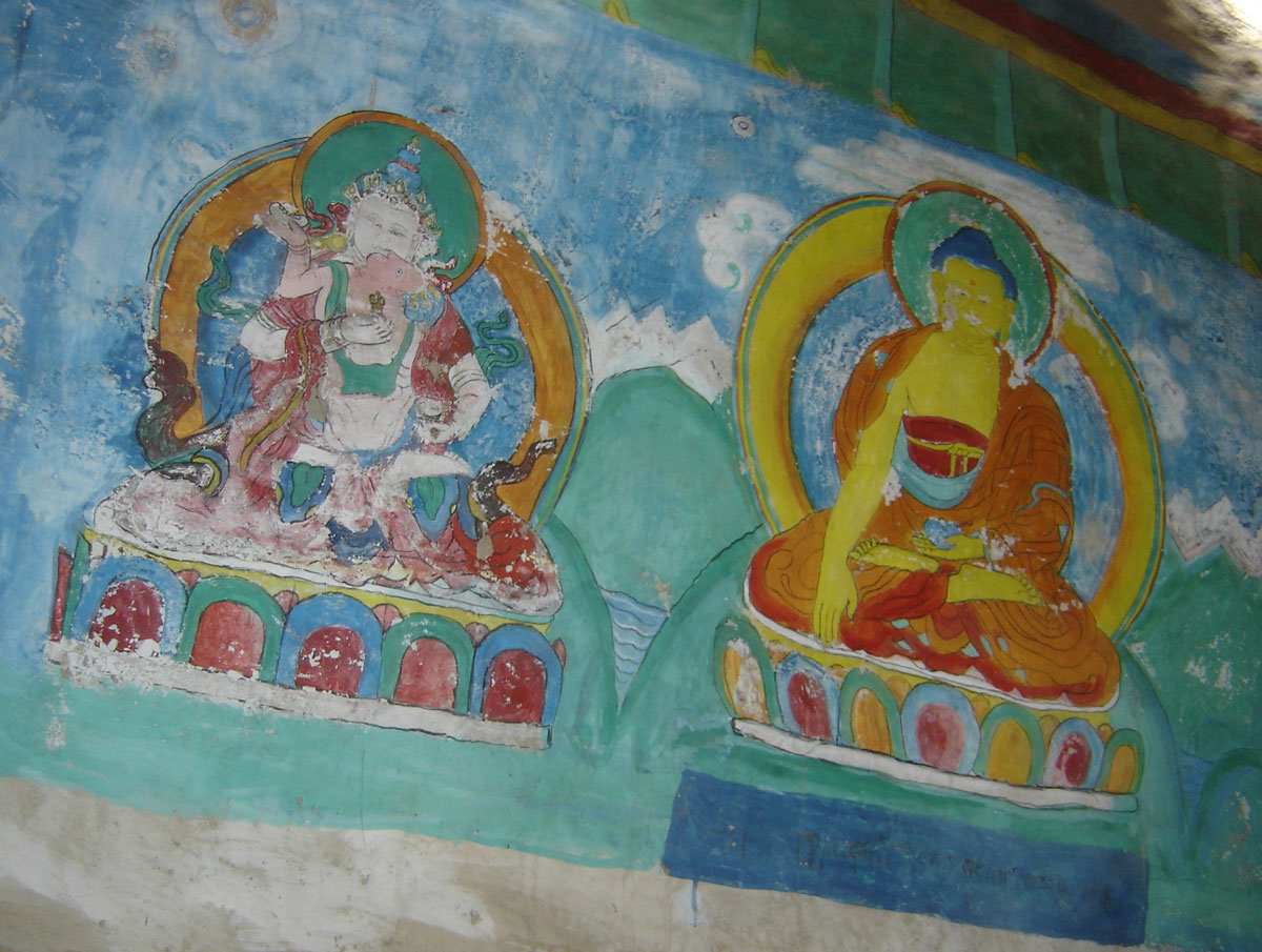
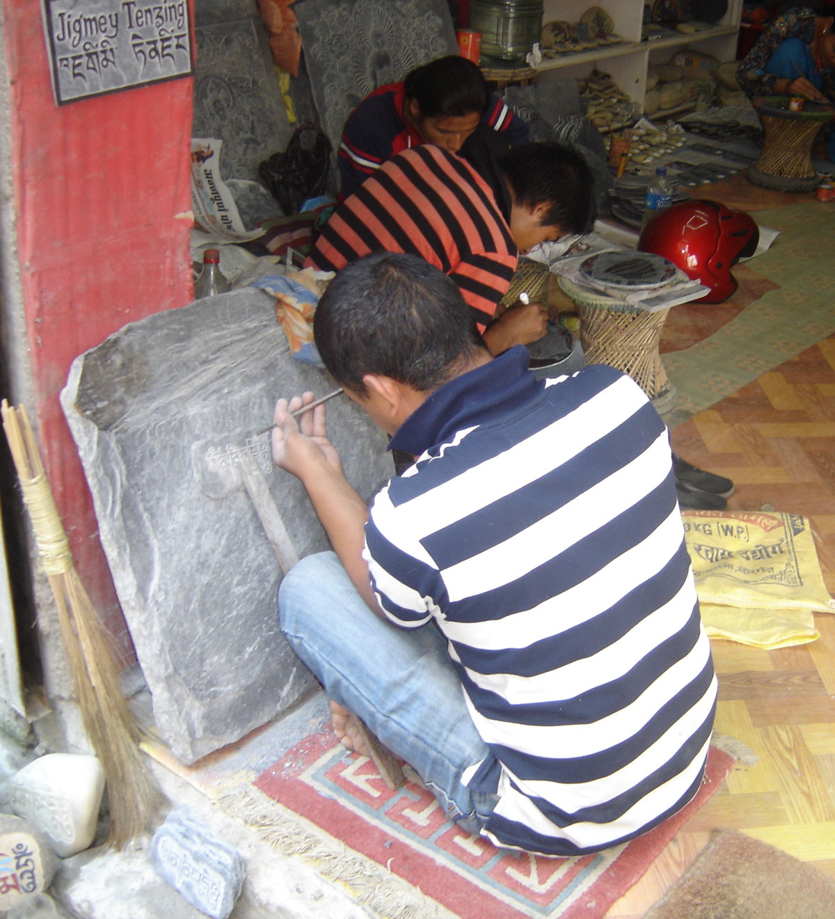
The area around the temple was bustling with pilgrims and tourists. The surrounding square is lined with souvenir shops, art galleries, tea houses, and restaurants. In one of the galleries we visited, we watched young artists working with incredible patience and precision, creating wondrous paintings inspired by religious and mystical motifs from the life of Buddha. On these vibrantly colored paintings, some of the finer details are often meticulously crafted using liquid 24-karat gold.
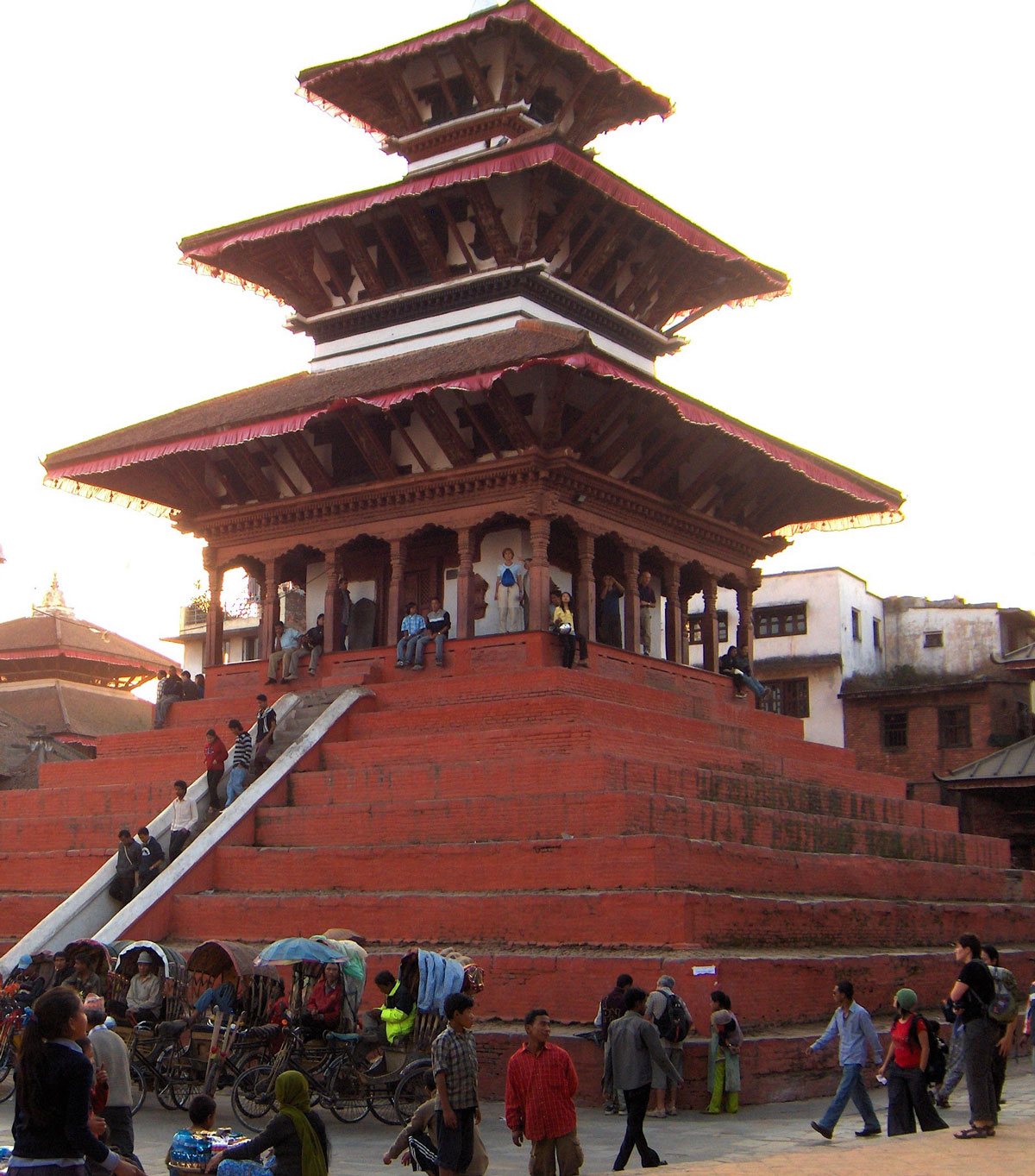
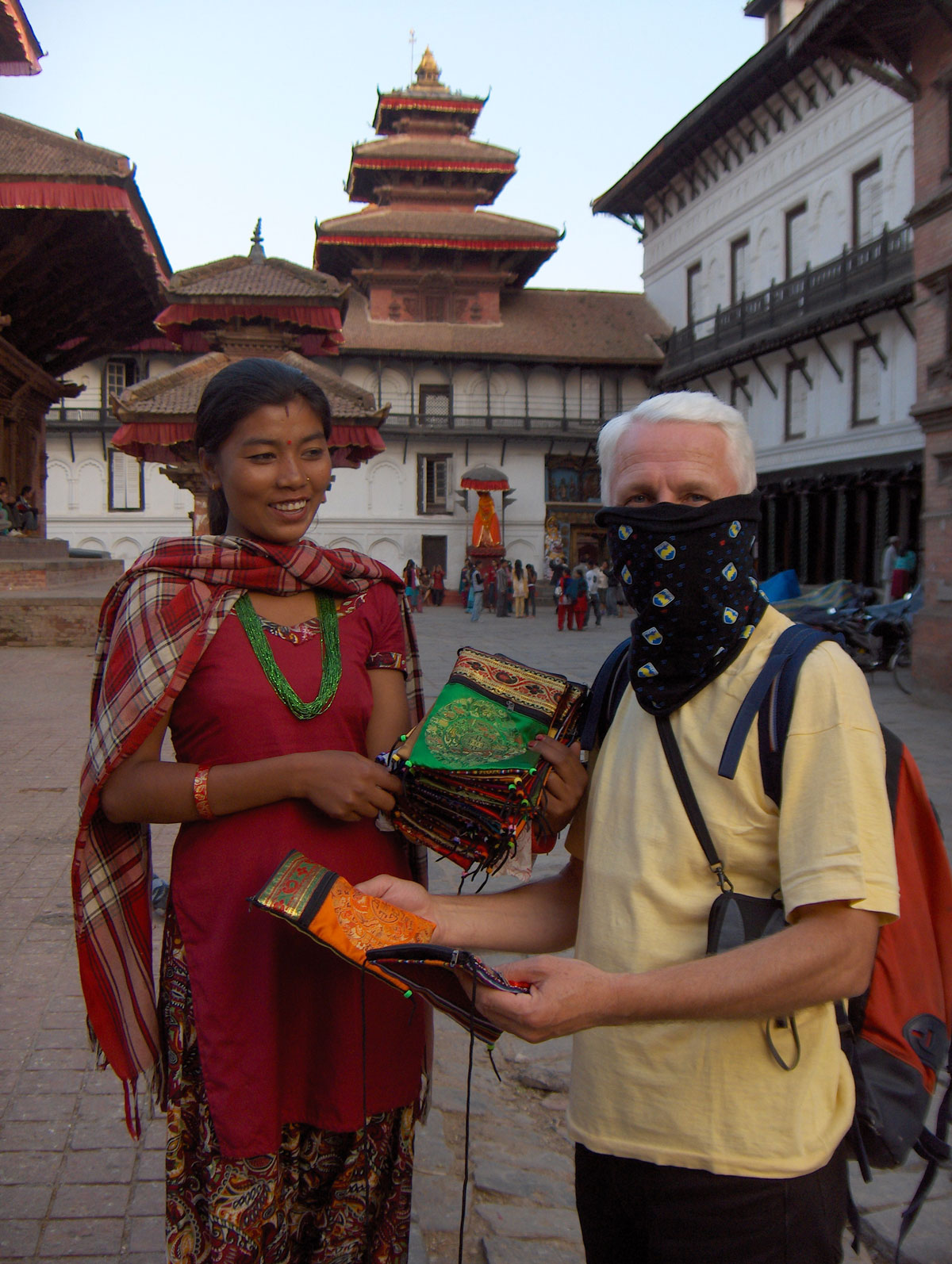
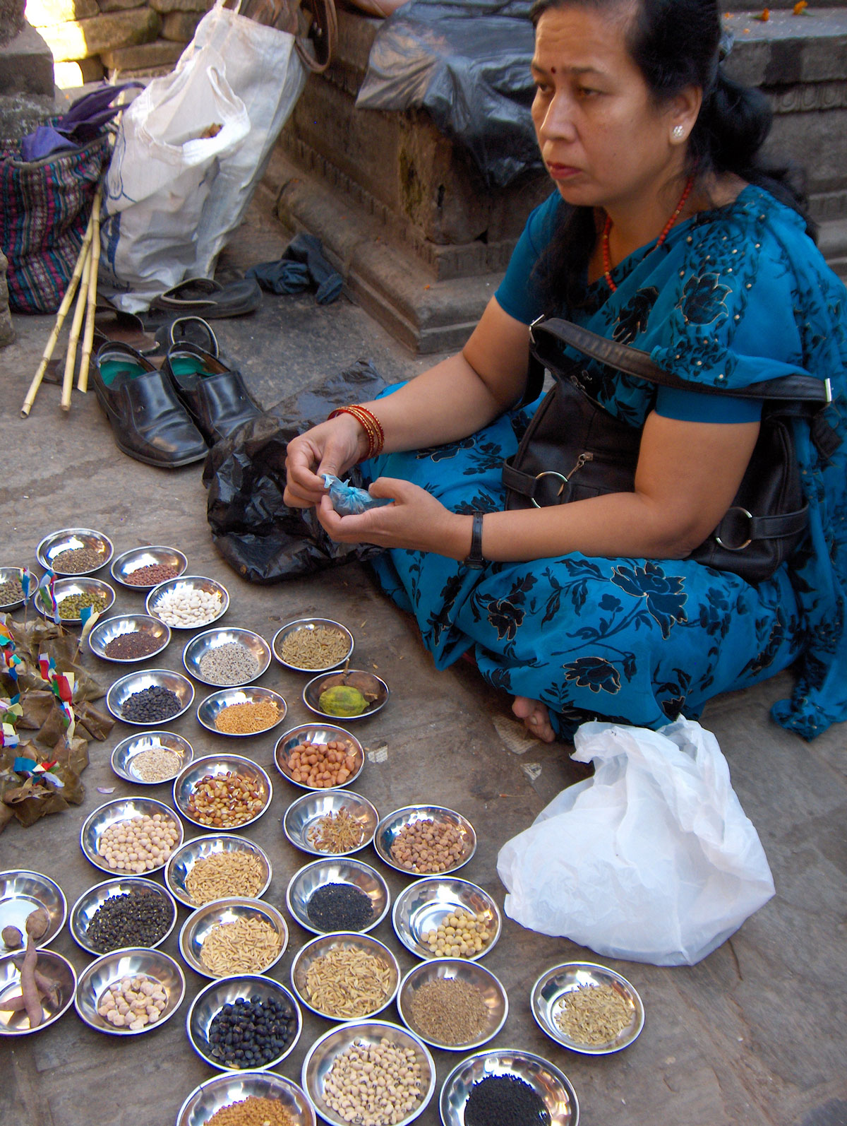
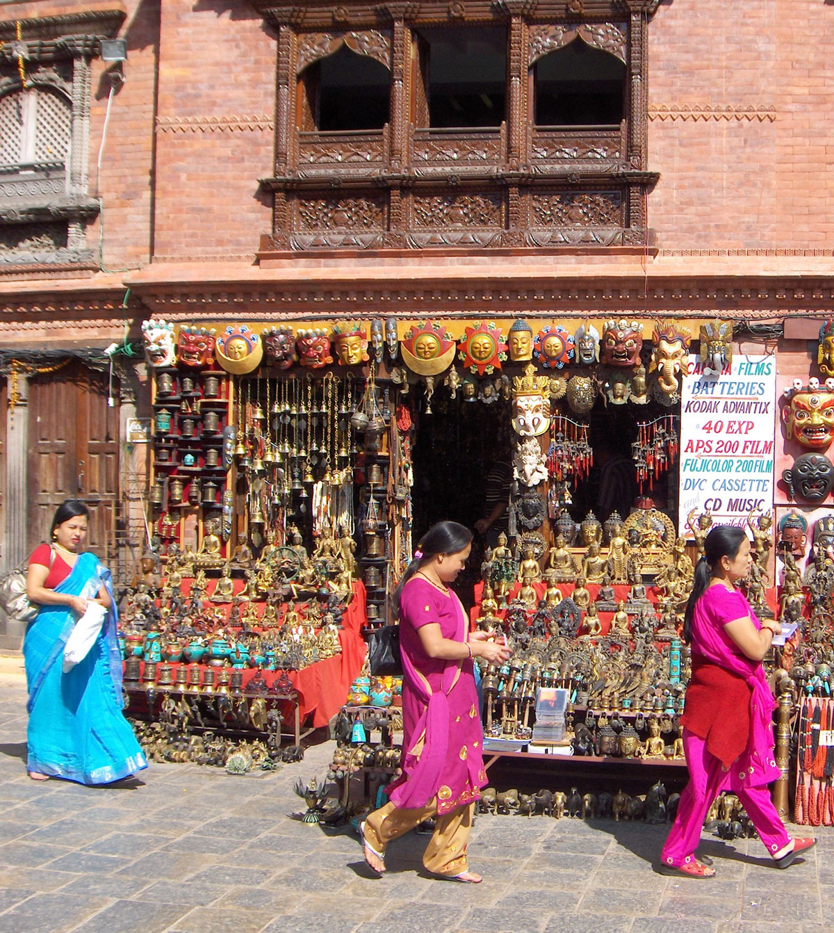
At the end of the day, we visited Durbar Square, a place surrounded by spectacular architecture featuring vivid motifs from the turbulent past of Nepal and Kathmandu, all intricately carved in wood. This is the heart of the old city, as it was once the site of the royal palace. The area consists of several squares connected by a maze of streets and alleys.
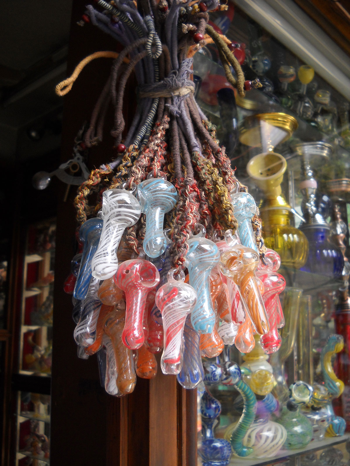
The squares are swarmed by street vendors offering tourists everything from flower garlands to hallucinogenic opiates. Perhaps because of my long hair, street dealers approached me frequently, offering hashish and marijuana. Appearances can be deceiving, but it was difficult to convince the dealers otherwise—they kept walking behind me, persistently praising the quality of their “goods.”
November 2, 2009: Kathmandu
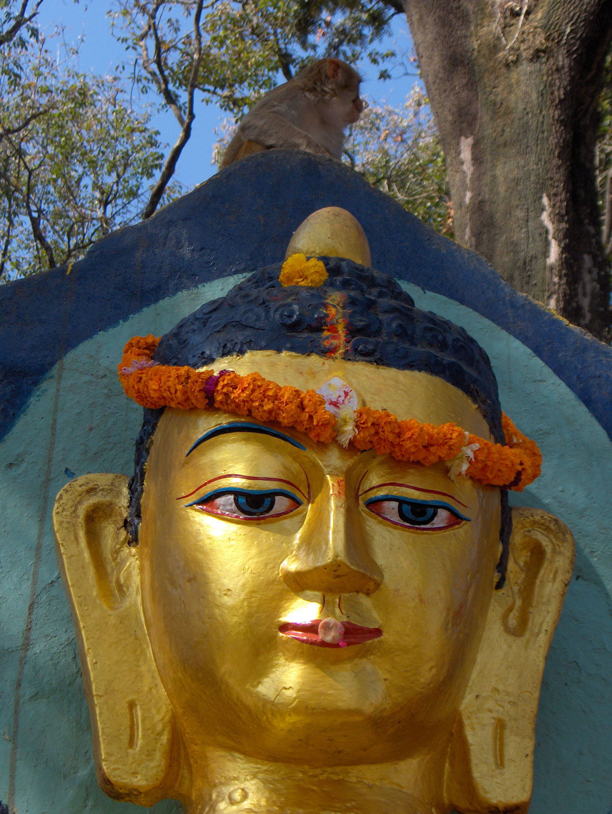
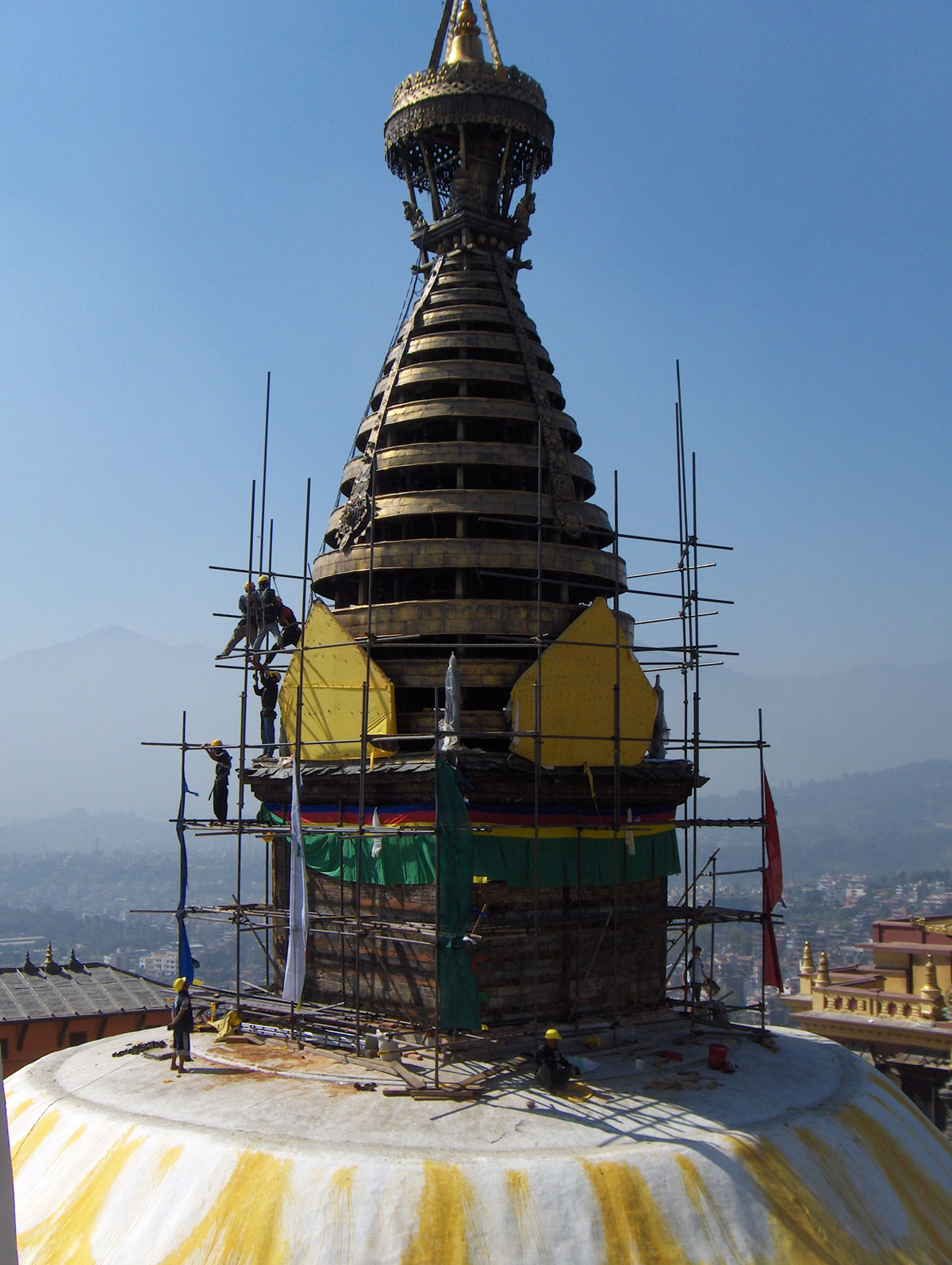
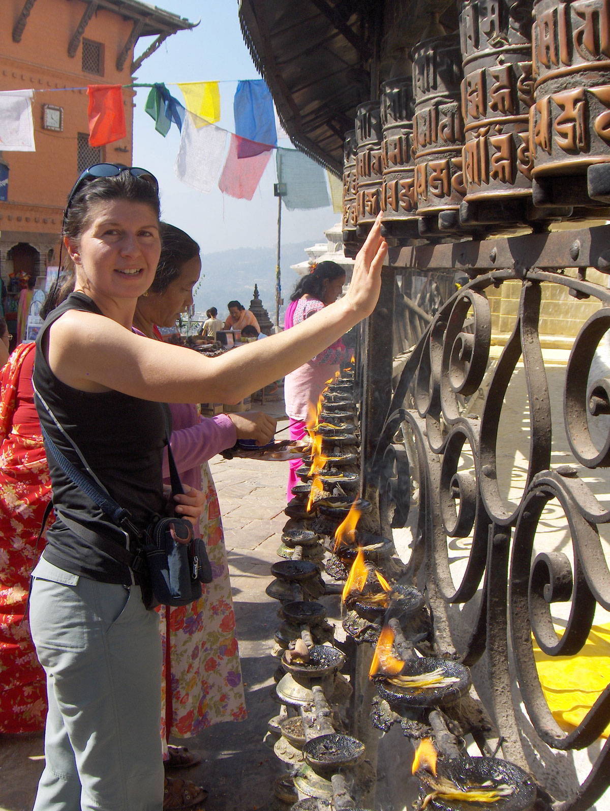
Early in the morning, Redžep, Sanja, and I set out to visit yet another famous sanctuary in Kathmandu. Despite it being Sunday, the streets are incredibly crowded; we soon learn that in Nepal, Saturday is the non-working day. Swayambhunath Temple, better known as the Monkey Temple, is a religious complex where monkeys live freely in one section. The temple is perched on a hill, offering a panoramic view of the entire Kathmandu Valley.
To reach the Buddha stupa at the top—where a Tibetan monastery, museum, and library are located—one must climb 365 steps. Even here, one is not safe from the persistence of street vendors. A saleswoman, whom we had casually asked about the price of a kukri knife and a small bell, chased us all the way up the stairs. Breathless and drenched in sweat, she offered us a 50% discount—just five minutes after she had refused to even hear of a lower price!
I was particularly amused by a bird seller with cages hanging from a long pole over his shoulder. He insisted I buy a bird; to get him to back off, I told him I couldn't take it on the plane. He quickly replied: “No problem, give it as a gift to one of the children here,” pointing to a group of smiling, curious boys who had surrounded us.
After touring the temple, we took a taxi back to the city. It is always best to negotiate the fare with taxi drivers beforehand, as they rarely use meters. A good rule of thumb: whatever price the driver offers, feel free to cut it in half—you'll find the driver will still be more than satisfied.
November 3, 2009: Kathmandu – Delhi
We used the morning for one last trip into the city to pick up the final gifts and souvenirs we had missed over the past two days. We decided to return to the hotel by rickshaw. The cost of transport is incredibly cheap; the driver was overjoyed when we paid him 300.00 NPR (roughly 3.00 EUR) for the ride. It’s nearly 3 km from Thamel to the hotel, and there were three of us squeezed into the rickshaw.
Around noon, Dragan Jaćimović and Nina Ađanin arrived at the hotel with their team, returning from a successful expedition to Island Peak (6189 m a.s.l.). Everyone was in high spirits—their climb had been a great success, with only one member unable to reach the summit due to health reasons. Over coffee, we shared stories and impressions from our respective climbs before saying our final goodbyes.
Farewell to the Kingdom
At the airport, we were met with the usual chaos of the terminal building: the repetitive process of weighing transport bags, checking in, security controls, and luggage searches. At 15:45 PM, our flight departed for Delhi.
We leave the Kingdom of Nepal deeply satisfied. In such a short time, we caught a glimpse of its rich cultural heritage, turbulent history, local customs, and religious rites—and, most importantly, the Himalayas, the very reason we embarked on this long journey. We return home spiritually enriched and strengthened, hoping that these experiences will serve us well in the life that lies ahead.
November 4, 2009: Delhi – London – Belgrade – Sarajevo
We slept through most of the long flight from Delhi to London. By exactly noon, we touched down at the Surčin Airport in Belgrade. Outside, the fields were covered in the first snowfall of the season. We soon learned that the airport had been completely closed to traffic only yesterday due to a severe snowstorm.
We finally arrived home in Sarajevo at 21:00 PM, after 24 days away.
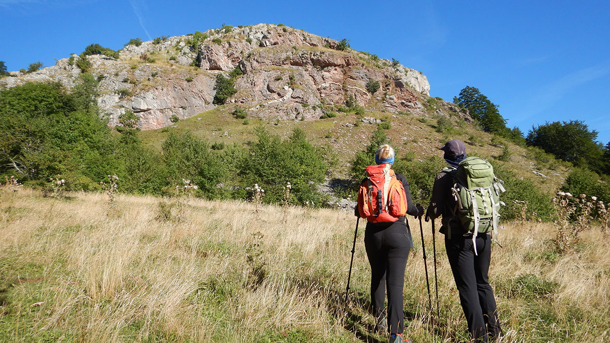
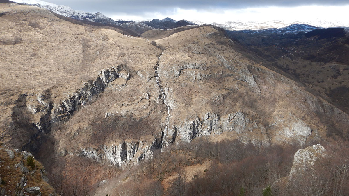
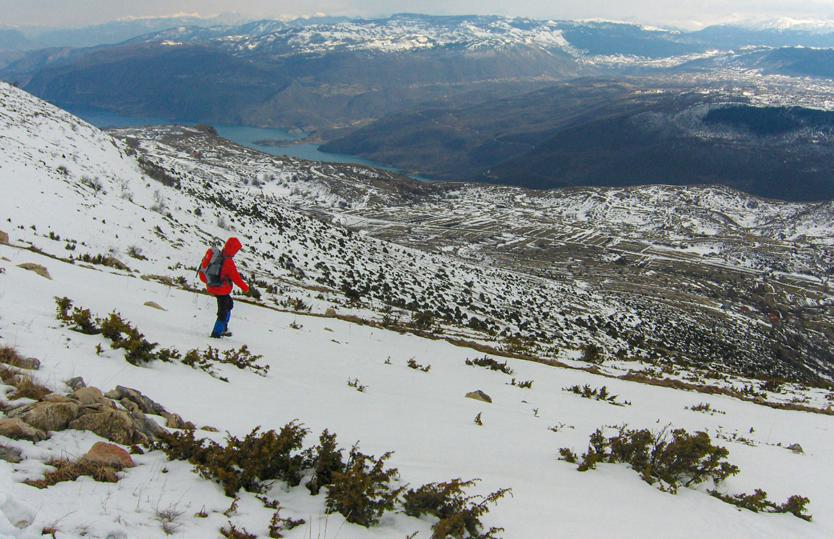
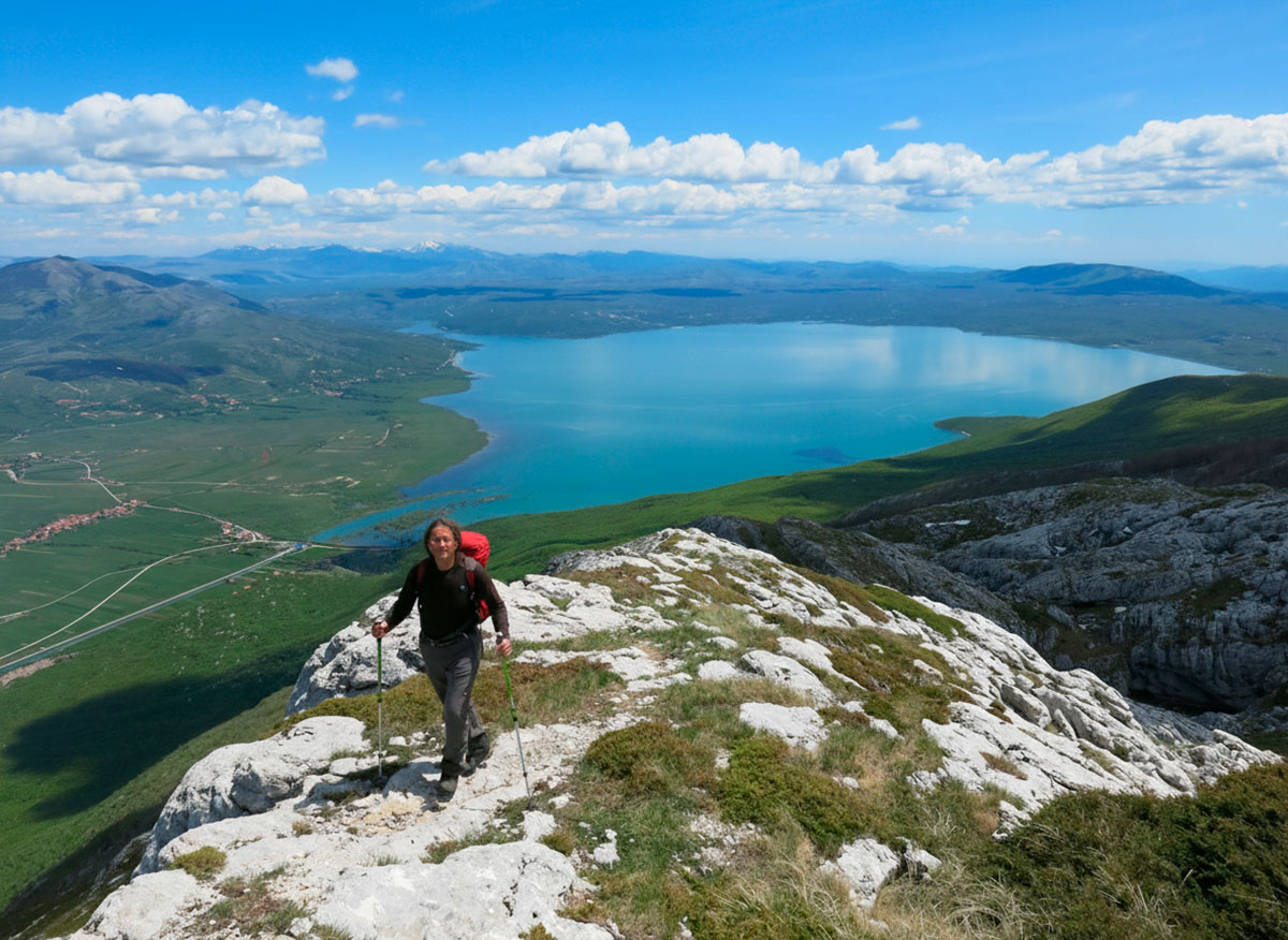
Cover Photo: Himalayas, a break at Kharka Teng (4,020 m a.s.l.)
Nepal stays in your heart long after you descend. Have you ever visited the Himalayas, or is a trek to Kathmandu on your bucket list? Share your favorite mountain memory or ask a question in the comments below.