
According to the mythology of Ancient Greece, Mount Olympus (Greek: Όλυμπος) was the sacred mountain where their gods resided. The assembly of Olympian gods in the Greek Pantheon consisted of twelve deities. While there were more in the hierarchy, the most prominent gods included: Zeus (the supreme God), Apollo, Ares, Aphrodite, Artemis, Athena, Demeter, Dionysus, Hephaestus, Hera, Hermes, and Poseidon.
The Greeks believed that crystal palaces, where these gods lived, were located at the mountain's summit. These palaces were built by the Titans and Cyclopes, while all artistic objects and devices were crafted and forged by Hephaestus. The gods lived in great luxury, consuming ambrosia as food and nectar as drink. According to legend, this divine sustenance granted them immortality.
The Greeks imagined their gods in human form and with human characteristics. They differed from their worshipers by their great strength, beauty, eternity, and the ability to heal from any wound. In the lives of the Greeks, the gods held a prominent place. As polytheists, they believed that the gods had the power to directly influence their lives and destinies. People turned to the gods when important decisions had to be made or when they wanted to know what the future held. It was believed that the gods must be pleased, so sacrifices and gifts were offered to them.
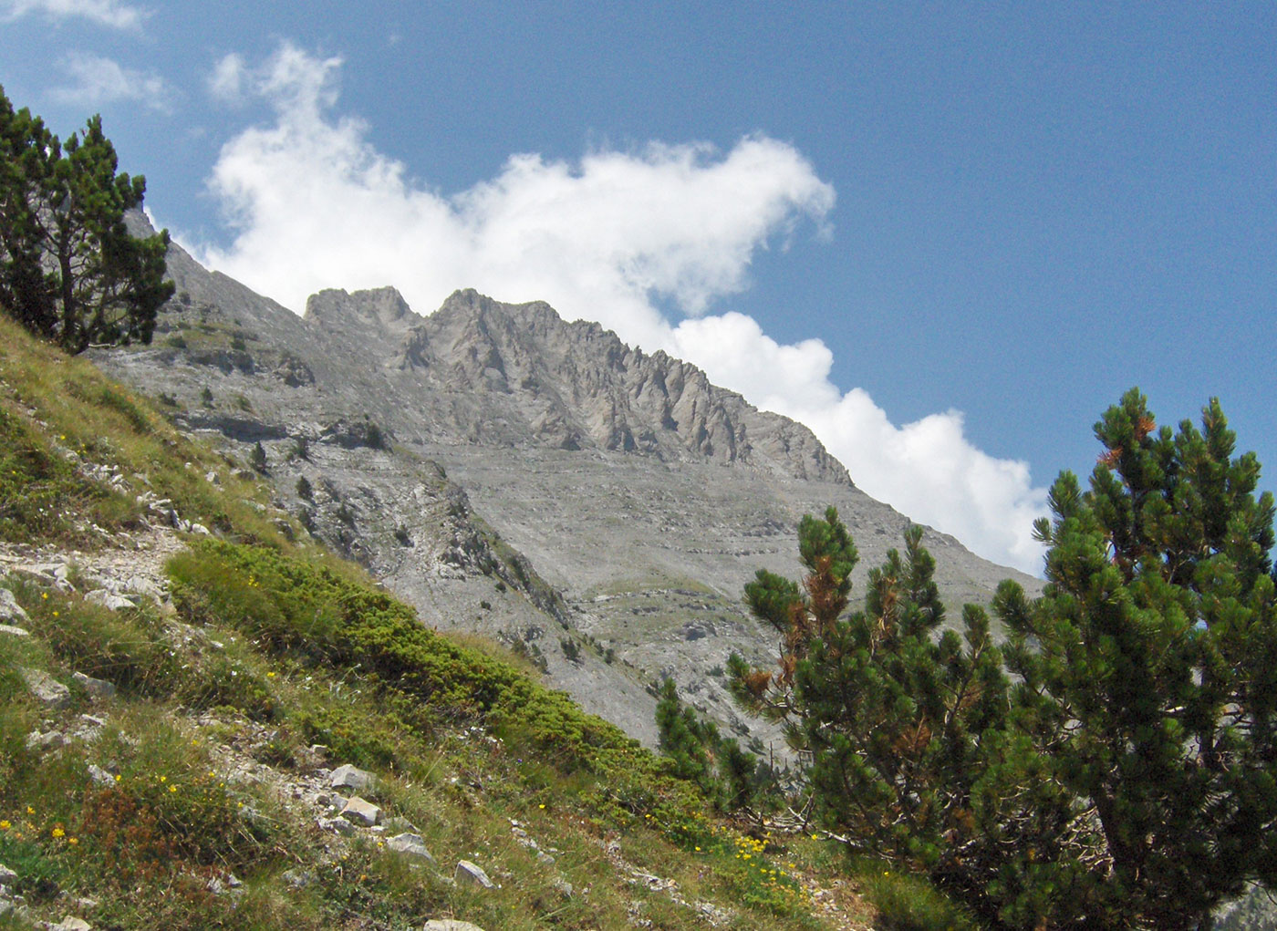
Mount Olympus is the highest and most beautiful mountain in Greece, and the second highest in the Balkan Peninsula. It is located near the eastern coast of the Aegean Sea, on the border between the regions of Thessaly and Macedonia. The highest peak of Mount Olympus is Mitikas (Greek: Mύτίκaς), which stands at an elevation of 2918 m a.s.l. Human feet first stepped on the highest point of Mytikas on August 2, 1913; the climbers were Christos Kakalos from Litochoro and Swiss explorers Frederic Boissonas and Daniel Baud-Bovy. On Mount Olympus, there are a total of 46 peaks higher than 2000 m and 47 higher than 1000 m above sea level. Besides Mytikas, mountaineers most frequently climb the peaks of Skala (2882 m.a.s.l.), Stefani (2909 m.a.s.l.), and Skolio (2912 m.a.s.l.).
Olympus is renowned for its rich flora, with about 1,500 plant species, 23 of which are endemic. Mount Olympus was declared a National Park in 1938. The significance of “Olympus“ National Park is recognized not only in Greece and Europe but worldwide. In 1981, UNESCO designated it a “Biosphere Reserve,” and the European Community included it on the list of “The Most Important Bird Areas in the European Community.” UNESCO added Mount Olympus to the World Heritage list in 1983.
Text and photography by: Braco Babić
I embarked on a trip to Bulgaria and Greece with a group of friends for a mountaineering expedition. The journey took place from August 6th to 12th, 2010. In Bulgaria, we reached the highest peaks of two mountains: Musala peak (2925 m.a.s.l.) on Rila and Vihren peak (2914 m.a.s.l.) on Pirin. Afterward, we continued our journey to Greece, where we climbed Mitikas (2918 m.a.s.l.), the highest peak of Mount Olympus. You can read about the ascent of these three highest peaks of the Balkan Peninsula in the entries from my mountaineering diary, which I have published in three installments.

On the morning of August 10th, we left Bansko and joined the Sofia – Thessaloniki highway at Simitli. The road led us through the Struma River valley to the Kulata border crossing. Before crossing, we stopped at a gas station to fill the tank, following reports of an announced fuel tanker drivers’ strike in Greece. Surprisingly, in the peak of the tourist season, there were no crowds at the border, and we soon continued our journey. We reached Thessaloniki via the old highway, as the newly built one had not yet been opened for traffic.
Thessaloniki (Greek: Θεσσαλονίκη) is the second-largest city in Greece and the capital of the Central Macedonia region. It was founded in 315 BC by Cassander, the King of Macedonia, who named it after his wife, Thessaloniki, the half-sister of Alexander the Great. The city stretches along the Thermaic Gulf for about 17 km and consists of 13 municipalities with a total population of around 1 million. It is an economic, industrial, commercial, and cultural hub, as well as a vital transportation point in Southeastern Europe.
While Thessaloniki has a relative lack of monuments from the ancient past, it more than makes up for it with numerous churches from the Early Christian and Byzantine periods, as well as monuments from the Ottoman era, including buildings belonging to Sephardic Jews. In 1988, many of these monuments and structures were inscribed on the UNESCO World Heritage list.
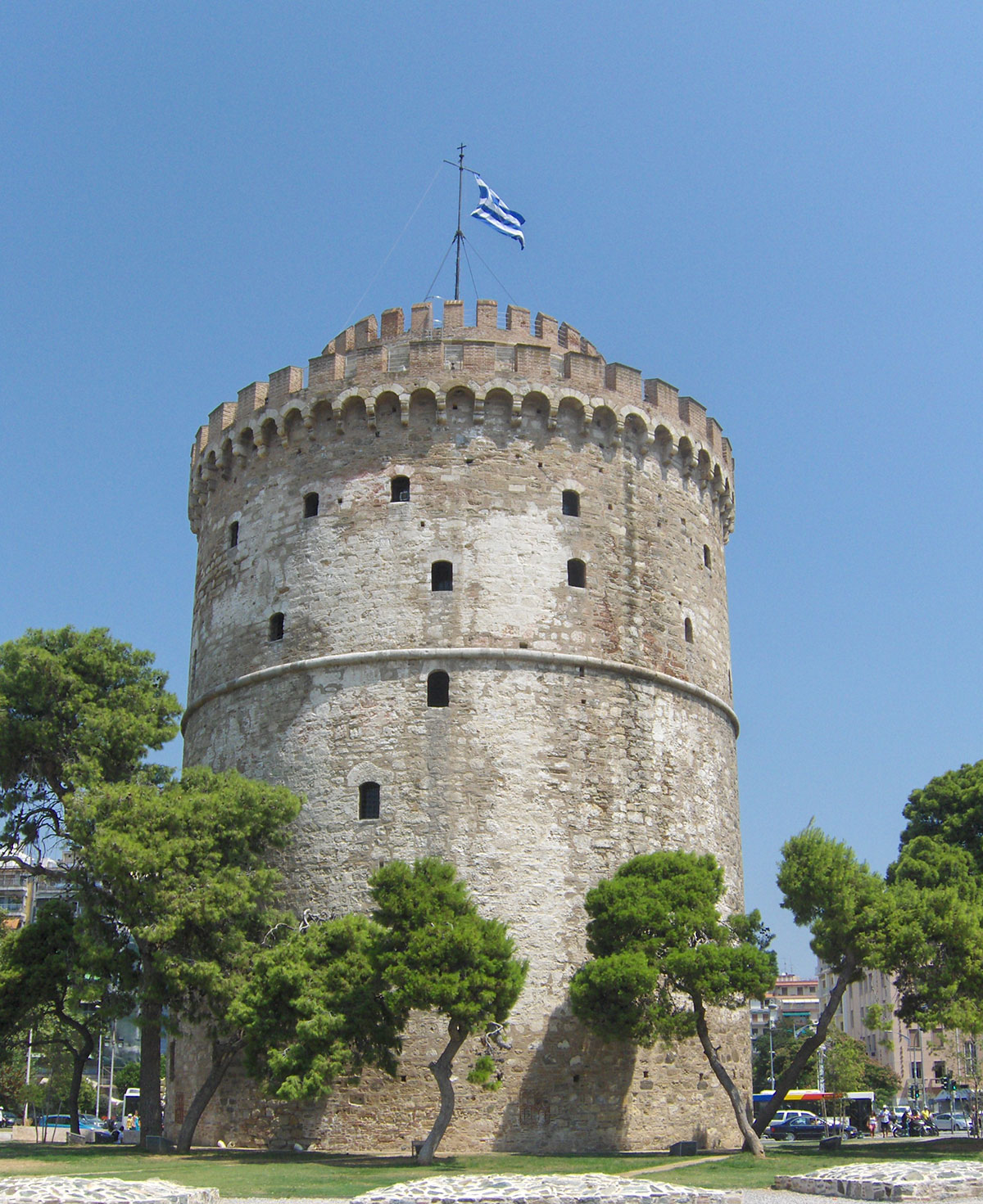
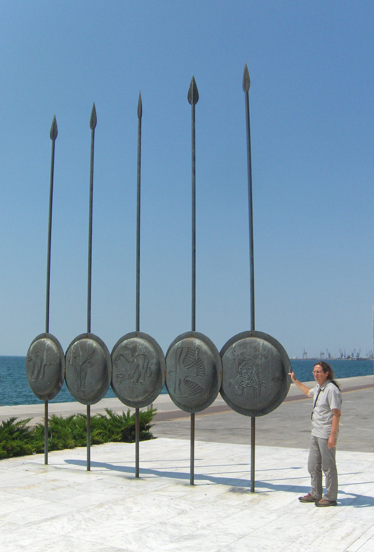
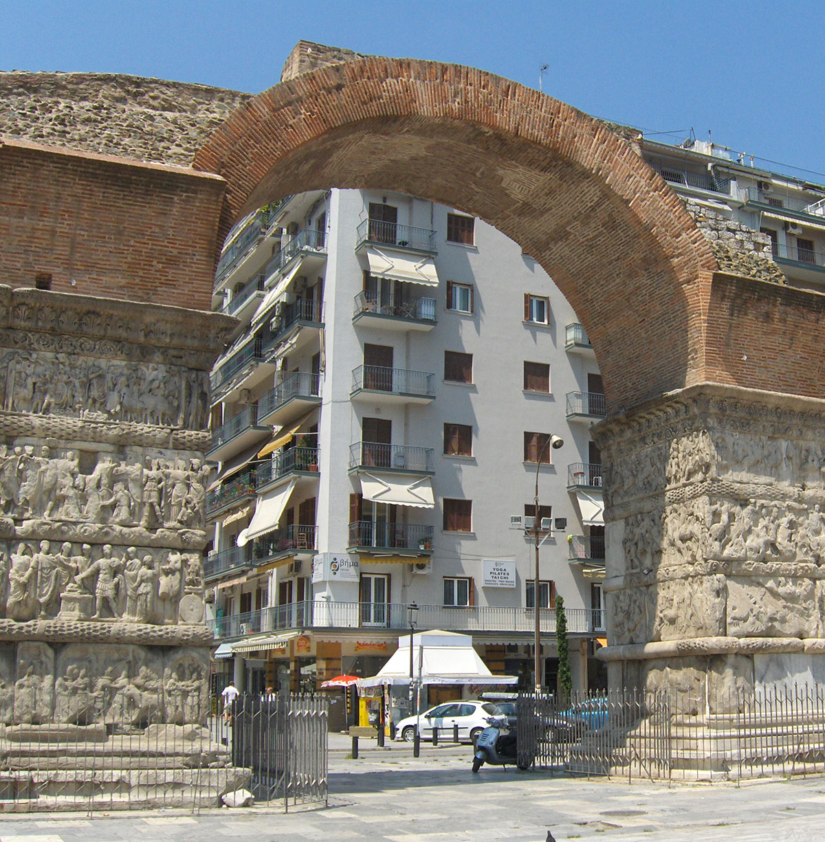
Thessaloniki is a city of turbulent history, claimed by many conquerors: Macedonians, Greeks, Romans, Byzantines, Venetians, and Turks. They all left behind numerous historical buildings and monuments. Tourists rarely stay in Thessaloniki for more than a day; usually, after a tour of the city's sights, everyone rushes to the famous Greek beaches. Since we planned to spend the night in Litohoro at the foot of Mount Olympus, we had enough time for a proper sightseeing tour. We started along the wide waterfront and soon reached the park where the famous White Tower stands—a structure that has become the symbol of the city. Built in the 16th century, it served as a fortress and a prison for many years. Today, it houses the City Museum. From the top of the tower, there is a beautiful view of the seaside promenade and the central part of the city. Nearby stands the bronze statue of the famous Macedonian commander, Alexander the Great.
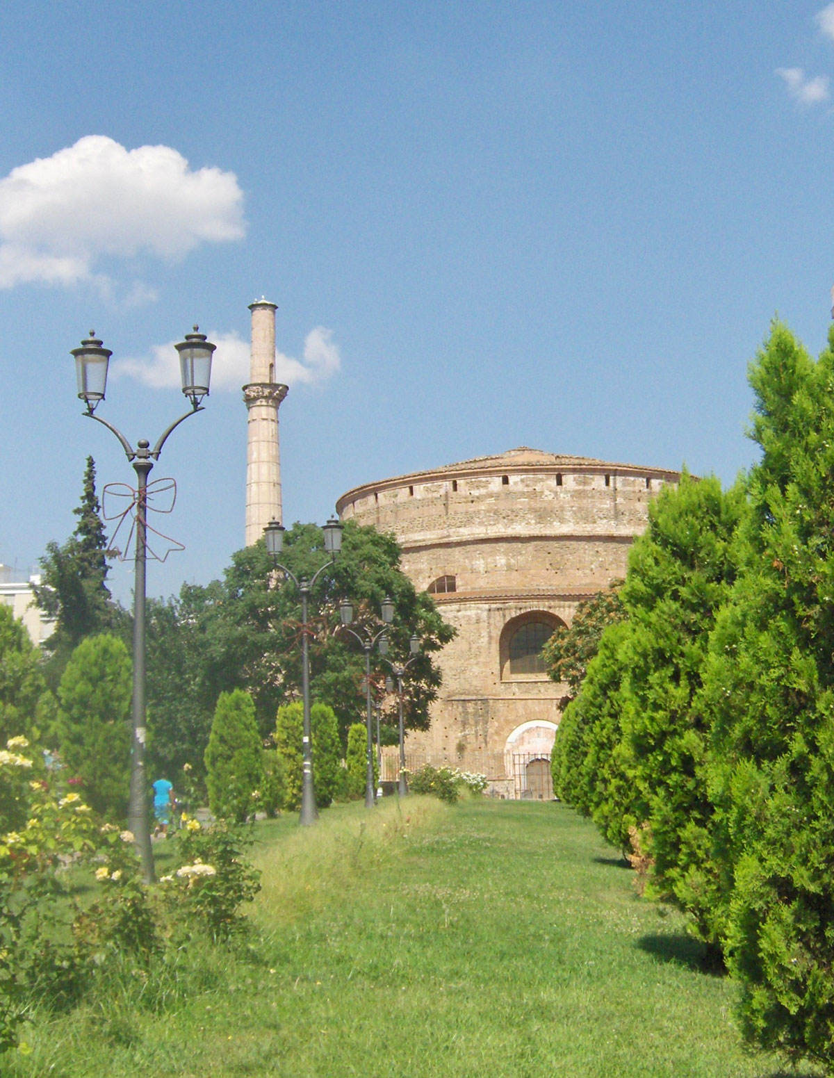
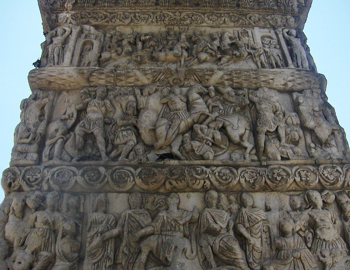
One of the most important historical monuments in Thessaloniki is the Rotunda. This cylindrical structure was built in 306 AD by the Roman Emperor (Tetrarch) Galerius. It is located near the Arch of Galerius built to commemorate his victory over the Persians. Some believe the Rotunda was intended to be Galerius's final resting place; however, he died in 311 AD and was buried in Felix Romuliana. In the 4th century, the Byzantine Emperor Constantine I converted it into the Orthodox church of St. George. In the 14th century, the Ottomans captured Thessaloniki, and in 1590, the Rotunda was turned into a mosque, with a minaret added that has been restored and survives to this day. In 1912, it was returned to its status as an Orthodox church until 1979, when a powerful earthquake caused serious structural damage. Today, the Rotunda is restored and serves as a sculpture museum and exhibition space. During our visit, there was an exhibition of old photographs of Balkan cities from the late 19th and early 20th centuries. Taking center stage were photographs of old bridges from Bosnia and Herzegovina, specifically from Konjic, Višegrad, Mostar, Trebinje, and Žepa.
After sightseeing, we stopped in a garden for an excellent Greek “Mythos” beer. Before leaving Thessaloniki, we headed to the “belly” of the city—the marketplace—where, amidst the indescribable hustle and bustle of merchants and buyers, we stocked up on groceries and fruit.
From Thessaloniki, we traveled along the highway toward Athens and, after a pleasant drive, arrived in Litohoro. Upon arrival, we checked into apartments recommended by the local tourist bureau. It would have been better if they hadn't recommended them; the stay wasn't exactly cheap, and in return, we got a bathroom with no hot water, towels, soap, television, or air conditioning. Hotel and apartment owners in Greece often use an old, tried-and-tested trick where uninformed tourists are charged an extra 5 to 10 euros for everything mentioned above, on top of the previously agreed room price.
The town of Litohoro is located in the northeastern part of the Greek province of Thessaly. It sits at the foot of Mount Olympus at 300 m above sea level. It is about 5 km from the Thessaloniki – Athens highway (24 km from Katerini, 65 km from Larissa, and 92 km from Thessaloniki). In the town's central square, there is a fountain and a church with a bell tower. Surrounding the square are restaurants, taverns, and numerous souvenir shops. Litohoro is a historical town featuring picturesque Macedonian architecture, narrow stone streets, and many small chapels. Nearby, the deep Litohoro Gorge and the Enipeas River Canyon are particularly interesting. From the town, there is a wonderful view of Mount Olympus and the Aegean Sea.

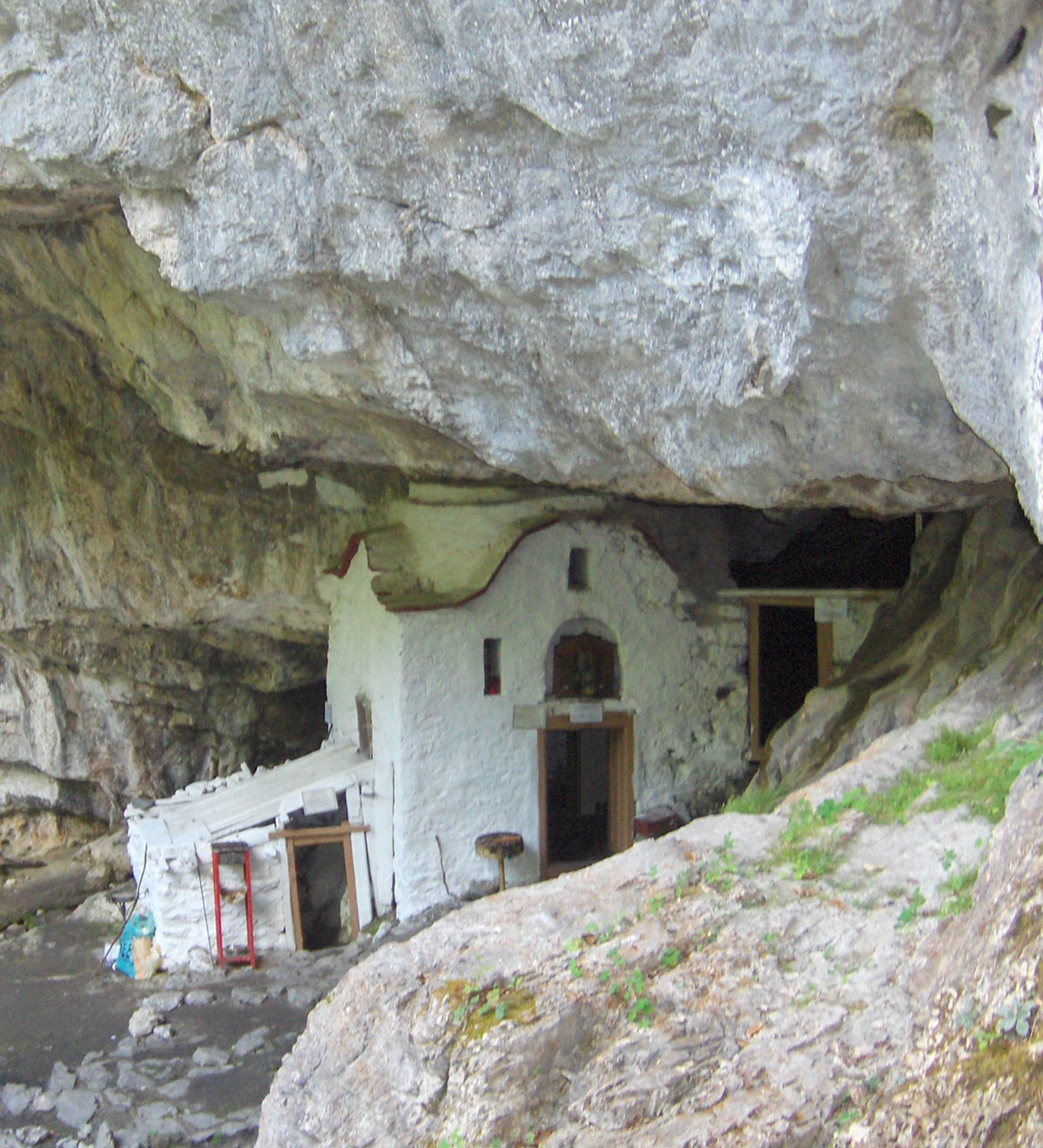
On the morning of August 11th, we set off from Litohoro for Prionia, driving along a wide asphalt road. Before reaching Prionia, we turned off onto a branch road leading to the Monastery of St. Dionysios of Olympus. The monastery is situated in a deep gorge at 850 m above sea level and is surrounded by coniferous forest. It was built in 1542, and the saint himself participated in its founding. After a Divine Revelation, St. Dionysios founded and dedicated the monastery to the Holy Trinity, but among the people, it later remained known exclusively by the name of its founder – Saint Dionysios of Olympus. He was buried in the chapel of the monastery at that time, and the remains of his tomb still exist today.
In 1821, the monastery was burned by the Ottomans, and in 1878, during the Olympus Rebellion, it served as a shelter for women and children from Litohoro. In 1943, German Nazis almost completely destroyed it with explosives because it served as a refuge for Greek resistance fighters. Today, several monks live in the monastery. In addition to their religious services, they find time to treat pilgrims and tourists with refreshing drinks and even watermelon, well-chilled in the stone basin of the monastery’s fountain. One can also buy red wine and herb brandy (rakija travarica) from the monks, packaged in exclusive containers. Aside from traveling by car, one can reach the monastery from Litohoro on foot via a marked hiking trail through the Enipeas River Gorge (a 5-hour walk).
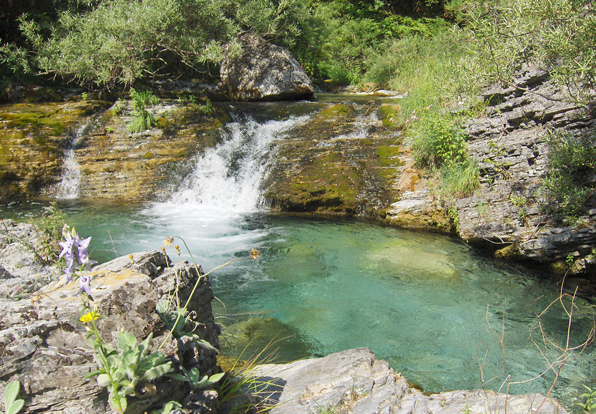
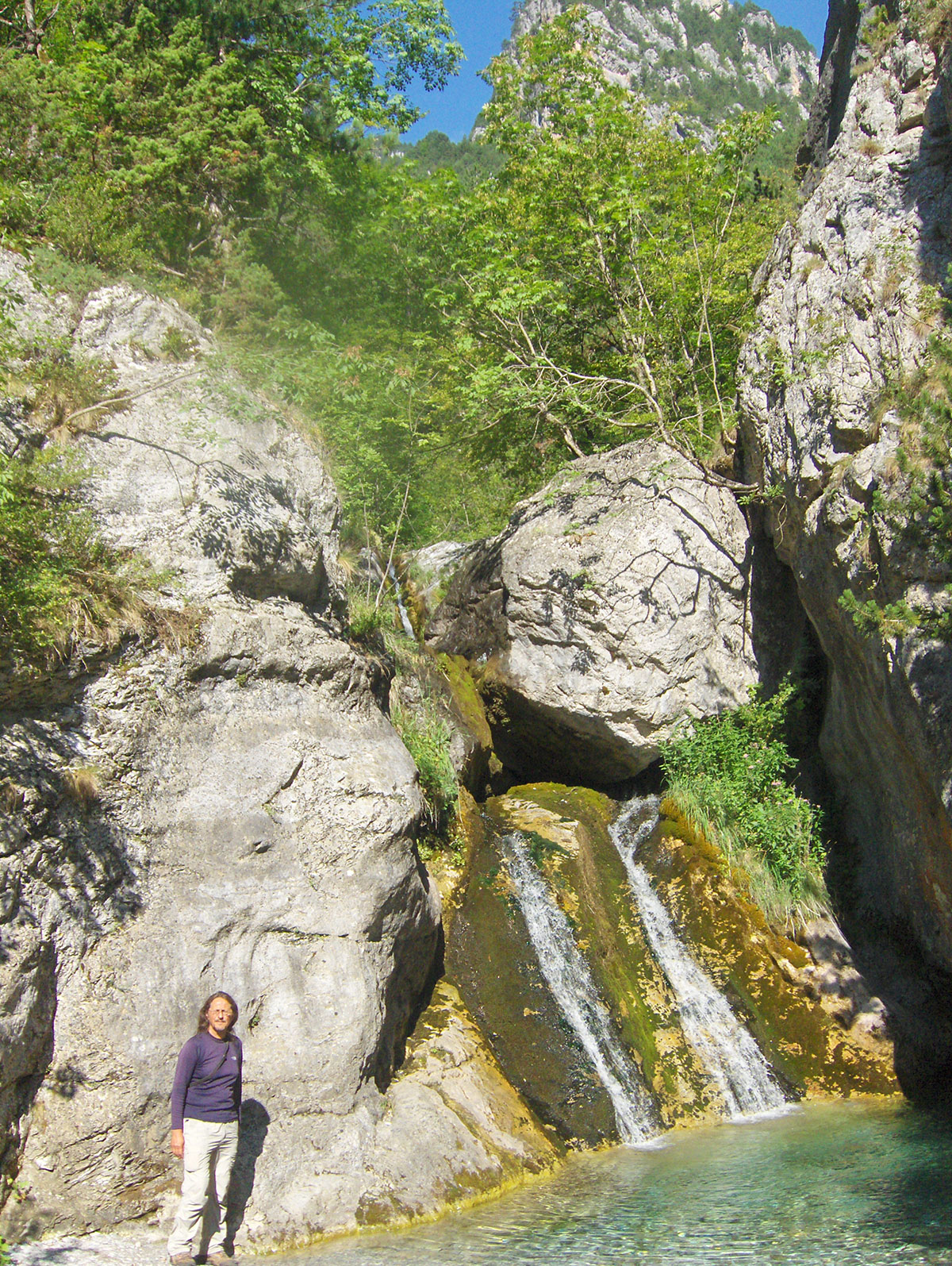
After visiting the monastery, we descended a steep footpath to a small bridge over a fast mountain stream, and then continued along a rugged path above the right bank to a small church located at the entrance of a cave. We reached the church from the monastery in about half an hour. It is believed that St. Dionysios of Olympus spent his ascetic days right here. Inside the cave near the church, there is a spring for which there is a folk belief that it cures all kinds of diseases. The afflicted should first drink water from this spring, then wash their face and hands, or ideally, bathe in this water. We are in no hurry; the summer day is long, and we have enough time to relax a bit and enjoy the shade of the pines and the murmur of the waterfalls of the clear mountain river Enipeas. Late in the afternoon, we leave this wonderful place and head for Prionia.
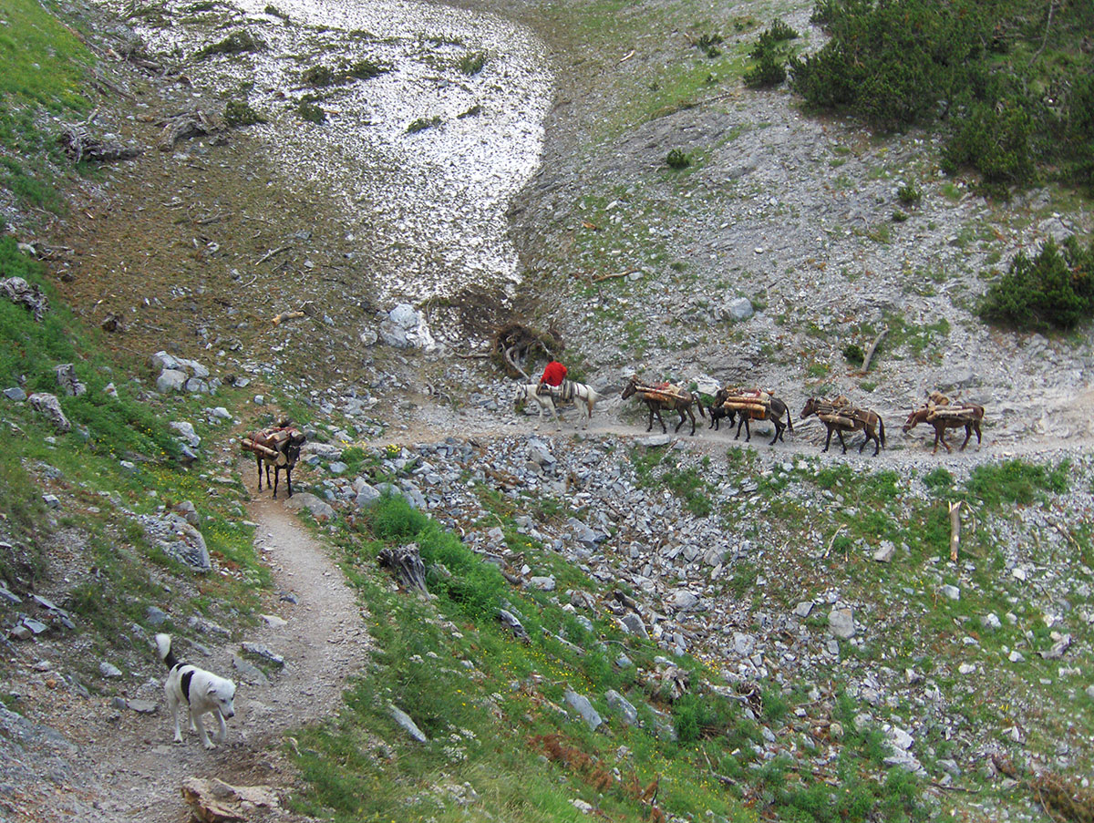
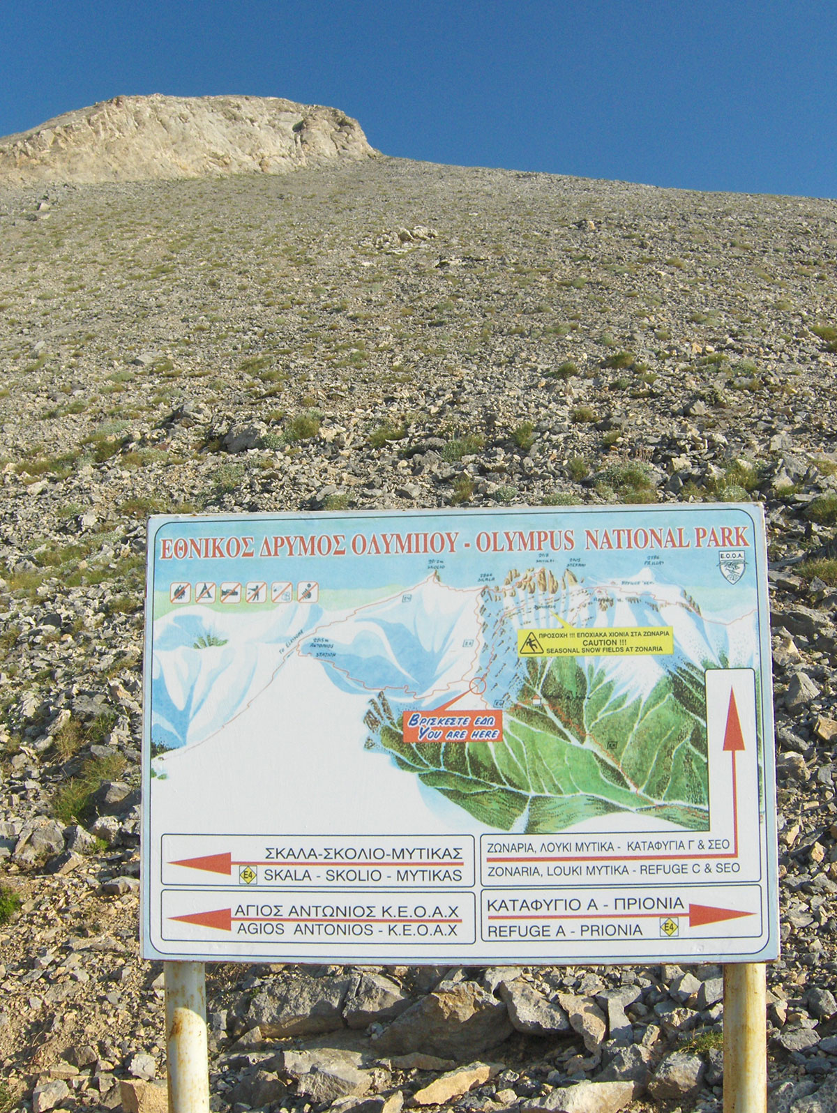
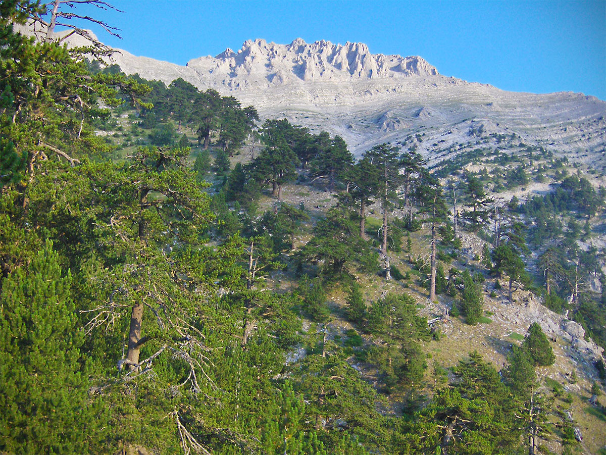
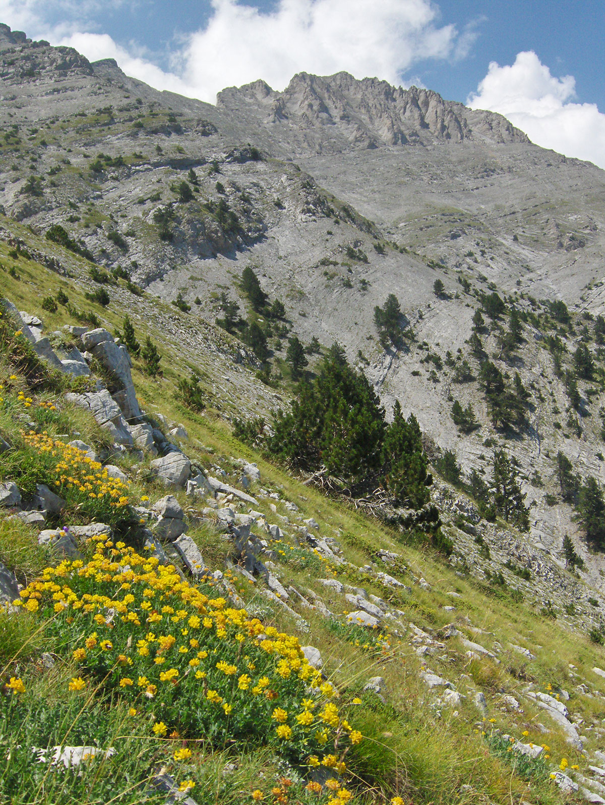
We reached Prionia via a macadam road (about 2 km) and parked in front of the restaurant. Prionia is situated at 1100 m above sea level and is about 18 km away from Litohoro. Prionia is the starting point for the ascent to the mountain hut “Spilios Agapitos“ / Refuge “A“ (2100 m.a.s.l.), which requires about a 3-hour hike. Before setting off, we filled our water bottles at the fountain near the parking area. There are no springs along the trail, so we need to conserve water until we reach the hut. We climbed along a well-trodden footpath where mountain markings are rare, as there are no crossroads on the way to the hut. Once we moved away from Prionia and reached a higher altitude, it was no longer hot. The trail ascends gently through long serpentines under the pleasant shade of a coniferous forest. As it was late afternoon, we frequently passed hikers descending into the valley. After 2 hours of walking, we took a short break at a viewpoint with benches, admiring the large specimens of Bosnian Pine, which is quite common on the slopes of Mount Olympus. We continued without further stops, except to give way to about ten horses heavily laden with firewood for the mountain hut.
After 3 hours of hiking, we arrived at the mountain hut, where we were warmly welcomed at the reception by the hostess, Marijana Zolota. We completed the check-in formalities since we had booked our stay in advance. As we settled into our room, we realized that we didn't need the sleeping bags we had carried in our backpacks at all; bringing two bed sheets would have been enough. The room we stayed in is located in the attic and can accommodate 30 people. After settling in, we went out to the terrace in front of the hut, which offers a clear view of the town of Litohoro, and in the distance, the endless blue of the Aegean Sea. In the early evening, we took a short walk along the trail above the hut and, after half an hour, reached a viewpoint with a stone bench.
The viewpoint offers a great view of the peaks of Mount Olympus, which the ancient Greeks believed was the home of the twelve gods of the Pantheon. Besides its strong connection to ancient Greek mythology and its natural beauty, Mount Olympus is known for its important ecological characteristics. For this reason, as early as 1938, Mount Olympus was declared the first National Park in Greece. The park covers 23,841 hectares, with a strictly protected zone of 4,000 hectares. A special protection regime is implemented within the park to preserve the flora, fauna, and natural landscape.
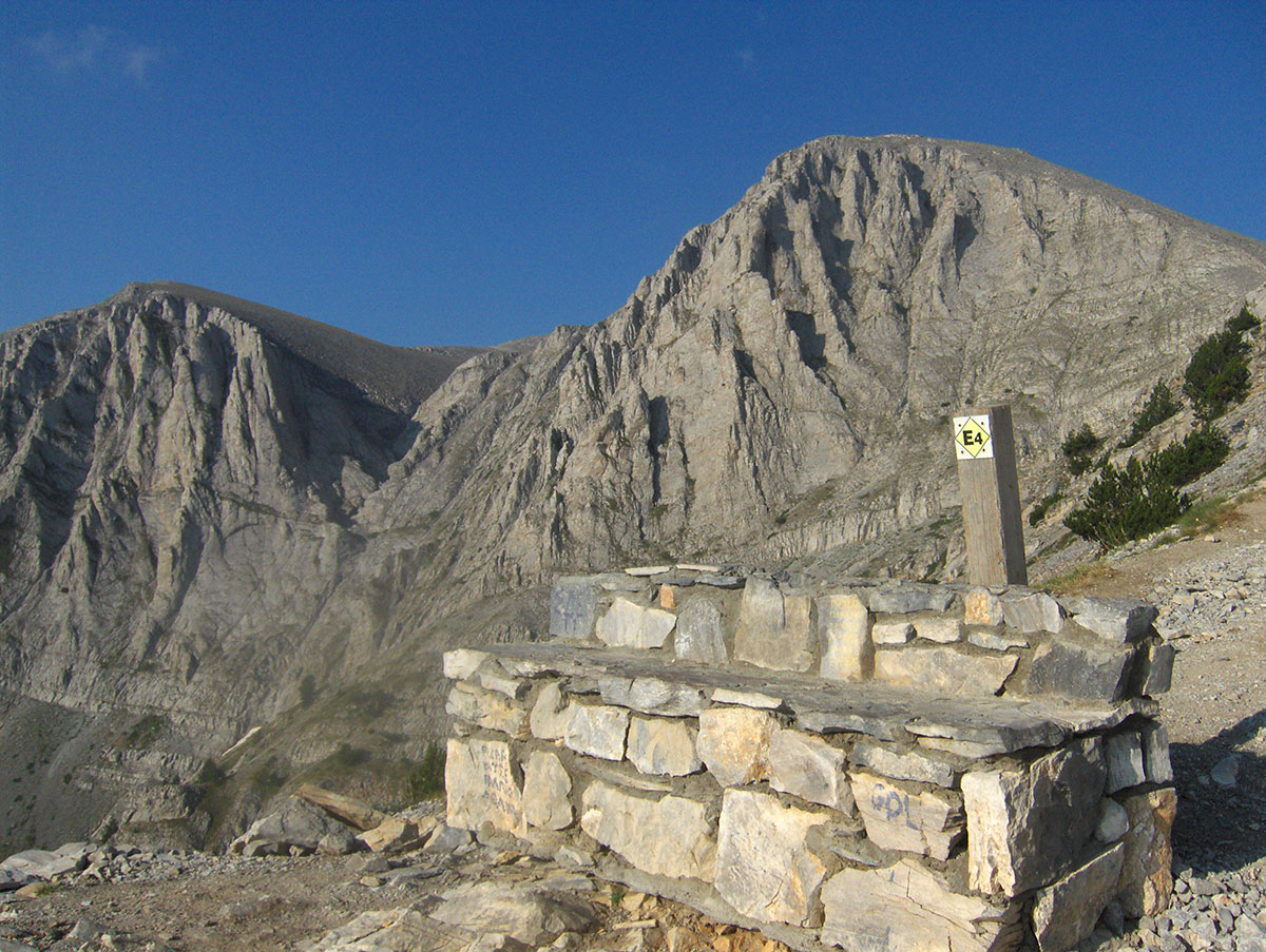
The significance of the “Olympus“ National Park is recognized not only in Greece and Europe but worldwide. In 1981, UNESCO designated it a “Biosphere Reserve,“ and the European Community included it on the list of “The Most Important Bird Areas in the European Community.“ UNESCO added Mount Olympus to the World Heritage list in 1983. Mount Olympus is the highest mountain in Greece, and its highest peak, Mitikas (2918 m.a.s.l.), which means “nose” in Greek, is also the second-highest peak in the Balkans. On Mount Olympus, there are 46 peaks higher than 2000 m above sea level, among which the most prominent are: Skolio (2912 m.a.s.l.), Stefani (2909 m.a.s.l.), and Skala (2882 m.a.s.l.). Due to its proximity to the sea, the climate on Mount Olympus during the summer months is almost Mediterranean, though heavy rain showers, hail, and thunderstorms are possible in the higher regions during the afternoons. From November to May, the mountain is covered in snow, and during this period, Mount Olympus takes on almost Alpine characteristics. There are several mountain huts and shelters on the mountain, and all hiking trails leading to the highest peaks are well-marked.
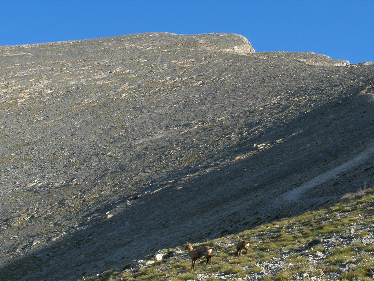
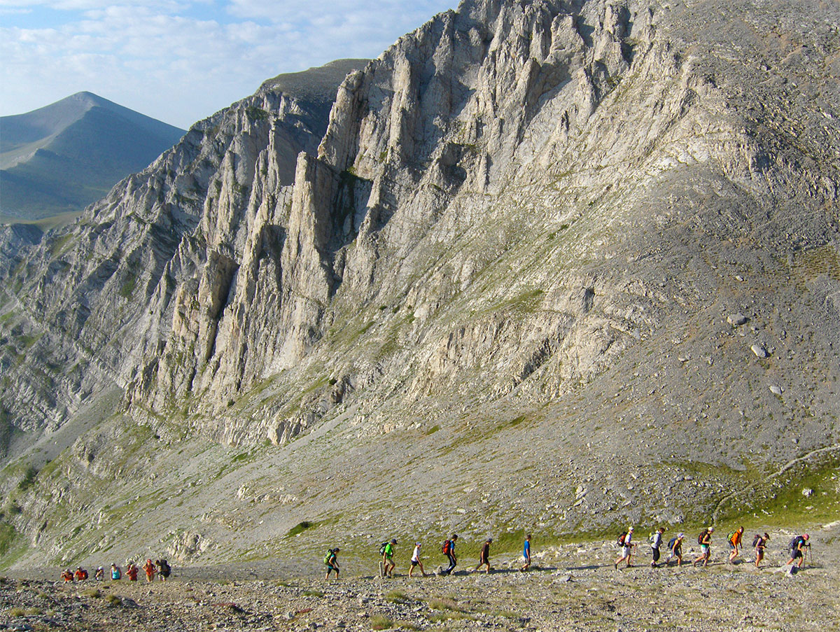
On the morning of August 12th, we set off early for the peaks of Mount Olympus. Our ascent plan is ambitious, as we aim to reach three peaks in a single day: Skala, Mitikas, and Skolio, and then descend back to Prionia. We are in good physical condition and eager to complete the plan in its entirety. On the mountain trail near the “second bench,” we overtook a large group of hikers from France who had started before us at a strong pace. They soon faltered and fell behind. Upon leaving the forest, we were greeted by high-mountain barren land, and for the first time, we could clearly see our approach route to Mitikas. While observing the striking peaks of Mount Olympus in silence, two chamois ran across our path. They surprised us with their appearance, but I still managed to photograph them. Larger wild animals that can be seen on Mount Olympus include wolves, jackals, wild cats, foxes, deer, and chamois. Over a thousand species of birds live in the protected area of “Olympus“ National Park, including rare and endangered species of woodpeckers and the golden eagle. Mount Olympus is also known for its numerous species of butterflies.
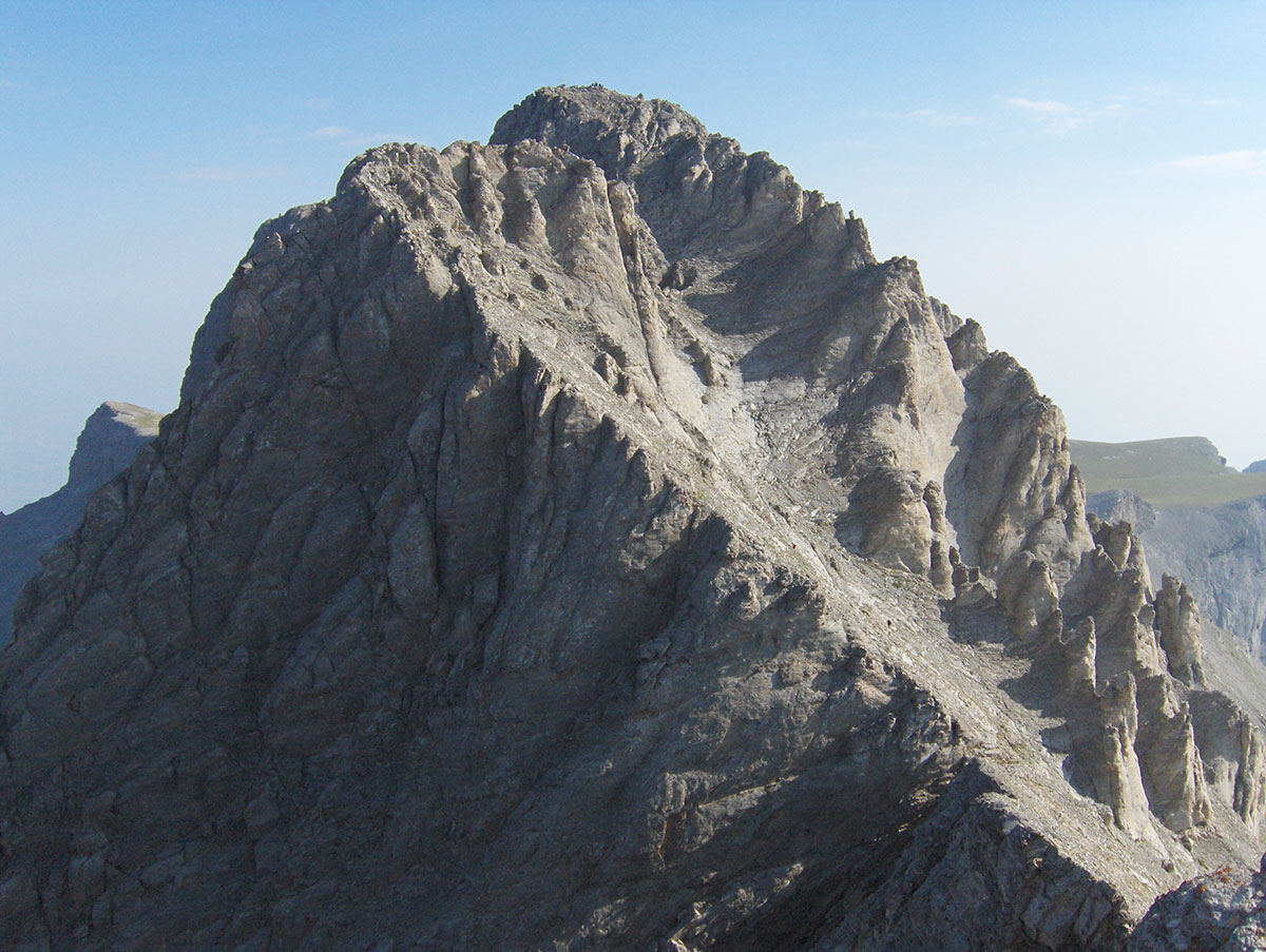
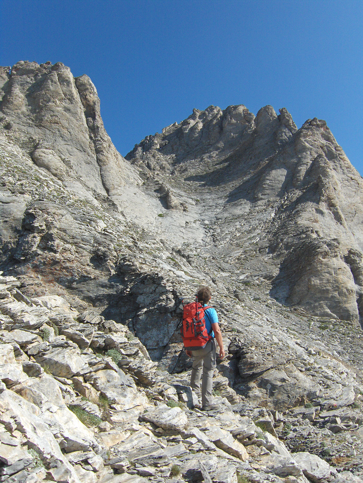
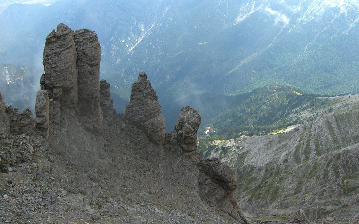
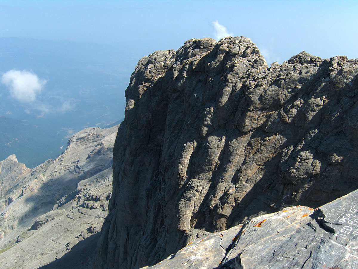
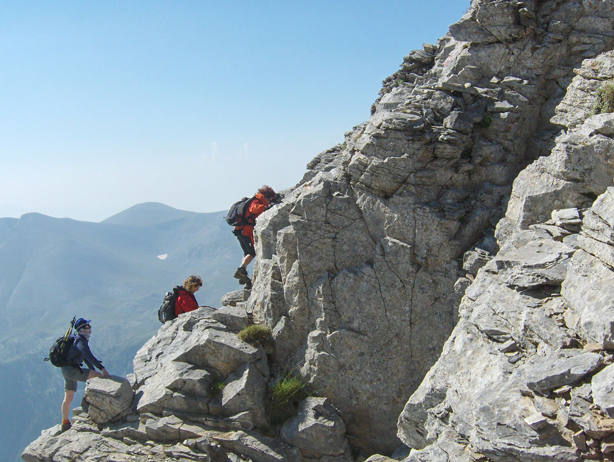
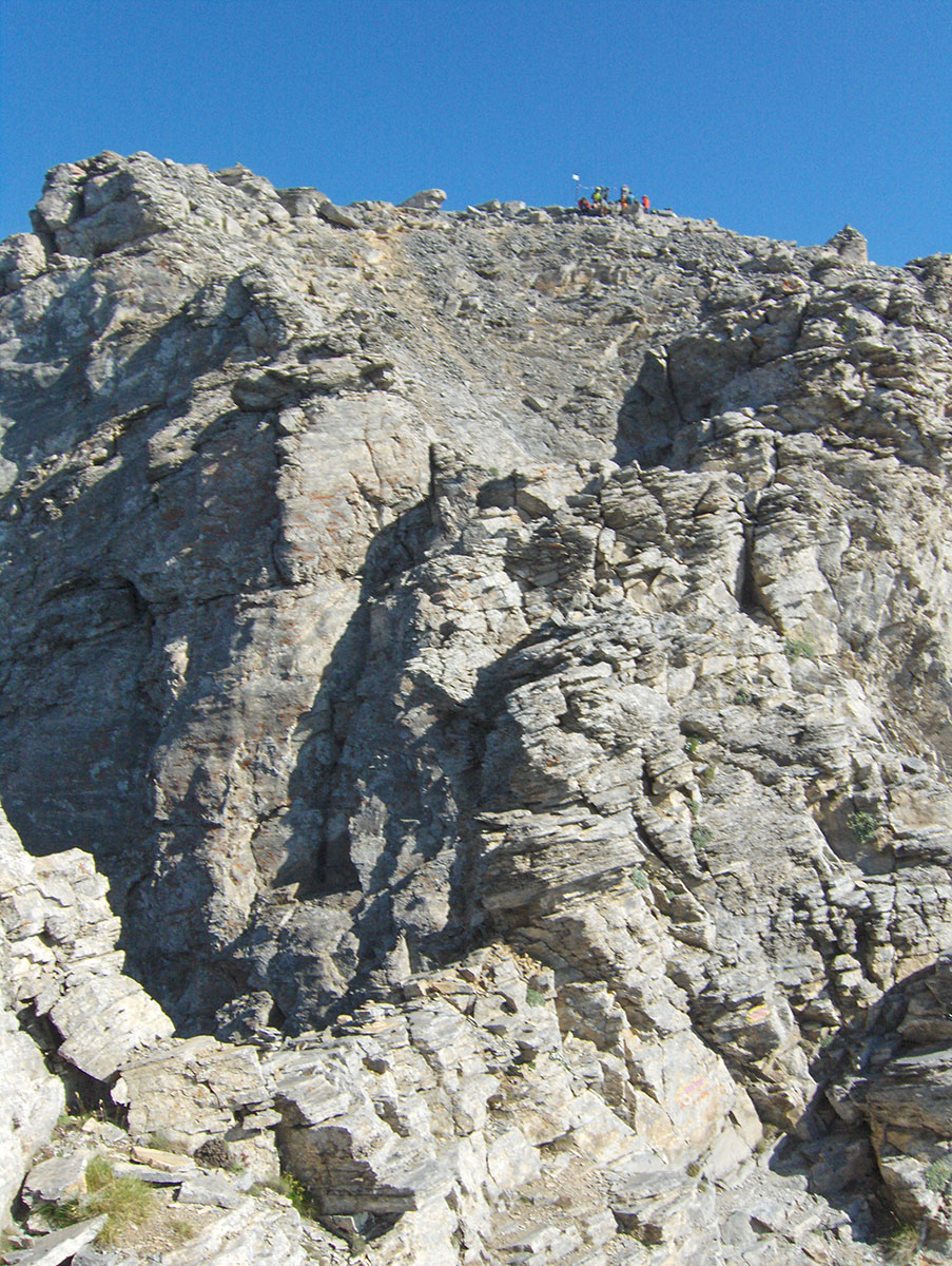
From the mountain hut where we started the ascent, we reached the peak of Skala in about 2 hours of walking. We took a short break at the top for sightseeing and photography. After a rest and some fruit for refreshment, we continued towards Mitikas. From Skala (2882 m.a.s.l.), one must descend about a hundred meters and then continue traversing the ridge toward Mitikas. Maximum concentration is required during the descent, as in the event of a slip, a fall from the steep ridge leads directly into the abyss. We were surprised that no safety equipment, such as cables or iron rungs, has been installed here, which would be helpful for many to ensure safety when tackling the ridge, especially if the rock is wet from rain or ice. After traversing the ridge, the ascent followed over smooth, protruding ledges in a steep rocky couloir. Upon exiting the couloir, another demanding climb awaited us over a very exposed rock where a safety cable with rungs has been installed. We overcame this final obstacle on the ascent and finally stepped onto the peak of Mitikas. From Skala to Mitikas, it took us about 1 hour of walking.
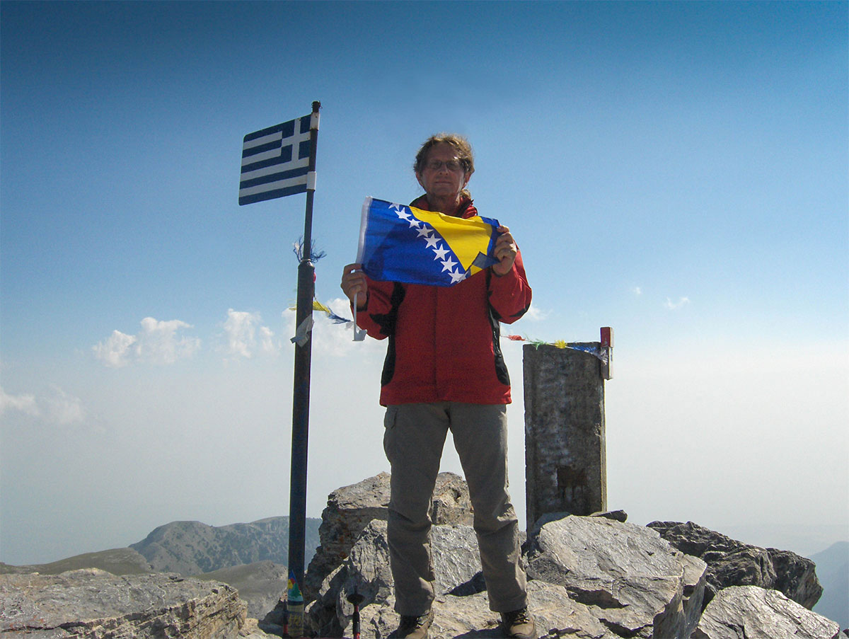
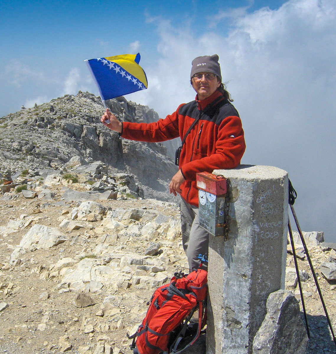
At the highest point of the peak stands a concrete triangulation pillar with a registry box and an iron mast with the flag of Greece. The peak offers a grand view of many other peaks of Mount Olympus, and on the horizon towards Litohoro, the Aegean Sea is visible. This was an unusual sight, especially for us mountaineers who live in the continental part of Europe. Aside from us, there were no other hikers at the summit, so we stayed for a long time to enjoy the silence and the surroundings. After taking photos and signing the visitor's book, we left the peak and cautiously descended through the rocky couloir over the protruding smooth ledges.
After exiting the couloir, we traversed the ridge back to Skala, which we had already tackled on the way up to Mitikas. From Skala, we continued along the ridge to the peak of Skolio (2912 m.a.s.l.), reaching it in less than 1 hour of walking. The weather served us well; it was sunny and a bit chilly, but without wind. In the afternoon, on the northern side of Mount Olympus, fog rose from the valley but failed to cross the summit ridge. Satisfied with the day's climbs, we left the peaks of Mount Olympus and arrived back at the mountain hut “Spilios Agapitos“ in about 2 hours. After a short break for rest and refreshment, we continued the descent to Prionia, arriving at 18:00 h. On the way back, we stopped at the resort of Paralia for a swim in the sea. That same evening, we left Greece and spent the night in Gevgelija.
The following day, we continued our journey through Macedonia and Serbia. We arrived in Sarajevo at 19:00 h. We spent a total of 8 days on the road, covered 2270 km by car, and reached 6 peaks, 4 of which are the highest on the Balkan Peninsula.


Cover Photo: Mount Olympus, Mitikas peak (2918 m/nv)

