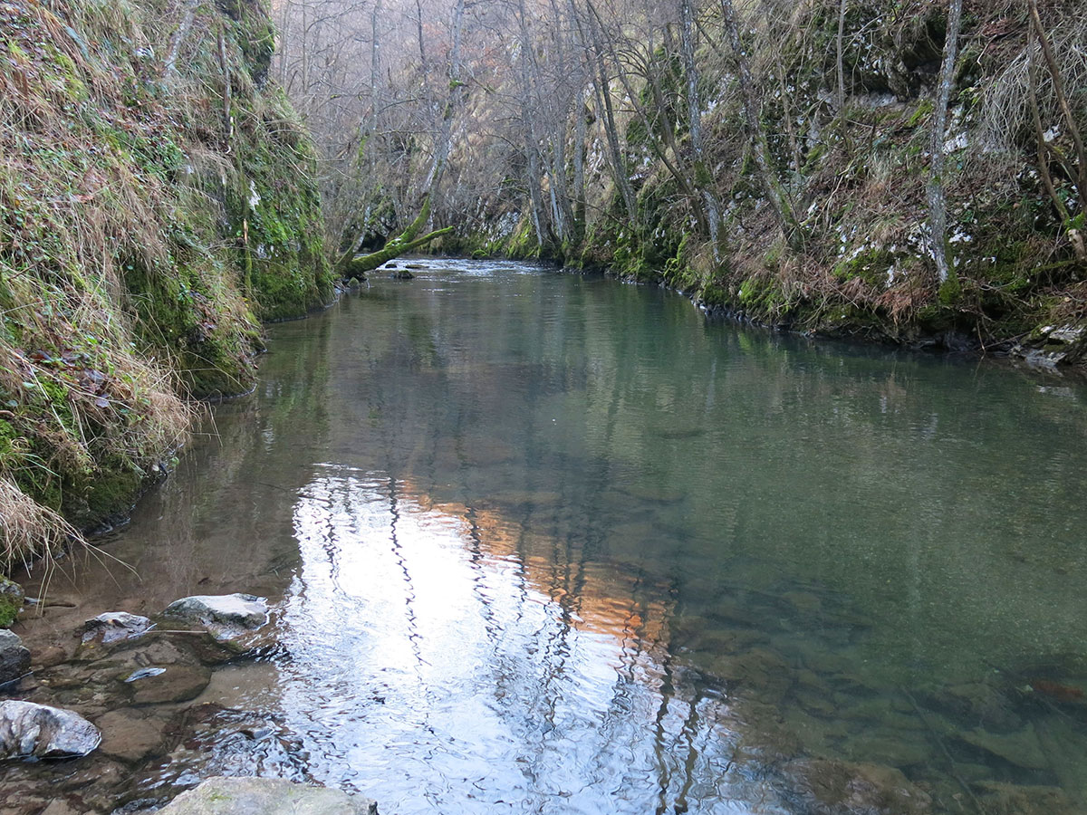
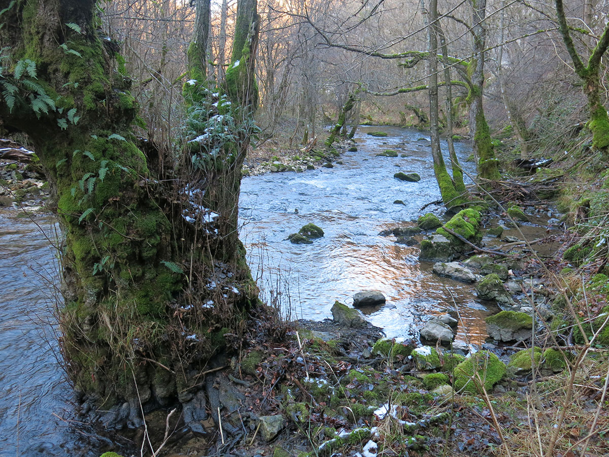
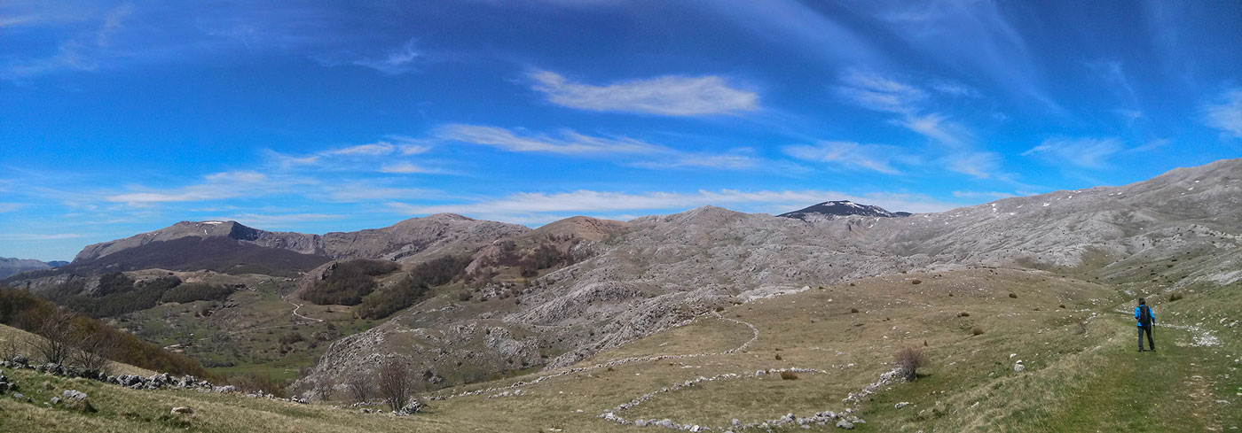
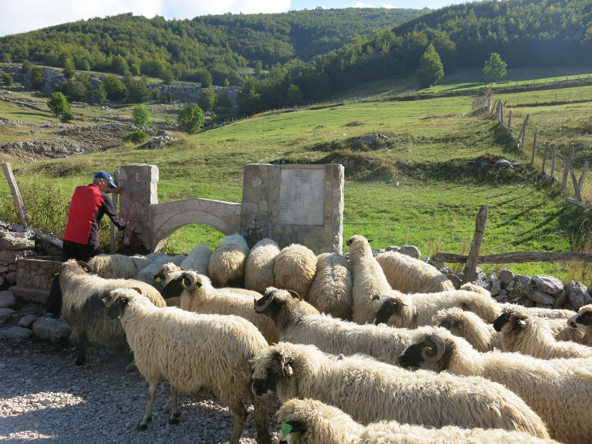
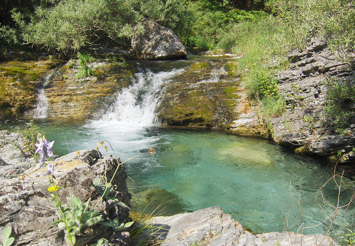
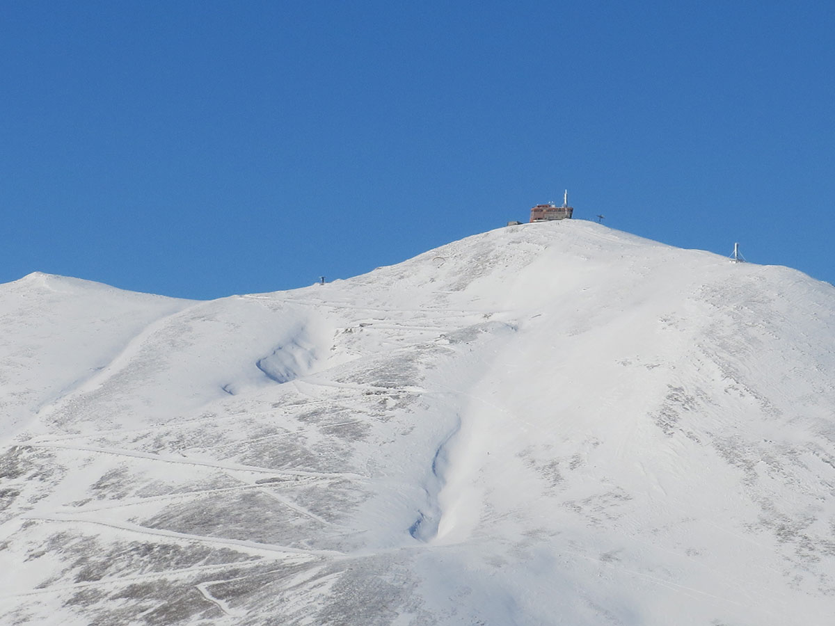
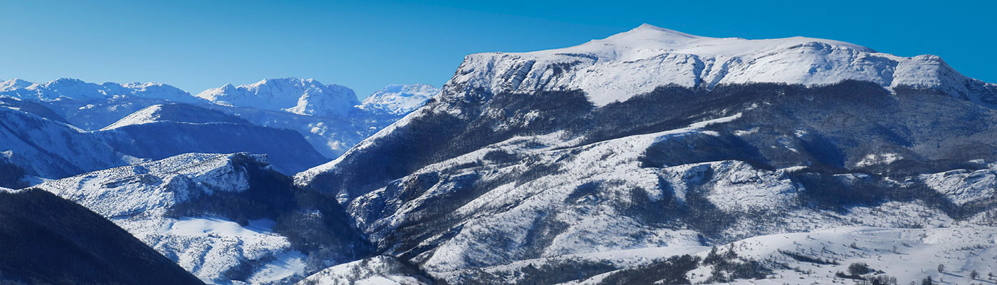
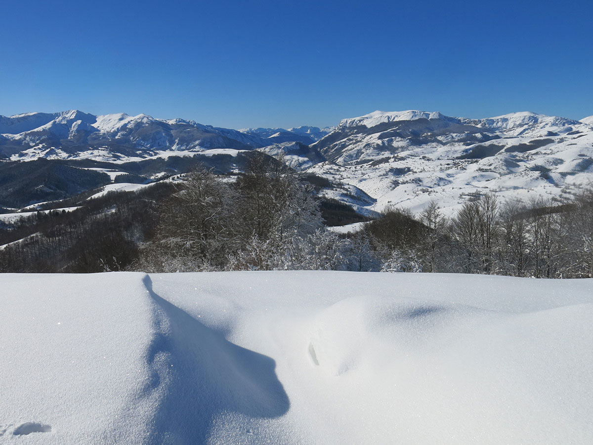
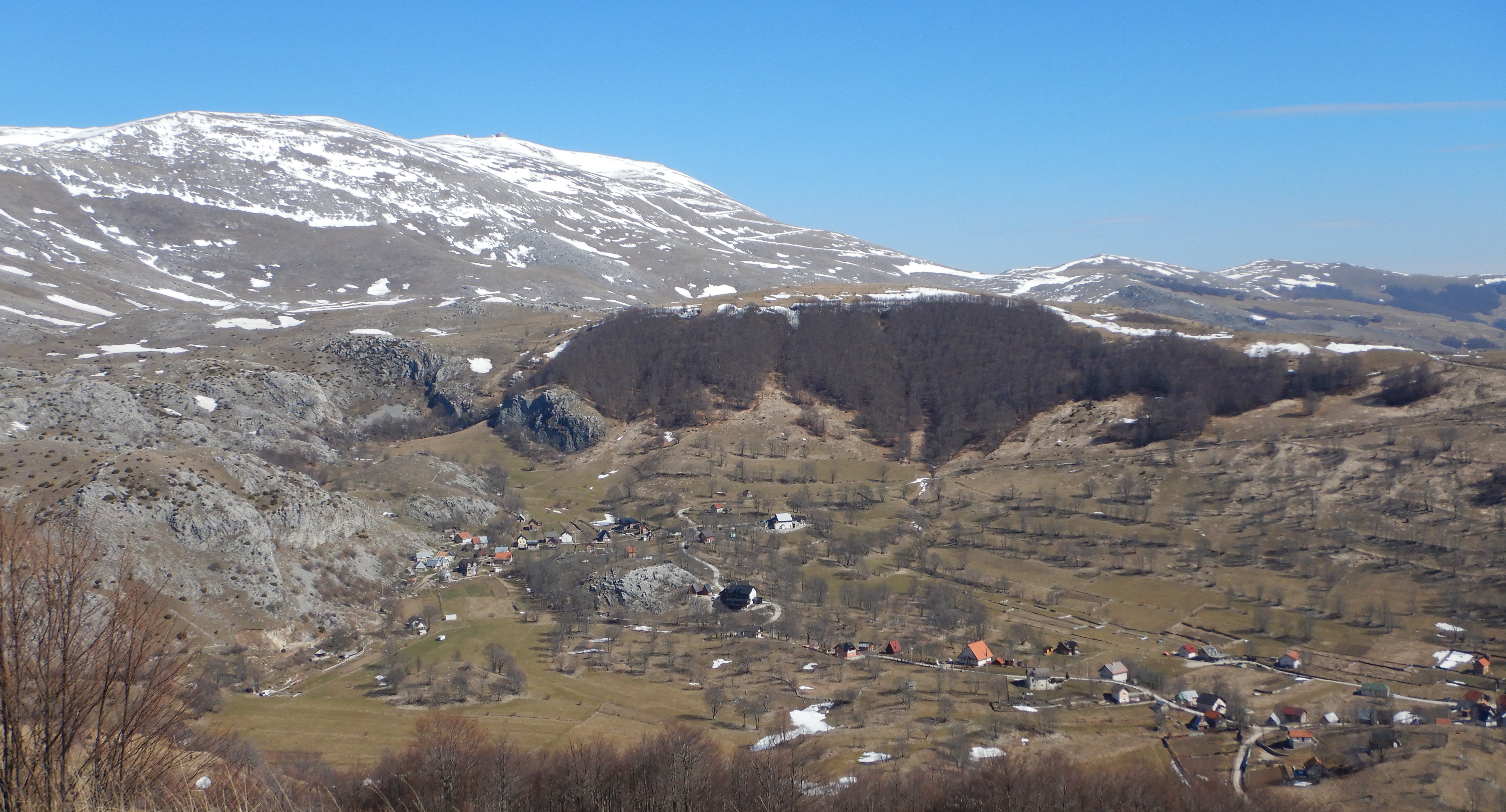
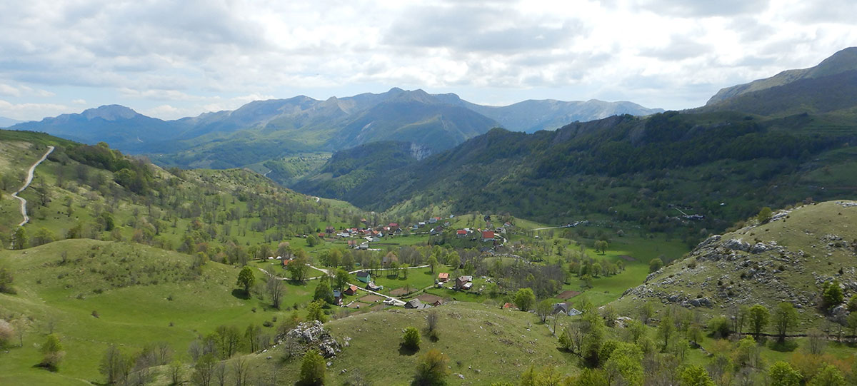
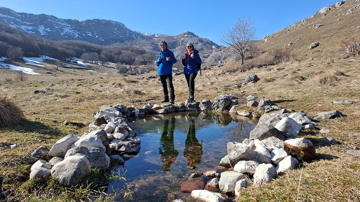
Rijeka Bijela nastaje od nekoliko većih potoka i izvora pod Hojtom (1672 m/nv) na Bjelašnici i pod Borikovcima (1577 m/nv) na Treskavici. Ukupna dužina rijeke je oko 12 km. Bijela je lijeva pritoka rijeke Željeznice u koju se ulijeva prije sela Kijeva. Visinska razlika od izvora do ušća je oko 600 m. Pripada Crnomorskom slivu. Izvorišnu čelenku rijeke Bijele formiraju potoci: Zilin potok, Makve, Dvorišta, Tijesni klanac, Mala Bijela i Dujmovićki Brod. Najveće pritoke su: Ledićki potok (sa vrelima Zbišće, Senabot i Husrevbegova vrela), Zasjen potok, Banj potok, Ostojićki Brod (sa vrelom Omeruk), Mijanovićki potok (sa vrelima Strugojnice, Krivelj i Studenac), vrela Mejtef i Jagodar, Duboki potok, Grozničevo vrelo i potok Presjenica. U Bijeloj obitavaju potočne pastrmke i rakovi što je dokaz da je voda u ovoj rijeci bezprijekorno čista i pitka.
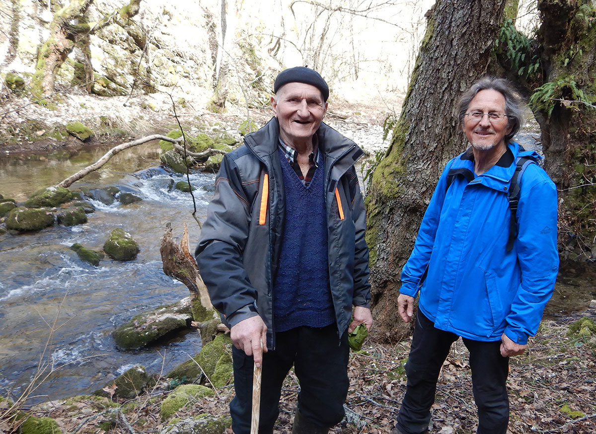
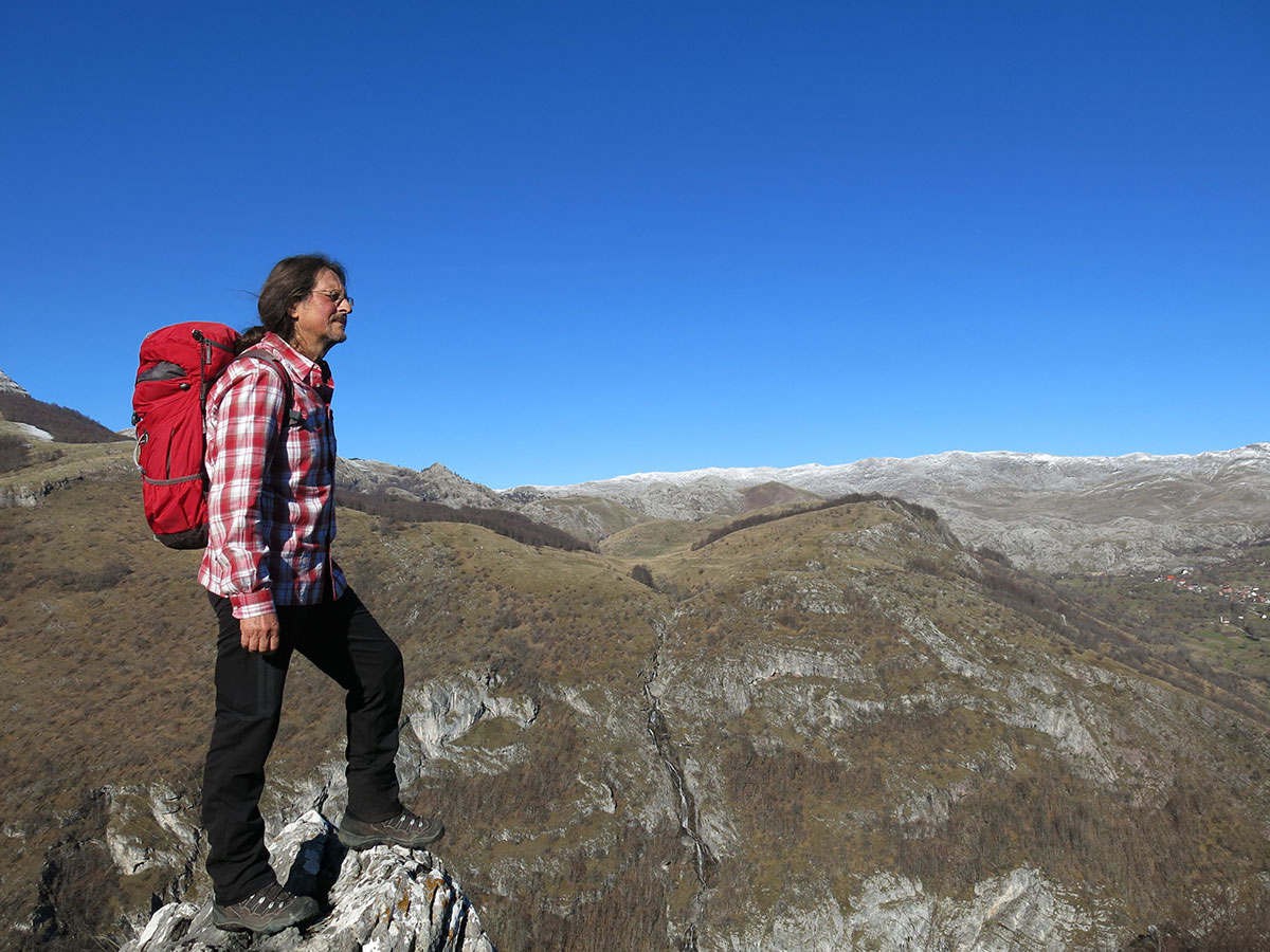
Autor teksta i fotografija: Braco Babić
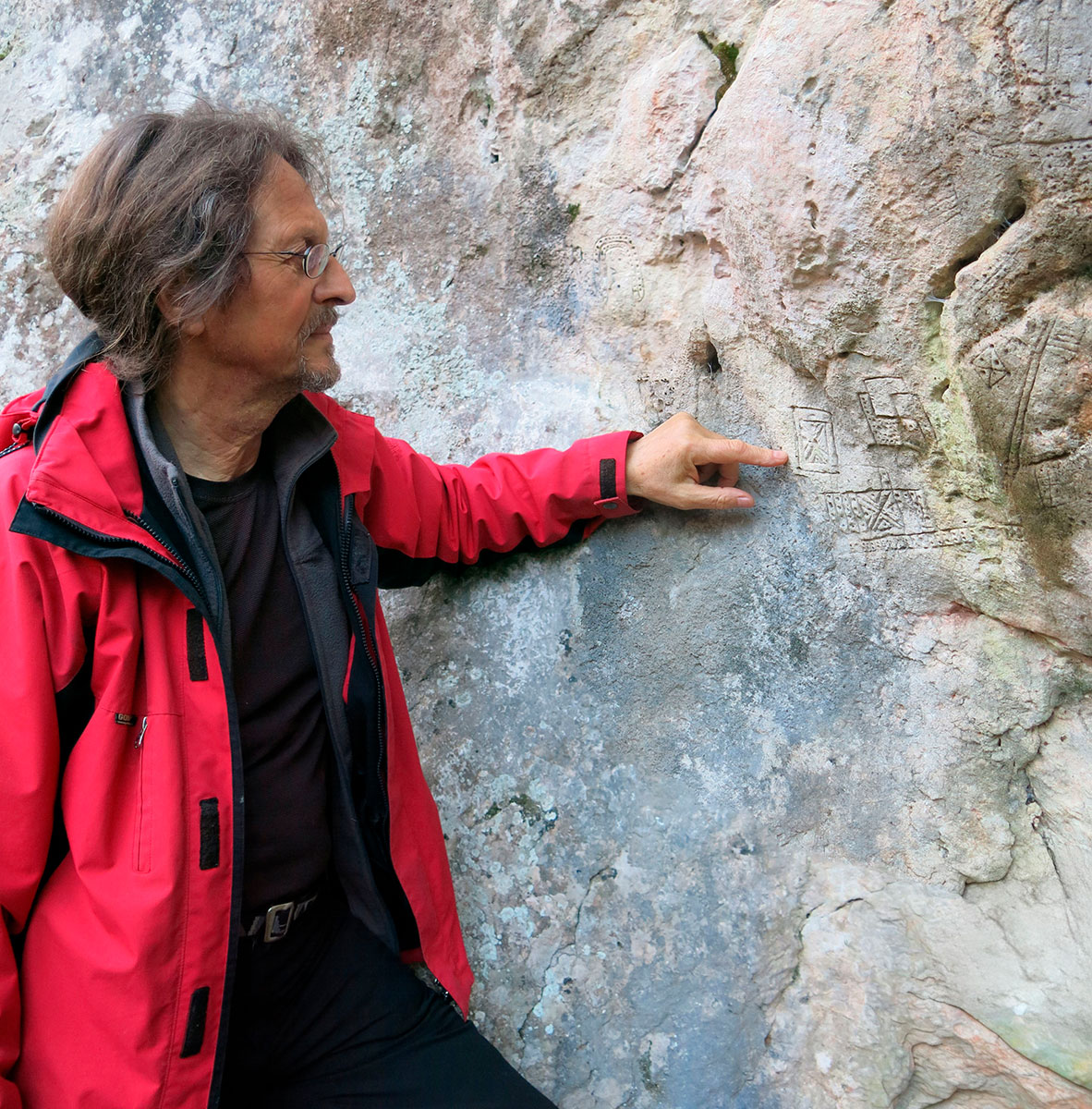
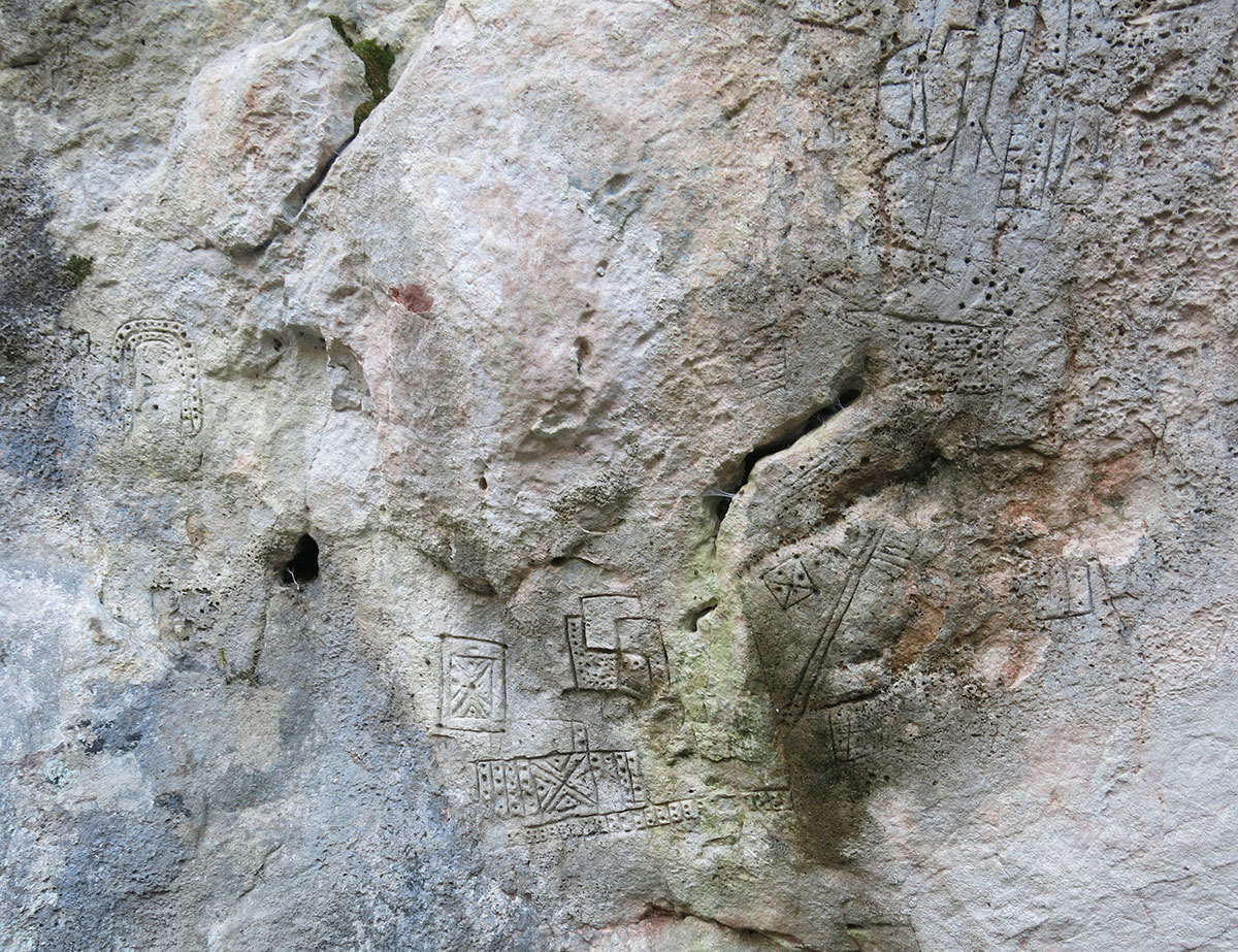
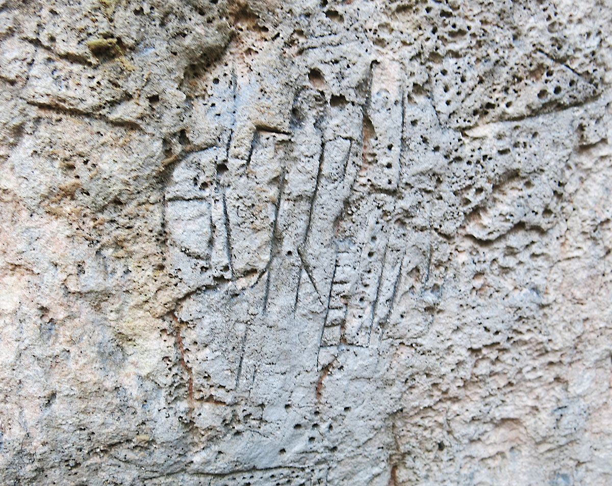
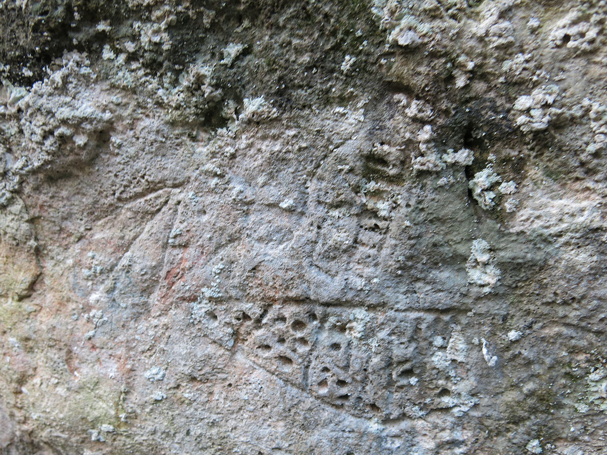
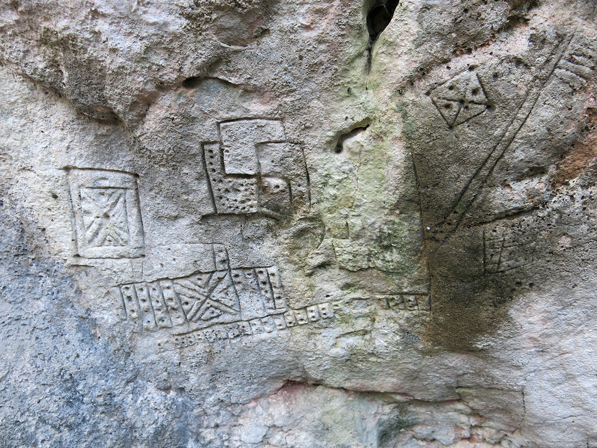
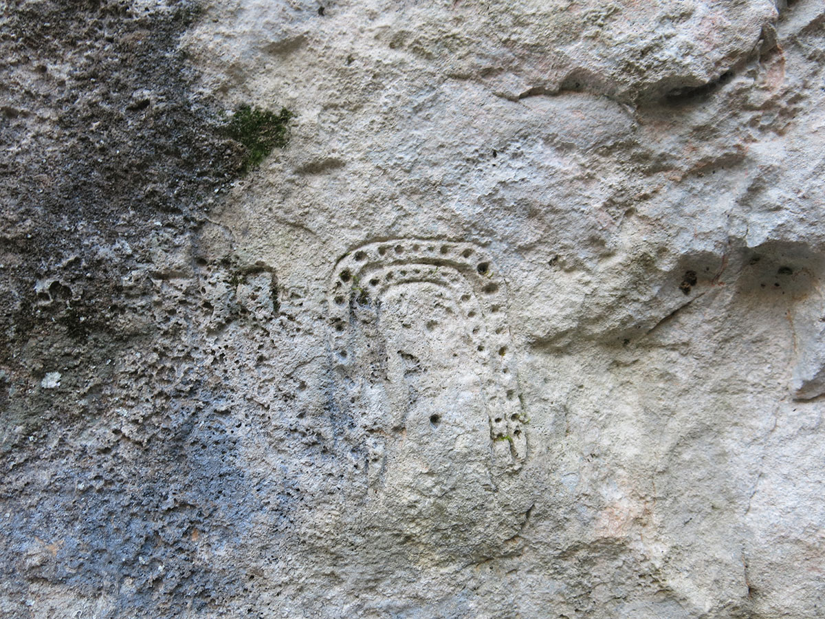
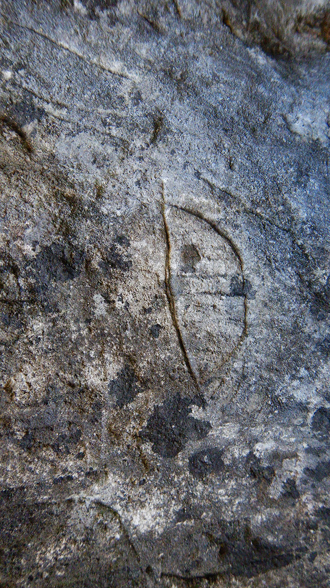
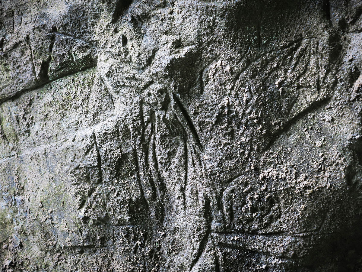
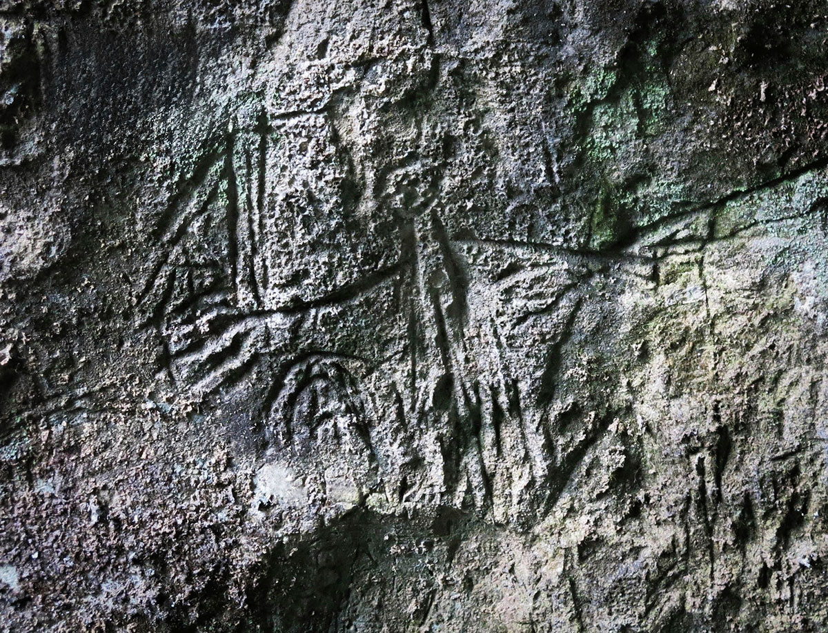
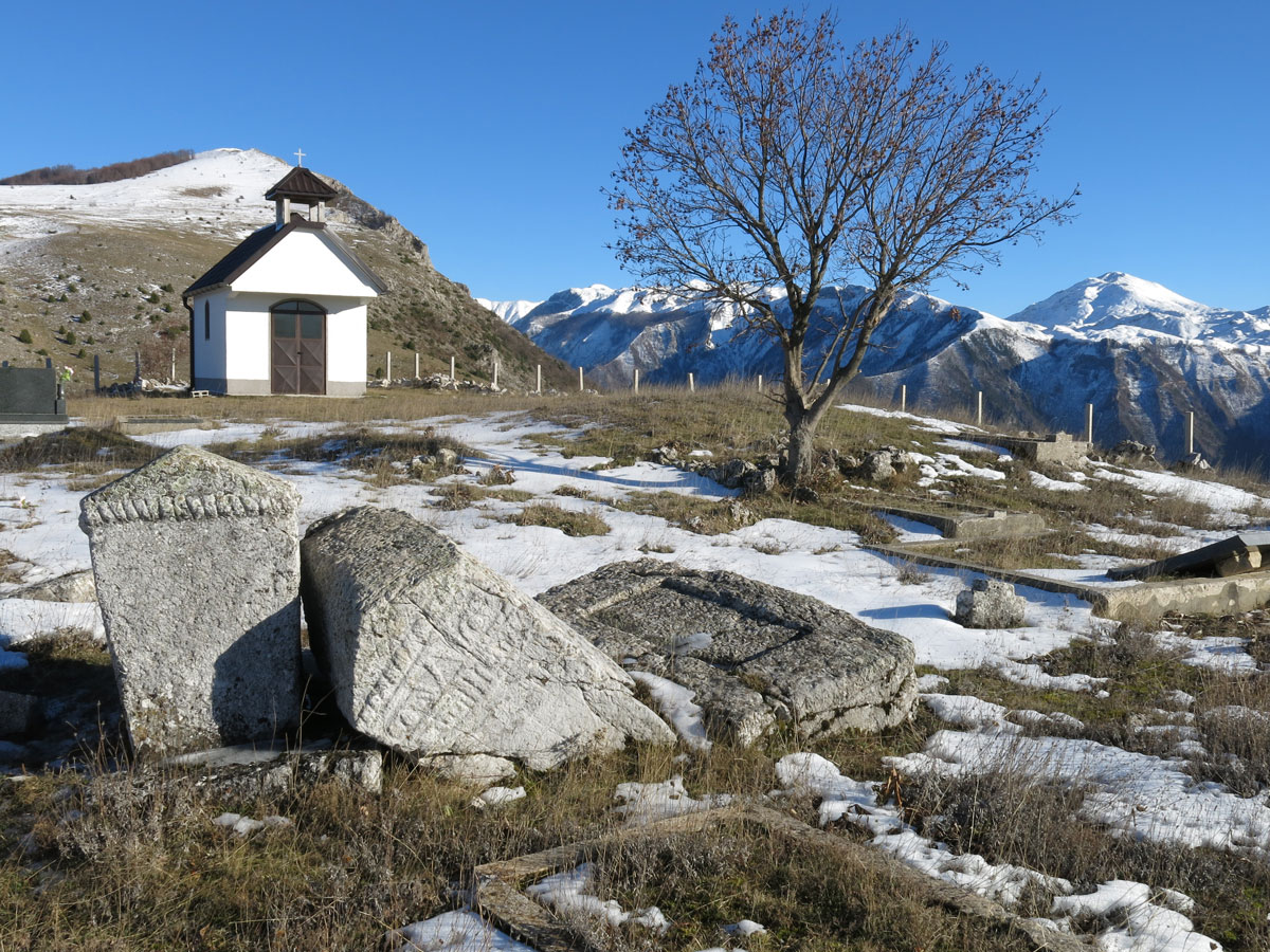
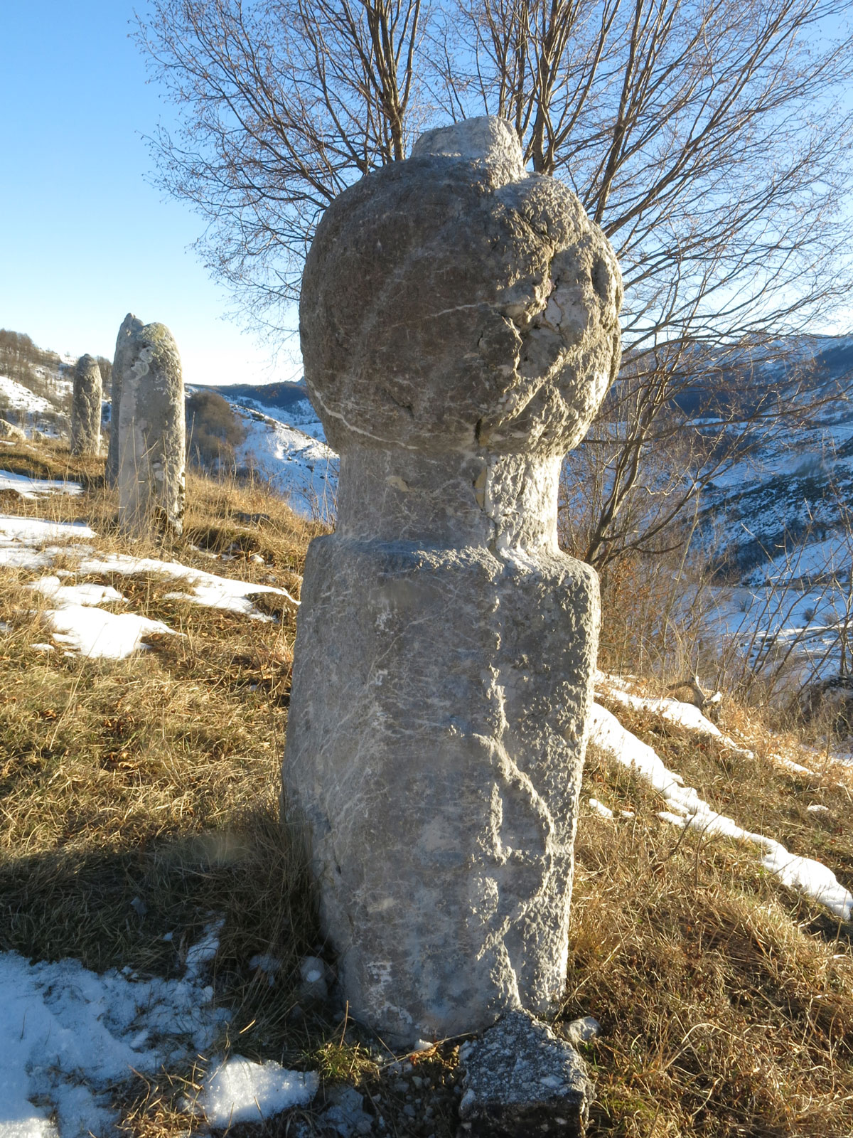
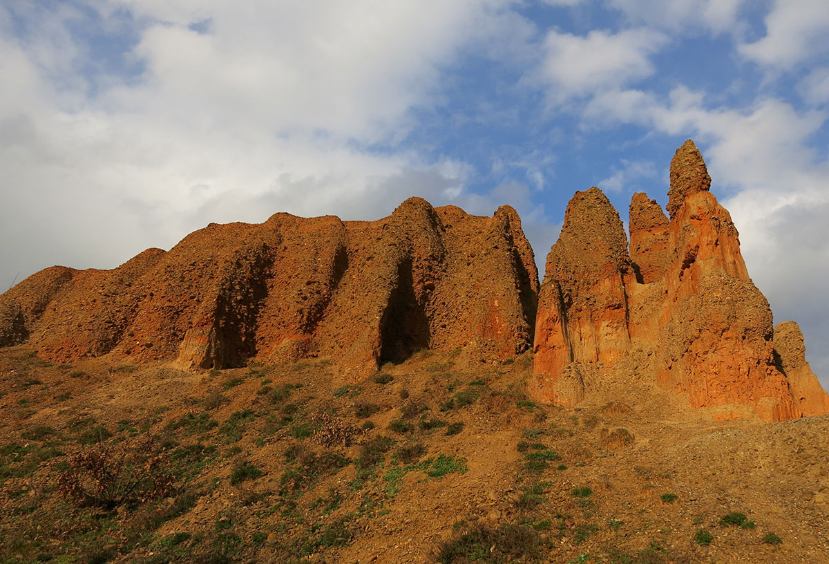
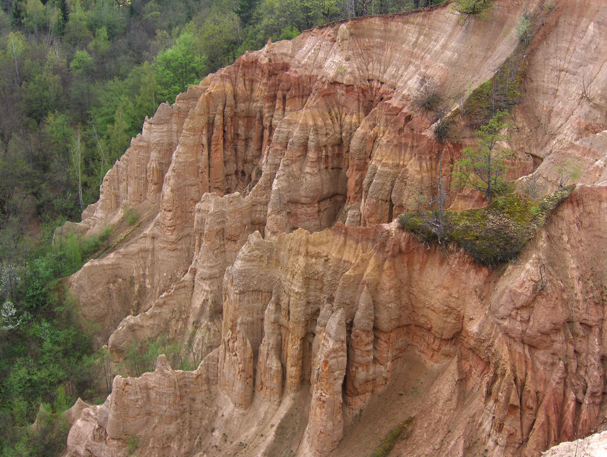
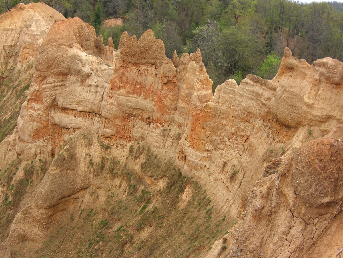
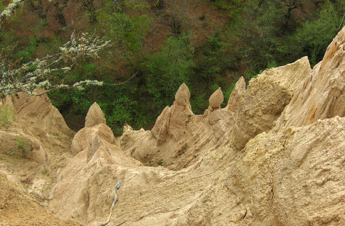
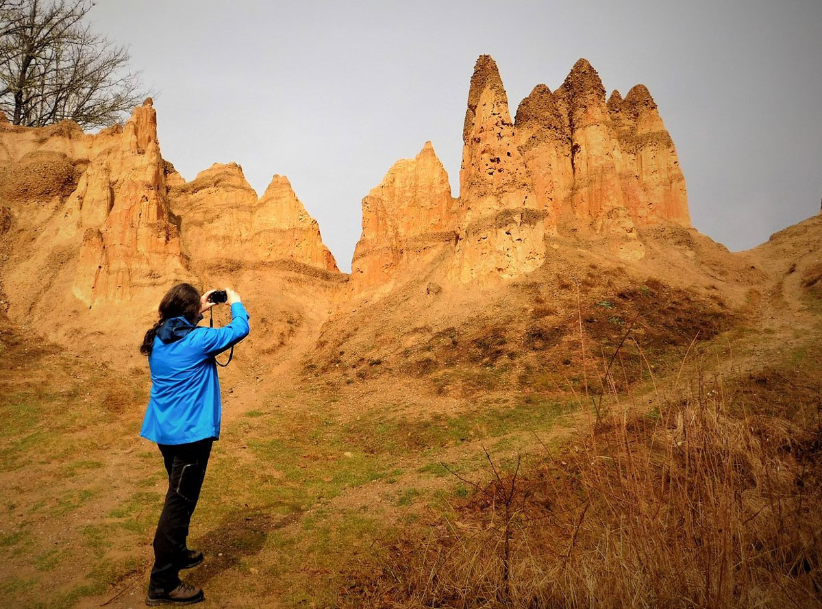
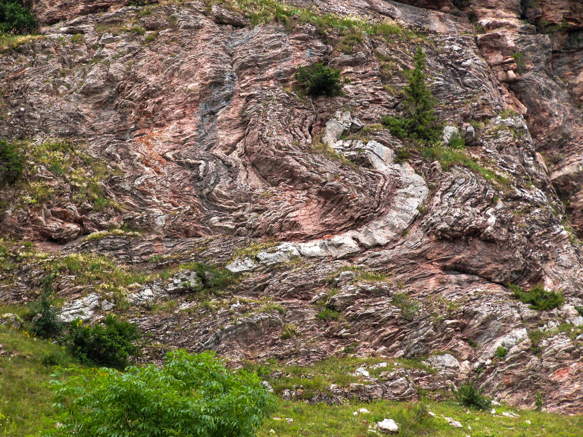
Zagonetni crteži i znakovi u kanjonu Bijele
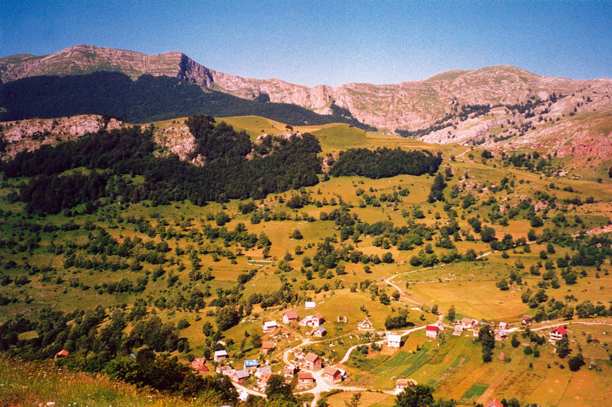
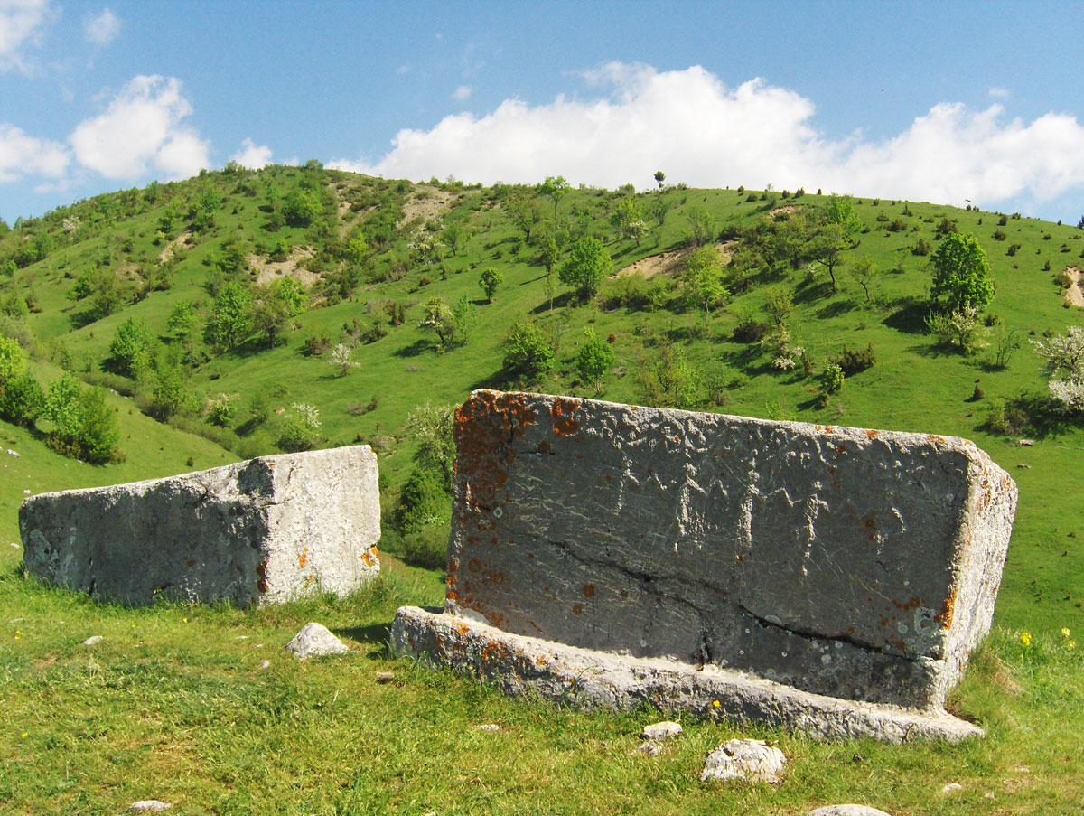
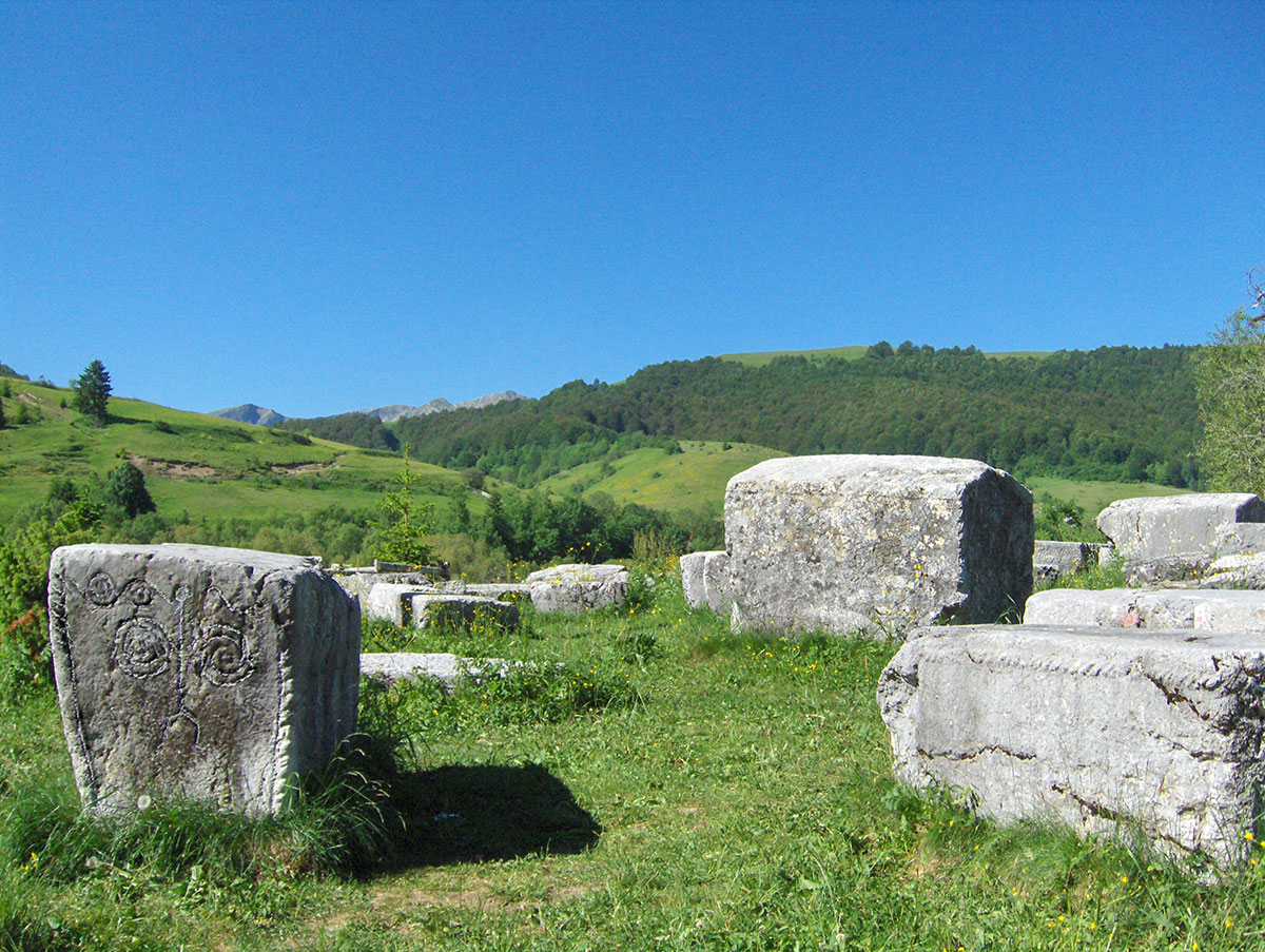
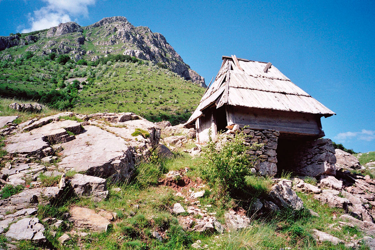
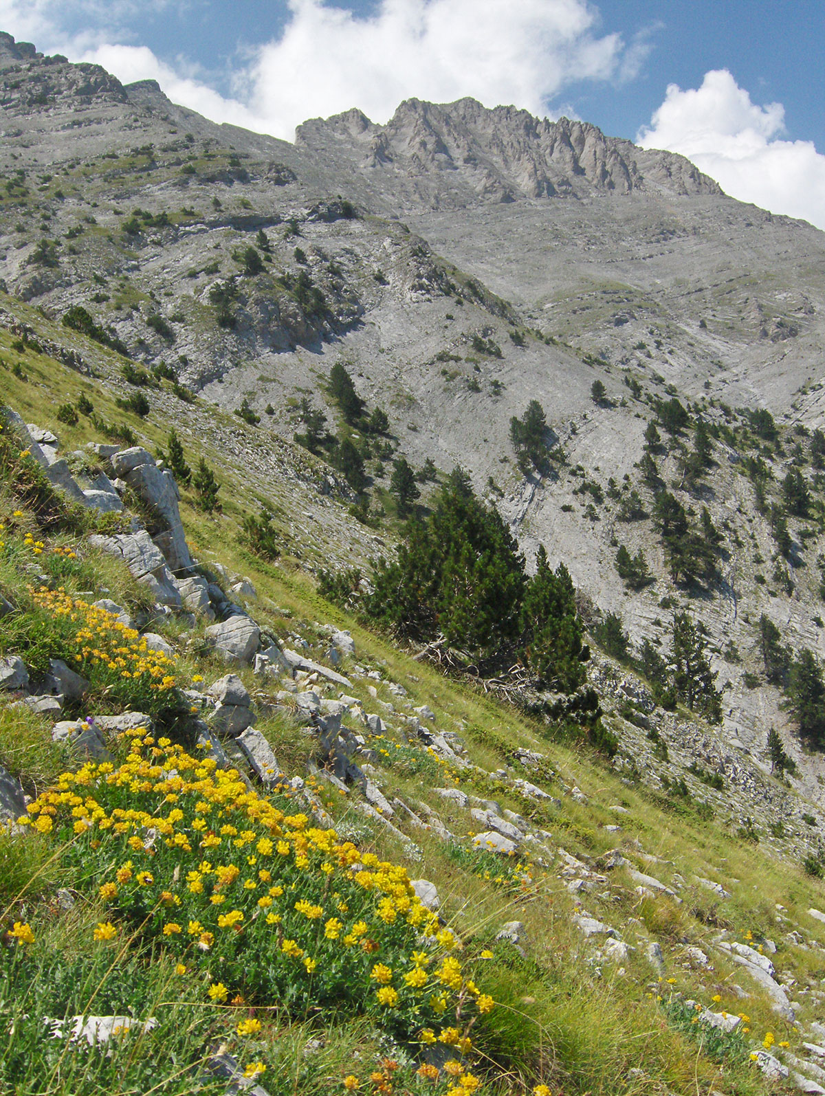
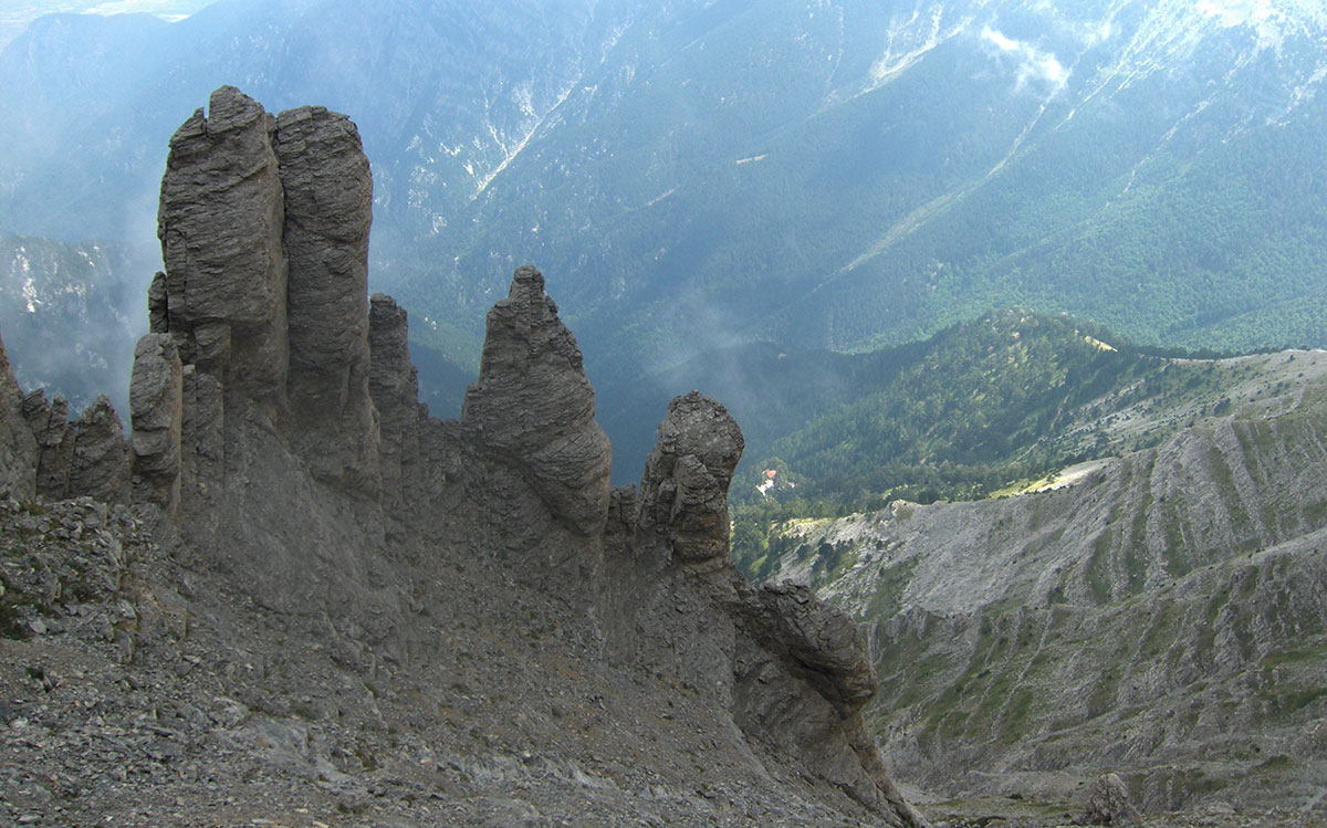
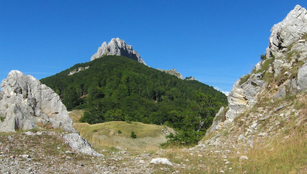
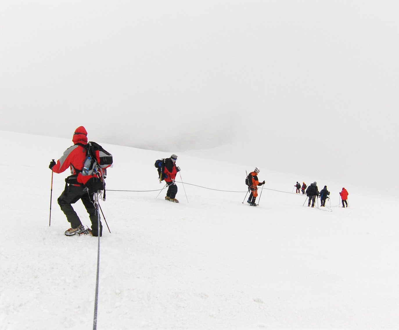
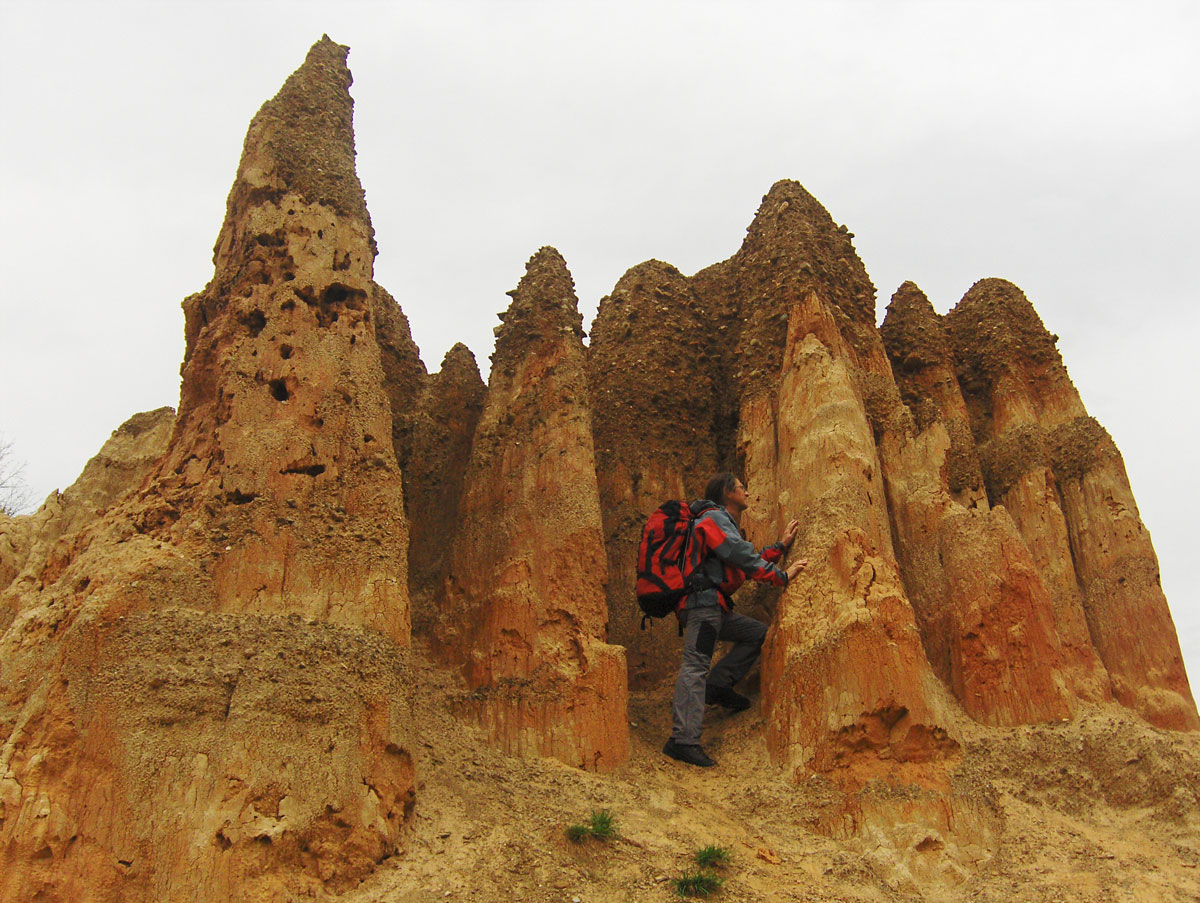
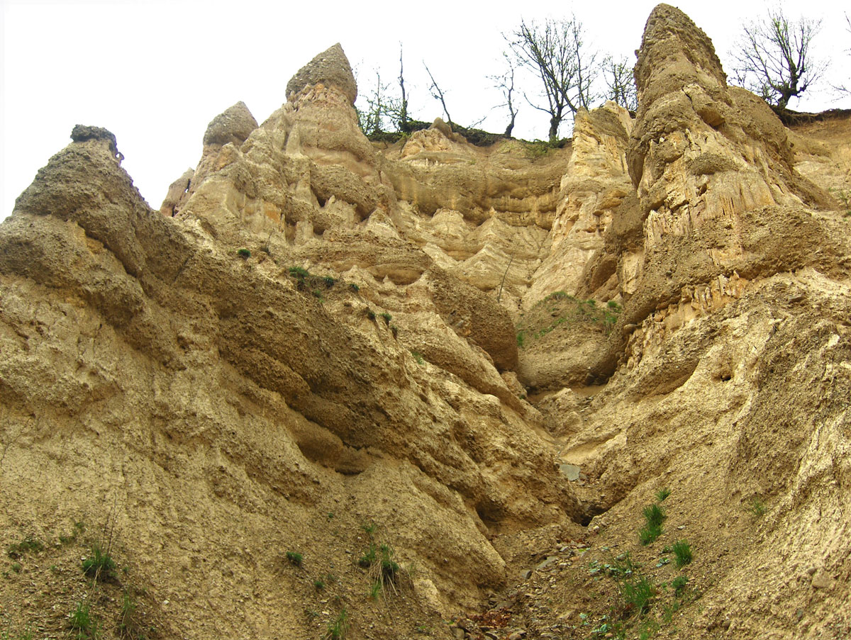
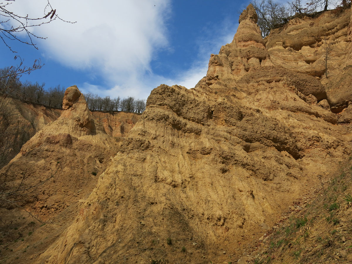
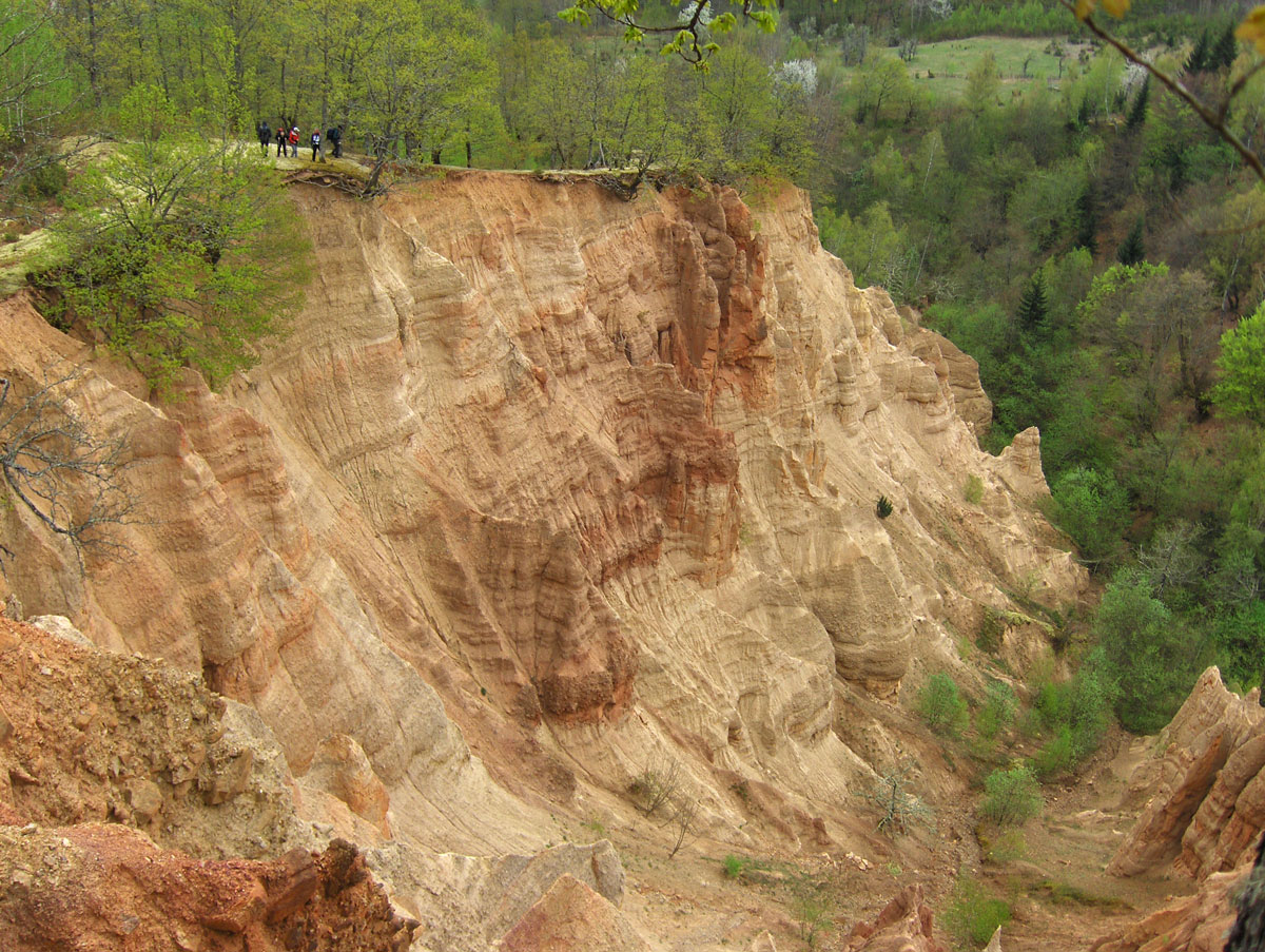
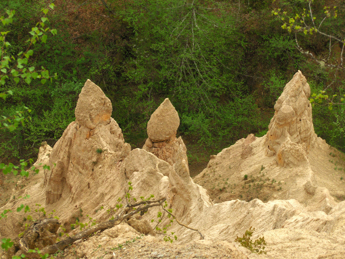
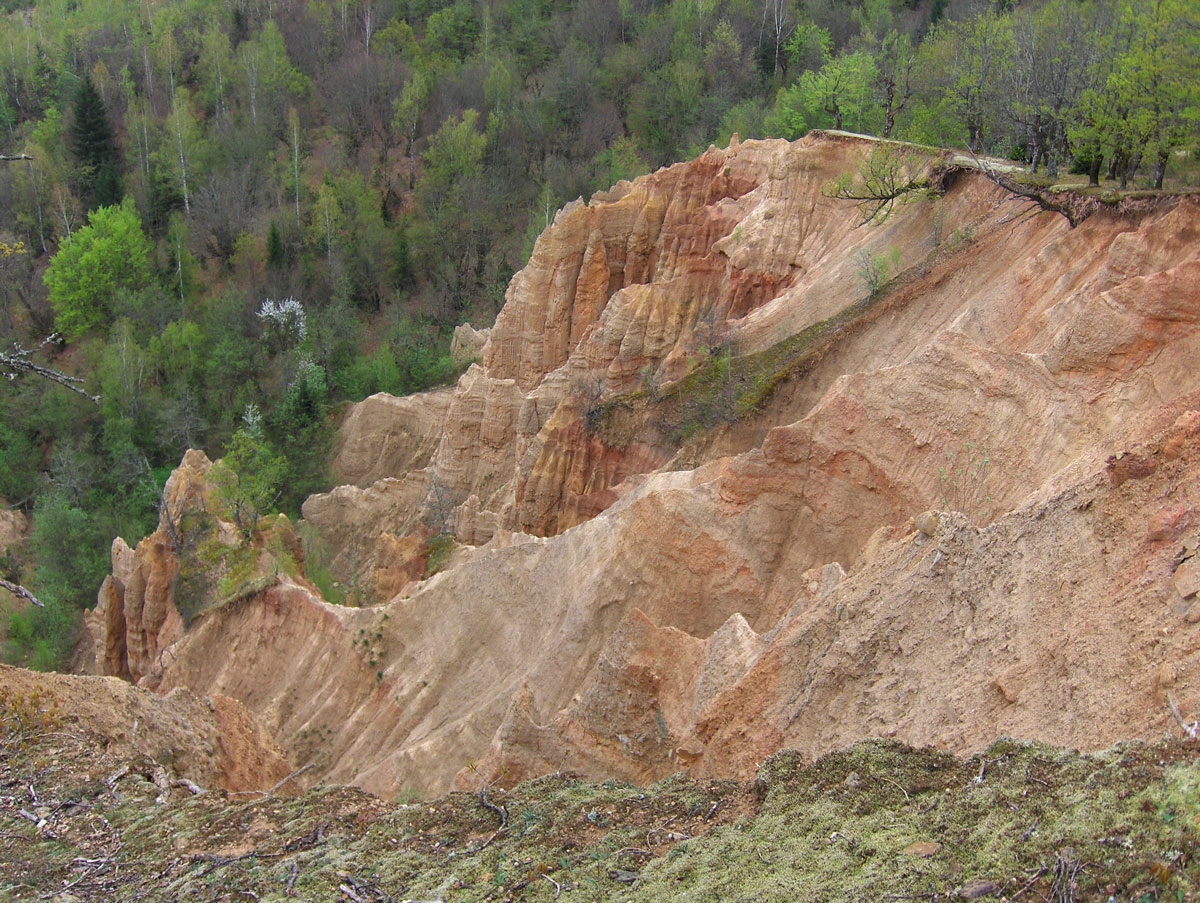
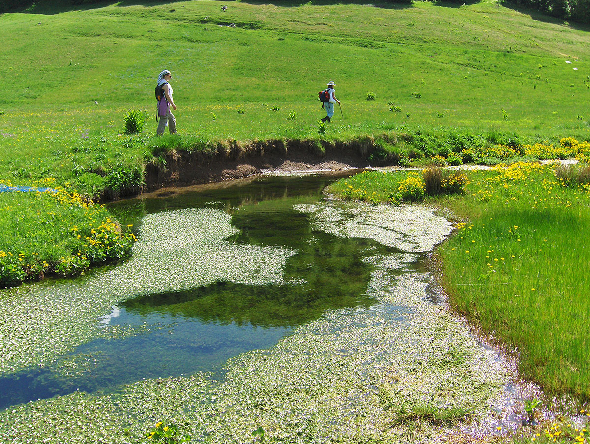
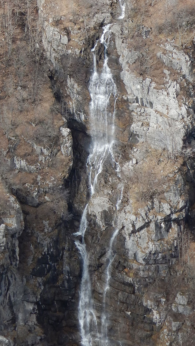
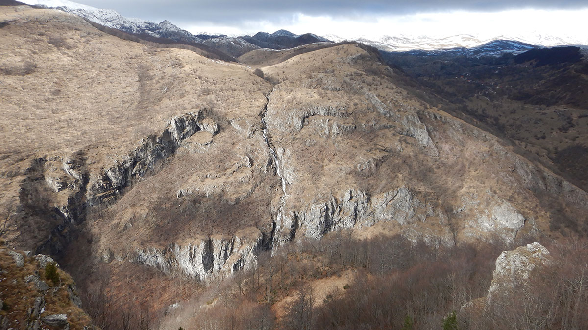
Rijeka Bijela je na svom toku od izvora prema Željeznici stvorila duboki kanjon dužine oko 6 km koji započinje ispod vrha Stojvice (958 m/nv) a završava prije sela Mošići (614 m/nv). Na tom dijelu rijeka čini nekoliko manjih slapova i brzaka nizvodno. Kanjon Bijele je slabo posjećen, ponekad naiđu rijetki ljubitelji prirode i ribolovci. U kanjonu je nekad davno bila vodenica, smještena na desnoj obali rijeke. Do vodenice se moglo pristupiti pješačkom stazom iz sela Gaj i Mijanovići, a koja je danas zarasla u žbunje. U blizini gdje se nalazila, na jednoj većoj, okomitoj stijeni urezani su zagonetni crteži i znakovi. Je li ovo bilo neko kultno mjesto u dalekoj prošlosti, možemo samo nagađati. Lokacija do danas nije arheološki istražena. Po mišljenju povjesničara, ti crteži potječu iz brončanog doba (2200. do 750/700. god. p.n.e.). Danas svjedoče o drevnoj ljudskoj prisutnosti u ovom lijepom planinskom kraju. Vrijedi spomenuti da se slični crteži i znakovi mogu vidjeti na ulazu pećine Ledenjača kod sela Budanj (blizu Miljevine) i Djevojačke pećine kod sela Brateljevići (blizu Kladnja).
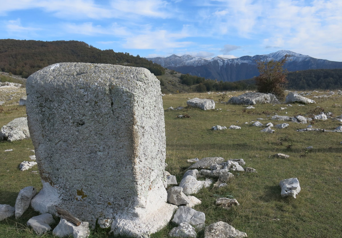
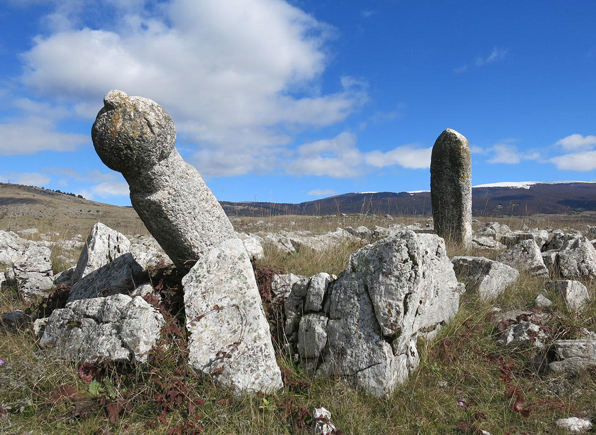
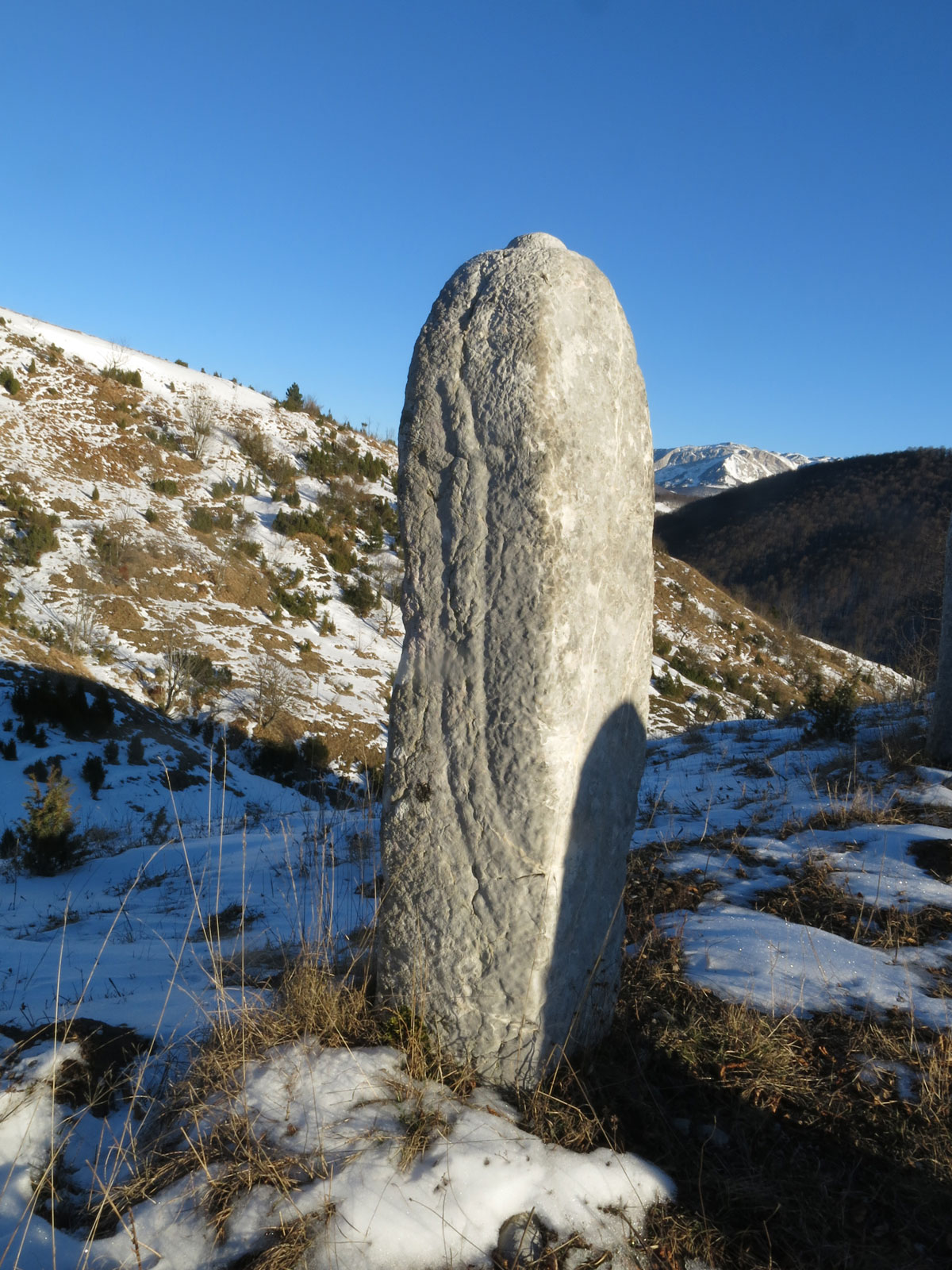
Stijenska umjetnost
Crtež ili znak izveden ljudskom rukom, tj. urezan ili slikan bojom, na površinu prirodne stijene je umjetnički izraz kao posebna vrsta opredmećivanja ljudskog stvaralaštva. Urezani crteži i znakovi nazivaju se još i petroglifima, a slikani piktografima. I jedni i drugi mogu biti u zatvorenom (na stijenama pećina ili pripećaka), ili na otvorenom (na prirodnim gromadama kamena ili namjerno postavljenim kamenim blokovima). Stijenska umjetnost raširena je širom svijeta već od razdoblja paleolitika, a iz različitih razloga: magijskih, religijskih, kao oznaka teritorija ili markacija staza i puteva, ili samo kao ukras. Takve je znakove i prikaze često teško datirati jer nemaju uvijek neki drugi arheološki ili povijesni kontekst, a oni na otvorenom izloženi su različitim vanjskim utjecajima i oštećenjima. Neki od njih prikazuju različite mitološke ili povijesne događaje, prizore iz svakodnevnog života, pa su važan dokument života i običaja pojedinih ljudskih zajednica.
Bosna i Hercegovina – “zemlja rijeka“
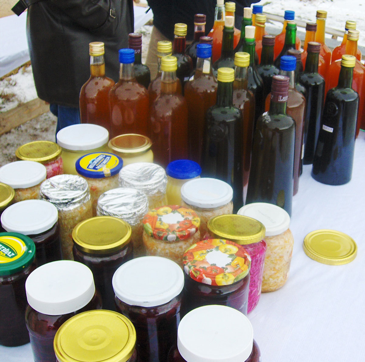
U Bosni i Hercegovini su evdentirane 262 manje ili veće rijeke, pa se stoga za našu zemlju s pravom može reći da je “zemlja rijeka“. Bosna i Hercegovina je poznata po svojim čistim i netaknutim vodama. Rijeke i potoci izviru u planinama, a potom urezuju sebi put kroz kanjone i doline. Pripadaju crnomorskom i jadranskom slivu. Najveći broj rijeka se ulijeva u Savu, glavnu pritoku rijeke Dunav, koja se ulijeva u Crno more, dok je Neretva jedina rijeka koja se ulijeva u Jadransko more. U novije vrijeme rijeke u BiH su pod stalnom opasnosti od uništavanja radi brojnih projekata za izgradnju malih hidroelektrana. U BiH je izgrađeno 114 MHE (do 2021. god.), a koje u svom punom kapacitetu rada samo do 3% doprinose proizvodnji električne energije na godišnjem nivou (koje imamo i viška u BiH pa se izvozi u susjedne države). Dok naše rijeke presušuju ekološki stručnjaci smatraju da u narednih nekoliko decenija možemo ostati bez dovoljnih količina pitke vode. Planskim dokumentima Općine Trnovo (FBiH) predviđena je izgradnja akumulacije na rijeci Bijela.
Ime rijeke Bijela
Ime rijeke Bijela dolazi od: pjenaste, “bijele” vode nastale zbog brzaka ili bijelog (svijetlog) kamenja u koritu. U Bosni i Hercegovini postoji nekoliko rijeka s istim imenom: – Bijela (pritoka Neretve), uzvodno od Konjica; – Bijela (pritoka Neretve), nizvodno od Jablanice; – Bijela (pritoka Neretve), uzvodno od Mostara; – Bijela (pritoka Lepenice), nizvodno od Tarčina; – Bijela (pritoka Drine), uzvodno od Foče; – Bijela, (pritoka Željeznice), nizvodno od Trnova.
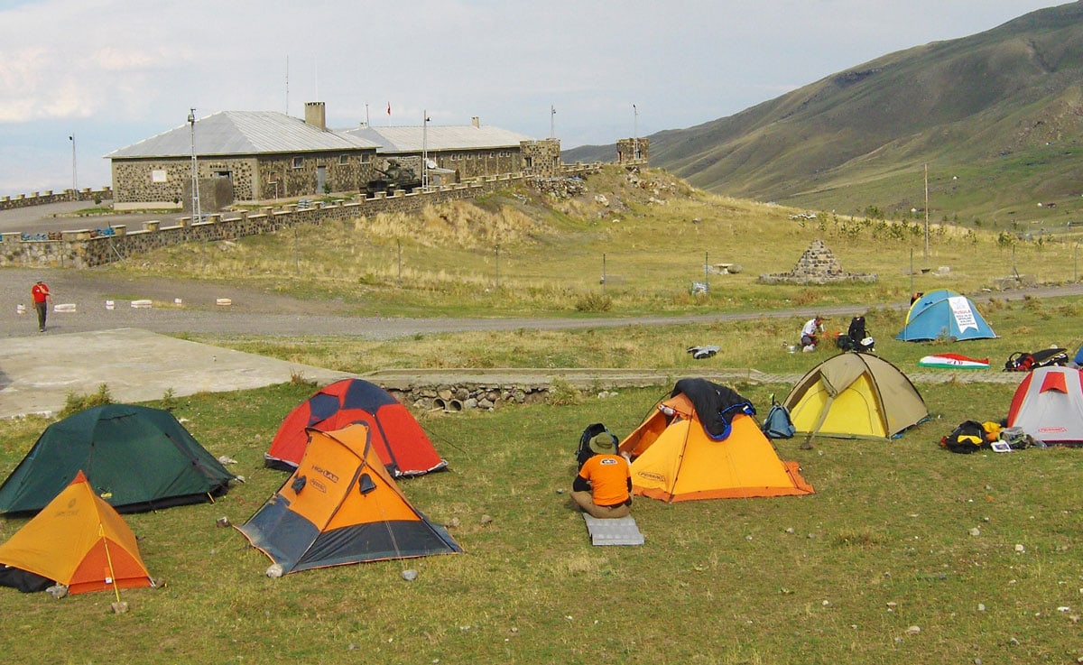
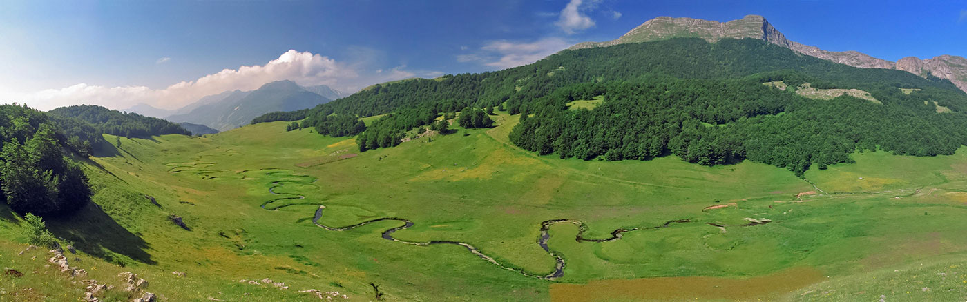
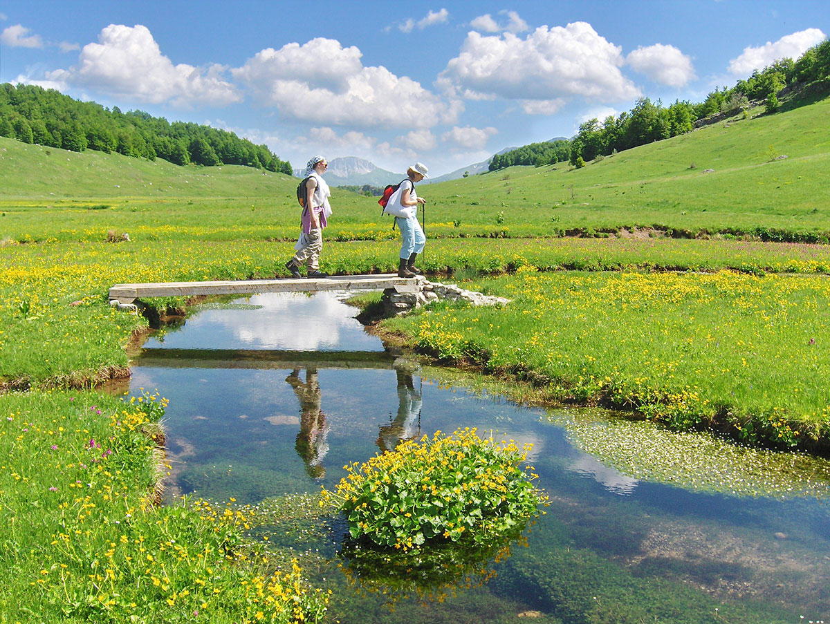
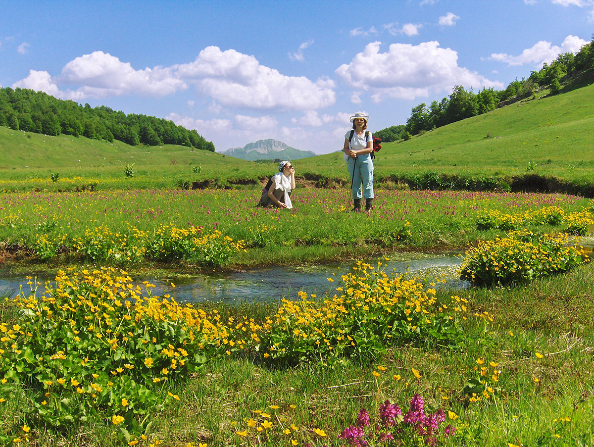
Zabjelašnica is a high-mountain region located in the central part of Bosnia and Herzegovina. The area is framed by the mountains Bjelašnica (2067 m.a.s.l.), Treskavica (2086 m.a.s.l.), and Visočica (1967 m.a.s.l.). Known for the extraordinary beauty of its landscapes, it is a place frequently visited by hikers and nature lovers alike. The entire region is characterized by a high degree of biodiversity and endemism. However, the greatest attention is drawn by the rich flora and fauna of the Rakitnica river canyon, which, stretching for about 20 km to its confluence with the Neretva, sharply divides Bjelašnica and Visočica.
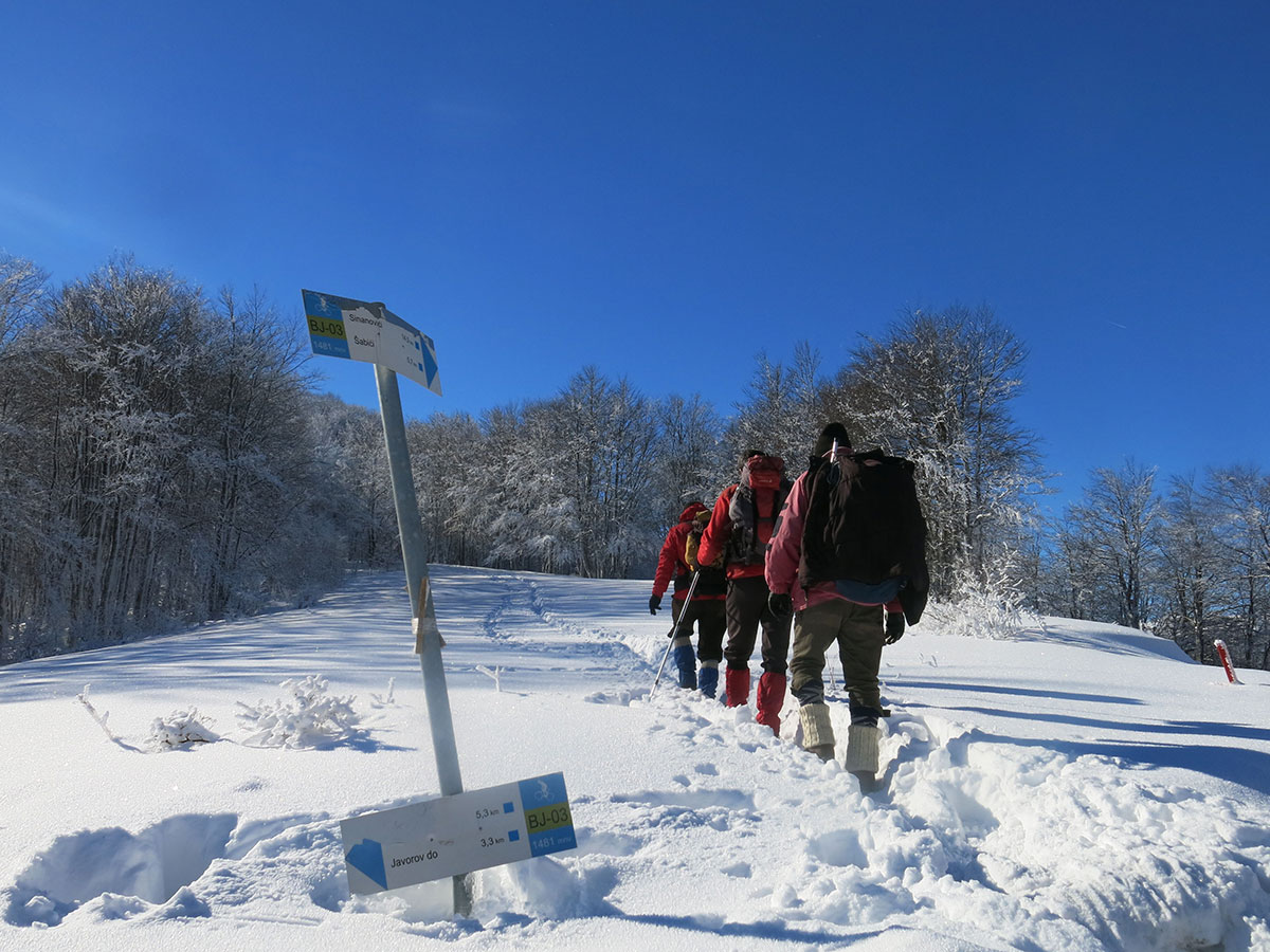
In this high-altitude area, many village settlements are situated at elevations ranging from 1150 – 1450 m.a.s.l. On the southern slopes of Bjelašnica lie Lukavac, Rašumovci, Milišići, Brda, Kramari, Elezovići, Umoljani, Šabići, and Rakitnica. On the northern slopes of Visočica, in the valley of the Tušilska river, are Sinanovići, Pervizi, Đulbašići, Ozimine, and Bobovica. West of this group, in the middle course of the Rakitnica (on the right bank), are Gornji Lukomir, Čuhovići, and Blace.
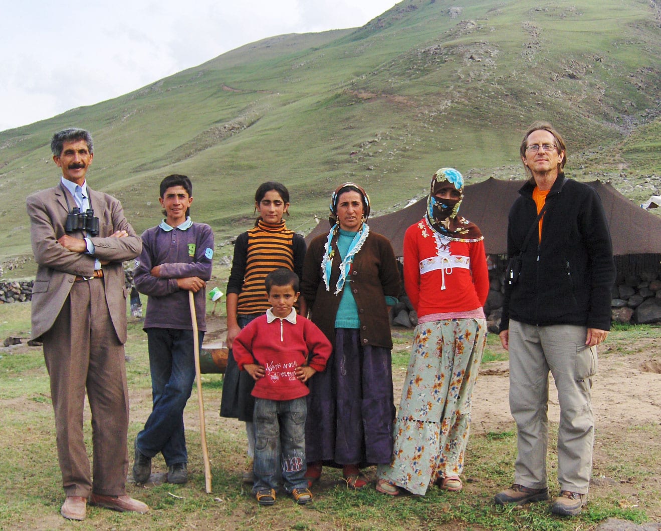
The inhabitants of these villages are mostly descendants of Herzegovinian livestock herders (Humljani), primarily from the regions of Podveležje, as well as from the Mostar, Nevesinje, Stolac, and Ljubuški areas. They originally came to this mountain region with their herds for summer grazing. For this reason, they built huts in many pastoral settlements (katuni, stanovi, mahale). Over time, they realized that one could live a beautiful life here and settled permanently. Within the entire area, the largest village by population is Umoljani, while the village at the highest altitude is Gornji Lukomir.
Text and photography by: Braco Babić
This mountain area has not been extensively studied, either archaeologically or historically, and the literature regarding these regions is very scarce. It has been inhabited since ancient times, dating back to the prehistoric era. One such site is Gradina, located on the elevation above the Umoljani pastoral settlement. In the late Middle Ages, the area from the Rakitnica river in the east to the small Trešanica river in the west belonged to the administrative district (knežija) of Črešnjevo within the Neretva county. At the beginning of the 15th century, the district was divided into a Bosnian part and a Herzegovinian part, with the Neretva river forming the border between these two areas. The region on the left bank of the Neretva once belonged to Humska zemlja, and later to Hercegovina, specifically to the regional lords from the Kosača noble family. The southeastern part of Bjelašnica, on the eastern border of the former Črešnjevo district, was, by all accounts, inhabited by the Vlach population (Vlasi katunari).
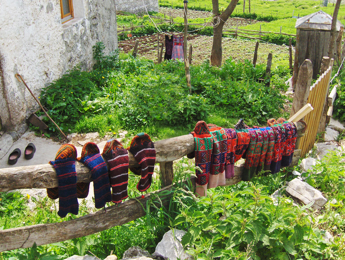
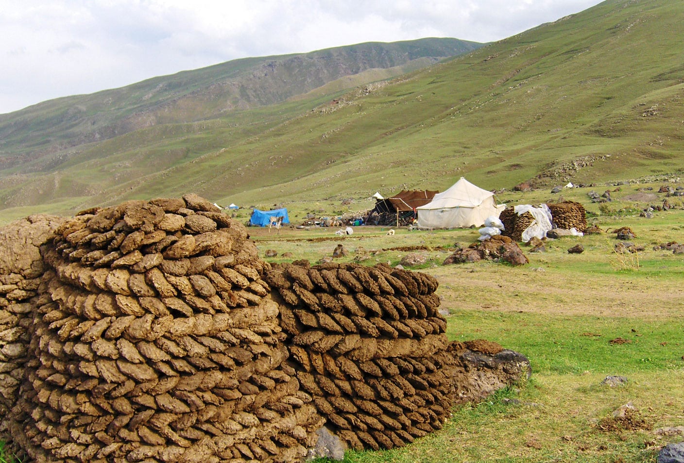
Most of the Zabjelašnica area is covered with coniferous and deciduous forests interspersed with pastures. It is rich in mountain streams and small rivers from which the Rakitnica river is formed. When it swells with the force of a wild mountain torrent, it roars and leaps into abysses, crushing everything in its path from Treskavica to the Neretva. Lush pastures, dense forests, and crystal-clear waters attracted the ancestors of today’s highlanders. The high and rugged mountains forced these brave people to eternally struggle against weather calamities and ferocious beasts. In winter, heavy snows fall, and villages can be cut off from the rest of the world for several months. Those who remain in the snow-covered villages become a kind of captive, left only to tend and feed the livestock, embroider traditional costumes, knit socks and gloves from sheep's wool, and sit by warm stoves during long winter nights, retelling various adventures and legends.
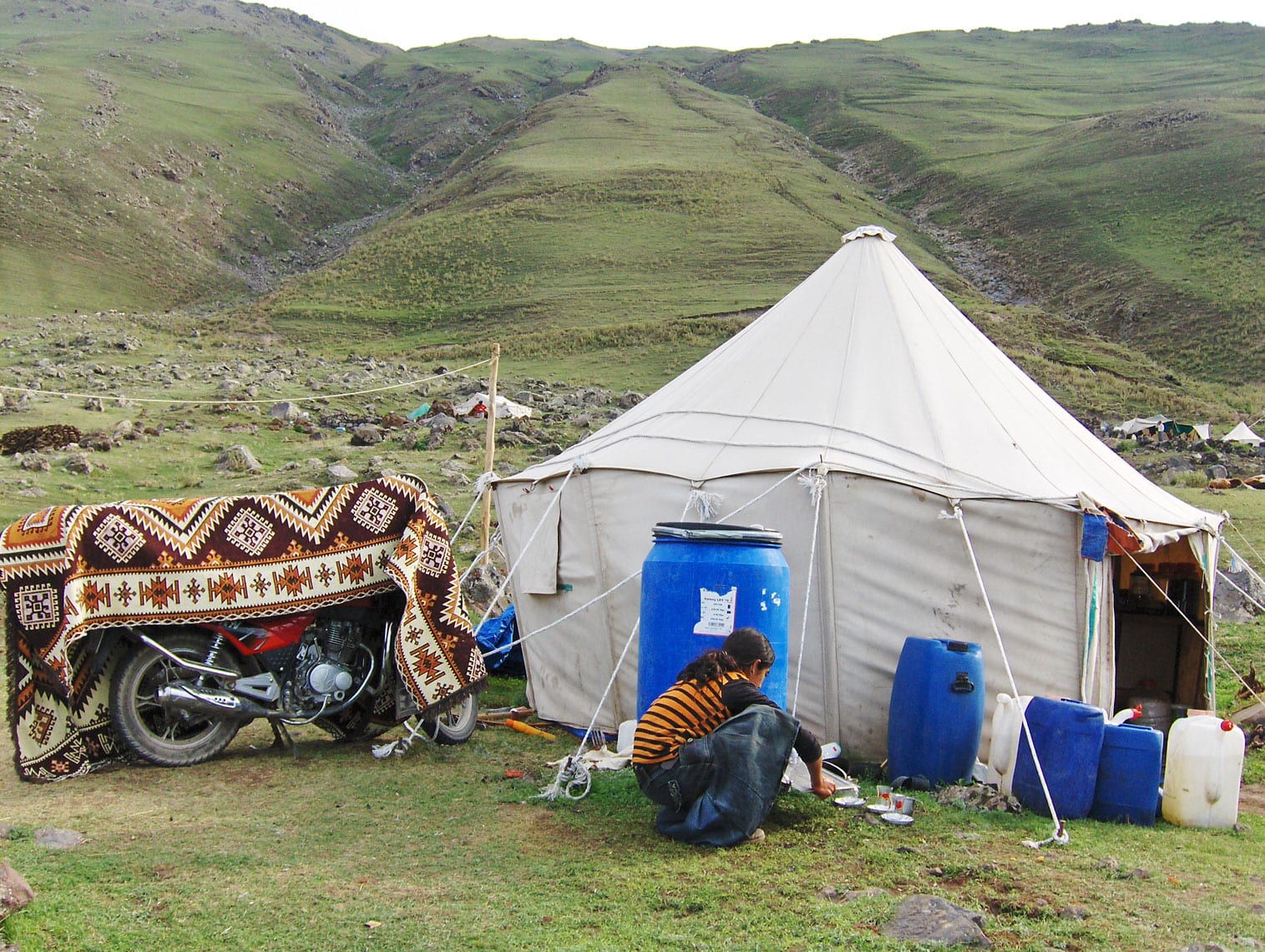
The villages in the Zabjelašnica area were once the very definition of distance and isolation from civilization. Educators and healthcare workers used to fear setting off for service in these places. This remote mountain region could only be reached by a full day's trek on foot or by horse. However, modern times have changed this area in many ways. Today, an asphalt road leads to almost every village; electricity, water, and telephone lines have been introduced, and public lighting has been installed. In 1993, during the past war, all the villages except Gornji Lukomir and Čuhovići were destroyed. Thanks to the hardworking hands of the locals and international humanitarian aid, all the houses have been rebuilt. In the past, village houses were built from natural materials – stone and wood. Today, that is no longer the case; new houses have been constructed with modern building materials and outside the scope of traditional architecture (houses with a čardak in the attic).
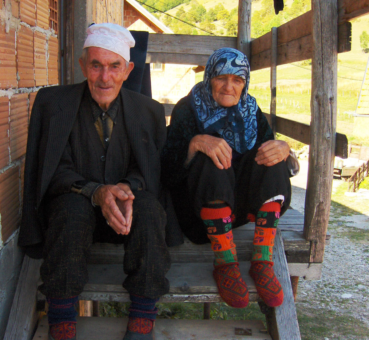
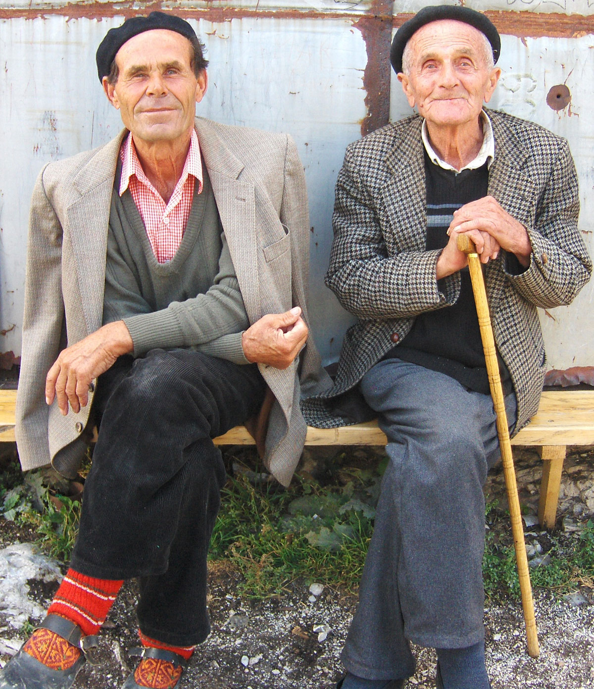
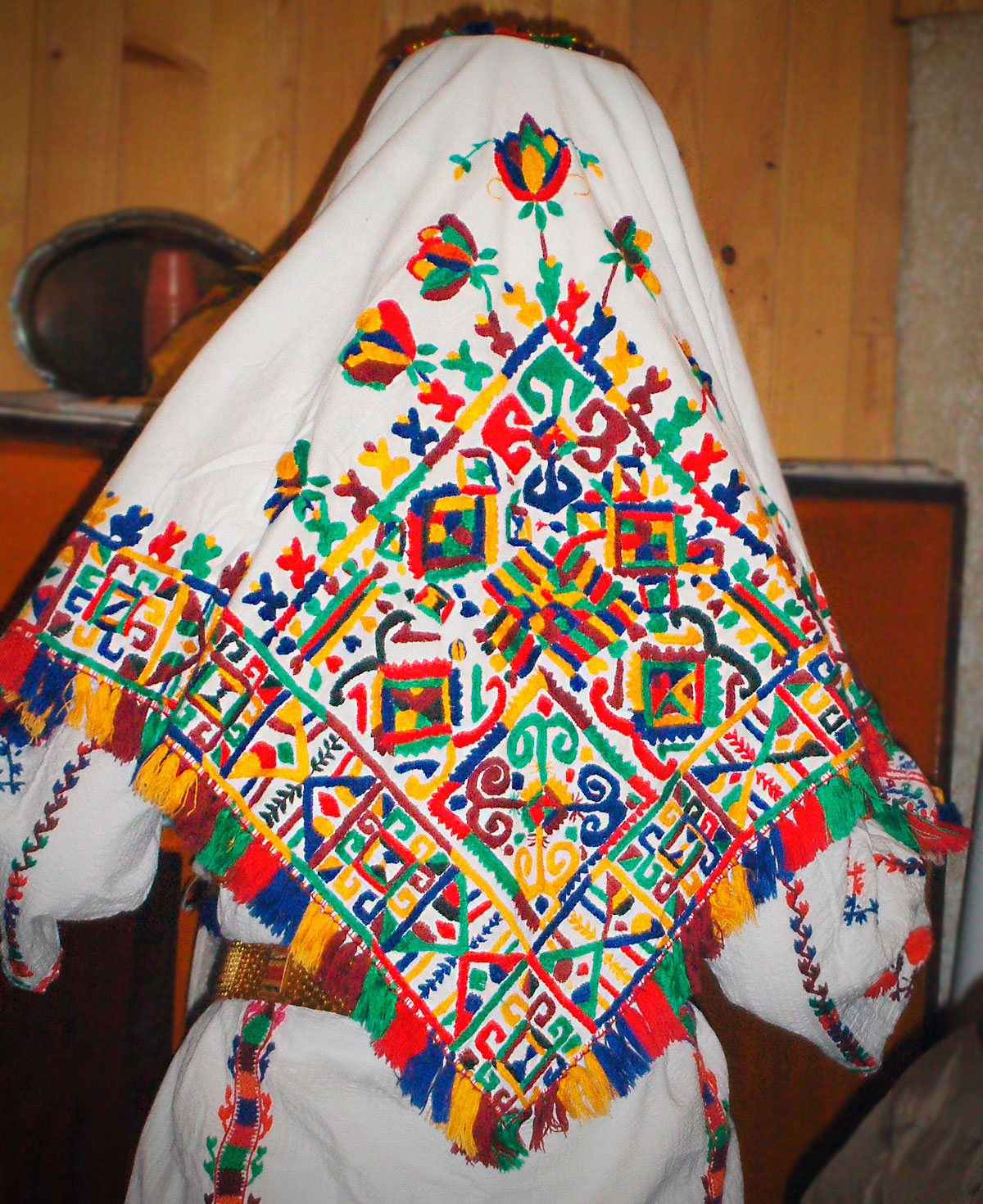
From the olden days, only the traditional costumes and adeti (customs) remain. The embroidery on the women's traditional costume is especially beautiful and rich in color. The men have largely abandoned the traditional attire, keeping only the white linen cap decorated with handwork, which they wear on formal occasions. Today, the majority of the population lives in Sarajevo, Konjic, Hadžići, Ilidža, and Hrasnica, visiting the villages only on weekends. Many households have stopped raising livestock. Cattle are now mostly grazed near the villages, so livestock farming in its original, traditional form no longer exists today. People have turned to easier and more profitable jobs related to rural tourism, which is currently undergoing rapid development.
Once, people steered clear of this area, but today it is visited by many tourists, nature lovers, hikers, and adventurers. They are drawn by the beauty of Bjelašnica, Visočica, and Treskavica, which offer a wide range of hiking and skiing tours, terrains for mountain bikes and quads, trekking along ancient pastoral paths, and exploring the Rakitnica canyon. Visitors also come to see the Illyrian burial mounds (gomile) and medieval necropolises with stećci (tombstones) in Šabići, Umoljani, Gornji Lukomir, Čuhovići, and Blace, as well as the old mosque in Umoljani, the watermills at the Sedrenik spring, the meander and waterfall on Studeni potok, the petrified dragon on the Gradina rock, and more. Every year in August, traditional mevludi and teferiči (festivals) are held, with the most visited ones being in Umoljani and Gornji Lukomir. In the villages, one can buy unique handwork made from wool with traditional folklore motifs from the locals, as well as natural, healthy food including dairy and meat products.
Bjelašnica, Gradina pastoral settlement (1490 m.a.s.l.) near the village of Umoljani.
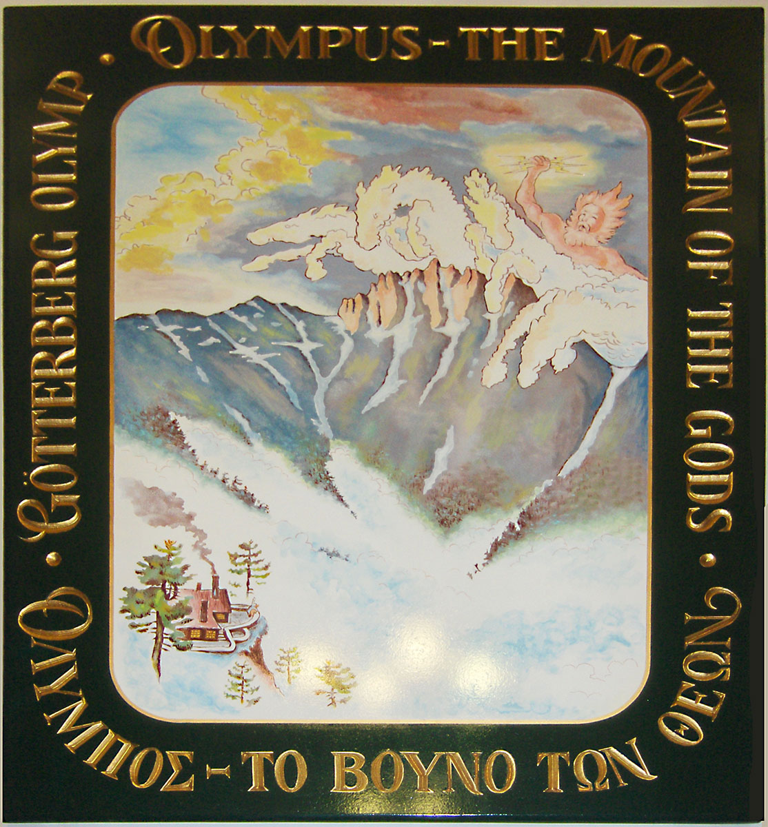
According to the mythology of Ancient Greece, Mount Olympus (Greek: Όλυμπος) was the sacred mountain where their gods resided. The assembly of Olympian gods in the Greek Pantheon consisted of twelve deities. While there were more in the hierarchy, the most prominent gods included: Zeus (the supreme God), Apollo, Ares, Aphrodite, Artemis, Athena, Demeter, Dionysus, Hephaestus, Hera, Hermes, and Poseidon.
The Greeks believed that crystal palaces, where these gods lived, were located at the mountain's summit. These palaces were built by the Titans and Cyclopes, while all artistic objects and devices were crafted and forged by Hephaestus. The gods lived in great luxury, consuming ambrosia as food and nectar as drink. According to legend, this divine sustenance granted them immortality.
The Greeks imagined their gods in human form and with human characteristics. They differed from their worshipers by their great strength, beauty, eternity, and the ability to heal from any wound. In the lives of the Greeks, the gods held a prominent place. As polytheists, they believed that the gods had the power to directly influence their lives and destinies. People turned to the gods when important decisions had to be made or when they wanted to know what the future held. It was believed that the gods must be pleased, so sacrifices and gifts were offered to them.
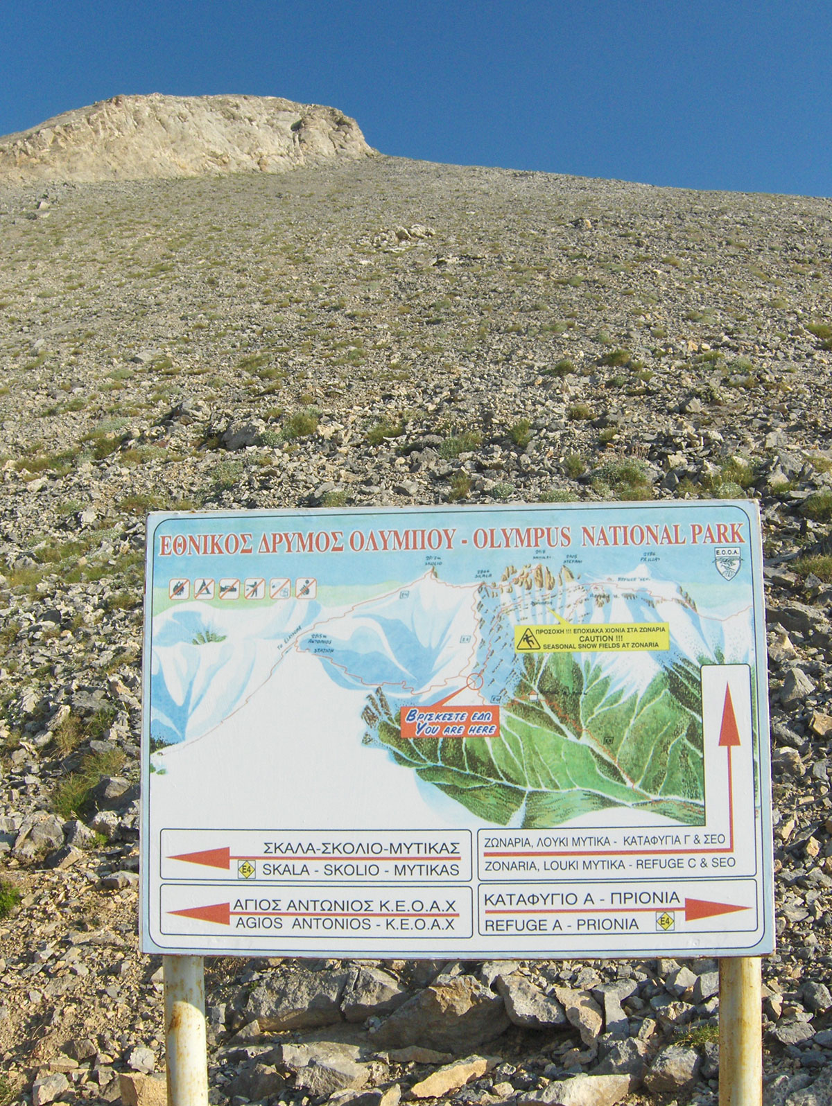
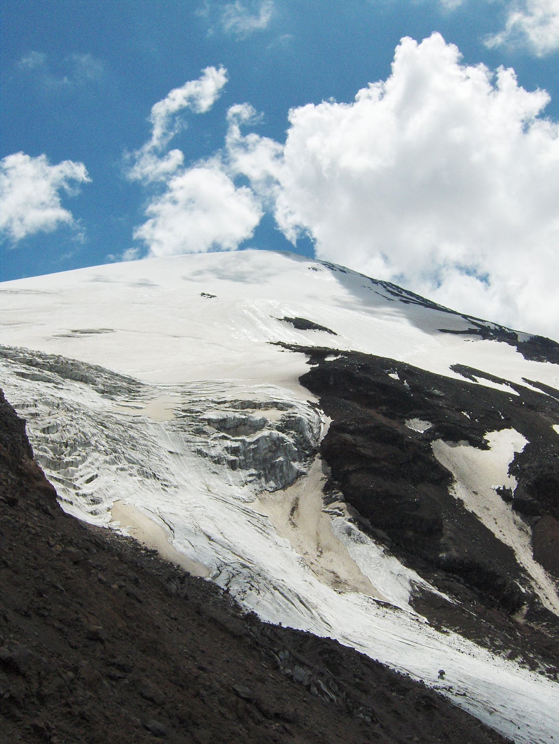
Mount Olympus is the highest and most beautiful mountain in Greece, and the second highest in the Balkan Peninsula. It is located near the eastern coast of the Aegean Sea, on the border between the regions of Thessaly and Macedonia. The highest peak of Mount Olympus is Mitikas (Greek: Mύτίκaς), which stands at an elevation of 2918 m a.s.l. Human feet first stepped on the highest point of Mytikas on August 2, 1913; the climbers were Christos Kakalos from Litochoro and Swiss explorers Frederic Boissonas and Daniel Baud-Bovy. On Mount Olympus, there are a total of 46 peaks higher than 2000 m and 47 higher than 1000 m above sea level. Besides Mytikas, mountaineers most frequently climb the peaks of Skala (2882 m.a.s.l.), Stefani (2909 m.a.s.l.), and Skolio (2912 m.a.s.l.).
Olympus is renowned for its rich flora, with about 1,500 plant species, 23 of which are endemic. Mount Olympus was declared a National Park in 1938. The significance of “Olympus“ National Park is recognized not only in Greece and Europe but worldwide. In 1981, UNESCO designated it a “Biosphere Reserve,” and the European Community included it on the list of “The Most Important Bird Areas in the European Community.” UNESCO added Mount Olympus to the World Heritage list in 1983.
Text and photography by: Braco Babić
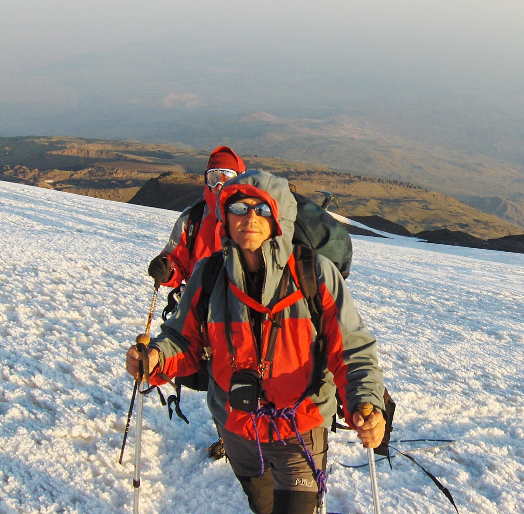
I embarked on a trip to Bulgaria and Greece with a group of friends for a mountaineering expedition. The journey took place from August 6th to 12th, 2010. In Bulgaria, we reached the highest peaks of two mountains: Musala peak (2925 m.a.s.l.) on Rila and Vihren peak (2914 m.a.s.l.) on Pirin. Afterward, we continued our journey to Greece, where we climbed Mitikas (2918 m.a.s.l.), the highest peak of Mount Olympus. You can read about the ascent of these three highest peaks of the Balkan Peninsula in the entries from my mountaineering diary, which I have published in three installments.
On the morning of August 10th, we left Bansko and joined the Sofia – Thessaloniki highway at Simitli. The road led us through the Struma River valley to the Kulata border crossing. Before crossing, we stopped at a gas station to fill the tank, following reports of an announced fuel tanker drivers’ strike in Greece. Surprisingly, in the peak of the tourist season, there were no crowds at the border, and we soon continued our journey. We reached Thessaloniki via the old highway, as the newly built one had not yet been opened for traffic.
Thessaloniki (Greek: Θεσσαλονίκη) is the second-largest city in Greece and the capital of the Central Macedonia region. It was founded in 315 BC by Cassander, the King of Macedonia, who named it after his wife, Thessaloniki, the half-sister of Alexander the Great. The city stretches along the Thermaic Gulf for about 17 km and consists of 13 municipalities with a total population of around 1 million. It is an economic, industrial, commercial, and cultural hub, as well as a vital transportation point in Southeastern Europe.
While Thessaloniki has a relative lack of monuments from the ancient past, it more than makes up for it with numerous churches from the Early Christian and Byzantine periods, as well as monuments from the Ottoman era, including buildings belonging to Sephardic Jews. In 1988, many of these monuments and structures were inscribed on the UNESCO World Heritage list.
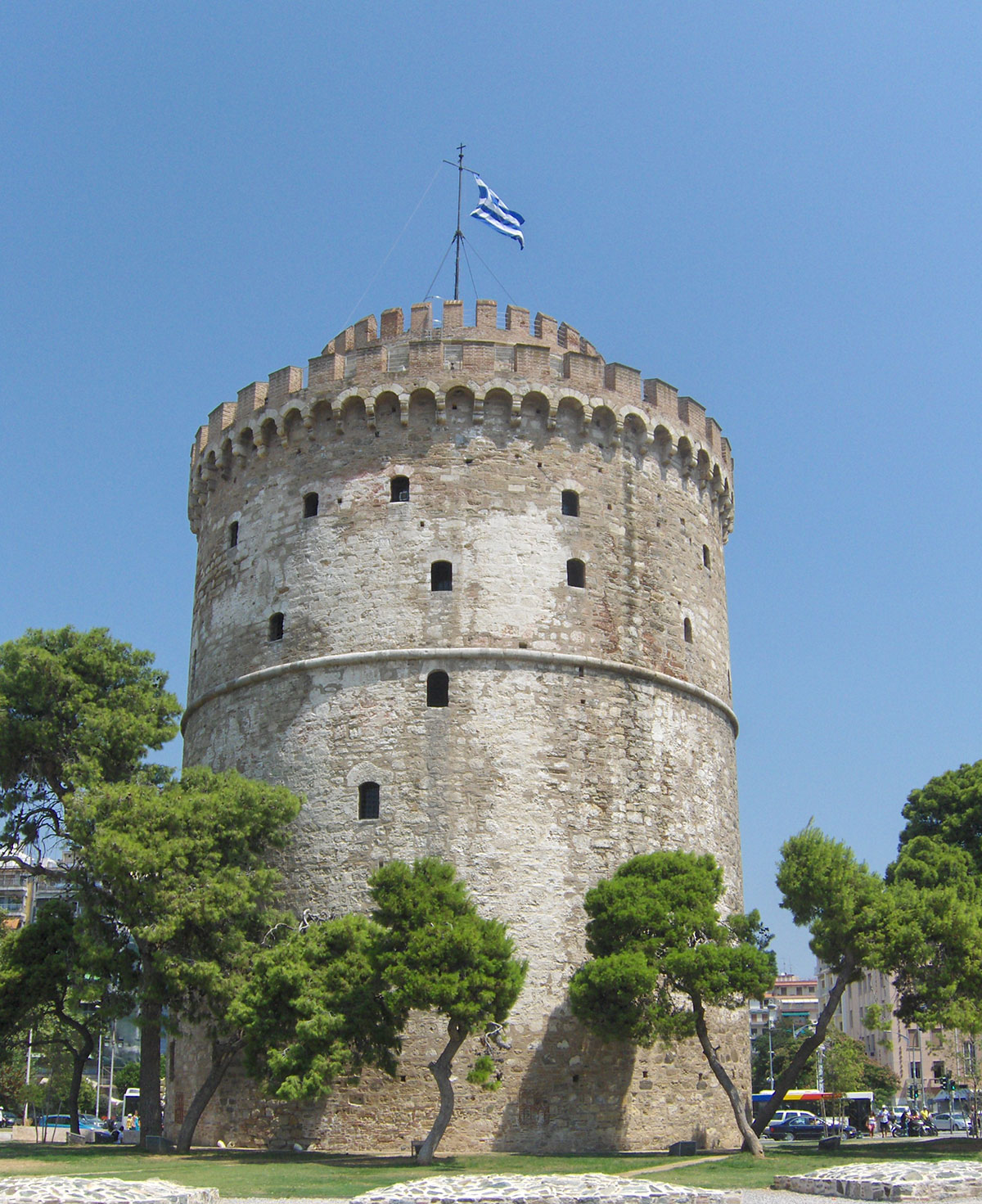
Thessaloniki is a city of turbulent history, claimed by many conquerors: Macedonians, Greeks, Romans, Byzantines, Venetians, and Turks. They all left behind numerous historical buildings and monuments. Tourists rarely stay in Thessaloniki for more than a day; usually, after a tour of the city's sights, everyone rushes to the famous Greek beaches. Since we planned to spend the night in Litohoro at the foot of Mount Olympus, we had enough time for a proper sightseeing tour. We started along the wide waterfront and soon reached the park where the famous White Tower stands—a structure that has become the symbol of the city. Built in the 16th century, it served as a fortress and a prison for many years. Today, it houses the City Museum. From the top of the tower, there is a beautiful view of the seaside promenade and the central part of the city. Nearby stands the bronze statue of the famous Macedonian commander, Alexander the Great.
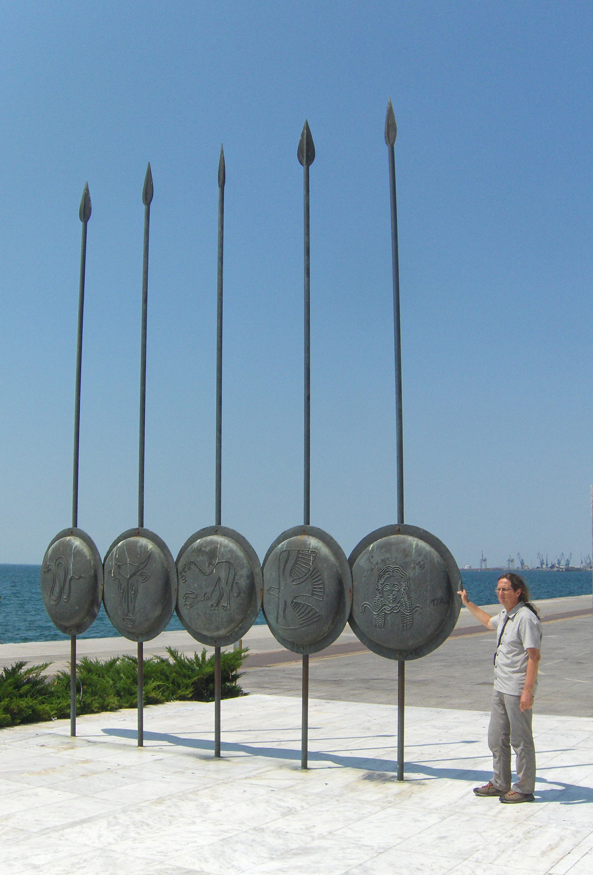
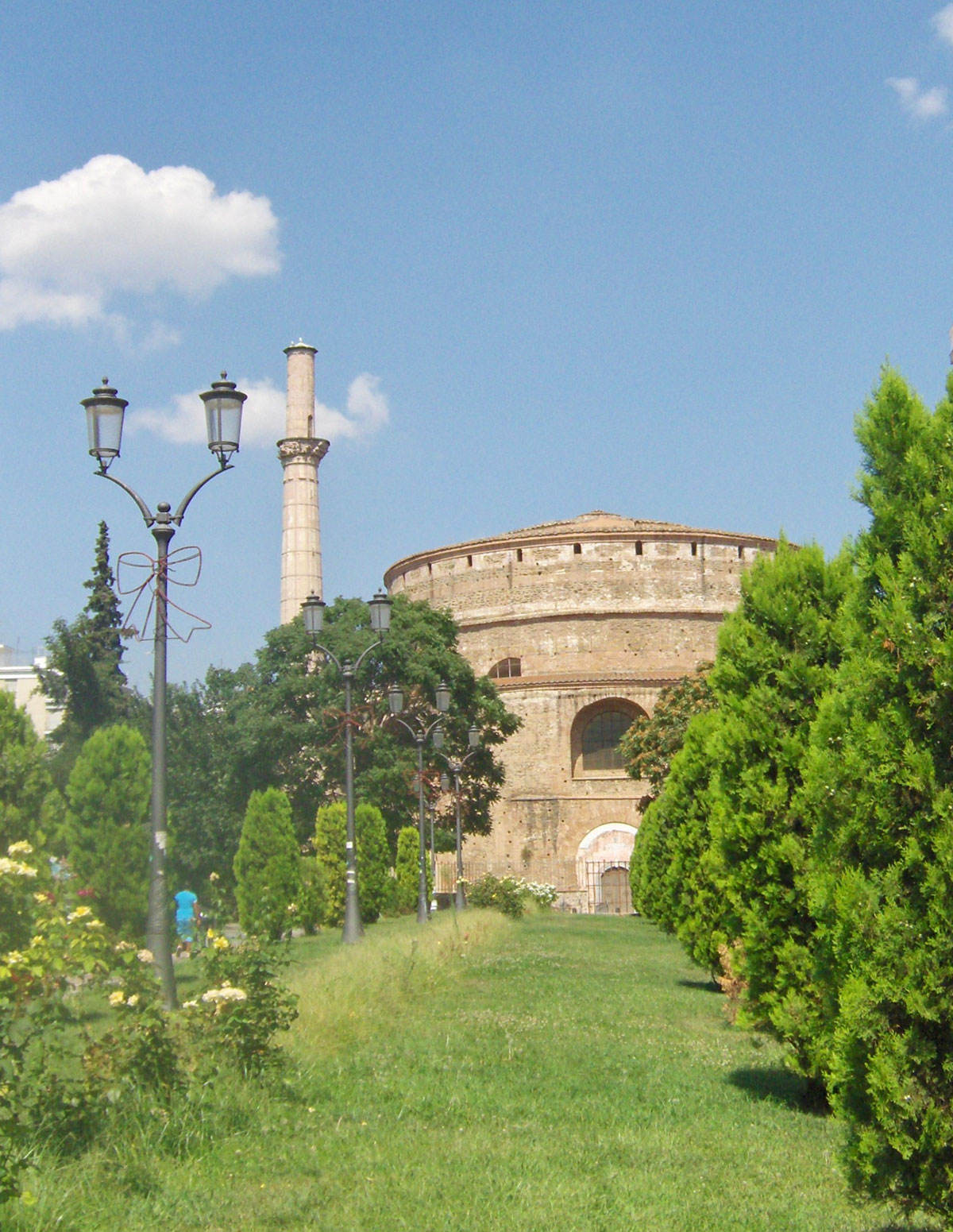
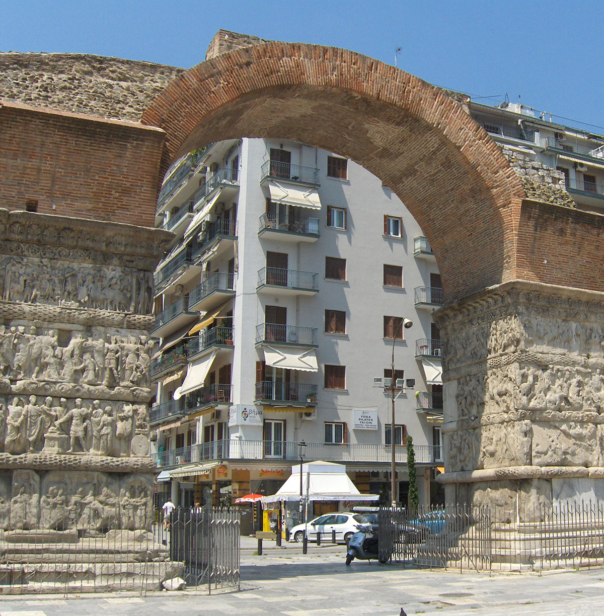
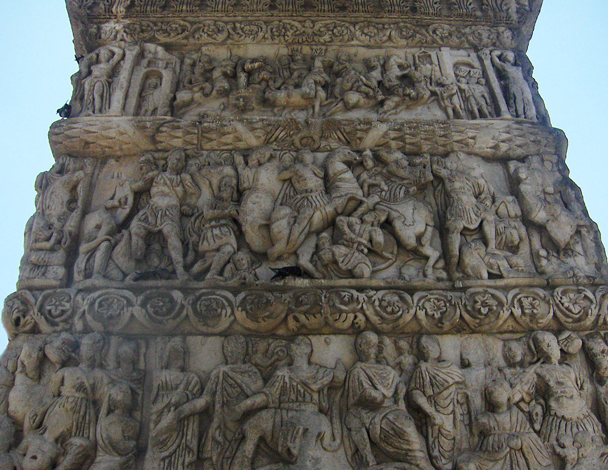
One of the most important historical monuments in Thessaloniki is the Rotunda. This cylindrical structure was built in 306 AD by the Roman Emperor (Tetrarch) Galerius. It is located near the Arch of Galerius built to commemorate his victory over the Persians. Some believe the Rotunda was intended to be Galerius's final resting place; however, he died in 311 AD and was buried in Felix Romuliana. In the 4th century, the Byzantine Emperor Constantine I converted it into the Orthodox church of St. George. In the 14th century, the Ottomans captured Thessaloniki, and in 1590, the Rotunda was turned into a mosque, with a minaret added that has been restored and survives to this day. In 1912, it was returned to its status as an Orthodox church until 1979, when a powerful earthquake caused serious structural damage. Today, the Rotunda is restored and serves as a sculpture museum and exhibition space. During our visit, there was an exhibition of old photographs of Balkan cities from the late 19th and early 20th centuries. Taking center stage were photographs of old bridges from Bosnia and Herzegovina, specifically from Konjic, Višegrad, Mostar, Trebinje, and Žepa.
After sightseeing, we stopped in a garden for an excellent Greek “Mythos” beer. Before leaving Thessaloniki, we headed to the “belly” of the city—the marketplace—where, amidst the indescribable hustle and bustle of merchants and buyers, we stocked up on groceries and fruit.
From Thessaloniki, we traveled along the highway toward Athens and, after a pleasant drive, arrived in Litohoro. Upon arrival, we checked into apartments recommended by the local tourist bureau. It would have been better if they hadn't recommended them; the stay wasn't exactly cheap, and in return, we got a bathroom with no hot water, towels, soap, television, or air conditioning. Hotel and apartment owners in Greece often use an old, tried-and-tested trick where uninformed tourists are charged an extra 5 to 10 euros for everything mentioned above, on top of the previously agreed room price.
The town of Litohoro is located in the northeastern part of the Greek province of Thessaly. It sits at the foot of Mount Olympus at 300 m above sea level. It is about 5 km from the Thessaloniki – Athens highway (24 km from Katerini, 65 km from Larissa, and 92 km from Thessaloniki). In the town's central square, there is a fountain and a church with a bell tower. Surrounding the square are restaurants, taverns, and numerous souvenir shops. Litohoro is a historical town featuring picturesque Macedonian architecture, narrow stone streets, and many small chapels. Nearby, the deep Litohoro Gorge and the Enipeas River Canyon are particularly interesting. From the town, there is a wonderful view of Mount Olympus and the Aegean Sea.
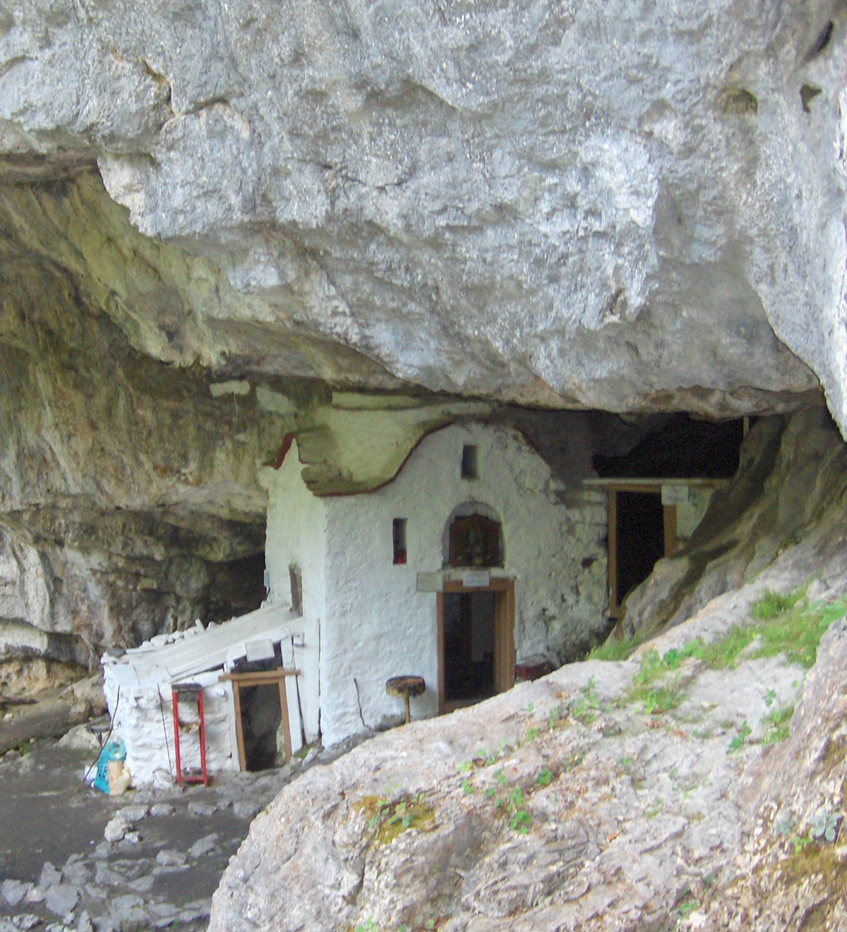
On the morning of August 11th, we set off from Litohoro for Prionia, driving along a wide asphalt road. Before reaching Prionia, we turned off onto a branch road leading to the Monastery of St. Dionysios of Olympus. The monastery is situated in a deep gorge at 850 m above sea level and is surrounded by coniferous forest. It was built in 1542, and the saint himself participated in its founding. After a Divine Revelation, St. Dionysios founded and dedicated the monastery to the Holy Trinity, but among the people, it later remained known exclusively by the name of its founder – Saint Dionysios of Olympus. He was buried in the chapel of the monastery at that time, and the remains of his tomb still exist today.
In 1821, the monastery was burned by the Ottomans, and in 1878, during the Olympus Rebellion, it served as a shelter for women and children from Litohoro. In 1943, German Nazis almost completely destroyed it with explosives because it served as a refuge for Greek resistance fighters. Today, several monks live in the monastery. In addition to their religious services, they find time to treat pilgrims and tourists with refreshing drinks and even watermelon, well-chilled in the stone basin of the monastery’s fountain. One can also buy red wine and herb brandy (rakija travarica) from the monks, packaged in exclusive containers. Aside from traveling by car, one can reach the monastery from Litohoro on foot via a marked hiking trail through the Enipeas River Gorge (a 5-hour walk).
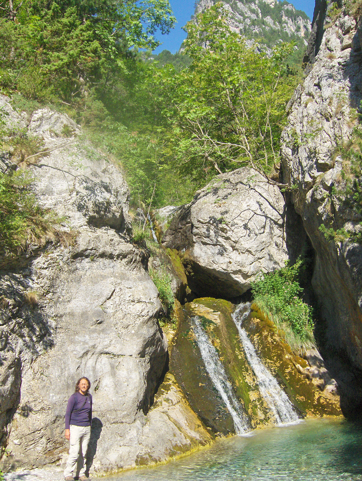
After visiting the monastery, we descended a steep footpath to a small bridge over a fast mountain stream, and then continued along a rugged path above the right bank to a small church located at the entrance of a cave. We reached the church from the monastery in about half an hour. It is believed that St. Dionysios of Olympus spent his ascetic days right here. Inside the cave near the church, there is a spring for which there is a folk belief that it cures all kinds of diseases. The afflicted should first drink water from this spring, then wash their face and hands, or ideally, bathe in this water. We are in no hurry; the summer day is long, and we have enough time to relax a bit and enjoy the shade of the pines and the murmur of the waterfalls of the clear mountain river Enipeas. Late in the afternoon, we leave this wonderful place and head for Prionia.
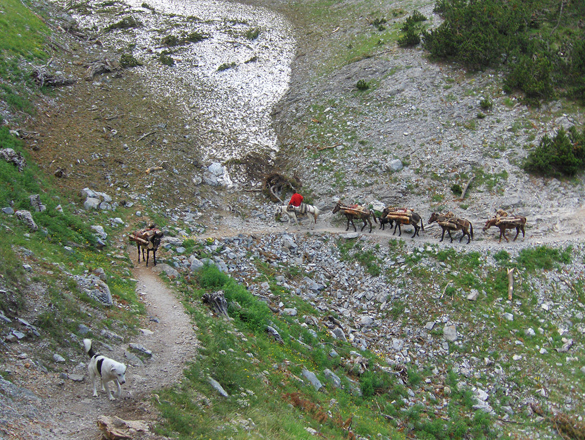
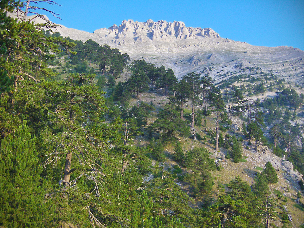
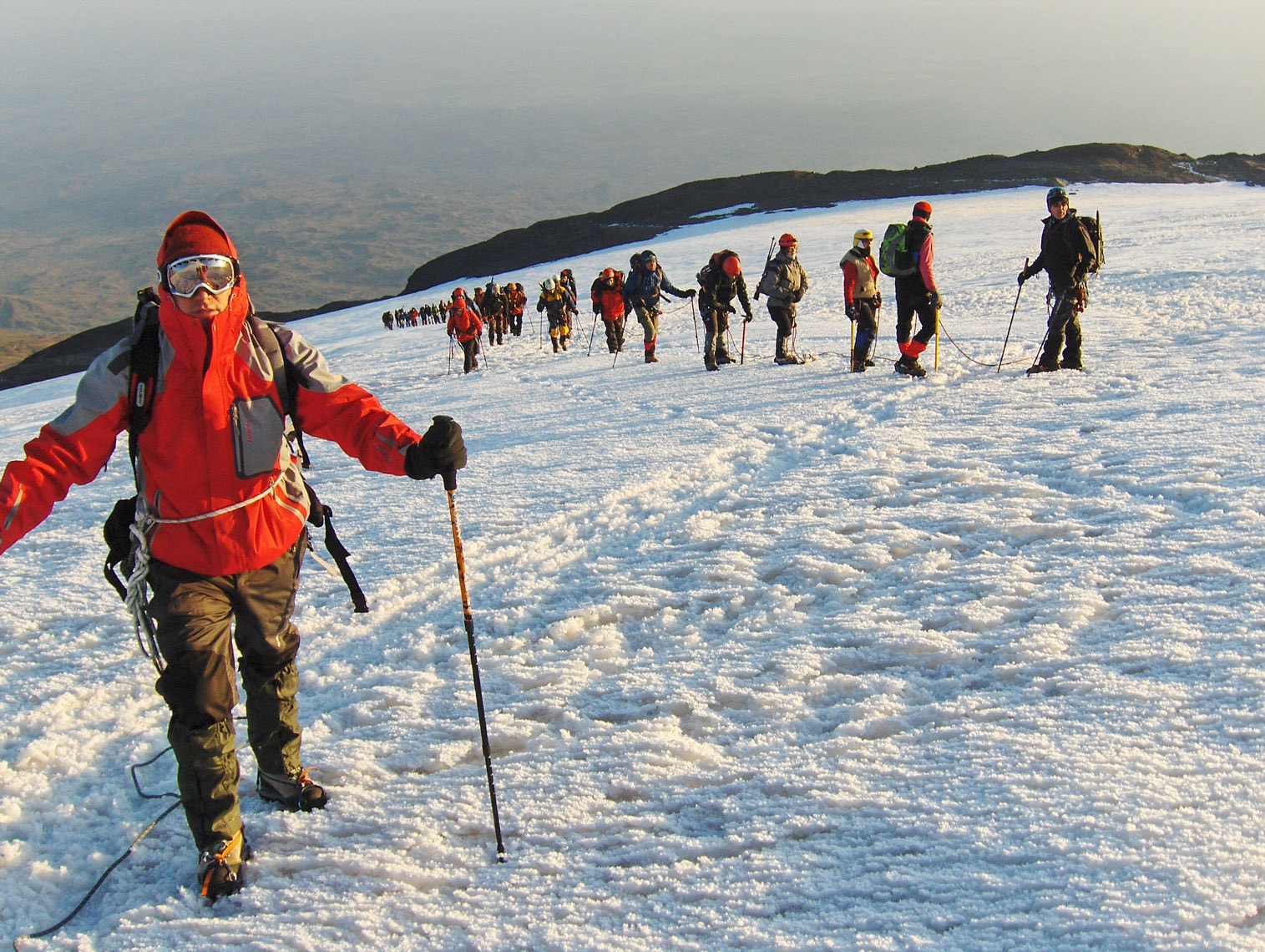
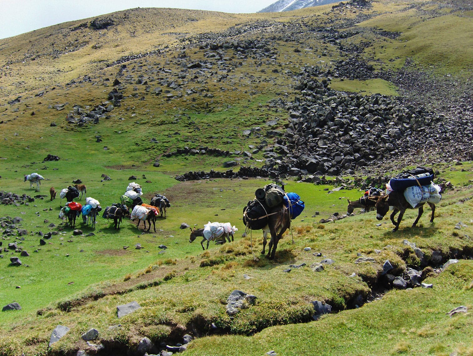
We reached Prionia via a macadam road (about 2 km) and parked in front of the restaurant. Prionia is situated at 1100 m above sea level and is about 18 km away from Litohoro. Prionia is the starting point for the ascent to the mountain hut “Spilios Agapitos“ / Refuge “A“ (2100 m.a.s.l.), which requires about a 3-hour hike. Before setting off, we filled our water bottles at the fountain near the parking area. There are no springs along the trail, so we need to conserve water until we reach the hut. We climbed along a well-trodden footpath where mountain markings are rare, as there are no crossroads on the way to the hut. Once we moved away from Prionia and reached a higher altitude, it was no longer hot. The trail ascends gently through long serpentines under the pleasant shade of a coniferous forest. As it was late afternoon, we frequently passed hikers descending into the valley. After 2 hours of walking, we took a short break at a viewpoint with benches, admiring the large specimens of Bosnian Pine, which is quite common on the slopes of Mount Olympus. We continued without further stops, except to give way to about ten horses heavily laden with firewood for the mountain hut.
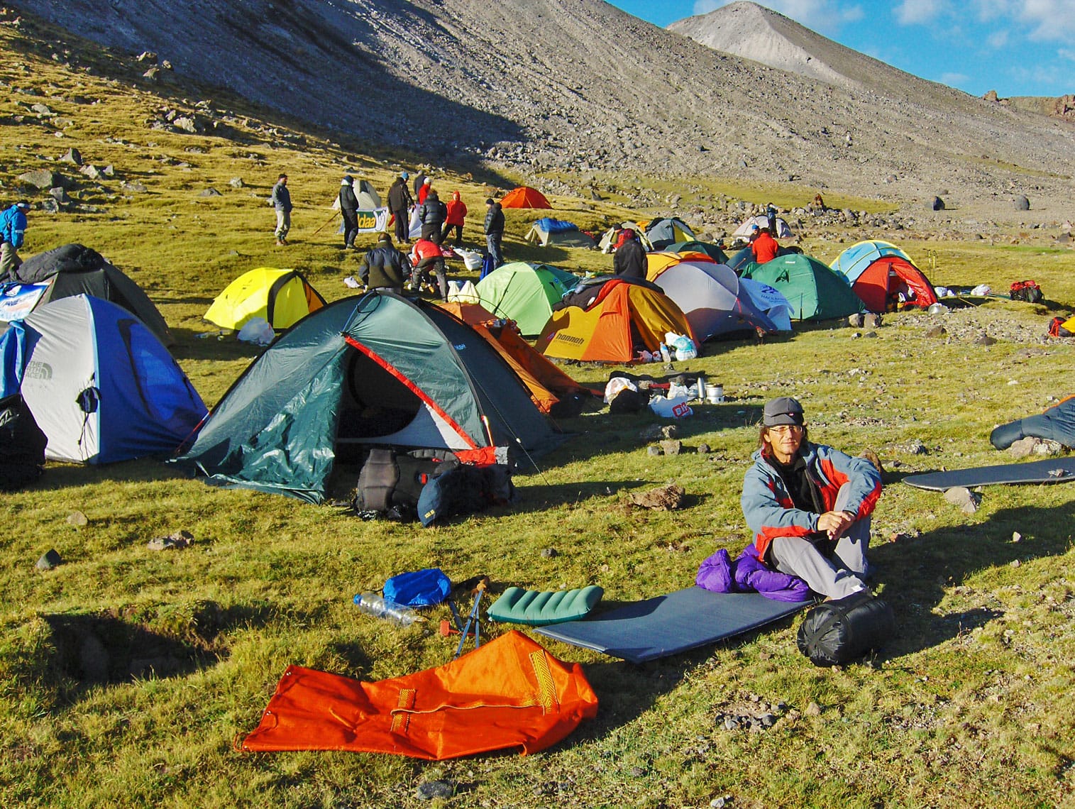
After 3 hours of hiking, we arrived at the mountain hut, where we were warmly welcomed at the reception by the hostess, Marijana Zolota. We completed the check-in formalities since we had booked our stay in advance. As we settled into our room, we realized that we didn't need the sleeping bags we had carried in our backpacks at all; bringing two bed sheets would have been enough. The room we stayed in is located in the attic and can accommodate 30 people. After settling in, we went out to the terrace in front of the hut, which offers a clear view of the town of Litohoro, and in the distance, the endless blue of the Aegean Sea. In the early evening, we took a short walk along the trail above the hut and, after half an hour, reached a viewpoint with a stone bench.
The viewpoint offers a great view of the peaks of Mount Olympus, which the ancient Greeks believed was the home of the twelve gods of the Pantheon. Besides its strong connection to ancient Greek mythology and its natural beauty, Mount Olympus is known for its important ecological characteristics. For this reason, as early as 1938, Mount Olympus was declared the first National Park in Greece. The park covers 23,841 hectares, with a strictly protected zone of 4,000 hectares. A special protection regime is implemented within the park to preserve the flora, fauna, and natural landscape.
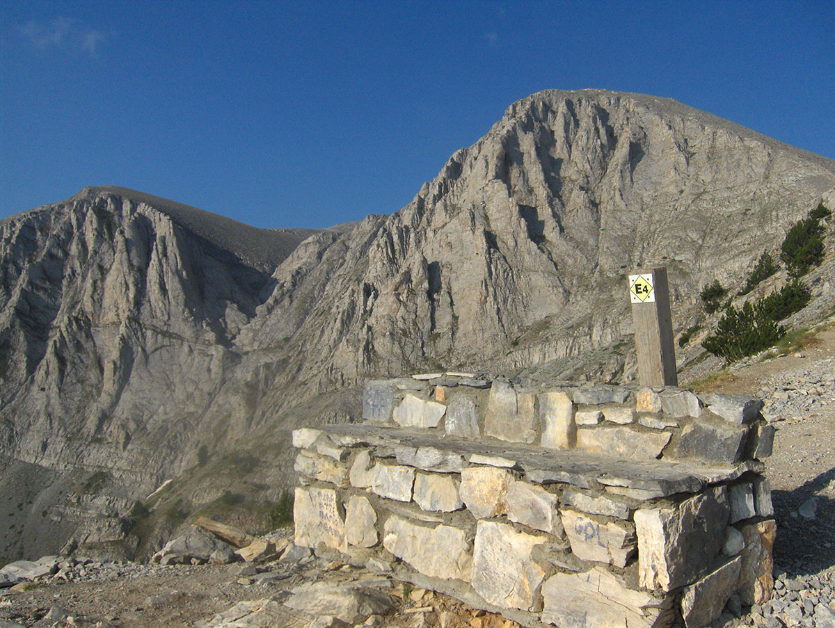
The significance of the “Olympus“ National Park is recognized not only in Greece and Europe but worldwide. In 1981, UNESCO designated it a “Biosphere Reserve,“ and the European Community included it on the list of “The Most Important Bird Areas in the European Community.“ UNESCO added Mount Olympus to the World Heritage list in 1983. Mount Olympus is the highest mountain in Greece, and its highest peak, Mitikas (2918 m.a.s.l.), which means “nose” in Greek, is also the second-highest peak in the Balkans. On Mount Olympus, there are 46 peaks higher than 2000 m above sea level, among which the most prominent are: Skolio (2912 m.a.s.l.), Stefani (2909 m.a.s.l.), and Skala (2882 m.a.s.l.). Due to its proximity to the sea, the climate on Mount Olympus during the summer months is almost Mediterranean, though heavy rain showers, hail, and thunderstorms are possible in the higher regions during the afternoons. From November to May, the mountain is covered in snow, and during this period, Mount Olympus takes on almost Alpine characteristics. There are several mountain huts and shelters on the mountain, and all hiking trails leading to the highest peaks are well-marked.
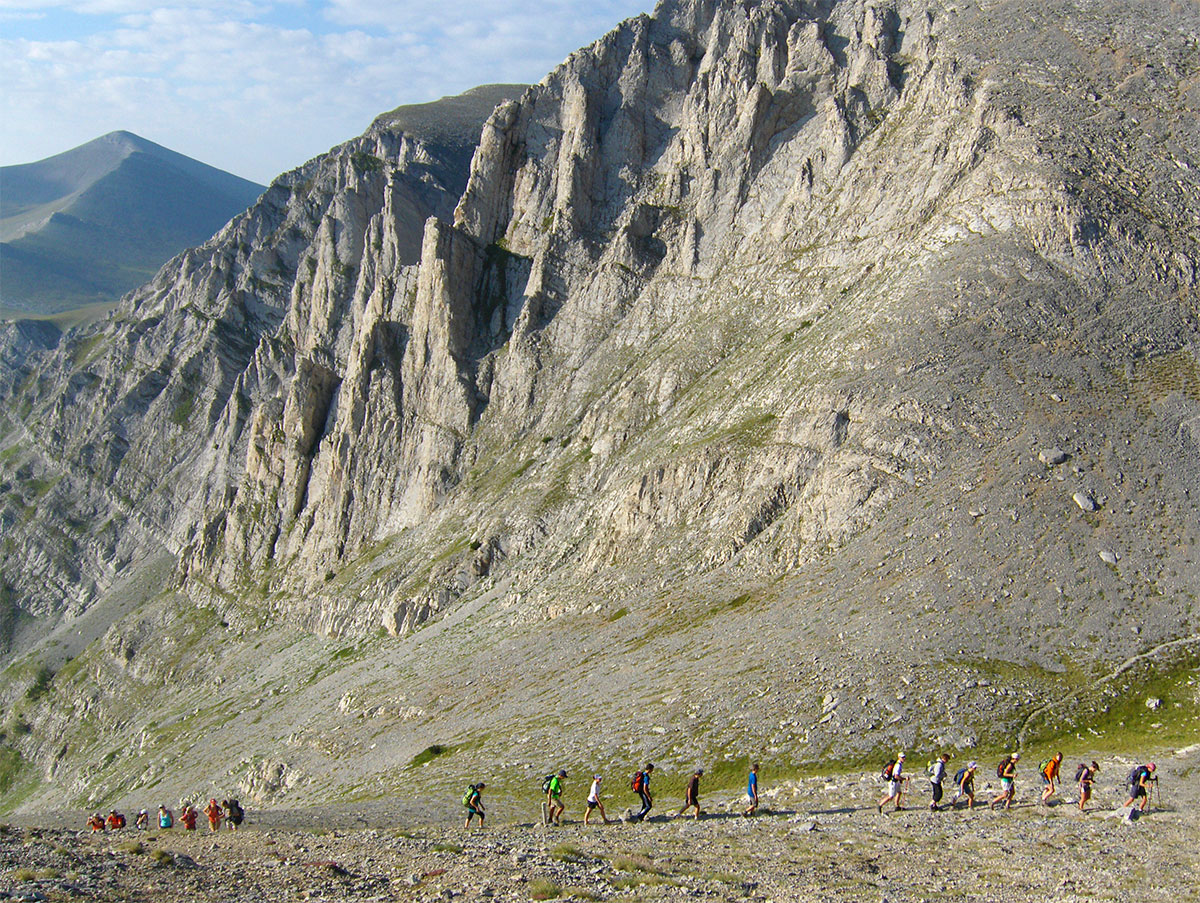
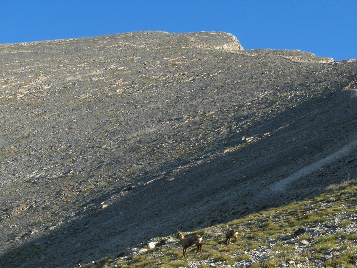
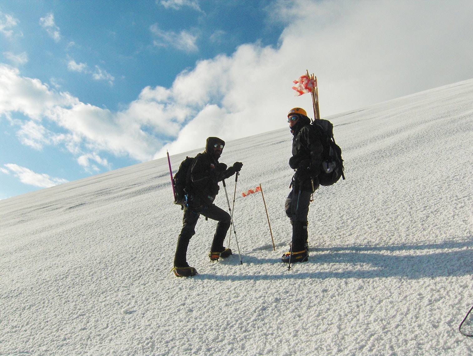
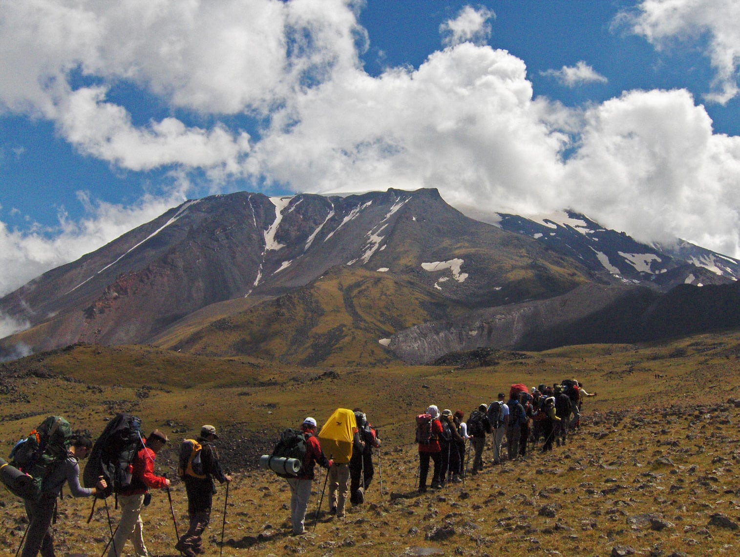
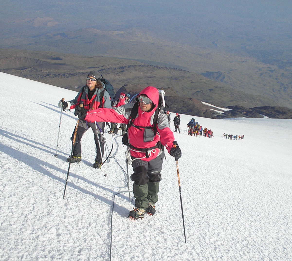
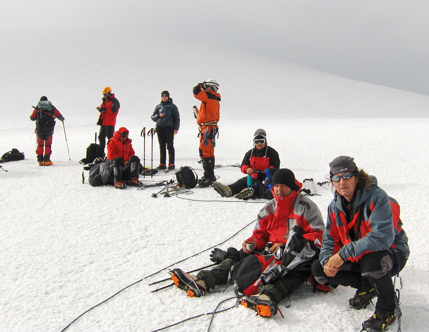
On the morning of August 12th, we set off early for the peaks of Mount Olympus. Our ascent plan is ambitious, as we aim to reach three peaks in a single day: Skala, Mitikas, and Skolio, and then descend back to Prionia. We are in good physical condition and eager to complete the plan in its entirety. On the mountain trail near the “second bench,” we overtook a large group of hikers from France who had started before us at a strong pace. They soon faltered and fell behind. Upon leaving the forest, we were greeted by high-mountain barren land, and for the first time, we could clearly see our approach route to Mitikas. While observing the striking peaks of Mount Olympus in silence, two chamois ran across our path. They surprised us with their appearance, but I still managed to photograph them. Larger wild animals that can be seen on Mount Olympus include wolves, jackals, wild cats, foxes, deer, and chamois. Over a thousand species of birds live in the protected area of “Olympus“ National Park, including rare and endangered species of woodpeckers and the golden eagle. Mount Olympus is also known for its numerous species of butterflies.
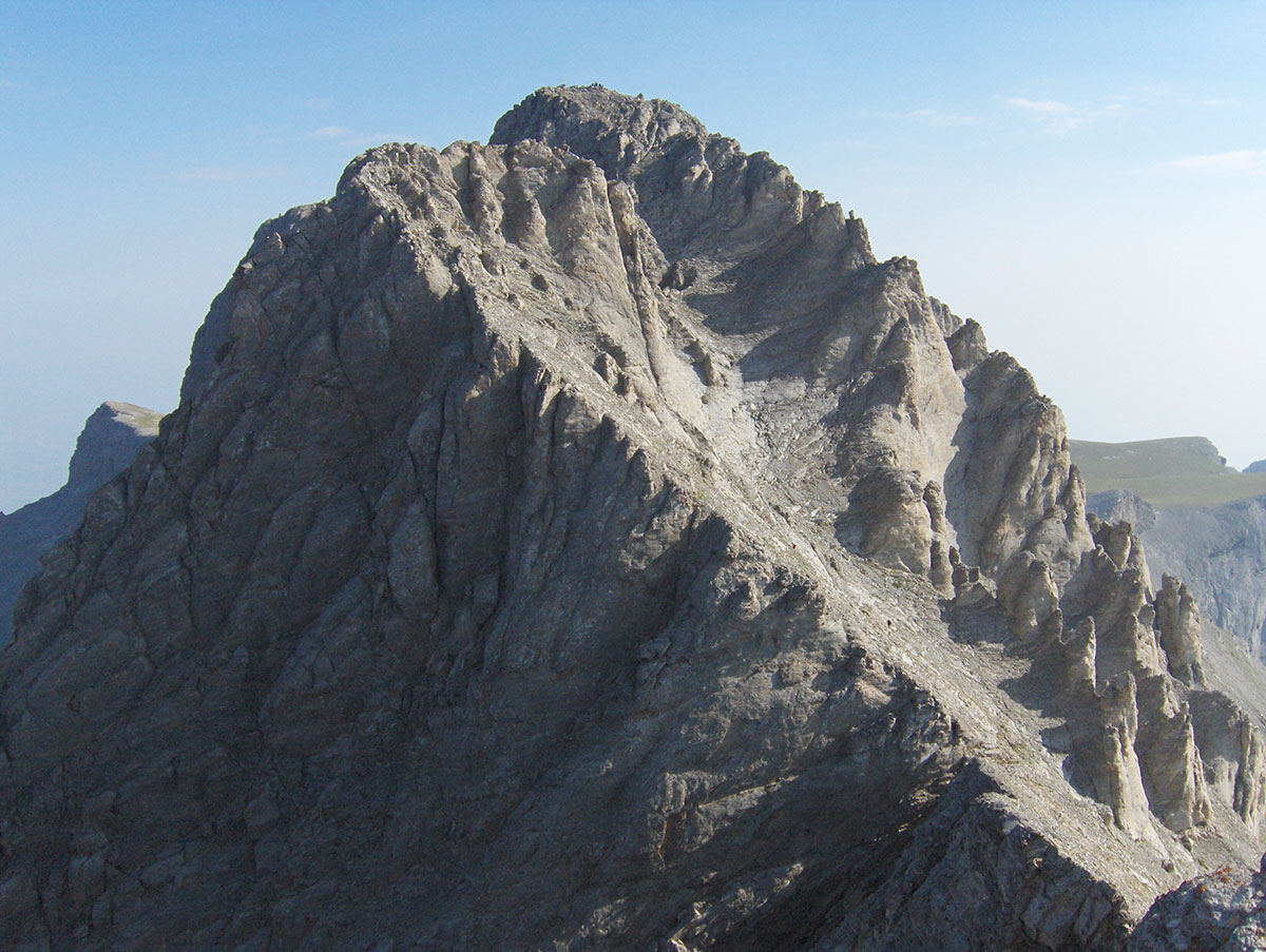
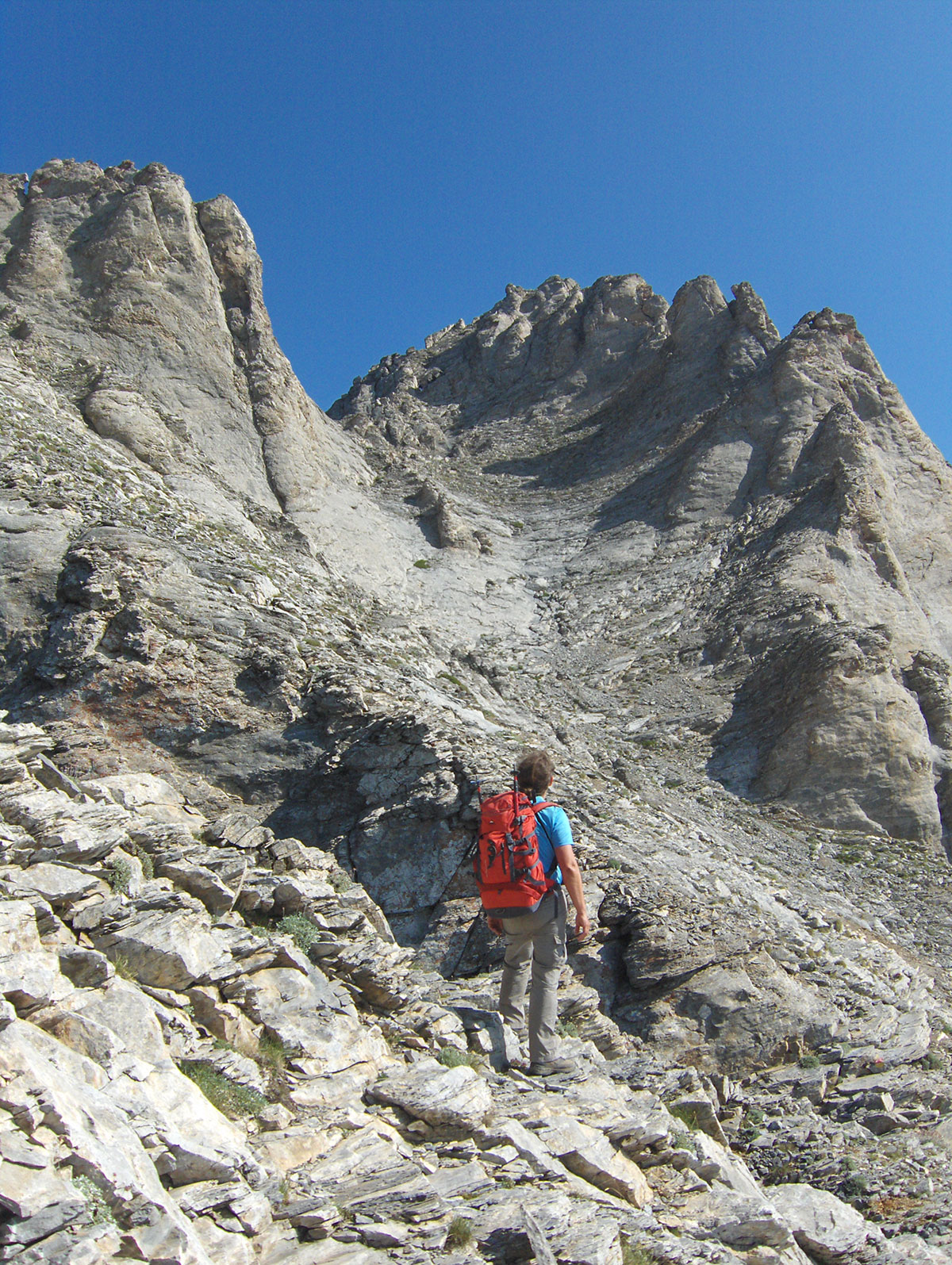
From the mountain hut where we started the ascent, we reached the peak of Skala in about 2 hours of walking. We took a short break at the top for sightseeing and photography. After a rest and some fruit for refreshment, we continued towards Mitikas. From Skala (2882 m.a.s.l.), one must descend about a hundred meters and then continue traversing the ridge toward Mitikas. Maximum concentration is required during the descent, as in the event of a slip, a fall from the steep ridge leads directly into the abyss. We were surprised that no safety equipment, such as cables or iron rungs, has been installed here, which would be helpful for many to ensure safety when tackling the ridge, especially if the rock is wet from rain or ice. After traversing the ridge, the ascent followed over smooth, protruding ledges in a steep rocky couloir. Upon exiting the couloir, another demanding climb awaited us over a very exposed rock where a safety cable with rungs has been installed. We overcame this final obstacle on the ascent and finally stepped onto the peak of Mitikas. From Skala to Mitikas, it took us about 1 hour of walking.
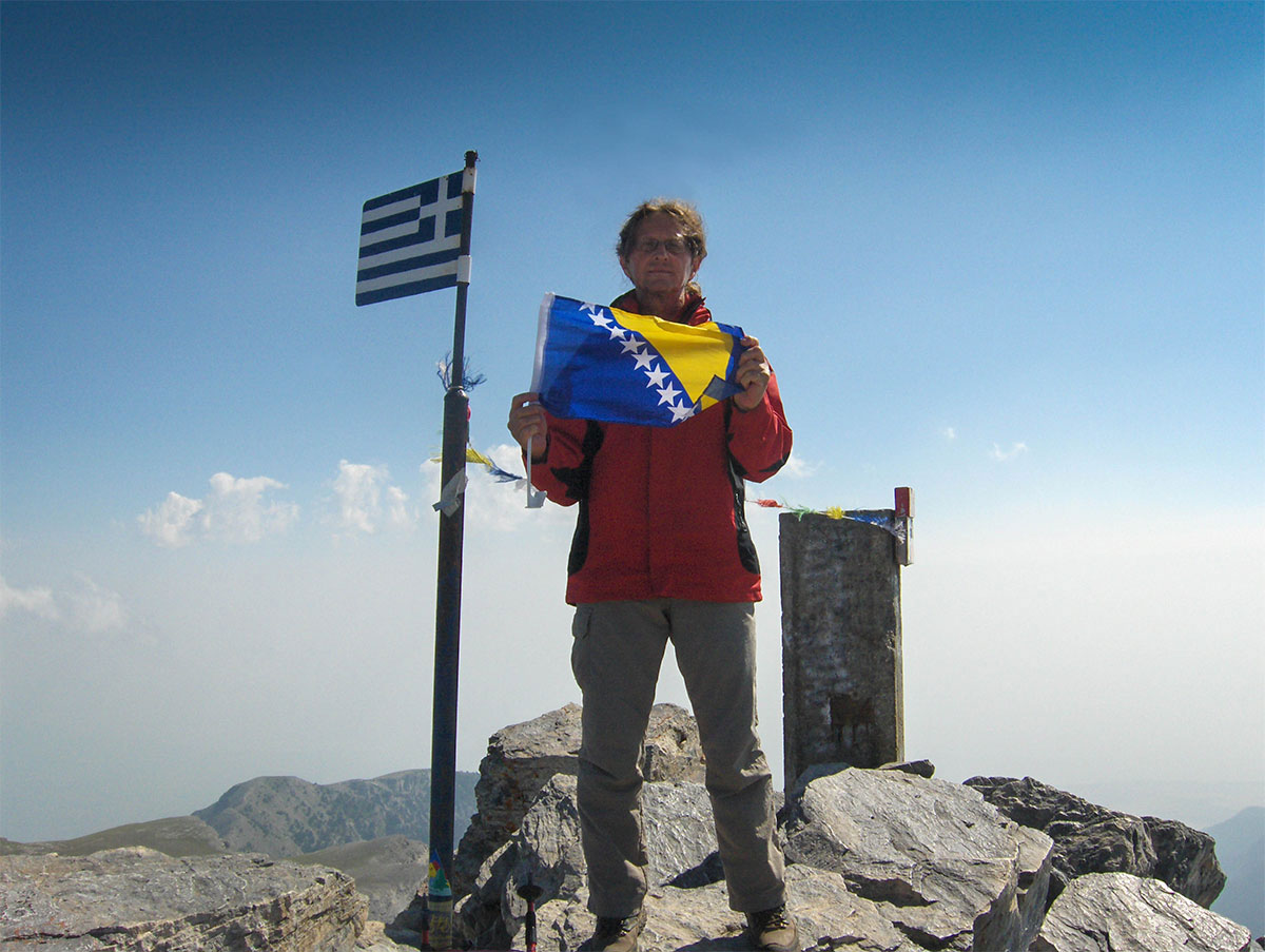
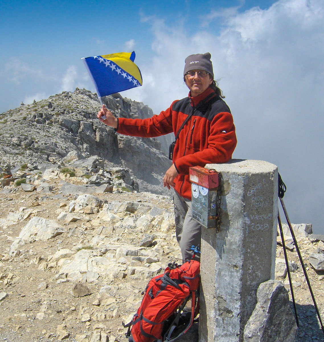
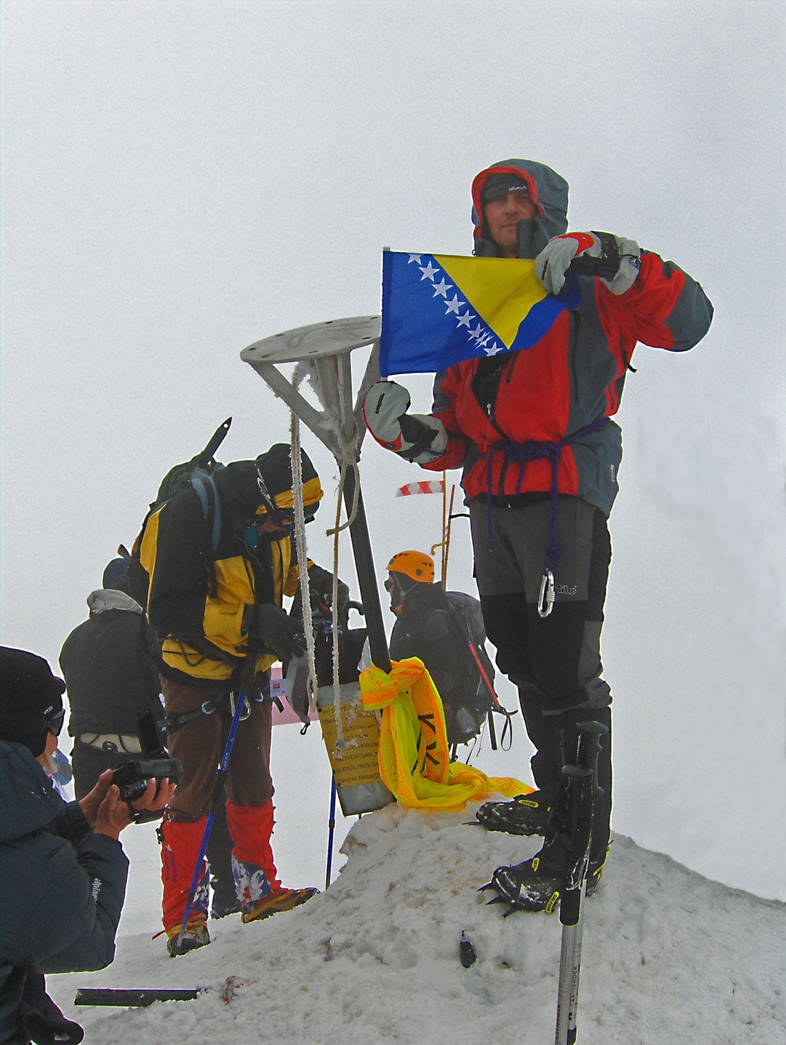
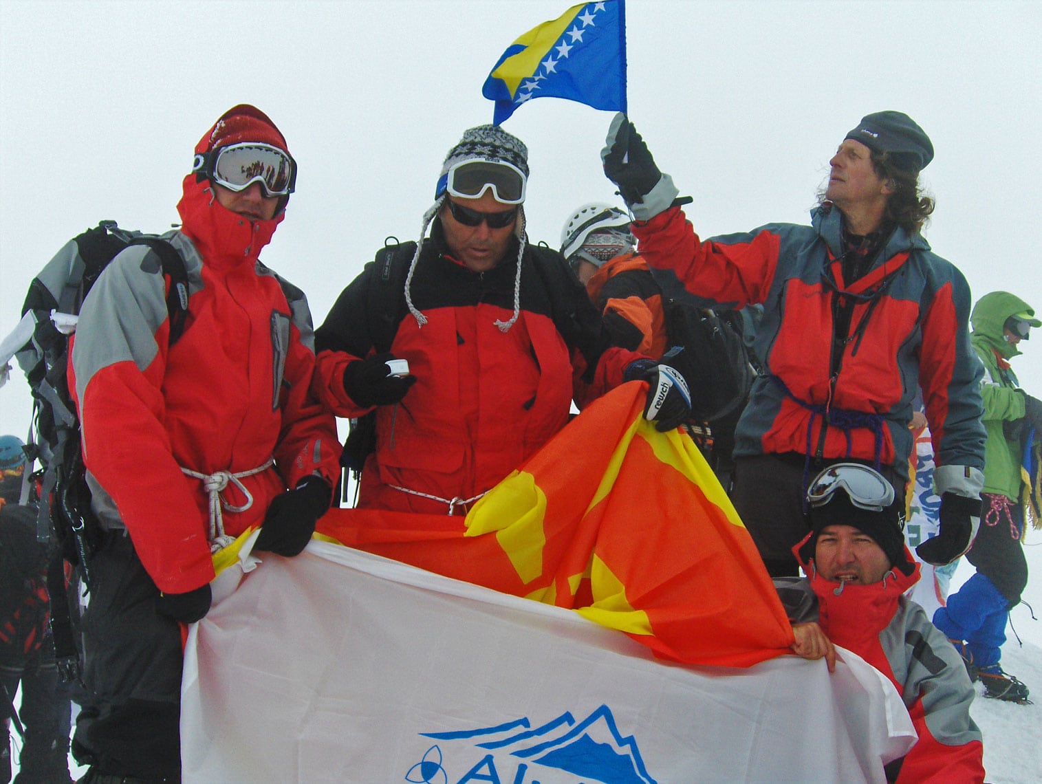
At the highest point of the peak stands a concrete triangulation pillar with a registry box and an iron mast with the flag of Greece. The peak offers a grand view of many other peaks of Mount Olympus, and on the horizon towards Litohoro, the Aegean Sea is visible. This was an unusual sight, especially for us mountaineers who live in the continental part of Europe. Aside from us, there were no other hikers at the summit, so we stayed for a long time to enjoy the silence and the surroundings. After taking photos and signing the visitor's book, we left the peak and cautiously descended through the rocky couloir over the protruding smooth ledges.
After exiting the couloir, we traversed the ridge back to Skala, which we had already tackled on the way up to Mitikas. From Skala, we continued along the ridge to the peak of Skolio (2912 m.a.s.l.), reaching it in less than 1 hour of walking. The weather served us well; it was sunny and a bit chilly, but without wind. In the afternoon, on the northern side of Mount Olympus, fog rose from the valley but failed to cross the summit ridge. Satisfied with the day's climbs, we left the peaks of Mount Olympus and arrived back at the mountain hut “Spilios Agapitos“ in about 2 hours. After a short break for rest and refreshment, we continued the descent to Prionia, arriving at 18:00 h. On the way back, we stopped at the resort of Paralia for a swim in the sea. That same evening, we left Greece and spent the night in Gevgelija.
The following day, we continued our journey through Macedonia and Serbia. We arrived in Sarajevo at 19:00 h. We spent a total of 8 days on the road, covered 2270 km by car, and reached 6 peaks, 4 of which are the highest on the Balkan Peninsula.
The adventures of tobacco smugglers are woven into the very fabric of our mountain legends. This story serves as a tribute to those men and the uncertainties they faced in the wild. Driven by a desire to keep this heritage alive and save it from oblivion, I retraced the paths they traveled most often.
Weighed down by heavy backpacks, these smugglers set out across the mountains with deep trepidation, never knowing if they would reach their destination with their cargo. It was a perilous adventure where lives were easily lost, and their names frequently appeared in the “dark chronicles” of the newspapers.
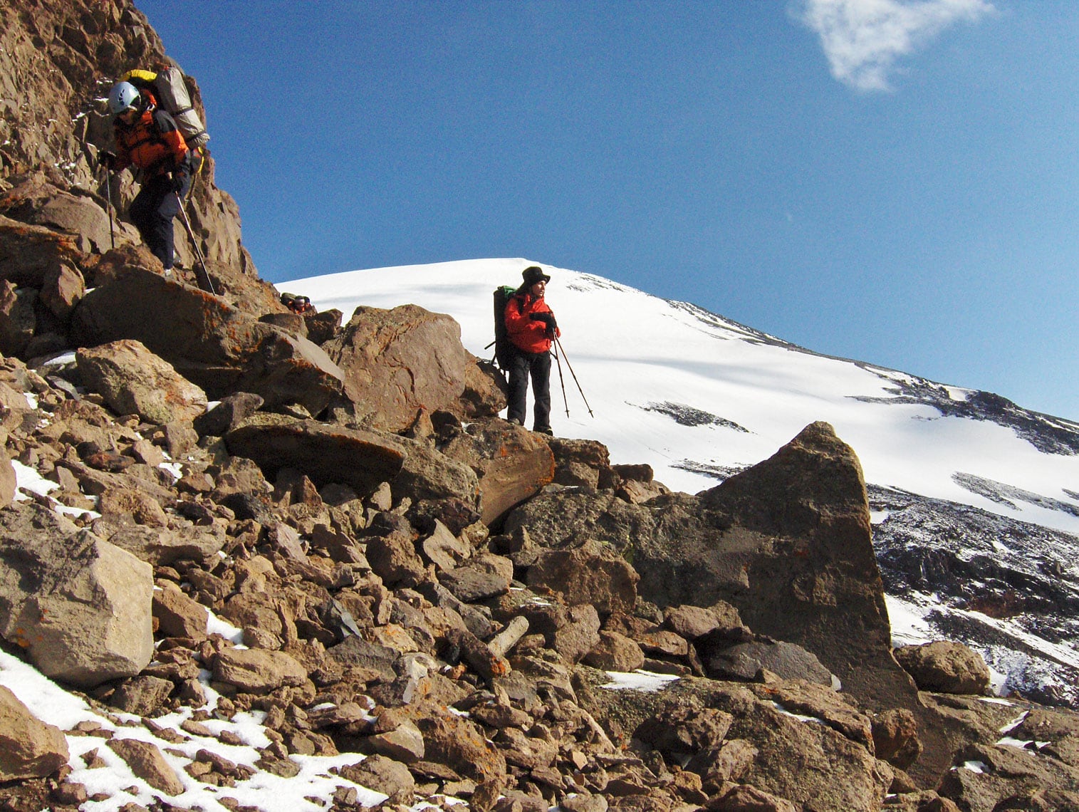
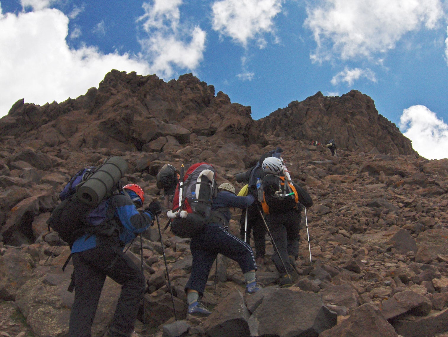
The ultimate challenge was transporting the tobacco to Sarajevo. Not only was it a long journey, but it required crossing several formidable mountain massifs: Prenj, Visočica, Treskavica, and Bjelašnica.
Text and photography by: Braco Babić
The Monopoly and the Secret of “Škija”
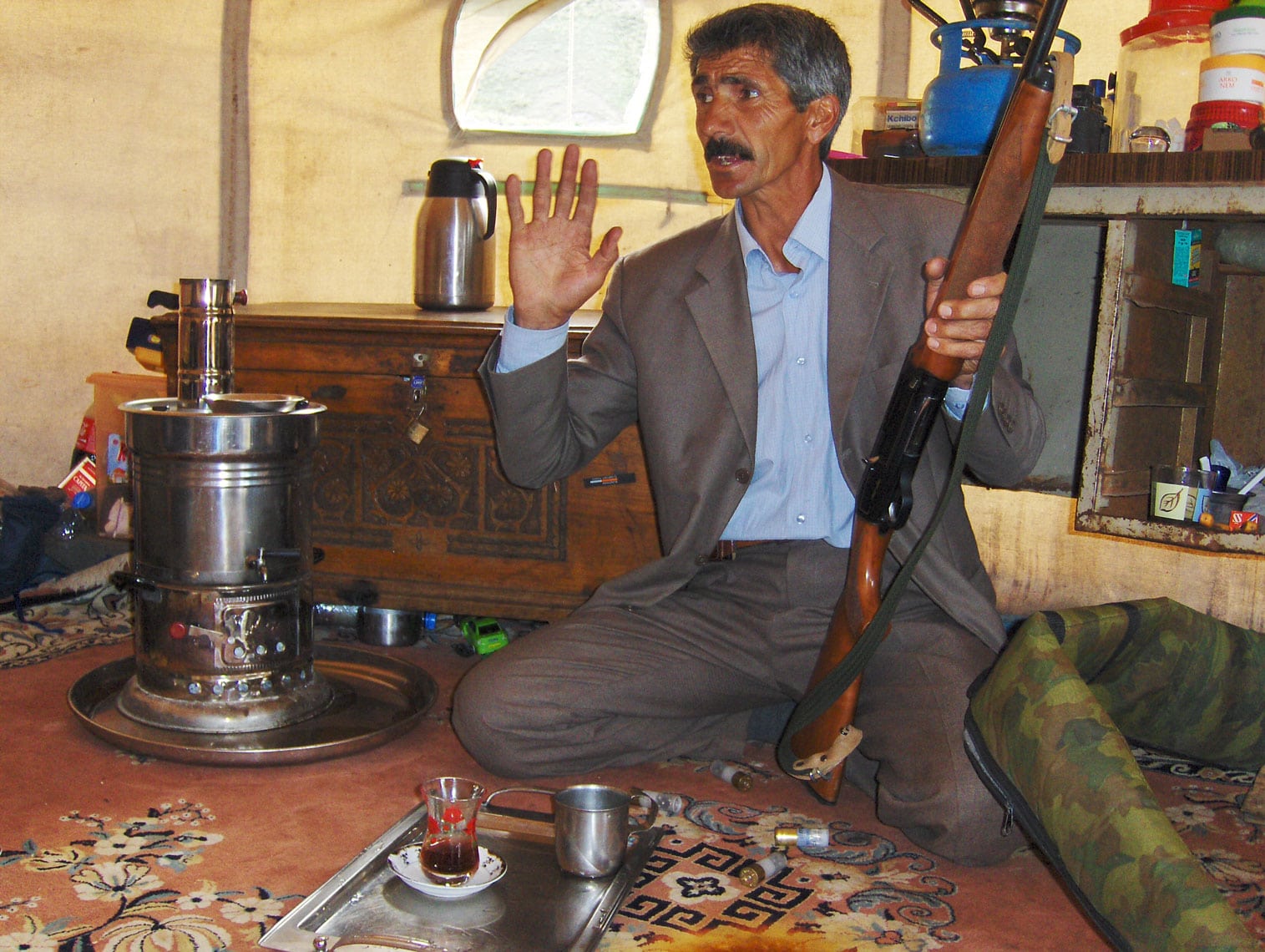
After the occupation of Bosnia and Herzegovina, the Austro-Hungarian authorities proclaimed a Monopoly Law, placing the entire production, processing, and sale of tobacco under strict state control. Farmers could only grow tobacco for personal use; any sale required a tax known as “mururija”. Faced with extreme poverty, local peasants were forced to find ways to survive, leading them into the world of tobacco smuggling. In those days, tobacco could not be spoken of by its name; among the people, it was known by the secret code: “škija”.
It was a lucrative but incredibly dangerous business that demanded great resourcefulness and the skill to outsmart the gendarmes (local police). It required hard labor from the entire family—from children to the elderly. The avan (a traditional tobacco mortar) and the cutting machines were kept in absolute secrecy, hidden in cellars or deep caves.
The gendarmes had their own methods of tracking. The blade of the avan had to be sharpened and forged periodically by local blacksmiths. These blacksmiths, often in trouble with the law themselves, would frequently strike deals with the gendarmes—as soon as they sharpened a blade for a smuggler, they would report it to secure their own leniency.
The Trail of “Yellow Gold”
To avoid the ambushes set by the authorities, smugglers chose nearly impassable trails high in the mountains, carrying immense loads on their backs. The routes from Western Herzegovina led to Dalmatia, Zagora, Krajina, Posavina, and wider Bosnia—mostly to major cities like Split, Dubrovnik, Banja Luka, and Sarajevo, where the demand for “yellow gold” (as passionate smokers fondly called škija) was high.
Loaded with heavy backpacks, they crossed the mountains with deep trepidation. It was a perilous journey where lives were easily lost, and stories of captured smugglers filled the “dark chronicles” of the newspapers. To reach the coast, they navigated goat paths over the rugged Biokovo massif.
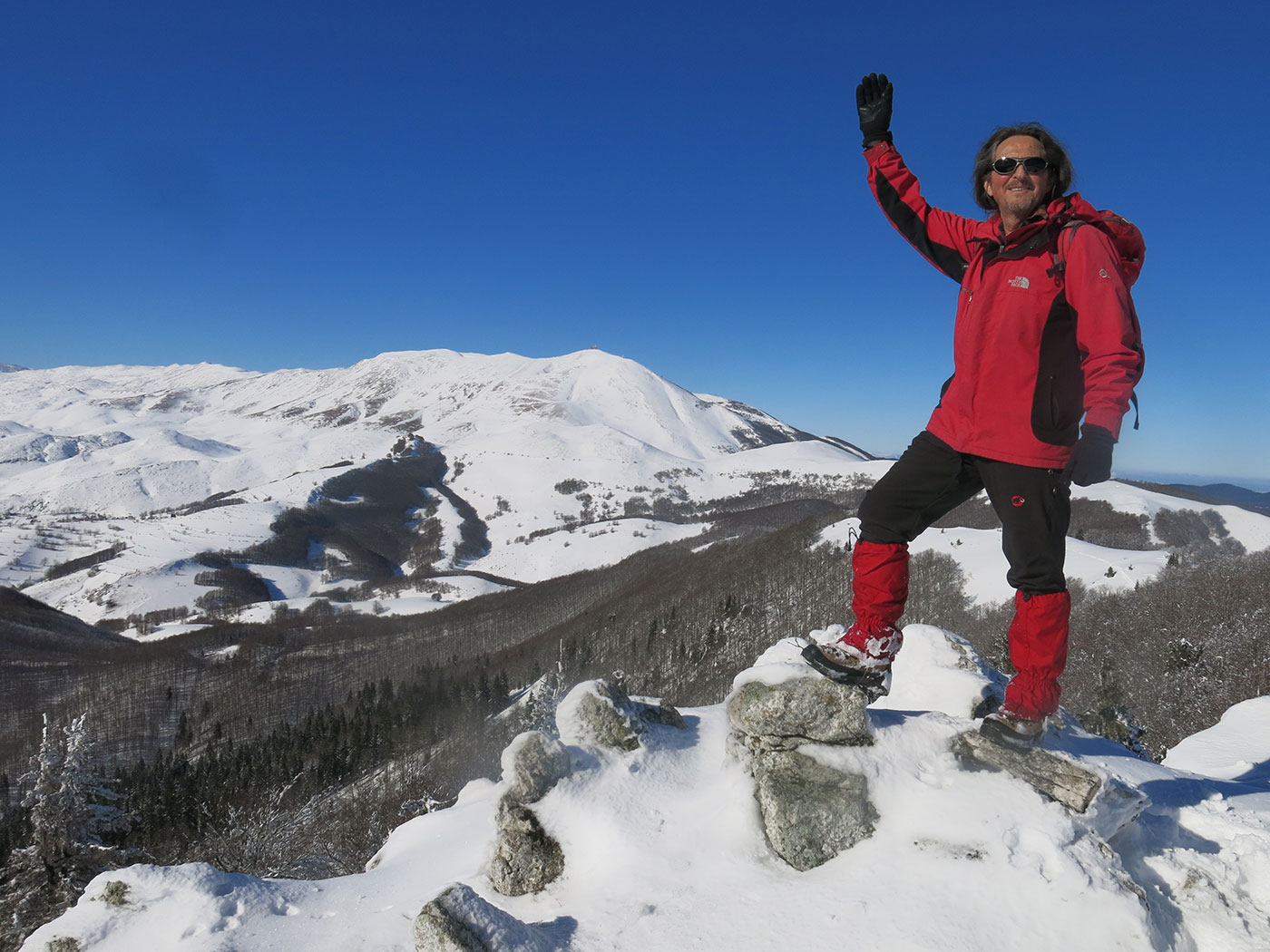
However, the hardest journey was to Sarajevo. Besides the great distance, it required crossing the formidable peaks of Prenj, Visočica, Treskavica, and Bjelašnica. These are high-altitude mountains where the weather shifts violently due to the collision of Mediterranean, Continental, and Alpine climates. In the summer, you can experience all four seasons in a single day!
Mount Prenj: View from Solila (1741 m a.s.l.). Peaks from left to right: Velika Motika (1832 m a.s.l.) and Velika Kapa (2004 m a.s.l.).
Survival of the Fittest: Avoiding Ambushes and Wild Beasts
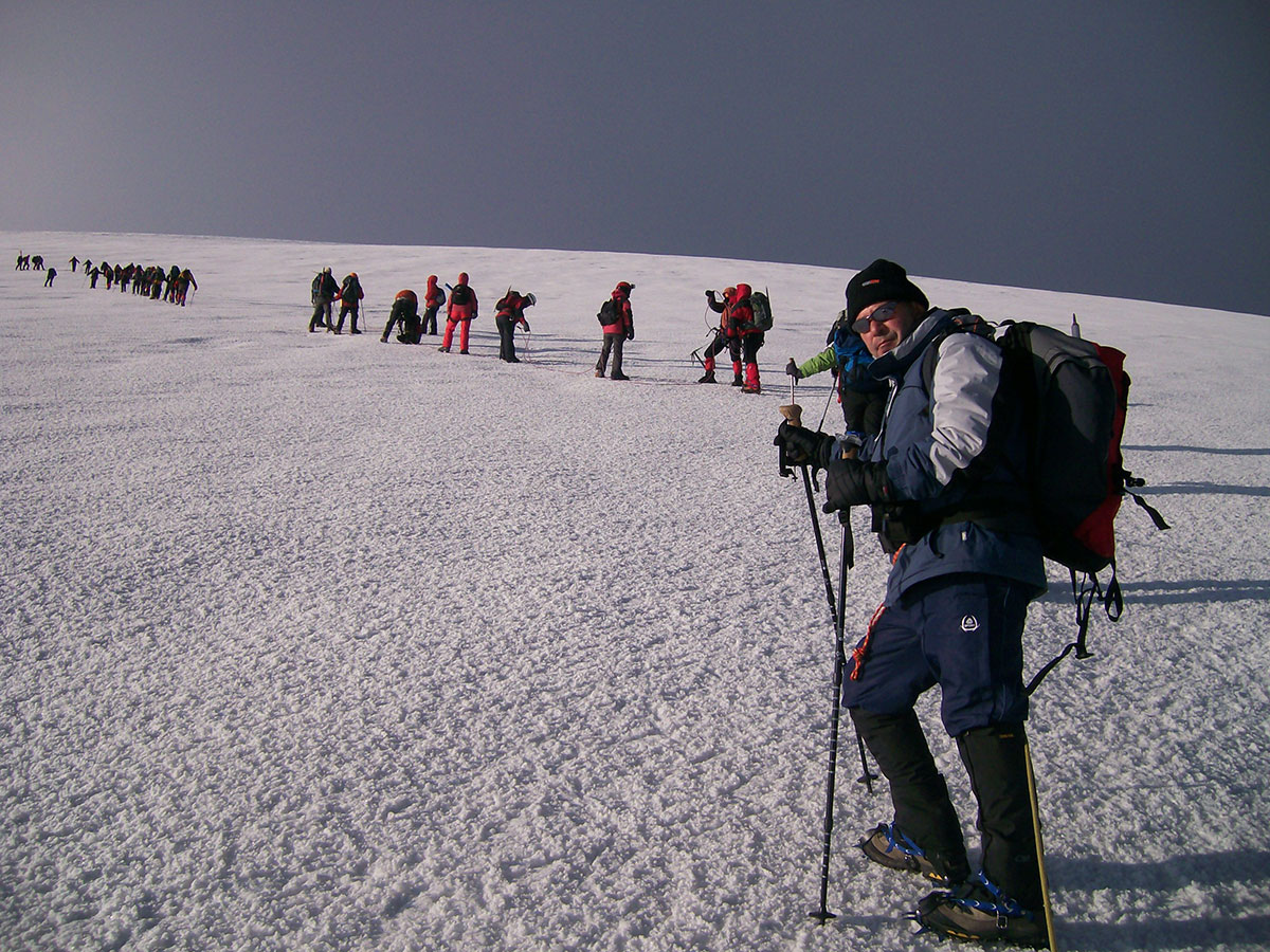
The rugged terrain and harsh weather were not the only obstacles; constant danger lurked in the form of gendarme ambushes and attacks by wild animals. To ensure their time in the mountains didn't last longer than planned, smugglers solved all problems “on the go,” without pauses or delays. Crossing these massifs took several days of grueling, non-stop hiking.
Tobacco smuggling continued year-round, regardless of the season or the ferocity of the mountain storms. During the Austro-Hungarian Empire and the Kingdom of Yugoslavia, ambushes were set by the Gendarmes, while in Socialist Yugoslavia (SFRJ), it was the People’s Militia. If they were caught in an ambush, smugglers often resorted to firearms to save their lives and protect their precious cargo.
To stay safe, they constantly changed their routes to cover their tracks. Their path was a sacred secret; not even their closest family members knew which trail they would take.
Mastering the Terrain
Smugglers often set out during the worst weather, hoping the fog and storms would deter the authorities from setting ambushes. Sadly, this meant many lost their way in the mist, froze to death, or perished in snow avalanches.
To conquer the unforgiving terrain while carrying massive loads, these men had to be exceptionally strong, enduring, and expert navigators. They knew these mountains like the back of their hands—every spring, cave, and shepherd’s hut. However, they often avoided these spots because they knew that was exactly where the authorities would be waiting.
Sometimes, they would hire locals from the mountain foothills as guides or extra carriers for a high fee. Over time, some of these locals became independent and started smuggling for their own profit.
The Secret Streets of Sarajevo
After overcoming the mountain hardships, the smugglers would finally arrive in Sarajevo, heading to a specific, narrow street below the Kovači neighborhood. It was common knowledge in the city that “under the table” tobacco was sold here. Frequent raids were conducted, but the seized loot was often insignificant. The smugglers clearly had precise intelligence on when the law would arrive.
They employed their own lookouts who watched every entrance to the street. At the slightest hint of trouble, the smugglers would vanish into side alleys, waiting for the patrol to pass before returning to business as if nothing had happened. They only kept two or three “shirts” of tobacco on them at a time; the rest was hidden in the homes of trusted associates nearby.
The “Shirt” as a Measure of Trade
In this secret market, the customer was the one to approach first, quietly asking: “How much for a shirt?” “Škija” (tobacco) was packed and sold in boxes originally meant for men's dress shirts, which became the standard retail measure of the time. For larger, pre-arranged orders, the smugglers would deliver directly to the buyer's address. Usually, the entire load was sold within two or three days. After that, they would take a train or bus back to Mostar, take a short rest, and then begin the perilous adventure all over again.
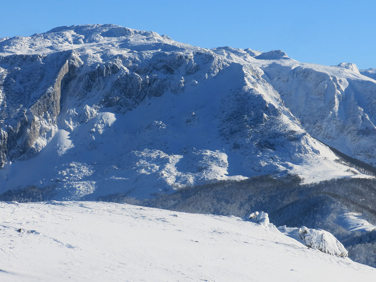
Mount Visočica:Mandin Do (1550 m a.s.l.) and the Puzim peak (1776 m a.s.l.).
A Face-to-Face Encounter: A Mountaineer’s Tale
Tobacco smugglers chose their paths with such skill that hikers rarely crossed their tracks. However, a veteran mountaineer from Sarajevo, Vinko Tomičić, shared with me a chilling story of a face-to-face encounter from the mid-1950s.
“It was the mid-1950s. The summer heat in Sarajevo was so suffocating that my friend Đuro Gϋrt and I decided to seek refuge in the high peaks of Prenj.I remember reaching Rujište under a scorching sun, our backpacks heavy. Two black Mercedes sedans were parked outside the mountain hut—a rare sight in those days. We soon learned that Džemal Bijedić, a high-ranking official, was there. He loved the mountains; it was the only place where he could truly escape politics and just be a mountaineer among mountaineers.
After a night at Rujište, we pushed on toward Jezerce. We were joined by Professor Stevo Jokanović and a young couple on their honeymoon. That night is etched into my memory forever.
We were sleeping in the attic of the hut. In the dead of night, the creak of the front door downstairs snapped us awake. Peering through the narrow gaps in the floorboards, all we could see were the glowing tips of several cigarettes. In the pitch black, faces were invisible. They spoke in hushed, urgent whispers—a dialect we couldn't quite catch. Back then, the mountains were still hiding remnants of rogue units from the war. We weren't just curious; we were terrified for our lives.
Professor Stevo, the eldest and wisest of us, whispered a plan: ‘Đuro, Vinko… go down there. Invite them up for coffee and brandy.’
My heart was pounding against my ribs as we descended into that dark room. We delivered the invitation. Immediately, one of them—their leader—stood up and followed us back to the attic. He didn't use his hands to open the door; he pushed it open with the barrel of his automatic rifle.
As the candlelight hit him, I saw a giant of a man. Broad-shouldered, with a thick mustache and skin bronzed almost black by the mountain sun. He sat next to Stevo, and they talked quietly while sharing a flask. Before leaving, he shook Stevo’s hand and left a small package of ‘škija’ on the table.
Then, he turned to the rest of us. He looked us dead in the eye and, without even taking the cigarette out of his mouth, spoke through clenched teeth:
‘Eto ljudi, dogovorili smo se. Niste nas vidjeli—nismo vas vidjeli.’ (So, we have a deal. You didn't see us—we didn't see you.)
None of us dared to move for the rest of the night. We didn't even dare to go to the restroom. When the sun finally rose, they were gone like ghosts. Stevo looked at us and gave us one final command: ‘Those were tobacco smugglers. You are never to speak a word of this to anyone. Not even to your families.’
And for a long time, we didn't. But the mountains never forget.”
Mount Bjelašnica: Peaks from left to right: Obalj (1896 m a.s.l.), Kobilica (1826 m a.s.l.), Veliki Vrh (1726 m a.s.l.), and Krvavac (2062 m a.s.l.).
A Memory from Bjelašnica: When Stories Get Too Real
While preparing this article, a memory from my own journey came back to me—a moment that shows just how deeply these legends are rooted in our mountain culture.
It was the early 1980s. A thick, soupy fog had swallowed Mount Bjelašnica as we arrived at the Mrtvanjske Stanare mountain hut. It was a Saturday, but surprisingly, the caretaker wasn't there—a rare occurrence back then. The main entrance was locked. As the rain began to pour, all six of us squeezed into the small windbreak at the side entrance, a space barely measuring 2 x 2 meters.
We huddled on the floor, placing a wide wooden plank across our knees to serve as a makeshift dining table. Our friend, the late Avdo Jelačić, was prepared as always. He carried a small gasoline stove, a pot, a few findžans (traditional coffee cups), and a bag of ground coffee in his backpack. He carefully set the stove on the plank and warned us: “Nobody move until the water boils!”
As the coffee started to heat up, someone asked Avdo to tell us about his own encounters with tobacco smugglers. Avdo was the eldest among us, a veteran who had started mountaineering as a boy back during the Kingdom of Yugoslavia.
He became so immersed in his storytelling—and we were so captivated by his words—that none of us noticed the pot boiling over. Suddenly, the scalding water splashed onto Avdo’s hand. He jumped from the pain, accidentally flipping the plank and sending the stove, the coffee, the cups, and all our food flying into the mud.
In that moment, he let out a curse so loud and colorful directed at the smugglers that we teased him for years, saying every smuggler in Western Herzegovina must have heard him!
Avdo is no longer with us, but I fondly remember our climbs together and this little mishap that brought the legends of the trails to life in the most unexpected way.
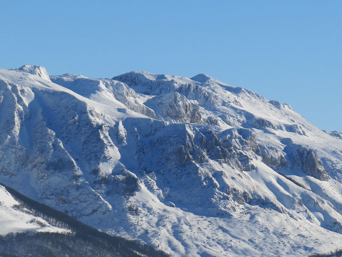
Mount Treskavica: Peaks from left to right: Zaviti Kamen (1892 m a.s.l.) and Nikoline Stijene (1971 m a.s.l.).
Among the countless stories of tobacco smugglers from the last century, one stands out for its wit and audacity. It’s a tale of a woman named Mare and an investigator who tried to break her story.
“Comrade Mare, tell me again—what was the name of the man you were delivering this tobacco to?” the investigator asked.
For the second time, Mare repeated a fabricated name and her entire story of how she had managed to bring a massive backpack full of tobacco into Sarajevo. In the early 1970s, a haul like that was a small fortune.
The investigator was persistent, wanting to see if Mare would slip up or change her defense. He leaned in once more: “Comrade Mare, tell me one more time… what was his name?”
Mare, realizing she had nothing left to lose, shot back with pure honesty: “Comrade Investigator, you truly are a madman! Back home, we tell something to small children once and they remember it. I’ve told you three times now, and you still can't get it through your head!”
Stunned by her fearless and blunt response, the investigator did something unexpected. He ordered that her backpack full of tobacco be returned to her. He even promised that from that day forward, she could smuggle tobacco into Sarajevo undisturbed. “If anyone gives you trouble,” he said, “tell them to call me, and I’ll handle it.”
Even the law could not help but admire the resourcefulness and grit of a woman fighting to feed her family.
The Summer Gendarmerie Outposts
Across the Dinaric Alps, the remains of stone structures stand as silent witnesses to the past. These outposts were known locally as “karaula” (from the Turkish karavulhana – guardhouse) or “pandurica” (from the Hungarian pandúr – guard). Their primary purpose was the surveillance and interception of tobacco smugglers, illegal loggers, and poachers.
Today, the ruins of these summer outposts can still be found at various strategic points across the mountains:
Mount Prenj: Gvozdine (965 m a.s.l.) and Rujište (1050 m a.s.l.)
Mount Treskavica: Čelina (1220 m a.s.l.), Valje (1453 m a.s.l.), and Rogoj (1315 m a.s.l.)
Mount Bjelašnica: Bijele Vode (1420 m a.s.l.) and near the village of Umoljani (1390 m a.s.l.)
Mount Radovan: Near the iron mine (1200 m a.s.l.)
Mount Lelija: Near Jablan Vrelo (1588 m a.s.l.)
Mount Zelengora: At the Orlovačko Lake crossroads (1500 m a.s.l.) and the entrance to Suha (700 m a.s.l.) near Tjentišta
Mount Raduša: Above Vilića Gumno (1409 m a.s.l.) and below Raduški Kamen/Triskavac (1486 m a.s.l.)
Mount Jahorina: Near the village of Pavlovac (1402 m a.s.l.) and at Varcarovine above the Duboka stream (1126 m a.s.l.)
Ozren-sarajevski: on the road from Vučja luka towards the mountain hut on “Ozren” (1396 m/a.s.l.); west of the village of Gornje Biosko (1150 m/a.s.l.)
Olovo-Kladanj Pass: On the road from Olovo to Kladanj (996 m a.s.l.)
Ulog & Romanija area: On the hill above the village of Obrnja near Ulog (1324 m a.s.l.), at Vučja Brda above the village of Romani (1253 m a.s.l.), and on Kukor hill above Gornja Ljubogošta (978 m a.s.l.)
Igman area: On the road from Hadžići toward Igman, near the Lokve crossroads (1144 m a.s.l.)
Željeznica Canyon: Above the Krupačke Stijene (800 m a.s.l.)
IN MEMORIAM
Prof. Dr. Stevo Jokanović (1892–1979)
Born in Doboj, where he completed high school, he graduated from the Faculty of Law in Budapest, earning his Doctorate in Legal Sciences in 1920. Following his education, he practiced law in several cities across Bosnia and Herzegovina. Shortly before World War II, he worked in Belgrade for a brief period before being expelled. After the war, he returned to Sarajevo, working first for the Government of the People's Republic of Bosnia and Herzegovina, then as a judge, and following his retirement, as a lawyer until the end of his life. Before World War II, he was a member of the mountaineering organization and, as an active mountaineer, visited a great number of mountains both at home and abroad. After the war, he was a member of the Mountaineering Society (PD) “Bjelašnica” Sarajevo. From June 1954 to October 1956, he served as the President of the Mountaineering Association of Bosnia and Herzegovina. In addition to numerous social recognitions, he was awarded the Order of Labor of the SFRY and the Order of Merit for the People. He passed away in Sarajevo in 1979.
The tobacco smugglers’ trails are now silent, reclaimed by the wind and the mountain grass. But the stories of their resilience, and the paths they carved through the Dinaric Alps, remain an inseparable part of our heritage.
Join me next time as we continue to explore these hidden histories.
✨ New stories from the mountains are published every Wednesday in English. Follow the blog and stay tuned for the next adventure!
Cover Photo Description: Mount Prenj: View from Privor (1540 m a.s.l.). Peaks from left to right: Otiš (2097 m a.s.l.), Zelena Glava (2103 m a.s.l.), Mali Otiš (2000 m a.s.l.), and Botini (2015 m a.s.l.).
Note: English version first. Napomena: Verzija na bosanskom jeziku nalazi se u donjem dijelu teksta. Bosanski jezik
Your monthly dose of success, health, and inner peace.
As February draws to a close and the scent of pre-spring lingers in the air, the New Year’s euphoria has long settled. Now, as the mountains prepare for their own spring transformation, we can finally focus on what truly matters: real transformation.
In my view, setting goals shouldn’t be a trend. Goals are solutions to problems. They represent what we want but don’t yet have (the solution)—instead of what we have but no longer want (the problem).
From Survival to Strategy
For more than half my life, I lived without a plan. Day by day. I grew up in a war where the only goal was to survive the day, and the only plan was to have no plan at all. In those extreme conditions, ultimate flexibility was a survival strategy. It was about living in the moment, resourcefulness, and raw instinct.
Later, in “normal” circumstances, I realized one crucial truth: A person without a goal and a plan definitely has a plan to fail.
I concluded that in modern business and life, the sweet spot is somewhere in the middle. You must have a long-term vision and goals as your compass, but maintain maximum flexibility on the journey. Change the strategy, but never abandon the goal. In life, unlike in the mountains where we might retreat due to weather, our goals are our life-solutions—and we do not give up on them.
Success is not about standing on the peak. It’s about what you do when you hit rock bottom. That first move you make when you are at your lowest point—deciding to rise—is the most decisive moment of all.
In life, the only way to fail is to give up. You can change your path, you can change your pace, but you never give up on the goal.
📌 Quick Reminder: If you missed the first part of this series, I highly recommend reading my previous article and completing the exercises. They are the blueprint for everything we are building today.
The First 3 Steps
As a Certified Coach, I use a specific methodology for success and vision-building that I’ve learned from the world’s leading coaching authorities. If you want to start working on this yourself, let these three steps be your guide:
1. WHAT? – CLARITY. What exactly do you want? Clarity is power. Instead of focusing on what you don’t want, ask yourself: What exactly do I want for my life? How much, and by when? A goal must be attractive and big enough to actually pull you toward it. Write it down—only then does it become real.
2. WHY? – PURPOSE. Why do you want it? Your “Why” is your engine. When things get brutally difficult and you ask yourself, “Why am I doing this?”, your Why is what will push you forward.
3. HOW? – THE ROADMAP. How will you achieve it? The plan comes last. What do you need to learn? What resources do you need (time, money)? Who do you need to help you? A mentor or a coach who can help you progress fast and efficiently. Find the people who have already succeeded in what you want to achieve, and learn by modeling their successful strategies.
A Small Task for You ☕
Today, while you enjoy your coffee (perhaps after a long hike), take one small but decisive step for yourself:
Define and write down ONE GOAL 🎯 you want to achieve this year. Something you will truly regret if you don’t accomplish—something you’ve been postponing or avoiding.
Set a 90-day deadline for its realization and put it in your calendar immediately.
Write down 5 key steps you need to take to get there.
Don’t wait for the “ideal moment” or perfection. It doesn’t exist.
Decide.
Commit.
And take massive action.
Right now!
Question for you: What is the one thing you will do TODAY that moves you toward that goal?
Inner Barriers: Identity as a Brake
Working on goals is a process of transformation. Many people know what they want, but they never achieve it because they try to reach it with their old identity.
I once worked with a client who desperately wanted freedom, slow mornings, and the life of an entrepreneur. She had the desire and the vision, but no clear, defined goal. For years, she stayed in an exhausting job that was draining her health. What was holding her back? Her identity was tied to the belief that working for others was the only “safe” and “correct” path.
Only when we redefined what security truly meant to her, set a clear goal, and defined who she must become, did the blockage vanish. To reach a new peak, you need a new version of yourself.
If you get stuck, ask yourself these two questions:
Am I ready to pay the price for this goal?
Who do I need to BECOME to achieve this?
What do you gain by setting goals?
You live by design. You stop surviving and start living. Life aligned with your values brings meaning to every second.
You create a solution. You build an exit strategy from a frustrating situation.
You reduce stress. When you know where you’re going long-term, daily chaos becomes manageable.
If you are facing a major challenge you can’t solve alone, or if you need clarity and freedom from inner blocks, I can help. My coaching uses a holistic approach focused on transformation, while protecting your well-being.
For those who want to dive deeper, I created the HUZURIJA Newsletter. This isn’t just another email. It’s your guide to:
🛡️ Inner Resilience for Outer Impact.
🚀 Success Strategies.
💎 Models of Success.
Imagine a life where you finally savor every day—working and living exactly as you’ve always dreamed. Imagine a reality where stress no longer threatens your health, but instead serves as a quiet reminder of your own unshakable inner strength.
Stop surviving. Start designing. You deserve to live your best life and lead a career that fulfills you. Join the HUZURIJA inner circle and start architecting your positive change today.
P.S. Next time, we meet in the full spirit of Huzurija. Until then, I look forward to your questions in the comments. See you on the trail. 🏔️🌟
Zašto je život bez cilja i plana siguran put ka neuspjehu?
Vaša mjesečna doza uspjeha, zdravlja i unutrašnjeg mira.
Dok se februar polako bliži kraju, a miris proljeća već lebdi u zraku, euforija s početka godine je odavno isparila. Sada, dok se planine pripremaju za svoju proljetnu transformaciju, možemo se konačno fokusirati na ono što je zaista bitno: stvarnu promjenu.
Po mom mišljenju, postavljanje ciljeva ne smije biti trend. Ciljevi su zapravo rješenja problema. Oni su ono što želimo, a nemamo (rješenje) – umjesto onoga što imamo, a više ne želimo (problem).
Od preživljavanja do strategije
Više od pola svog života živjela sam neplanski. Dan po dan. Odrasla sam u ratu gdje je jedini cilj bio preživjeti dan, a jedini plan – da plana nema. U takvim ekstremnim situacijama, ultimativna fleksibilnost bila je strategija za opstanak. Život u trenutku, snalažljivost i sirovi instinkt.
Kasnije, u “normalnim” okolnostima, shvatila sam jednu ključnu istinu: Čovjek bez cilja i plana definitivno ima plan da ne uspije.
Zaključila sam da je u modernom biznisu i životu najbolje biti negdje između. Imati dugoročnu viziju i ciljeve kao svoj kompas, ali zadržati maksimalnu fleksibilnost na putu ostvarenja. Mijenjati strategiju, ali od cilja nikada ne odustati. Za razliku od planine, gdje nekad odustanemo od vrha zbog nevremena, u životu se od ciljeva ne odustaje.
Uspjeh nije u tome da si na vrhu. On se krije u onom momentu kada si na samom dnu i odlučiš da se digneš. Taj prvi korak koji napraviš kada si na najnižoj tački – odluka da kreneš gore – najbitniji je momenat od svih.
U životu, jedini način da ne uspiješ je da odustaneš. Možeš mijenjati put, možeš mijenjati tempo, ali od cilja nikad ne odustaj.
📌 Kratki podsjetnik: Ako ste propustili prvi dio ovog serijala, obavezno pročitajte moj prethodni članak i uradite vježbe. One su temelj za sve što gradimo danas.
Prva 3 koraka
Postoji čitava metodologija uspjeha i kreiranja vizije i ciljeva koju radim sa svojim klijentima kao certificirani Coach, a koju sam naučila od najvećih svjetskih coaching lidera. Ako na sebi želite raditi sami, neka Vam ova tri koraka budu vodilje:
ŠTA? – JASNOĆA. Šta tačno želite? Jasnoća je moć. Umjesto fokusiranja na ono što ne želite, zapitajte se: Šta tačno želim od sebe i svog života? Koliko toga i kada to želim postići? Cilj mora biti dovoljno privlačan i velik da ga zaista želite. Zapišite ga – tek tada on postaje stvaran.
ZAŠTO? – RAZLOG. Zašto to želite? Razlog je Vaš motor. Kada postane neizdrživo teško i zapitate se: “Šta je meni ovo trebalo u životu?”, sjetite se svog Zašto. To će Vas gurati naprijed.
KAKO? – MAPA PUTA. Kako ćete to postići? Tek na kraju ide plan. Šta trebate naučiti? Šta Vam sve treba (novac, vrijeme)? Koga trebate naći da Vam pomogne? Mentora, coacha da napredujete brzo i efikasno. Ljude koji su to uspjeli prije Vas od kojih možete preuzeti uspješne strategije.
Mali zadatak za Vas uz ☕
Danas, dok pijete kafu, uradite jedan mali, ali presudan korak za sebe:
Odredite i zapišite JEDAN CILJ 🎯 koji želite postići ove godine. Nešto zbog čega ćete žaliti ako ne ostvarite i što ste do sada stalno odlagali ili izbjegavali.
Dajte sebi rok od 90 dana za realizaciju i odmah to unesite u kalendar.
Napišite 5 ključnih koraka koje trebate poduzeti da to postignete.
Nemojte čekati idealan trenutak niti neko savršenstvo. To ne postoji.
Odlučite.
Prezmite odgovornost.
I krenite u masovnu akciju.
Odmah! Kao da gori!
Šta je to što ćete uraditi VEĆ DANAS, a što Vas vodi ka tom cilju?
Unutrašnje barijere: Identitet kao kočnica
Rad na ciljevima je proces transformacije. Mnogi ljudi znaju šta žele, ali to nikada ne ostvare jer pokušavaju to postići sa svojim starim identitetom.
Radila sam s klijenticom koja je željela slobodu i preduzetništvo, ali je godinama ostajala na iscrpljujućem poslu koji joj je uništavao zdravlje. Kočilo ju je uvjerenje da je jedino “sigurno” raditi za druge. Tek kada smo redefinisale šta za nju zaista znači sigurnost i kakva osoba ona mora postati da bi bila slobodna, blokada je nestala.
Za postizanje cilja potrebno je da postanete nova verzija sebe.
Ako zapnete u postavljanju svojih ciljeva, postavite sebi dva ključna pitanja:
Da li sam spreman/na platiti cijenu ovog cilja? Svaki cilj ima cijenu. Cijena je visoka, ali je i nagrada velika. Tek kada ste spremni platiti tu cijenu bez obzira na sve, Vi imate cilj.
· Ko ja trebam POSTATI da bih postigao/la taj cilj? Stara verzija Vas ne može postići ono što ste zacrtali u budućnosti. Staro ‘ja’ mora da umre. To nije fizička smrt, već svjesno odustajanje od starih uvjerenja i obrazaca koji Vam više ne služe. Staro ‘ja’ mora da ustupi mjesto novom ‘ja’ — toj osobi sposobnoj za taj uspjeh koji želite. I to je svakodnevna borba dok traje proces. Staro ‘ja’ protiv novog ‘ja’.
Šta dobijate postavljanjem ciljeva?
Stvarate rješenje: Pravite sebi izlaz iz situacije koja Vas frustrira.
Smanjujete stres: Kada dugoročno znate kuda idete, svakodnevna hektika i prepreke postaju podnošljivije.
Živite prema dizajnu: Vi više ne preživljavate, već živite. Život u skladu sa sopstvenim vrijednostima i svrhom donosi ispunjenje i smisao svakoj sekundi.
Ako ste u velikom problemu koji već dugo ne možete riješiti sami, ako Vam je potrebna jasnoća ili oslobađanje od unutrašnjih blokada – mogu Vam pomoći. Moj coaching ima holistički pristup sa fokusom na transformaciju i pronalaženje rješenja za naizgled bezizlazne situacije, čuvajući pritom Vaše zdravlje. Na mom Coach profilu možete detaljnije vidjeti koje sve probleme Vam mogu pomoći da riješite i pročitati iskustva drugih ljudi koji su bili na mom coachingu i napravili pozitivnu promjenu u svom životu ili karijeri:
Za sve vas koji želite raditi na sebi dublje, kreirala sam HUZURIJA Newsletter. To nije samo još jedan email u inboxu, već Vaš vodič za:
🛡️ Unutrašnju otpornost za vanjski uticaj. Kako da izgradite nepokolebljiv unutrašnji mir i sačuvate zdravlje na putu do uspjeha, u savremenom svijetu punom stresa i nesigurnosti.
🚀 Strategije uspjeha: Konkretni alati, provjerene metodologije i strategije za mjerljiv napredak na profesionalnom i privatnom planu.
💎 Inspiracija kroz modele uspjeha: Ekskluzivne priče ljudi koji su prevazišli izazove s kojima se Vi sada suočavate iz kojih možete naučiti kako da modelirate njihove pobjedničke strategije.
Zamislite život u kojem vi upravljate svojim danom, a ne on vama. Zamislite da stres više nije prijetnja vašem zdravlju, već podsjetnik na vašu unutrašnju snagu.
Prestanite preživljavati. Dizajnirajte svoj život. Zaslužujete karijeru i život koji vas ispunjavaju. Pridružite se HUZURIJA krugu i krenite stvarati promjenu već danas.
P.S. Sljedeći put se čitamo u punom duhu i ruhu Huzurije. Do tada, vidimo se na planini ili u komentarima. 🏔️🌟
Elena Babić-Đaković HUZURIA | Strategic Leadership & Inner Resilience
I am the founder of Huzuria, a system designed for leaders and high-achievers who refuse to choose between their ambition and their health. Having survived extreme transformations, I know that success at the cost of well-being is not true success. My mission is to provide you with the tools to stay “in the game” and navigate any storm without falling apart.
Through a unique blend of high-performance protocols, NLP, Mindfulness, and restorative nature-based practices, I help you shift from being driven by stress to being powered by inner stability. Whether through premium 1:1 partnerships, digital protocols, or immersive retreats at sea and in the mountains, I provide the roadmap for your total systemic reset and a return to full vitality.
Backed by Experience: Certified Life & Business Coach (ICI) | NLP Master (IN) | Mindfulness Trainer (In-Me).
The Prokletije (Albanian: Bjeshkët e Nemuna) are part of the Dinaric Alps, forming its rugged southeastern peripheral group that ends at the Drin River in Albania. This mountain space, unique in both the Balkans and Europe, is administratively divided into three parts: the Montenegrin, Albanian, and Kosovar Prokletije.
For a long period, these were practically “forbidden mountains.” Following the political conflict triggered by the 1948 Informbiro Resolution, the state border between the SFR Yugoslavia and the Republic of Albania was strictly militarized. For five decades, until 1998, this high-mountain region was home to the most heavily guarded border in Europe.
Thanks to the mountaineering transversal established in 1957 by the PD “Prokletije” Peć (Albanian: Peja), many hikers were able to discover the beauty of the massif on the Yugoslav side. Meanwhile, the Albanian side remained largely unexplored, shrouded in mystery.
With the independence of Montenegro and Kosovo, the borders with Albania were demilitarized and placed under the supervision of border police. This finally realized the noble, long-held vision of “Prokletije Without Borders.” For us mountaineers, this was a moment of great joy—the chance to finally explore the entire massif across all three countries.
Many nature lovers share the same sentiment: these mountains possess a unique beauty and a “wild romance” found nowhere else. They are often considered the most stunning mountains in the Balkans. Because of this untouched wilderness, Prokletije is home to three National Parks: in the Plav-Gusinje region of Montenegro, and in the Valbona and Theth valleys of Albania.
Text and photography by: Braco Babić
Prokletije, from left to right: Maja e Jezercës (2,694 m a.s.l.), Maja e Kolacit (2,490 m a.s.l.), Maja e Malisorës (2,421 m a.s.l.), Maja Bojs (2,461 m a.s.l.), and Maja Scokistes (2,353 m a.s.l.).
The Prokletije (Albanian: Bjeshkët e Nâmuna) form the southeastern peripheral group of the Dinaric Alps, reaching their end at the Drin River in Albania. This unique mountain region—one of the most distinct in Europe—is administratively divided into three sections: the Montenegrin, Albanian, and Kosovar Prokletije. They stretch along the borders of eastern Montenegro, northern Albania, and the western and southern parts of Kosovo, covering a total area of approximately 3,500 km². The largest portion of the range lies within Albania, while the remaining third is shared between Montenegro and Kosovo. The highest peak of the entire Prokletije range is Maja e Jezercës (2,694 m a.s.l.) in Albania, which also holds the title of the highest peak in the entire Dinaric Alps. Each section of the range boasts its own giants: Đerovica / Maja e Gjeravicës (2,656 m a.s.l.) is the highest peak of the Kosovar Prokletije, the highest point in Kosovo, and the second-highest peak in the entire Prokletije massif. Zla Kolata / Kollata e Keqe (2,534 m a.s.l.) is the highest peak of the Montenegrin Prokletije and the highest point in all of Montenegro.
The oldest recorded name for these mountains is Mons Bertiscus, appearing on a map created by the ancient Greek mathematician, geographer, and astronomer Claudius Ptolemaeus (83 – 161 BC). In some later ancient maps, the name Beriseldi appears instead of Bertiscus.
For centuries, the Prokletije remained a mystery to the outside world. It wasn't until the first half of the 19th century that the first naturalists and explorers arrived, led by geographers, biologists, and geologists. The French-Austrian scientist Ami Boué (1794 – 1881) described the Prokletije as: “The most inaccessible and wildest mountain range on the Balkan Peninsula.” Similarly, the German botanist and phytogeographer August Grisebach (1814 – 1879) dubbed them the “Southern Alps of Europe,” a synonym that perfectly captures the character of this mountain group.
The Serbian geographer and geologist, Prof. Dr. Jovan Cvijić (1865 – 1927), conducted significant field research in the karst landscapes of the Prokletije. He noted that this is one of the few mountain groups in the Balkans where the effects of the glacial period are so vividly visible—with deep, wide valleys carved and shaped by the movement of glaciers, from which rise many rocky peaks of fascinating forms.
From a mountaineering perspective, the Prokletije were once very rarely visited. It was only after the establishment of the Prokletije Mountaineering Transversal in 1957 that we saw a significant increase in hikers on the Yugoslav side of the range. To make the peaks more accessible, mountain huts were built at key locations: the Jelinak hut in Bjeluha, and others in Boga, Čakor, Pločice (below Đerovica), Slane Poljane (Ljumbard mountain), and the Grebaja valley.
The Prokletije were documented by renowned Yugoslav mountaineers and explorers, including Prof. Dr. Branimir Gušić, Prof. Dr. Željko Poljak, Branislav Cerović, Rado Kočevar, Mirko Marković, Miodrag Božinović, Branko Kotlajić, Velibor Stanišić, Stanislav Gilić, Uzeir Beširović, Franci Savenc, and many others. Their travelogues, published in mountaineering journals such as HPS’s “Naše planine” and PZS’s “Planinski vestnik”, were the most-read stories of their time. These writings finally lifted the veil of mystery from the unknown expanses of the Prokletije.
The relief of the Prokletije is rugged, with numerous high and striking peaks, deep gorges, steep slopes, river valleys of the Alpine type, and other natural phenomena. On the Prokletije, many high peaks are located on the border line of three states, and in the following list, next to the name and altitude, stands the mark: CG (Montenegro), K (Kosovo), A (Albania).
The highest peaks in the Montenegrin part are: Zla Kolata / Kollata e Keqe (2,534 m) – CG / A, Dobra Kolata / Kollata e Mires (2,528 m) – CG / A, Rosni vrh / Maja Rosit (2,524 m) – CG / A, Veliki vrh / Kremeni vrh / Maja e Gurte e Zjarmit (2,490 m), Sjeverni vrh / Maja e Balles (2,460 m), Južni vrh / Zlovrh / Maja e Keqe (2,441 m), Crni krš / Bandera (2,426 m), Maja e Preht (2,408 m), Pasji vrh (2,405 m) – CG / K, Hajla (2,403 m) – CG / K, Krš Bogićevica (2,374 m), Orlov krš / Maja e Male (2,372 m) – CG / K, Tromeđa / Trekufir (2,366 m) – CG / A / K, Žljeb (2,365 m), Veliki Hridski krš (2,358 m), Starac (2,352 m), etc.
The highest peaks in the Kosovar part are: Maja e Gjeravicës / Đerovica (2,656 m), Maja e Gusanit (2,539 m) – K / A, Marijash / Bogdaš (2,533 m), Guri i Kuq / Žuti kamen (2,522 m), Maja e Ropës (2,501 m), Guri i Zi (2,470 m), Veternik / Koprivnik (2,461 m), Maja e Barl (2,425 m) – K / A, Velika Podina (2,424 m), Vrh Čvrlje (2,413 m), Pasji vrh (2,405 m) – K / CG, Maja Bogicaj (2,404 m) – K / A, Hajla (2,403 m) – K / CG, Rusolija (2,381 m), Maja Streoc (2,377 m), Maja e Male / Orlov krš (2,372 m) – K / CG, Tromeđa / Trekufir (2,366 m) – CG / A / K, Žljeb (2,365 m), Maja e ram arucit (2,358 m) – K / A, etc.
The highest peaks in the Albanian part are: Maja e Jezercës / Jezerski vrh (2,694 m), Maja Grykat e Hapëta (2,625 m), Maja Radohines (2,570 m), Maja e Popllukës (2,569 m), Maja Brijaset (2,567 m), Maja e Paces (2,561 m), Maja e Hekurave (2,560 m), Podi e Kolatës / Ravna Kolata (2,556 m), Maja e Madhe (2,554 m), Maja Koprishtit (2,554 m), Maja e Lagovjet (2,545 m), Maja e Fat (2,543 m), Kollata e Keqe / Zla Kolata (2,534 m) – A / CG, Maja Gavnit (2,530 m), Kollata e Mires / Dobra Kolata (2,528 m) – A / CG, Maja e Ismet Bruca (2,525 m), Maja Rosit / Rosni vrh (2,524 m) – A / CG, Maja Vinsens (2,517 m), Maja e Kokervhakes (2,508 m), Maja Shkurz (2,499 m), Maja Reshkulit (2,498 m), Maja e Livadit (2,496 m), Maja e Kolacit (2,490 m), Maja e Ragamit (2,472 m), Maja e Aljis (2,471 m), Maja Preht (2,466 m), Maja Bojs (2,461 m), Maja Prozmit (2,452 m), Maja Vukoces (2,450 m), Maja Sjapit (2,450 m), Maja Xhevarhirit (2,445 m), Maja Kuci (2,438 m), Maja e Cet Harushes (2,424 m), Maja e Malisorës (2,421 m), Maja e Boshit (2,416 m), Maja Nigvacit (2,412 m), Maja e Desles (2,403 m), Maja e Zez (2,400 m), etc.
Across the wider area of the Prokletije, three distinct climate zones stand out: temperate-continental (500 – 800 m a.s.l.), sub-mountain (800 – 1,200 m a.s.l.), and mountain (above 2,000 m a.s.l.). These zones are characterized by short, fresh summers and long, moderately cold winters, with a relatively high annual sum of precipitation. Autumns here are warmer than springs, and the vegetation period is notably short.
The Prokletije have always captured the attention of botanists and scientists as an inexhaustible field of research. Rare plant species, medicinal herbs, and wild fruits represent the natural wealth of this range. Many medicinal, honey-bearing, aromatic, and vitamin-rich species thrive in this pristine space. The most well-known medicinal plants include: wild thyme, yarrow, rose hip, hawthorn blossom, dandelion, horsetail, marshmallow, nettle, sweet fern, chicory, gentian, hellebore, valerian, lily of the valley, primrose, and others. Forest and field fruits are also significantly represented: blueberries, wild strawberries, raspberries, blackberries, juniper, and many species of edible mushrooms (chanterelle, porcini, saffron milk cap, oyster mushroom, morel, parasol mushroom, button mushroom, etc.).
The Prokletije abound in a rich and diverse fauna of mammals, birds, fish, amphibians, and insects. The most significant game species inhabiting the high-mountain zone are the brown bear, wolf, wild boar, chamois, and roe deer. Small game includes the fox, hare, badger, polecat, otter, marten, and squirrel. The bird population is equally impressive, featuring the golden eagle, short-toed snake eagle, common buzzard, imperial eagle, mountain eagle, griffon vulture, vulture, western capercaillie, black grouse, northern goshawk, peregrine falcon, Eurasian hobby, grey partridge, rock partridge, common quail, hazel grouse, woodcock, and more.
The floristic composition of the Prokletije includes numerous rare, endemic, relict, and protected plant species. Among them are Balkan, European, and world-class floristic rarities. In addition to herbaceous plants, there are many species of relict and endemic dendroflora (trees) that attract the attention of naturalists and hikers alike. Of particular interest are the Bosnian pine (munika), Macedonian pine (molika), yew, and mountain maple.
Prokletije su bogate vodom i čine razvođe jadranskog i crnomorskog sliva. U nižim predjelima su izvorišta velikih rijeka: Ljumi i Valbons (Valbona), Ljumi i Shales (Lesnices), Ljumi i Curajt (Nikajt), Ljumi i Cem (Cijevna), Lim, Tara, Ibar, Drinit të Bardhë (Bijeli Drim), Erenik (Ribnik), Pećka Bistrica i Dečanska Bistrica.
Na Prokletijama je veliki broj lijepih jezera ledenjačkog porijekla. Na području Crne Gore: Plavsko jezero (906 m), Visitorsko jezero (1734 m), Hridsko jezero (1968 m), Bukumirsko jezero (1450 m) i Rikavačko jezero (1313 m). Na području Kosova: Kučiško jezero (1850 m) i Dreljsko jezero (1750 m) na Malji necinat, Veliko jezero i Malo jezero (2350 m) pod vrhom Đeravica / Maja e Gjeravicës, Tropojsko jezero (2220 m) pod vrhom Maja e ram arucit i Veliko jezero (2340 m) pod vrhom Maja e Gusanit. Na području Albanije: u Doberdolu je smještena veća skupina jezera na nadomorskoj visini od 1900 – 2100 m, zatim Buni i Jezercës (2200 m) skupina od šest jezera smještena u slikovitoj dolini pod najvišim vrhom Prokletija – Jezerski vrh / Maja e Jezercës.
The Prokletije Mountaineering Transversal
Founder: PD “Đerovica“ Peć / alb. Peja
Established: 1957
Duration: 12 days
Number of Checkpoints: 27 CP
Checkpoint Names and Altitudes: Peć / alb. Peja (550 m), Hasanov vrh (1,871 m), peak Rusolija / Žljeb (2,381 m), peak Ahmica / Štedim (2,272 m), peak Hajla (2,403 m), mountain hut in Boga (1,540 m), tourist house in Kućište (1,110 m), Jelinak mountain hut in the Bjeluha valley (1,410 m), peak Vaganica (2,112 m), peak Planinica (2,077 m), mountain hut on the Čakor pass (1,849 m), peak Djevojački krš (2,046 m), peak Crni krš / Bandera (2,426 m), peak Maja e Bajrakut (2,078 m), peak Bogdaš / alb. Marijash (2,533 m), peak Hridski krš / Bogićevica (2,358 m), Hridsko Lake (1,968 m), katun Kofiljača (1,650 m), Plav (945 m), Vokšanske pločice mountain hut (2,070 m), peak Đerovica / alb. Maja e Gjeravicës (2,656 m), Kućiško Lake (1,850 m), peak Žuti kamen (2,522 m), mountain hut on Slane poljane / Ljumbard mountain (1,520 m), peak Veternik (2,461 m) and peak Krš Čvrlje (2,413 m) on Koprivnik, Dečani (550 m).
Note: Following the dissolution of SFR Yugoslavia in 1991, the Prokletije Transversal is no longer in function and has not been restored to this day.
Mountaineering Calendar: Traditional Ascents and Expeditions
January | Traditional Memorial Ascent to Hajla (2,403 m) Dedicated to Safet Mavrić, an alpinist from Novi Pazar who perished during a winter climb near the summit.
Access: Rožaje (Montenegro).
Route: Bandžov hut (1,479 m) – Katun Brahim beg – Grope hut (1,880 m) – Mala gora pass – ridge walk northwest to the summit.
Duration:5 hours (one way).
Elevation Gain:924 m.
Organizer:PSK “Hajla“ Rožaje.
March | Winter Expedition to the Highest Peak of the Dinarides – Maja e Jezercës (2,694 m) A high-altitude tour involving two nights of winter camping (bivouacking) near the former border outpost at Vusanjski Zastan (Montenegro) or in the Buni e Jezercës valley (Albania).
Access:Gusinje (Montenegro).
Route: Gornje Vusanje (980 m) – Oko Skakavice spring – Ropojana valley – Vusanjski Zastan (1,350 m) – Border stone B17 (1,774 m) – Buni i Jezercës (1,792 m) – Maja e Jezercës summit.
Duration: 6 hours (one way).
Elevation Gain: 1,714 m.
Organizers: Mountaineering Association of Montenegro and PD “Hrid“ Plav.
March | Traditional Memorial Ascent to Očnjak / Maja njeri e kriyte – “The Frozen Man” (2,185 m) Dedicated to Zvonimir Blažina, a Belgrade alpinist who, along with Dušan Močilnik, completed the first winter ascent of this peak in 1963.
Access: Gusinje (Montenegro).
Route:“Branko Kotlajić“ hut (1,175 m) in Grbaja – Suljova česma – junction for Lugu e Kuq – right toward the eastern ridge – final ascent via snowy ledges and broken rock.
Note: The final climb is highly demanding due to exposure and is intended only for experienced climbers with proper winter gear.
Duration: 6 hours (one way).
Elevation Gain: 1,010 m.
Organizers: Belgrade Mountaineering Association, PD “Radnički,“ and PD “Pobeda“ Belgrade.
May | Memorial Ascent to Karaula (1,915 m) Dedicated to Zijo Ibrahimagić, a mountaineer from Gusinje and long-time president of PD “Karanfil.“
Access: Gusinje (Montenegro).
Route: “Branko Kotlajić“ hut (1,175 m) in Grbaja valley – marked “border trail” via serpentines to the pass (1,740 m) – right below the south face of Karaula (avoid the cliffs!) through the pine stands to the summit.
Duration:2.5 hours (one way).
Elevation Gain: 740 m.
Organizer: PK “Karanfil“ Gusinje.
June | “Peaks of the Balkans” (PoB) Cross-Border Trekking With the support of GTZ (German Technical Cooperation), this 130 km circular trail connects the most beautiful valleys across Montenegro, Kosovo, and Albania. The trek covers 6,500 m of total elevation gain over 10 days.
Miljan Radović & Rajko Marić, Montenegrin Prokletije – Nature, People, Tourism, Development; Publisher: Ministry of Tourism of Montenegro, Podgorica, 2002.
Branko Kotlajić & Radonja Šekularac, Grbaja – The Gusinje Part of Prokletije – History, Anthropogeography, and Mountaineering Guide; Publisher: PD “Radnički“, Belgrade, 2003.
Daniel Vincek, Ratko R. Popović & Mijo Kovačević, Mountains of Montenegro – A Guide for Mountaineers; Publisher: “Monitor“, Podgorica, 2004.
Michal Kleslo, Across the Mountains of the Balkans: Bosnia and Herzegovina, Montenegro – Tourist Guide (in Czech); Publisher: SKY, Vresina, 2004.
Mountaineering Guide: Hajla; Publisher: NGO Pogled and PK Pogled, Rožaje, 2010.
Ervin Kalač, Mountains of the Rožaje Region – A Monograph; Rožaje, 2013.
Mountaineering and Topographic Maps
Prokletije – Brada, Topographic Map 1:50,000; Toponymy collected and processed by Prof. Dr. Branimir Gušić in collaboration with Prof. Dr. Željko Poljak; compiled and produced by Mirko Marković. On the back of the map is a panoramic sketch from the summit of Maja e Ballës. Publisher: HPS Mountaineering Journal “Naše planine”, Zagreb, 1963.
Prokletije – Mountaineering Map 1:75,000; Publisher: PSD “Đerovica” and the Tourist Association of the Peć Region, 1966.
Prokletije – Hiking and Biking, Map 1:50,000; Publisher: Local Tourist Organization Plav with the support of GTZ (German Technical Cooperation), 2009.
Topographic Maps 1:25,000 and 1:50,000 (1972) and 1:100,000 (1970); Edition: Military Geographical Institute (VGI) Belgrade.
Cover photo: Prokletije, border stone on the Maja Popadija ridge (2,030 m a.s.l.). Along the border line of the three neighboring states—Albania, Montenegro, and Kosovo—the old markings on the stone pyramids still stand: SFRJ (Socialist Federal Republic of Yugoslavia) and SPSH (Republika Popullore e Shqipërisë / People's Socialist Republic of Albania).
Vrh Hojta se nalazi na nadmorskoj visini od 1672 m. Smješten je jugoistočno od najvišeg vrha planine Bjelašnice (2067 m/nv), oko 4 km zračne linije. Na središnjem je dijelu grebena koji povezuje Bjelašnicu sa susjednom planinom Treskavicom. Greben je dugačak oko 8 km i pruža se u smjeru sjeverozapad-jugoistok, što je klasični dinarski smjer. Završava na Poljicama (1550 m) pod Ogorjelim kukom – na Treskavici. Predstavlja vododjelnicu dva sliva: Jadranskog (Rakitnica na zapadu) i Crnomorskog (Bijela na istoku). Na tom moćnom grebenu ističu se mnogi vrhovi: Lisičija gl. (1678 m), Šiljak (1689 m), Kočarin (1606 m), Musino brdo (1550 m), Hojta (1672 m), Borikovci (1577 m) i kota 1520 m. Bjelašnicu od Treskavice razdvaja prijevoj na Ogumanju, jugoistočno od vrha Hojte, oko 1,5 km zračne linije. Prijevoj se nalazi na nadmorskoj visini od 1451 m i preko njega prelazi makadamska cesta. Bila je ovo važna saobraćajnica iz pravca Trnova za povezivanje sa selima na području Zabjelašnice. U selu Šabići bio je priključak na makadamsku cestu iz pravca Babinog dola. Kasnije, u prvoj deceniji 21. stoljeća izgradnjom novih putnih komunikacija obje ceste izgubile su na značaju. Naziv vrha Hojta vjerojatno potječe od njemačke riječi hütte što u prijevodu znači koliba. Naime za vrijeme vladavine Austrougarske Monarhije u BiH u blizini vrha bila je sagrađena koliba za smještaj planininara i lovaca. Tada je bila uređena i označena pješačka staza od Bjelašnice do Treskavice na pravcu: Babin do – Štini do – Bijele vode – vrelo Lađevac – vrelo Vranovac – Zagon – Bijela ljeska – Ogumanje – Poljice – Ogorjeli kuk – Prohin smet – Trokun vrelo – Crno jezero – Šišan – Kozja luka. Za prelazak te staze bilo je potrebno oko 8 sati hoda. Kasnije su na tom pravcu prelazile Sarajevska transverzala (1958.) i Famosova transverzala (1983.). Obje transverzale bile su u funkciji do 1992. godine.
Autor teksta i fotografija: Braco Babić
Planinarski uspon na vrh Hojte
Uspon na Hojtu može se izvesti kraćom ili dužom turom. Obje ture je najbolje izvesti po vedrom danu a posebno vrijedi u zimskom periodu zbog prelijepih vidika koji se pružaju na mnoge planine. Tada se na horizontu jasno vide vrhovi Ozrena (sarajevski), Trebevića, Romanije, Ravne-planine, Jahorine, Treskavice, Crvnja, Visočice, Prenja i Bjelašnice.
Najkraći uspon na Hojtu je od planinarske kuće “Bijele vode“ (1451 m/nv). Do pl. kuće stiže se asfaltiranom cestom od Olimpijskog skijaškog centra u Babinom dolu (oko 5 km). U blizini ove kuće može se parkrati automobil. Pješačka staza započinje od česme (hair voda) smještene na 1481 m/nv odmah pokraj ceste za sela Šabići i Sinanovići. Blagim usponom preko Musinog brda (1550 m/nv) stiže se na kotu 1628 m/nv od koje dalje nastaviti grebenom sve do izlaska na najviše tjeme Hojte (1672 m/nv). Ukupno vrijeme trajanja ove ture s povrtakom na polaznu tačku je oko 3 sata hoda.
Duža tura je kružna a polazna tačka Olimpijski ski-centar Bjelašnica. Uspon pješačkom stazom vodi pravcem: Babin dol – Štini do – pl. kuća “Bijele vode“ – Musino brdo – vrh Hojta – Musino brdo – česma na vrelu Bijele vode – Pandurica – Javorov do – spilja Klokočevica – Kobil do – Babin dol. Ukupno vrijeme trajanja ove ture s povratkom na polaznu tačku je oko 6 sati hoda.
Napomena: od Štinog dola do pl. kuće “Bijele vode“ pješačka staza je označena putokaznim tablama i planinarskim markacijama. Upozorenje: Musino brdo i vrh Hojta su na području gdje postoji opasnost od neeksplodiranih ubojitih sredstava i protupješačkih mina iz minulog rata. Također je rizično područje na Borikovcima i Poljicama.
Planinarska kuća “Bijele vode“
Planinarska kuća “Bijele vode“ nalazi se jugozapadno od Sarajeva (oko 35 km). Smještena je na nadmorskoj visini od 1451 m u blizini prijevoja preko kojeg prelazi regionalna asfaltirana cesta za sela Šabići i Sinanovići. Od Olimpijskog skijaškog centra Bjelašnica je udaljena oko 5 km. Parking za automobile nalazi se u blizini pl. kuće. Pl. kuća raspolaže sa ukupno 25 ležaja, kuhinjom i trpezarijom. Pod upravom je planinarskog društva “Željezničar“. Potrebna je najava za noćenje ili boravak. Izleti i ture: najviši vrh Bjelašnice / Opservatorija (2067 m/nv) 3 h; vrh Hojta (1672 m/nv) 1½ h; selo Umoljani (1353 m/nv) 3½ h; Babin dol (1289 m/nv) 1 ½ h; Javorov do (1345 m/nv) 1 h.
Naslovna slika: Bjelašnica, vrh Hojta (1672 m/nv).Na sredini slike vidi se najviši vrh planine Bjelašnice (2067 m/nv).
Mount Ararat is a dormant volcano situated in the Iğdır province of eastern Türkiye, standing as a sentinel where the borders of Armenia and Iran meet. Every nation that lives in its shadow knows it by a different name: to the Turks, it is Ağrı Dağı; to the Armenians, Masis; to the Kurds, Çiyayê Alavhat; and to the Persians, Koh-i-Nuh. It earned the name Ağrı Dağı during the period when its territory officially belonged to the Turkish province of Ağrı. The mountain is defined by two majestic peaks separated by about 15 kilometers: Greater Ararat (Büyük Ağrı Dağı), which stands at 5,137 m a.s.l. as the highest point in the Republic of Türkiye, and the significantly lower Little Ararat (Küçük Ağrı Dağı) at 3,896 m a.s.l. While older topographical and geographical maps often cited the elevation of the highest summit as 5,165 meters, modern measurements have revealed that the peak is actually 28 meters lower than previously recorded.
Beyond its towering heights, Ararat and its expansive plateaus serve as a sanctuary for diverse flora and rare mountain flowers, while also acting as a vital migration route for birds. These landscapes offer ideal motifs for photo safaris and provide a stunning arena for recreational sports such as mountaineering, ski touring, and paragliding. It remains the most visited mountain in Türkiye, partly due to the ancient legend of the prehistoric Great Flood and Noah’s family, who survived the cataclysm along with the animal kingdom thanks to a divine warning. According to this timeless tradition, Noah’s Ark (also known as a bark, kora, or ship) came to rest on Ararat after the floodwaters subsided. Although certain archaeological finds have captured the imagination of researchers worldwide, it has never been proven with certainty that these are indeed the remains of the vessel.
The legend of the flood exists in various forms across almost every religious system, predating even the records found in the Bible. In the story where Ararat is described as the cradle of humanity, God saw that the earth had become corrupt and filled with evil, deciding to bring an end to all living beings. He commanded Noah to build an ark of resinous wood and to bring his immediate family and two of every living creature inside. After 40 days and 40 nights of rain, the waters finally waned and the ark settled on Mount Ararat. Noah then released a raven and later a dove, which initially returned because water still covered the earth. Seven days later, he released the dove again, and it returned with an olive branch—a sign that the waters had finally receded. From Noah's three sons—Shem, Ham, and Japheth—the branches of a new world began to grow, marking a fresh start for mankind from the slopes of this legendary mountain
Text and Photography by: Braco Babić
Many mountaineers from all over the world come to Mount Ararat, each attempting to challenge Marco Polo’s famous claim that “no one will ever conquer it.” I felt a burning desire to stand on the roof of this mythical mountain myself, and in June 2009, I applied for the “10th International Victory Climb To Mount Agri Dagi.” This traditional expedition is organized by the Turkish Mountaineering Federation (Türkiye Dağcılık Federasyonu) to commemorate August 30th – Victory Day. As the departure date drew near, the organizers had yet to confirm my application. However, with a little help from my friends in Ankara just days before my journey to Türkiye, I finally received the official written invitation to participate. The following travelogue, detailing the ascent to the eternally snow-capped summit of Ararat, is taken directly from my mountaineering diary.
Mount Ararat – The final push to the summit is across the glacier on the northwestern side of the mountain (the lower boundary of the glacier begins at 4,200 m a.s.l.).
August 25, 2009
I am traveling to Türkiye with a team of mountaineers from Montenegro: Ramiz Redžematović (Plav), Valentina Perunović (Podgorica), Bojan Đokić (Danilovgrad), and Zoran Mitrović (Podgorica). We depart from Sarajevo at 06:15 AM on a flight to Istanbul. After a two-hour flight, we arrive at Istanbul International Airport, quickly transferring to a domestic flight bound for Kars, a city in the far east of the country. From there, we continue our journey south by minibus, arriving in Iğdir at 5:00 PM.
At the local police station, the officer on duty informs us that we will be accommodated for the night in the Teachers’ Dormitory. As we prepare to head into town, we realize it is the holy month of Ramadan; we wait for the restaurants to open at iftar (the sunset meal). We eventually find a small, traditional eatery serving authentic Oriental specialties.
After dinner, we join some Turkish mountaineering friends at a tea house on the outskirts of the city. There, sitting on traditional minderluks (cushioned floor seats) under the open sky and the pleasant shade of a nearby forest, we enjoy traditional tea. We pour it from a large samovar into small, heat-resistant glass cups. None of the Turks speak English—they mentioned learning Russian in school—and since our knowledge of that language is non-existent, we communicate through a few shared words and plenty of mimicry and gestures. We speak of our shared love for the mountains and the upcoming ascent of Ararat. Late at night, we part ways with our new friends and head back to the dormitory. As we walk through the streets, our laughter echoes alongside the few Russian words we learned that evening: spasiba, harasho, zdrastvujte!
Mount Ararat – On the final push from Camp 3 toward the summit.
August 26, 2009
We begin our tour of the city’s cultural and historical landmarks early in the morning to beat the intense heat. Iğdir is both a city and the capital of the eponymous province in eastern Türkiye. It occupies an area of 3,588 $km^2$ and serves as a strategic border point with Armenia and Iran, while internally bordering the provinces of Kars to the northwest and Ağrı to the south and west. Established in 1993 from the southeastern part of Kars province, it is now home to approximately 180,000 residents, with a population primarily composed of Kurds and Azeris. Most of the province is a vast, sweeping plain stretching beneath the shadow of Mount Ararat. The climate here is the warmest in this part of Türkiye, which is ideal for the cultivation of cotton and various Mediterranean fruits.
The city of Iğdir itself has about 76,000 inhabitants and sits at 850 m a.s.l. It is located at a vital crossroads leading to Batumi, Tabriz, Tbilisi, and Yerevan—some of the most significant cities on the legendary Silk Road between East and West. Having welcomed caravans for hundreds of years since its founding in the 12th century during the Seljuk period, Iğdir is a mosaic of civilizations. From a viewpoint above the city, one can see three distinct cultures converging, truly earning Iğdir the title “Crossroads of Cultures.” While the traditional architecture is now rare, overtaken by contemporary buildings, the city’s historical spirit remains palpable.
Turkish merchants are legendary, with shops displaying everything “from a needle to a locomotive.” If something is missing, the shopkeeper will likely have it on the shelf by the next day. Our specific problem, however, was gas canisters for our camping stoves. We weren't allowed to bring them in our luggage at the Sarajevo airport, and climbing Ararat without them is impossible. After a frantic search through the city—where large industrial tanks were plenty but small hiking canisters were nowhere to be found—a resourceful merchant saved the day. He ordered eight canisters from a neighboring town via phone, and his cousin retrieved them by motorcycle within two hours. With the fuel secured, we can now boil water for tea, soup, and drinking during the expedition.
Relieved, we headed to the local market to buy Iğdir’s famous apples (al alma) and incredibly flavorful peaches (salagi), finishing our haul with a massive, juicy watermelon (karpuz).
At 7:30 PM, in the Culture House hall, the President of the Turkish Mountaineering Federation, Mr. Alaattin Karaca, briefed the participants on the program and conditions for the ascent. The expedition consists of 51 mountaineers (30 local and 21 international). For the past three years, the route has followed the northwestern ridge, starting from the Korhan Plateau near the gendarmerie barracks. This route is more demanding than the southern approach from Doğubeyazit, but it is considered safer due to past regional tensions. In fact, access to Ararat was restricted for a time due to security concerns; just days before our arrival, an incident occurred involving the destruction of a Noah’s Ark replica and a skirmish with local forces.
The evening’s slide projection showcased the breathtaking beauty of this challenging mountain. Ararat is a sanctuary for rare mountain flora and a vital corridor for migratory birds. Whether for a photo safari, mountaineering, or paragliding, it is clear why this remains the most visited mountain in Türkiye.
Mount Ararat – On the final push from Camp 3 toward the summit.
August 27, 2009
Today, our journey to Ararat finally begins. We spend the morning packing our mountaineering and camping gear. Our backpacks, tents, and transport bags are loaded onto a large truck destined for the Korhan Plateau, while we prepare to follow shortly after by minibus. At 11:00 AM, we gather at the main city square for the official opening ceremony. Accompanied by the sounds of the Turkish national anthem and attended by the Mayor of Iğdir, the provincial Governor, and many local citizens, the expedition is formally inaugurated. Flags from all participating nations flutter in the breeze: Türkiye, Romania, Ukraine, Bulgaria, Bosnia and Herzegovina, Montenegro, Macedonia, Serbia, Greece, and Iran.
Following the ceremony, we depart for the Korhan Plateau in a comfortable, air-conditioned minibus. Our route takes us through a military checkpoint fortified with barbed wire, sandbags, and machine-gun nests. Soldiers in full combat gear inspect the vehicle and our documents. During the check, we strike up a friendly conversation with soldiers who had previously served in a peacekeeping mission in Kosovo. We then continue along a dusty road under reconstruction toward Doğubeyazit before veering onto a winding side road that snakes up toward the plateau. Along the way, our guides point out a massive depression near the road—a crater formed by a meteor impact.
At 2:00 PM, after a 35 km drive, we reach the gendarmerie barracks on the Korhan Plateau, where we establish Camp 1 (1,950 m a.s.l.). After pitching our tents, we visit the barracks, where a tank is parked within the perimeter. We meet the gendarmes who will accompany us to Camp 2 tomorrow. They welcome us warmly, providing bottled water and full access to the station’s facilities, including showers, toilets, power for charging batteries, and a military canteen.
The station commander is a young officer of Bosnian descent who speaks our language fluently. He tells us that his grandparents moved to Türkiye after World War I, though he and his parents were born here. Having recently visited Bosnia and Herzegovina—touring Travnik, Sarajevo, and Mostar—he speaks enthusiastically about our nature and the beauty of the people. With his blessing, we are permitted to visit a nearby settlement of Kurdish nomads.
In the late afternoon, Ramiz, Bojan, and I visit the nomads and meet the head of the settlement, Ahmet Nas. He invites us into his tent (yurta), where he has his prized possession—a new Japanese motorcycle—carefully draped in a beautiful rug from Tabriz. Outside, a magnificent horse grazes peacefully on the meadow. At the entrance, Ahmet’s family—his wife and four children—greets us warmly. His eldest daughter helps us communicate using a pocket electronic translator.
As we sit on floors covered with handmade rugs, Ahmet pours hot tea from a samovar and shares stories of the arduous life of Kurdish nomads. When we ask how many times he has reached the summit of Ararat, his eyes light up. He has climbed it about ten times as a guide for foreign mountaineers, and he proudly shows us a pair of binoculars gifted to him by a German climber he once led to the peak.
Our conversation continues over a traditional dinner of warm somun bread, sheep’s cheese, black olives, and sour milk. When asked about wild animals on the mountain, Ahmet nimbly jumps up to retrieve his hunting rifle, demonstrating his skill with the weapon. Though we could have listened to his stories until dawn, the exhaustion of the day finally pulls us back to Camp 1 for a well-deserved rest.
Mount Ararat – On the final push from Camp 3 toward the summit.
August 28, 2009
We wake up at 06:00 AM to pack our tents and gear, which will be transported to Camp 2 by donkeys. The area around the camp is filled with thick dust and the braying of animals. The handlers are firm, using sticks to corral the donkeys and prepare them for loading. We struggle to communicate while negotiating the transport price, and a lingering feeling tells us the agreement might change by the time we return from the summit.
At 08:30 AM, we all set off together. The handlers take a longer, easier route with the donkeys, while we ascend via a steep hiking trail. Camp 2 is located at 3,400 m a.s.l., and the climb takes about 5.5 hours, covering an elevation gain of 1,450 meters. Leading the column are mountain guides Mustafa Kiziltaş (from Balikesir) and Cemal Ertugay (from Antalya). Joining us is Mr. Alaattin Karaca (from Erzurum), the President of the Turkish Mountaineering Federation, marking his tenth ascent of Ararat. At the rear, three gendarmes armed with rifles escort us to Camp 2. We maintain a moderate, “step-by-step” pace. The weather is in our favor—calm and not too cold. Occasionally, we pass through curtains of fog, which completely clear by the time we reach Camp 2 at 2:00 PM, as the sun emerges once more.
We pitch our tents near a spring at the base of a slope on the edge of a large plateau. After settling in, we boil water for tea and soup, carefully straining it first due to the sandy sediment at the bottom of the pots. We strictly follow high-altitude protocols: drink as much fluid as possible! At 5:00 PM, we head out for an acclimatization hike, reaching an elevation of 3,750 m a.s.l. We return to Camp 2 at 7:15 PM. In total, we spent 7 hours and 45 minutes hiking today, with a total ascent of 1,800 meters and a descent of 350 meters. After dinner, we prepare water for tomorrow’s move to Camp 3. The night is unusually warm for this altitude. Before retiring to our tents, we take one last look from the edge of the plateau at the distant lights of Iğdir and Yerevan.
Ararat was Armenian territory until it came under Ottoman rule in 1915. The mountain remains a national symbol of Armenia, featured on their national coat of arms and currency. It is said that Ararat is clearly visible from almost everywhere in Armenia, including the capital, Yerevan. However, Turkish authorities strictly monitor foreigners climbing the mountain and do not permit Armenians to make the ascent.
Mount Ararat – On the final push from Camp 3 toward the summit.
August 29, 2009
We wake up at 07:00 AM. Ramiz and Zoran complain of a poor night's sleep and headaches—clear signs of the altitude. They jokingly envy me for sleeping soundly and “sawing logs” all night, though I assure them I heard nothing! After breakfast, we prepare for the move to Camp 3. From today, everyone must carry their own weight. Tents, sleeping bags, ice climbing gear, winter clothing, and food for two days are all packed into our large backpacks; any excess gear is left behind at Camp 2.
We set off at 09:00 AM. Due to the heavy loads, we climb at our own individual paces, dictated by our physical stamina. The route requires us to overcome a 750-meter elevation gain over approximately 4 hours. The terrain is demanding, consisting of rugged karst with massive boulders broken off from the cliffs that loom above us throughout the ascent. We move with caution to avoid triggering any rockfalls. At 01:00 PM, we emerge onto the crest of a near-vertical cliff where a small, flat plateau awaits. On this ledge, like an “eagle's nest,” we establish Camp 3 (4,150 m a.s.l.). From this vantage point, a wide view stretches across the borderlands of Türkiye and Armenia.
Just as we finish pitching our tents, a storm hits—initially marked by loud thunder and flashes of lightning, followed by a heavy snow squall. We quickly retreat into our tents to wait it out. Fortunately, it lasts only about half an hour before the sky clears and the sun breaks through the clouds again. After lunch and some rest, we head to a nearby stream formed by melting snow to collect enough water for the rest of the day and tomorrow's summit push.
At 04:30 PM, we head out for an acclimatization hike, reaching an elevation of 4,300 m a.s.l., returning to Camp 3 by 06:00 PM. In total, we spent 5 hours and 30 minutes hiking today, with a 900-meter total ascent and a 150-meter descent.
After dinner, we pack our bags for tomorrow’s final push. The stars and gentle moonlight illuminate the sky above our camp—a reliable sign that fair weather awaits us for the summit. Joyful at this turn of events, we head to bed early, knowing a grueling day lies ahead.
Mount Ararat – Braco Babić with the flag of Bosnia and Herzegovina at the summit of Greater Ararat / Büyük Ağrı Dağı (5,137 m a.s.l.).
August 30, 2009
We wake up at 03:00 AM. After a final gear check to ensure our ice climbing equipment is ready, we set off at exactly 04:00 AM. Moving in a single-file line, the silence is broken only by the rhythmic sound of our footsteps. The moonlight is so intense that our headlamps are almost unnecessary. We soon reach the lower edge of the glacier at 4,200 m a.s.l., where we fix our crampons and rope up. I am joined in the rope team by a group from Macedonia: Živko Temelkovski (Skopje), Artan Luma, and Memet Memeti (Tetovo).
As we emerge onto the northwestern ridge at 4,500 m a.s.l., the morning sun greets us. To protect ourselves from the high-altitude rays, we apply high-factor sunscreen and put on our protective eyewear and hats. Everyone feels strong; we make only two brief 15-minute breaks on our way to the summit. It is warm and calm—conditions that often signal an incoming change in weather. Sure enough, at 5,000 m a.s.l., a thick fog rolls in and stays with us until the peak.
The Summit of Ararat
At 10:30 AM, after 6.5 hours of hiking and an elevation gain of 1,015 meters, we finally reach the highest point of Mount Ararat. Standing by the summit marker, our rope leader Živko simply says: “To je to” (That’s it). Congratulations and photos with national flags follow. Each of us has a reason to celebrate: for Živko, this is his tenth consecutive ascent; for Artan, Memet, and myself, it is our first time standing above 5,000 meters. A total of 51 mountaineers from 10 countries reached the summit today—a perfect success rate. As the Turks would say: Aferim! (Bravo!).
We stay at the summit for only 30 minutes. At 11:00 AM, we begin our descent back to Camp 3. Our guides’ decision to move early due to the shifting weather proves wise; as soon as we step off the glacier and remove our crampons, thunder roars and a heavy snowstorm begins. Within minutes, ten centimeters of fresh snow covers the ground.
We arrive at Camp 3 at 2:00 PM after a three-hour descent. After a short rest to regain our strength, we pack our heavy tents and gear for the long trek down to Camp 2. We reach Camp 2 at 7:00 PM after another three hours of hiking. Exhausted and with little appetite, we quickly prepare some tea and soup before heading to bed. It was a grueling day: 11.5 hours of trekking with a 987-meter ascent and a massive 1,737-meter descent.
August 31, 2009
We wake up at 07:00 AM, still feeling the fatigue from yesterday’s triumph. However, the pressure is gone; we no longer have to scan the sky or worry about the weather—the summit is “in the bag.” After breakfast, we pack our tents and gear into transport bags for the donkeys. As we suspected, the negotiation for the transport fee takes a turn; the price agreed upon four days ago has suddenly doubled. After some persistent bargaining, we reach a mutual agreement: 45.00 EUR per piece of luggage for the round trip. We set off at 09:45 AM and arrive back at Camp 1 by 01:45 PM. The descent took 4 hours, covering a vertical drop of 1,450 meters.
At the entrance to the gendarmerie barracks, we encounter the eldest son of our host, Ahmet Nas. He has come on horseback specifically to say goodbye. As a parting gift, we give him our remaining food and a gas burner with canisters. We are then treated to a final meal in the military mess hall—warm pita bread and cold, refreshing drinks.
By 05:00 PM, we are back in Iğdir. After days on the mountain, the simple luxuries of civilization—soap, shampoo, and a hot shower—feel incredible. At 08:00 PM, a formal ceremony is held at the Culture House, where each participant is personally awarded a certificate for the successful ascent of Ararat. To celebrate, nine of us from the former Yugoslav republics (Montenegro, Macedonia, Serbia, and Bosnia and Herzegovina) head to a local restaurant to toast our shared achievement.
Expedition Summary
The journey to Türkiye lasted 11 days (August 25 – September 4, 2009). The ascent via the northwestern ridge from the Korhan Plateau included:
Duration: 4 days and 4 nights across 3 camps.
Camps: K1 (1,950 m a.s.l.), K2 (3,400 m a.s.l.), and K3 (4,150 m a.s.l.).
Trekking Time: 28 hours in total.
Elevation Gain/Loss: 3,687 meters of total ascent and descent.
Following the climb, we spent the next four days exploring the cultural riches of Doğubayazit, Kars, the medieval Armenian city of Ani, and the magnificent city of Istanbul.
Cover Photo:At the summit of Greater Ararat / Büyük Ağrı Dağı (5,137 m a.s.l.): Živko Temelkovski, Artan Luma, Memet Memeti (Macedonia), and Braco Babić (Bosnia and Herzegovina).
The Sand Pyramids are located in the broader area of Daničići, accessible by car via the old road connecting Foča and Miljevina. The largest and deepest craters featuring these formations are situated near the villages of Donje Selo, Sijerice, and Staništa, at an elevation of 650 – 700 m a.s.l.
These pyramids are a true natural phenomenon, born from soil erosion and shaped by the relentless forces of rain, snow, wind, and sun. While they do not follow a strict pyramidal geometry, these furrowed sand pillars rise from broad bases and taper toward their peaks. They represent an extraordinary geomorphological rarity that continues to captivate both geologists and nature enthusiasts.
The process of erosion is constant. These formations do not disappear; instead, they continue to grow and evolve, carving out new craters and pillars over time. They are at their most beautiful when illuminated by the sun, which highlights a rich palette of earth tones—ranging from deep browns and oranges to vibrant yellows and reds.
The most accessible pyramids are located immediately beside the old Foča – Miljevina road, near the village of Staništa.
For the safety of visitors, a dedicated viewing platform and protective fencing have been installed above the main crater.Photographing and exploring the pyramids can be hazardous. The “eaves” or edges above the craters are often undermined by erosion and are not visible from the top edge. Extreme caution is advised, not only at this primary site but throughout the entire pyramid complex.
Work is expected to continue on the protection of the entire complex. Plans include the development of new pedestrian trails that will connect the largest craters, allowing for a more comprehensive and safer exploration of the site.
Text and Photography by: Braco Babić
The significance of this natural wonder was officially recognized in 2021 when the public postal service, JP BH Pošta, issued a commemorative postage stamp featuring the Sand Pyramids of Foča. Year of Issue: 2021. Designers: R. Čosović / T. Lučarević
Cover Image: The Sand Pyramids, Daničići – Staništa (700 m a.s.l.)
Studeni potok se nalazi jugozapadno od sela Umoljani na planini Bjelašnici. Izvorišnu čelenku potoka formiraju tri izdašna vrela smještena na nadmorskoj visini od 1415 m. Do ovih vrela može se pristupiti seoskim putem od katuna na Gradini (1490 m/nv) poviše Umoljana. Studeni potok je desna pritoka rijeke Rakitnice. Pripada Jadranskom morskom slivu. Od izvora nizvodno najvećim dijelom meandrira dolinom dugom oko 2 km do lokaliteta Badnji gdje se obrušava vodopadom sa visine od oko 400 m. Vodopad je sezonskog karaktera (u rano proljeće i kasnu jesen). Ljeti gotovo presuši a zimi zaledi.Dolina kojom teče Studeni potok ograničena je sa jedne strane stjenovitim grebenom Oblog kuka (1843 m/nv) a sa druge šumovitim grebenom Orlovca (1525 m/nv). O Studenom Potoku i Gradini postoji legenda da je u davna vremena zmaj izašao iz obližnjeg kanjona rijeke Rakitnice i svojim zmijolikim tijelom izdubio vijugavu udubinu kroz koju danas teče potok. Iz straha od zmaja, seljani su pobjegli na brdo Pošijak i molili se Svevišnjem da im spasi živote i zaštiti selo. Svemogući je čuo njihovu molitvu i pretvorio zmaja u kamen na stijeni u blizini Gradine. Od te molitve, odnosno “umoljavanja”, selo je dobilo ime – Umoljani. Stijena je poznata kao “Zmajeva stijena”. Na kraju ove po mnogo čemu zanimljive legende vrijedi spomenutii i perzijsku riječ “aždahâr” što u prijevodi znači “zmaj“. Ta riječ vodi porijeklo iz Avestanskog za ime mitološke zoroastrijske zmije “Aži Dahāka” (“Velika Zmija”). Jedan je od najstarijih naziva za zmaja na svijetu. Mještani u Umoljanima upravo tako zovu okamenjenog zmaja – aždaha.
Autor teksta i fotografija: Braco Babić
Umoljani i seoski turizam
Selo Umoljani se nalazi na južnoj strani Bjelašnice smješteno u prostranoj dolini na nadmorskoj visini od 1353 m. Administrativno pripada općini Trnovo, FBiH. To je drevno naselje gdje je nekad bila ilirska utvrda koja ga štitila. O tome svjedoče ostaci kamenih zidina, temelji nastambi i bunari za vodu na Gradini i Pošijaku. Stanovništvo se oduvijek bavilo stočarstvom i zemljoradnjom, u posljednje vrijeme i seoskim turizmom (u razvoju). Porijeklom su od hercegovačkih stočara koji su ovdje dolazili i dogonili stoku “sitnog zuba“ (ovce i koze) u ljetnom periodu radi ispaše na planini Bjelašnici. Bili su to seljani iz okoline Mostara, Nevesinja, Čapljine i Ljubuškog. Neki su ostali zimi i uvidjeli da se u ovom planinskom kraju može lijepo živjeti i tu se trajno naselili.
Nekadašnje ime za Hercegovinu bilo je Hum i te stočare su nazivali Humnjacima, a vjerojatno je i selo po njima dobilo ime. Umoljani je najveće naselje na području poznatom po nazivu Zabjelašnica. Na tom području smješteno je 13 sela. Zabjelašnica je prostrana visoravan okružena planinama: Bjelašnicom (2067 m) na sjeveru, Treskavicom (2086 m) na istoku, Visočicom (1967 m) na jugu, kanjonom rijeke Rakitnice i Obljem (1896 m) na jugozapadu i zapadu.
Umoljani sa okolicom je zanimljiva turistička destinacija koju vrijedi posjetiti. Na putu prema selu u Dolovima nalazi se srednjovjekovna nekropola sa stećcima i mezarje sa nišanima iz osmanskog perioda. Nešta dalje, poviše od tog mjesta sa puta vidi se skupna malih vodenice na Sedreniku. Na ulazu u selo je smještena džamija sa kamenom munarom, o njenom opstanku kroz minula stoljeća i tri rata govori jedna legenda. Iznad sela nalazi se stijena sa reljefom okamenjene aždahe (zmaja) i stare kolibe katuna na Gradini. Najprivlačnija je posjeta Studenom potoku koji meandrira lijepom dolinom na čijem kraju se nalazi vodopad i vidikovac na kanjon rijeke Rakitnice. U selu postoji nekoliko privatnih ugostiteljskih objekata u kojima su na jelovniku domaća hrana i specijateteti bosanske kuhinje. Kod mještana mogu se kupiti unikatne rukotvorine pravljene od vune sa tradicionalnim folklornim motivima i šarama, prirodna zdrava hrana od mliječnih i mesnih proizvoda kao i povrća proizvedenog bez upotrebe vještačkih đubriva i pesticida.
Kružna planinarska tura iz Umoljana na Gradinu i Studeni potok
Studeni potok svojom lijepom dolinom privlači mnoge planinare i ljubitelje prirode u sva četiri godišnja doba. Najkraći put iz Umoljana do Studenog potoka vodi pješačkom stazom od mezarja (groblja) gdje se ispred može parkirati automobil. Staza je obilježena planinarskim oznakama (markacijama) i putokaznim tablama. Od mezarja započinje uspon blagom strminom i ubrzo se stiže do mjesta sa kojeg se vidi stijena sa reljefom okamenjene aždahe. Malo poviše se nalazi katun Gradina, malo čobansko naselje smješteno iznad Umoljana. Do katuna se može prići i asfaltiranom cestom iz Umoljana (oko 1,5 km). Od Gradine nastaviti nizbrdo poljskim putem do izvora Studenog potoka. Na ulazu u dolinu se nalazi nadstrešnica sa klupama a malo dalje su tri veća izvora. Nakon odmora i osvježenja čistom planinskom vodom od izvora dalje nastaviti nizvodno pokraj potoka desnom stranom doline. Dok potok polako i tiho meandrira dolinom u skladu prema zakonima prirode u dolini vlada mir i duboka tišina. Jako lijep krajolik za uživanje svakom od prolaznika. Na kraju doline potok se na mjestu Badnji obrušava vodopadom u kanjon rijeke Rakitnice sa visine od oko 400 m. Vodopad je sezonskog karaktera (u proljeće i jesen) a najbolje se vidi sa vidikovca na Prutu (1436 m/nv) – na lijevoj strani kanjona Rakitnce, kod sela Bobovica na susjednoj planini Visočicici. Od sela Bobovice do vidikovca na Prutu potrebno je oko 30 minuta hoda čobanskom stazom (nije obilježna putokazom i pl. markacijom!).
Prije Badnji gdje se dolina sužava nalazi se raskrižje staza koje je označeno putokaznim tablama: desno staza vodi za selo Gornji Lukomir, a lijevo za selo Umoljani. Od ovog raskrižja krenuti prema Umoljanima stazom preko Rudina gdje se nalazi vidikovac i klupa za odmor. Sa vidikovca se pruža pogled na impresivni kanjon rijeke Rakitnice (desna pritoka Neretve). Kanjon je dužine oko 20 km i dubok preko 1000 m – najdublji u BiH. Od vidikovca na Rudinama nastaviti stazom prema vrelu Sedrenik gdje se na potoku nalazi nekoliko malih vodenica. Dalje krenuti stazom prema Umoljanskoj džamiji te cestom kroz selo do parkinga za automobile ispred mezarja (groblja). Ukupno za ovi turu sa ragledanjem, fotografisanjem i pauzama za odmor potrebno je 2,5 – 3 sata hoda.
Planinarske ture iz Umoljanana Bjelašnicu
Umoljani su povoljna polazna tačka za mnoge pl. ture i uspone na vrhovima Bjelašnice: Krvavac (2062 m), Veliki vrh (1726 m), Siljevica (1662 m), Orlovac (1525 m), Saruk (1726 m), Obli kuk (1750 m), Kobilica (1826 m), Ledni kuk (1843 m), Rasuha (1842 m) i Obalj (1896 m), Izazovna je i razgledna pl. tura u selo Gornji Lukomir (1472 m/nv) dolinom Studenog potoka i iznad kanjona rijeke Rakitnice. U Gornji Lukomir se može pristupiti i stazom preko Saruka, Oblog kuka i Oblja a vratiti se u Umoljane predhodno navedenom stazom u suprotnom smjeru (kružna tura). Najveći broj staza je obilježen putokaznim tablama i planinarskim oznakama (markacijama).
Pristup u Umoljane
Iz pravca Sarajeva krenuti sa Stupske petlje magistralnim putem za Foču i na raskršću kod kamenoloma u Krupcu skrenuti desno na regionalni put koji vodi u olimpijski skijaški centar na Bjelašnici (u Babinom dolu) te dalje nastaviti pored Bijelih voda i sela Šabići do mosta na Rakitnici. Kod mosta skrenuti desno na asfaltiranu lokalnu cestu koja na pojedinim mjestima uz oštre serpentine vodi u selo Umoljani (ukupno oko 50 km).
Naslovna slika: Bjelašnica, Studeni potok (1415 m/nv)