

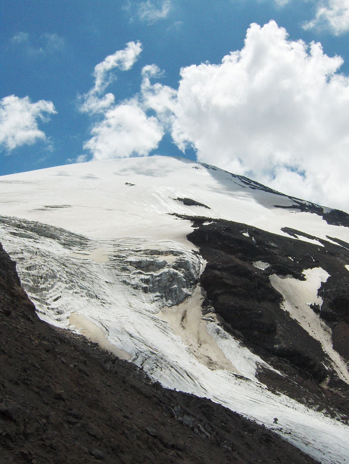
Mount Ararat is a dormant volcano situated in the Iğdır province of eastern Türkiye, standing as a sentinel where the borders of Armenia and Iran meet. Every nation that lives in its shadow knows it by a different name: to the Turks, it is Ağrı Dağı; to the Armenians, Masis; to the Kurds, Çiyayê Alavhat; and to the Persians, Koh-i-Nuh. It earned the name Ağrı Dağı during the period when its territory officially belonged to the Turkish province of Ağrı. The mountain is defined by two majestic peaks separated by about 15 kilometers: Greater Ararat (Büyük Ağrı Dağı), which stands at 5,137 m a.s.l. as the highest point in the Republic of Türkiye, and the significantly lower Little Ararat (Küçük Ağrı Dağı) at 3,896 m a.s.l. While older topographical and geographical maps often cited the elevation of the highest summit as 5,165 meters, modern measurements have revealed that the peak is actually 28 meters lower than previously recorded.
Beyond its towering heights, Ararat and its expansive plateaus serve as a sanctuary for diverse flora and rare mountain flowers, while also acting as a vital migration route for birds. These landscapes offer ideal motifs for photo safaris and provide a stunning arena for recreational sports such as mountaineering, ski touring, and paragliding. It remains the most visited mountain in Türkiye, partly due to the ancient legend of the prehistoric Great Flood and Noah’s family, who survived the cataclysm along with the animal kingdom thanks to a divine warning. According to this timeless tradition, Noah’s Ark (also known as a bark, kora, or ship) came to rest on Ararat after the floodwaters subsided. Although certain archaeological finds have captured the imagination of researchers worldwide, it has never been proven with certainty that these are indeed the remains of the vessel.
The legend of the flood exists in various forms across almost every religious system, predating even the records found in the Bible. In the story where Ararat is described as the cradle of humanity, God saw that the earth had become corrupt and filled with evil, deciding to bring an end to all living beings. He commanded Noah to build an ark of resinous wood and to bring his immediate family and two of every living creature inside. After 40 days and 40 nights of rain, the waters finally waned and the ark settled on Mount Ararat. Noah then released a raven and later a dove, which initially returned because water still covered the earth. Seven days later, he released the dove again, and it returned with an olive branch—a sign that the waters had finally receded. From Noah's three sons—Shem, Ham, and Japheth—the branches of a new world began to grow, marking a fresh start for mankind from the slopes of this legendary mountain
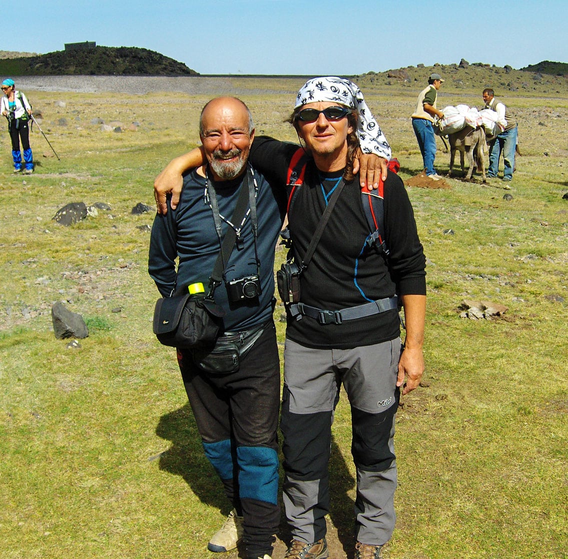
Text and Photography by: Braco Babić
Many mountaineers from all over the world come to Mount Ararat, each attempting to challenge Marco Polo’s famous claim that “no one will ever conquer it.” I felt a burning desire to stand on the roof of this mythical mountain myself, and in June 2009, I applied for the “10th International Victory Climb To Mount Agri Dagi.” This traditional expedition is organized by the Turkish Mountaineering Federation (Türkiye Dağcılık Federasyonu) to commemorate August 30th – Victory Day. As the departure date drew near, the organizers had yet to confirm my application. However, with a little help from my friends in Ankara just days before my journey to Türkiye, I finally received the official written invitation to participate. The following travelogue, detailing the ascent to the eternally snow-capped summit of Ararat, is taken directly from my mountaineering diary.
August 25, 2009
I am traveling to Türkiye with a team of mountaineers from Montenegro: Ramiz Redžematović (Plav), Valentina Perunović (Podgorica), Bojan Đokić (Danilovgrad), and Zoran Mitrović (Podgorica). We depart from Sarajevo at 06:15 AM on a flight to Istanbul. After a two-hour flight, we arrive at Istanbul International Airport, quickly transferring to a domestic flight bound for Kars, a city in the far east of the country. From there, we continue our journey south by minibus, arriving in Iğdir at 5:00 PM.
At the local police station, the officer on duty informs us that we will be accommodated for the night in the Teachers’ Dormitory. As we prepare to head into town, we realize it is the holy month of Ramadan; we wait for the restaurants to open at iftar (the sunset meal). We eventually find a small, traditional eatery serving authentic Oriental specialties.
After dinner, we join some Turkish mountaineering friends at a tea house on the outskirts of the city. There, sitting on traditional minderluks (cushioned floor seats) under the open sky and the pleasant shade of a nearby forest, we enjoy traditional tea. We pour it from a large samovar into small, heat-resistant glass cups. None of the Turks speak English—they mentioned learning Russian in school—and since our knowledge of that language is non-existent, we communicate through a few shared words and plenty of mimicry and gestures. We speak of our shared love for the mountains and the upcoming ascent of Ararat. Late at night, we part ways with our new friends and head back to the dormitory. As we walk through the streets, our laughter echoes alongside the few Russian words we learned that evening: spasiba, harasho, zdrastvujte!
August 26, 2009
We begin our tour of the city’s cultural and historical landmarks early in the morning to beat the intense heat. Iğdir is both a city and the capital of the eponymous province in eastern Türkiye. It occupies an area of 3,588 $km^2$ and serves as a strategic border point with Armenia and Iran, while internally bordering the provinces of Kars to the northwest and Ağrı to the south and west. Established in 1993 from the southeastern part of Kars province, it is now home to approximately 180,000 residents, with a population primarily composed of Kurds and Azeris. Most of the province is a vast, sweeping plain stretching beneath the shadow of Mount Ararat. The climate here is the warmest in this part of Türkiye, which is ideal for the cultivation of cotton and various Mediterranean fruits.
The city of Iğdir itself has about 76,000 inhabitants and sits at 850 m a.s.l. It is located at a vital crossroads leading to Batumi, Tabriz, Tbilisi, and Yerevan—some of the most significant cities on the legendary Silk Road between East and West. Having welcomed caravans for hundreds of years since its founding in the 12th century during the Seljuk period, Iğdir is a mosaic of civilizations. From a viewpoint above the city, one can see three distinct cultures converging, truly earning Iğdir the title “Crossroads of Cultures.” While the traditional architecture is now rare, overtaken by contemporary buildings, the city’s historical spirit remains palpable.
Turkish merchants are legendary, with shops displaying everything “from a needle to a locomotive.” If something is missing, the shopkeeper will likely have it on the shelf by the next day. Our specific problem, however, was gas canisters for our camping stoves. We weren't allowed to bring them in our luggage at the Sarajevo airport, and climbing Ararat without them is impossible. After a frantic search through the city—where large industrial tanks were plenty but small hiking canisters were nowhere to be found—a resourceful merchant saved the day. He ordered eight canisters from a neighboring town via phone, and his cousin retrieved them by motorcycle within two hours. With the fuel secured, we can now boil water for tea, soup, and drinking during the expedition.
Relieved, we headed to the local market to buy Iğdir’s famous apples (al alma) and incredibly flavorful peaches (salagi), finishing our haul with a massive, juicy watermelon (karpuz).
At 7:30 PM, in the Culture House hall, the President of the Turkish Mountaineering Federation, Mr. Alaattin Karaca, briefed the participants on the program and conditions for the ascent. The expedition consists of 51 mountaineers (30 local and 21 international). For the past three years, the route has followed the northwestern ridge, starting from the Korhan Plateau near the gendarmerie barracks. This route is more demanding than the southern approach from Doğubeyazit, but it is considered safer due to past regional tensions. In fact, access to Ararat was restricted for a time due to security concerns; just days before our arrival, an incident occurred involving the destruction of a Noah’s Ark replica and a skirmish with local forces.
The evening’s slide projection showcased the breathtaking beauty of this challenging mountain. Ararat is a sanctuary for rare mountain flora and a vital corridor for migratory birds. Whether for a photo safari, mountaineering, or paragliding, it is clear why this remains the most visited mountain in Türkiye.

August 27, 2009
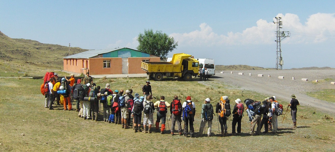
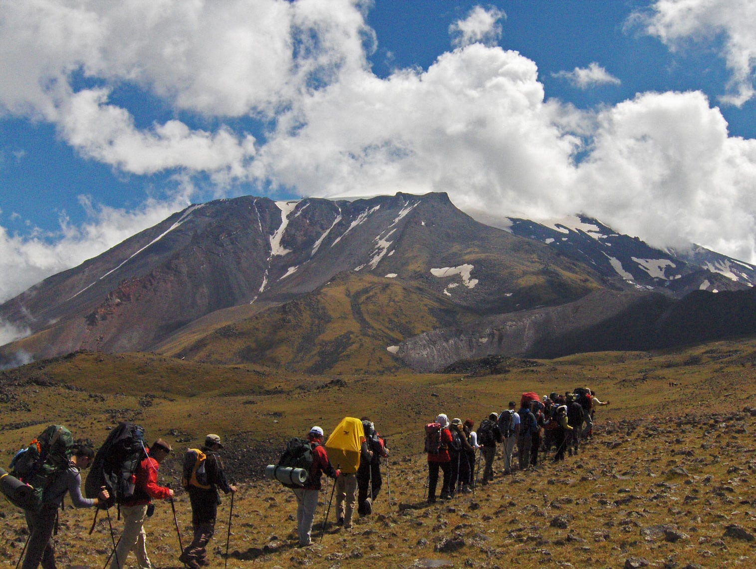
Today, our journey to Ararat finally begins. We spend the morning packing our mountaineering and camping gear. Our backpacks, tents, and transport bags are loaded onto a large truck destined for the Korhan Plateau, while we prepare to follow shortly after by minibus. At 11:00 AM, we gather at the main city square for the official opening ceremony. Accompanied by the sounds of the Turkish national anthem and attended by the Mayor of Iğdir, the provincial Governor, and many local citizens, the expedition is formally inaugurated. Flags from all participating nations flutter in the breeze: Türkiye, Romania, Ukraine, Bulgaria, Bosnia and Herzegovina, Montenegro, Macedonia, Serbia, Greece, and Iran.
Following the ceremony, we depart for the Korhan Plateau in a comfortable, air-conditioned minibus. Our route takes us through a military checkpoint fortified with barbed wire, sandbags, and machine-gun nests. Soldiers in full combat gear inspect the vehicle and our documents. During the check, we strike up a friendly conversation with soldiers who had previously served in a peacekeeping mission in Kosovo. We then continue along a dusty road under reconstruction toward Doğubeyazit before veering onto a winding side road that snakes up toward the plateau. Along the way, our guides point out a massive depression near the road—a crater formed by a meteor impact.
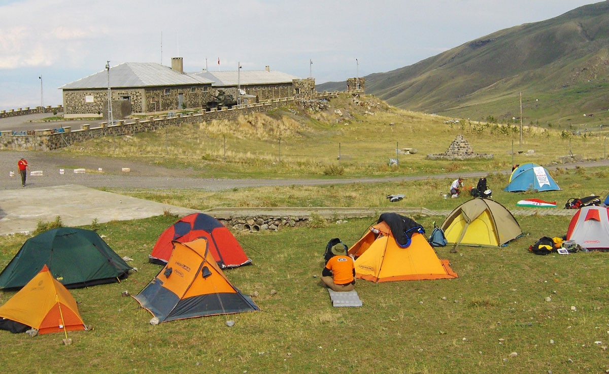
At 2:00 PM, after a 35 km drive, we reach the gendarmerie barracks on the Korhan Plateau, where we establish Camp 1 (1,950 m a.s.l.). After pitching our tents, we visit the barracks, where a tank is parked within the perimeter. We meet the gendarmes who will accompany us to Camp 2 tomorrow. They welcome us warmly, providing bottled water and full access to the station’s facilities, including showers, toilets, power for charging batteries, and a military canteen.
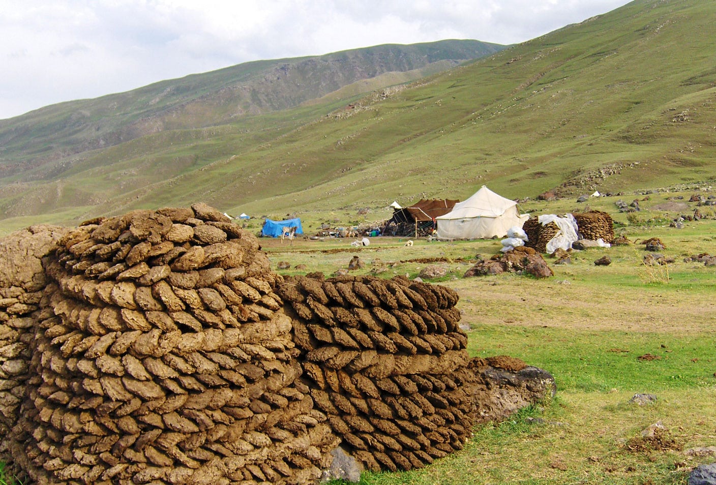
The station commander is a young officer of Bosnian descent who speaks our language fluently. He tells us that his grandparents moved to Türkiye after World War I, though he and his parents were born here. Having recently visited Bosnia and Herzegovina—touring Travnik, Sarajevo, and Mostar—he speaks enthusiastically about our nature and the beauty of the people. With his blessing, we are permitted to visit a nearby settlement of Kurdish nomads.
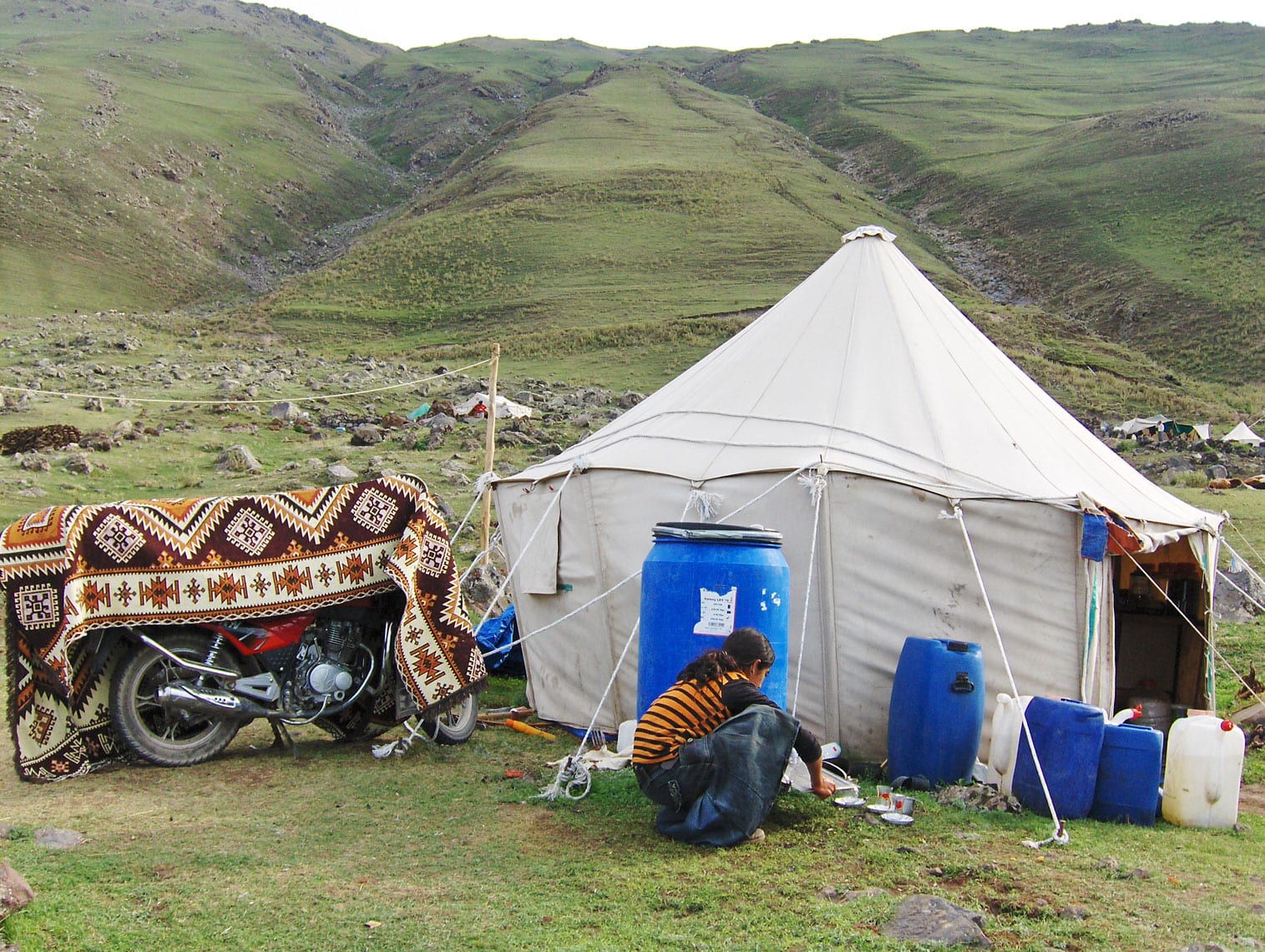
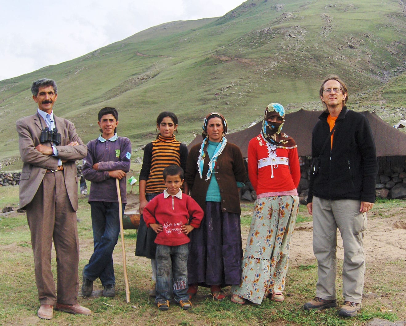
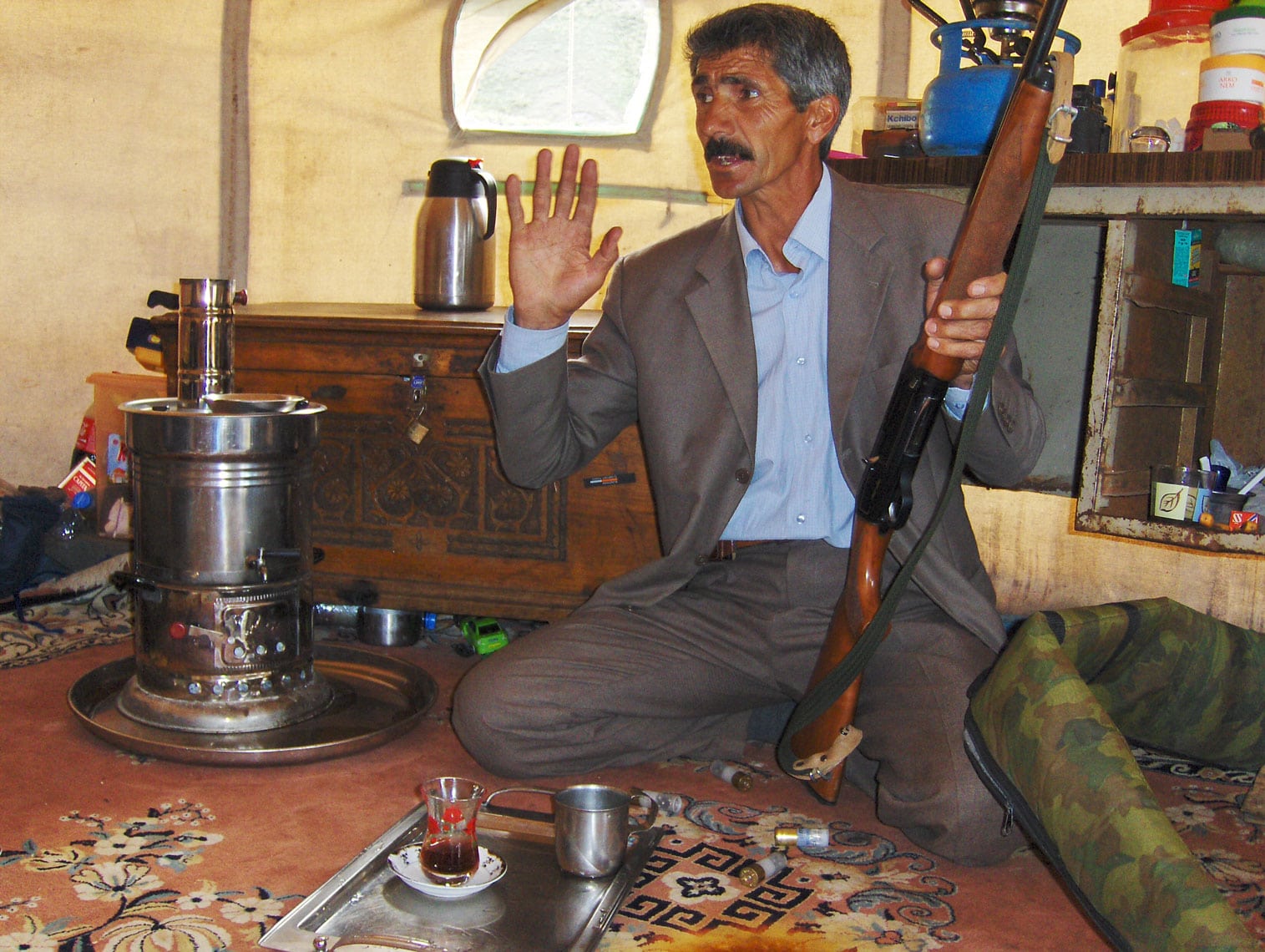
In the late afternoon, Ramiz, Bojan, and I visit the nomads and meet the head of the settlement, Ahmet Nas. He invites us into his tent (yurta), where he has his prized possession—a new Japanese motorcycle—carefully draped in a beautiful rug from Tabriz. Outside, a magnificent horse grazes peacefully on the meadow. At the entrance, Ahmet’s family—his wife and four children—greets us warmly. His eldest daughter helps us communicate using a pocket electronic translator.
As we sit on floors covered with handmade rugs, Ahmet pours hot tea from a samovar and shares stories of the arduous life of Kurdish nomads. When we ask how many times he has reached the summit of Ararat, his eyes light up. He has climbed it about ten times as a guide for foreign mountaineers, and he proudly shows us a pair of binoculars gifted to him by a German climber he once led to the peak.
Our conversation continues over a traditional dinner of warm somun bread, sheep’s cheese, black olives, and sour milk. When asked about wild animals on the mountain, Ahmet nimbly jumps up to retrieve his hunting rifle, demonstrating his skill with the weapon. Though we could have listened to his stories until dawn, the exhaustion of the day finally pulls us back to Camp 1 for a well-deserved rest.
August 28, 2009
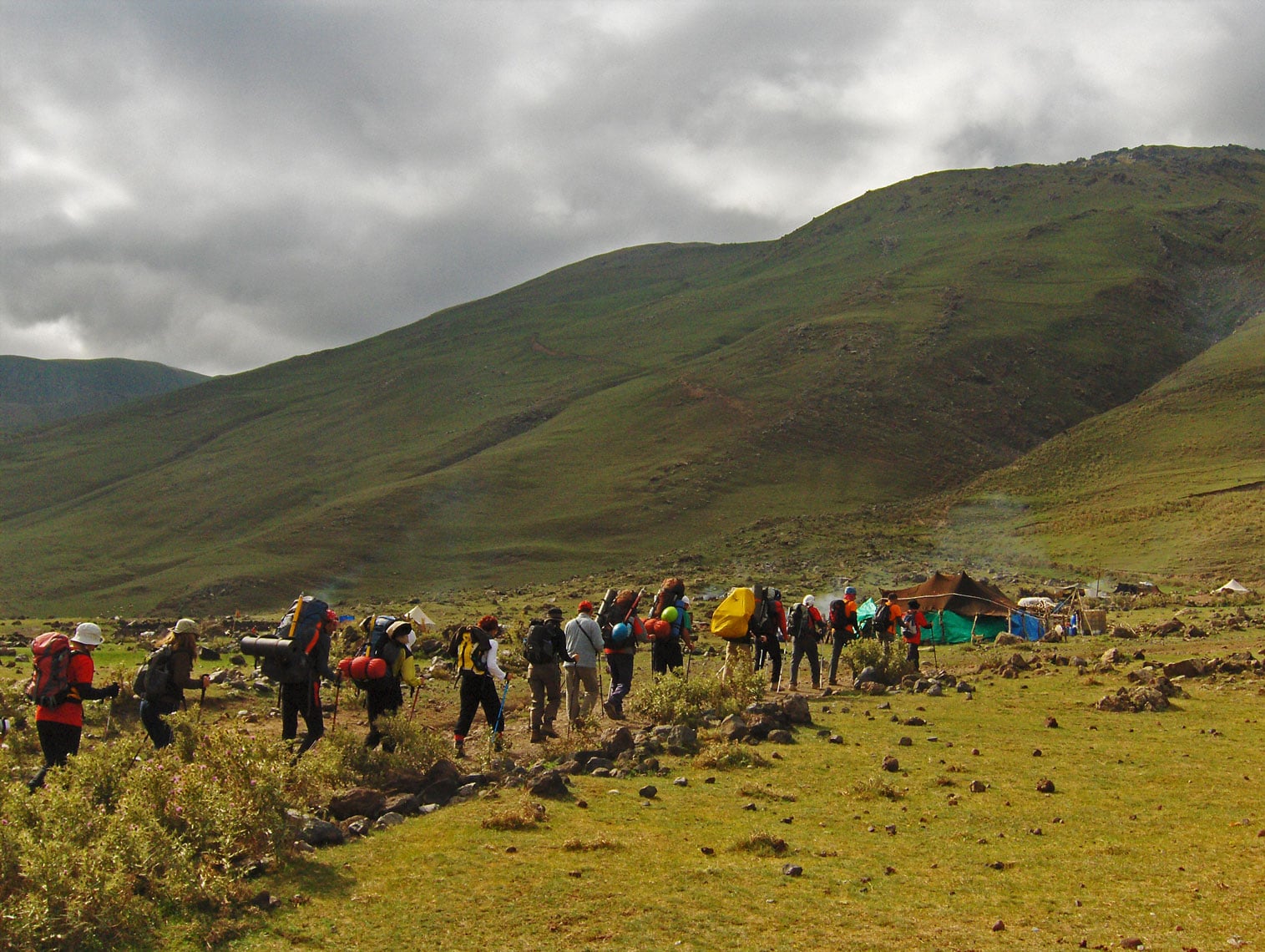
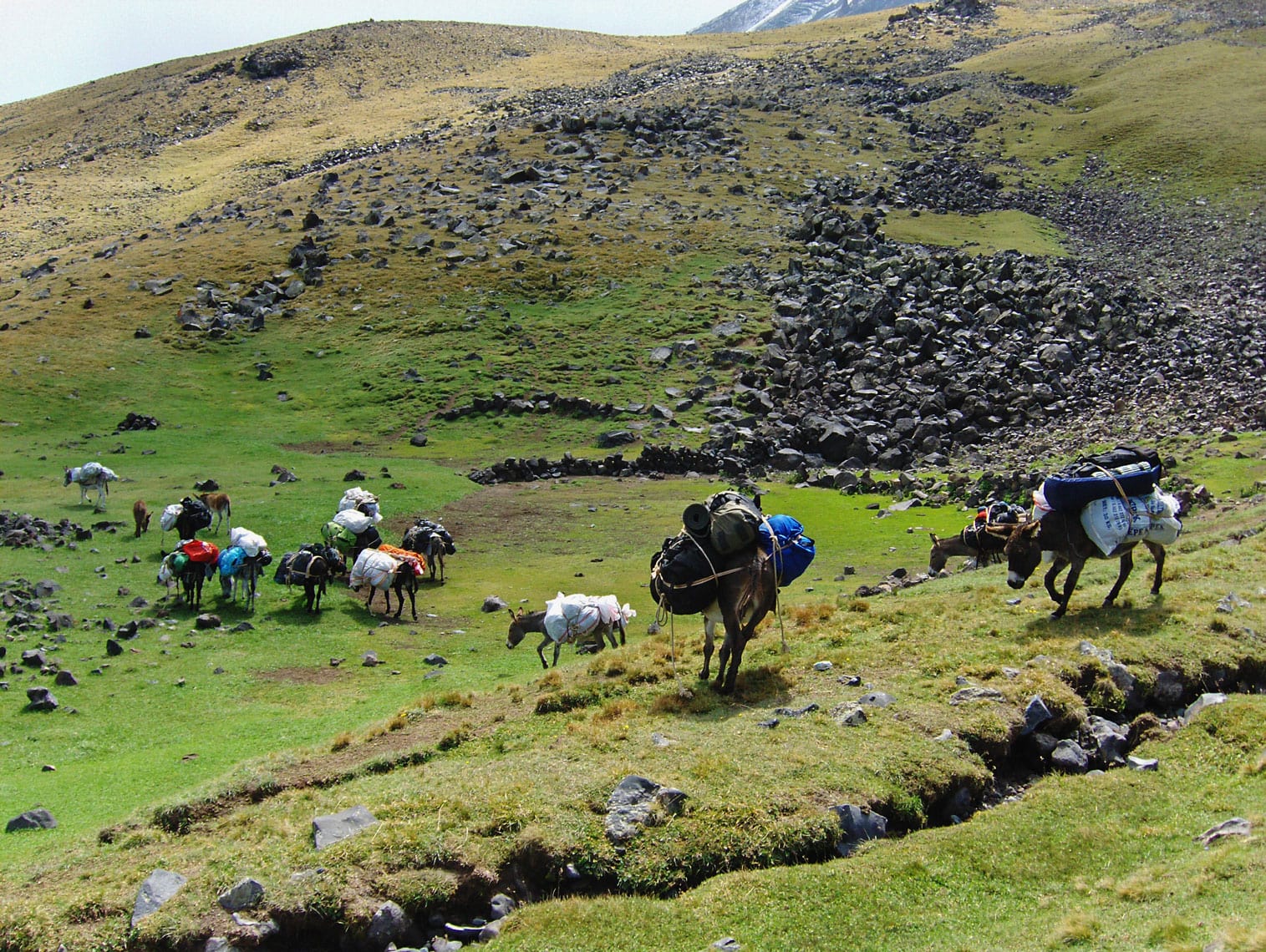
We wake up at 06:00 AM to pack our tents and gear, which will be transported to Camp 2 by donkeys. The area around the camp is filled with thick dust and the braying of animals. The handlers are firm, using sticks to corral the donkeys and prepare them for loading. We struggle to communicate while negotiating the transport price, and a lingering feeling tells us the agreement might change by the time we return from the summit.
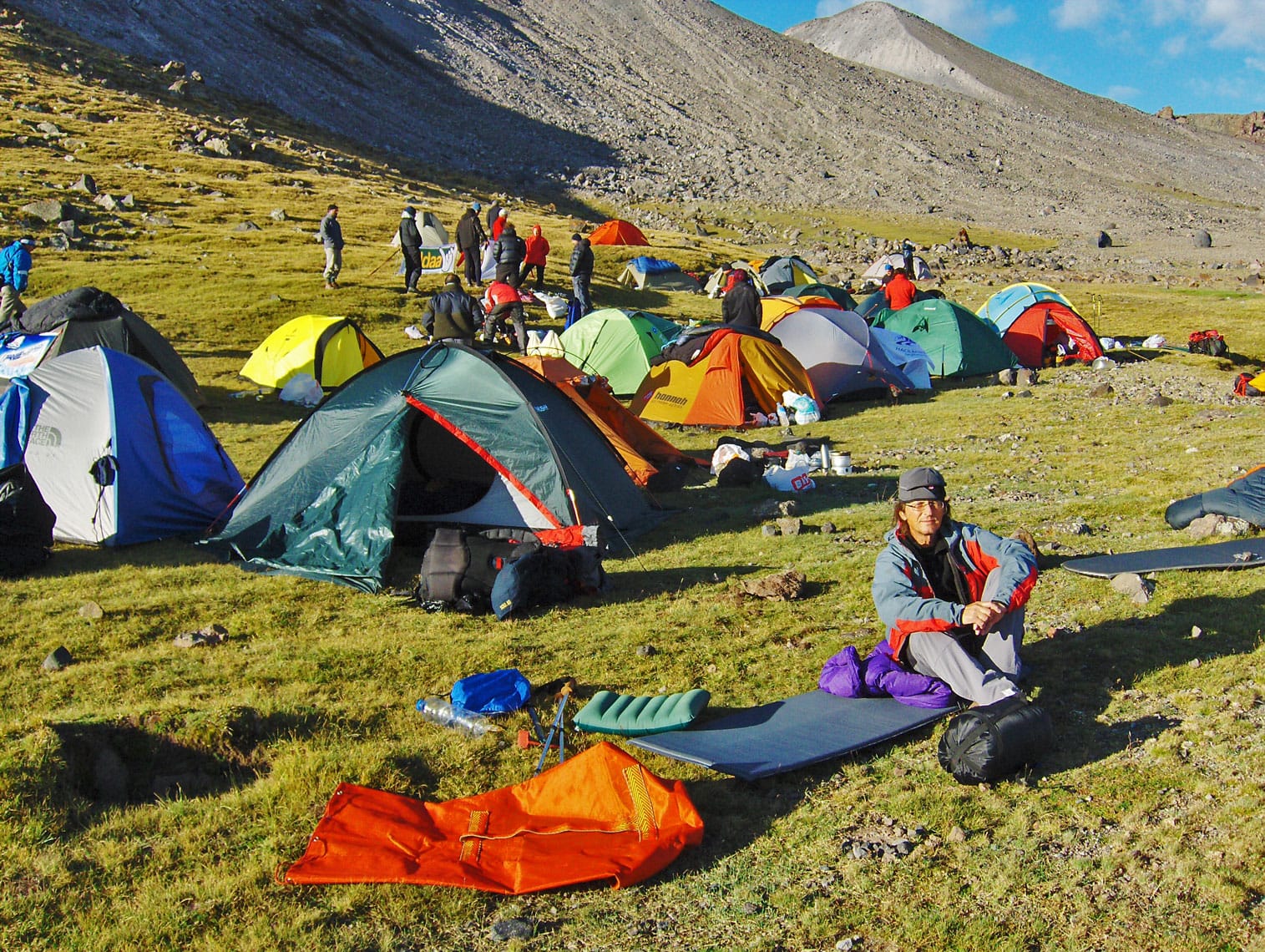
At 08:30 AM, we all set off together. The handlers take a longer, easier route with the donkeys, while we ascend via a steep hiking trail. Camp 2 is located at 3,400 m a.s.l., and the climb takes about 5.5 hours, covering an elevation gain of 1,450 meters. Leading the column are mountain guides Mustafa Kiziltaş (from Balikesir) and Cemal Ertugay (from Antalya). Joining us is Mr. Alaattin Karaca (from Erzurum), the President of the Turkish Mountaineering Federation, marking his tenth ascent of Ararat. At the rear, three gendarmes armed with rifles escort us to Camp 2. We maintain a moderate, “step-by-step” pace. The weather is in our favor—calm and not too cold. Occasionally, we pass through curtains of fog, which completely clear by the time we reach Camp 2 at 2:00 PM, as the sun emerges once more.
We pitch our tents near a spring at the base of a slope on the edge of a large plateau. After settling in, we boil water for tea and soup, carefully straining it first due to the sandy sediment at the bottom of the pots. We strictly follow high-altitude protocols: drink as much fluid as possible! At 5:00 PM, we head out for an acclimatization hike, reaching an elevation of 3,750 m a.s.l. We return to Camp 2 at 7:15 PM. In total, we spent 7 hours and 45 minutes hiking today, with a total ascent of 1,800 meters and a descent of 350 meters. After dinner, we prepare water for tomorrow’s move to Camp 3. The night is unusually warm for this altitude. Before retiring to our tents, we take one last look from the edge of the plateau at the distant lights of Iğdir and Yerevan.
Ararat was Armenian territory until it came under Ottoman rule in 1915. The mountain remains a national symbol of Armenia, featured on their national coat of arms and currency. It is said that Ararat is clearly visible from almost everywhere in Armenia, including the capital, Yerevan. However, Turkish authorities strictly monitor foreigners climbing the mountain and do not permit Armenians to make the ascent.

August 29, 2009
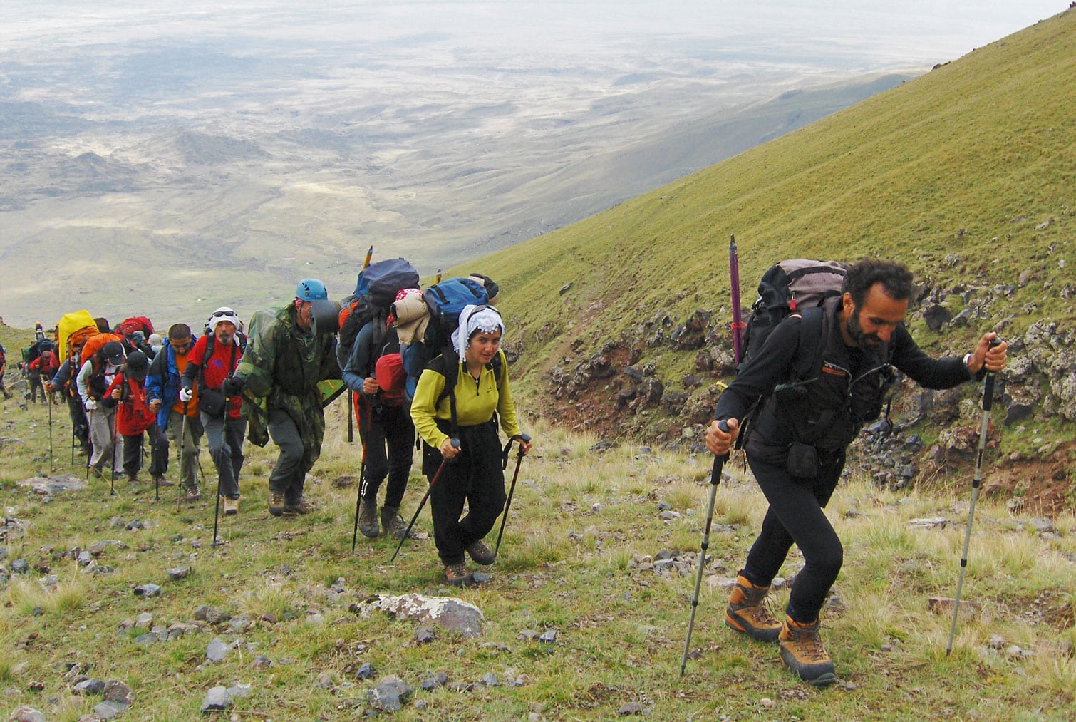
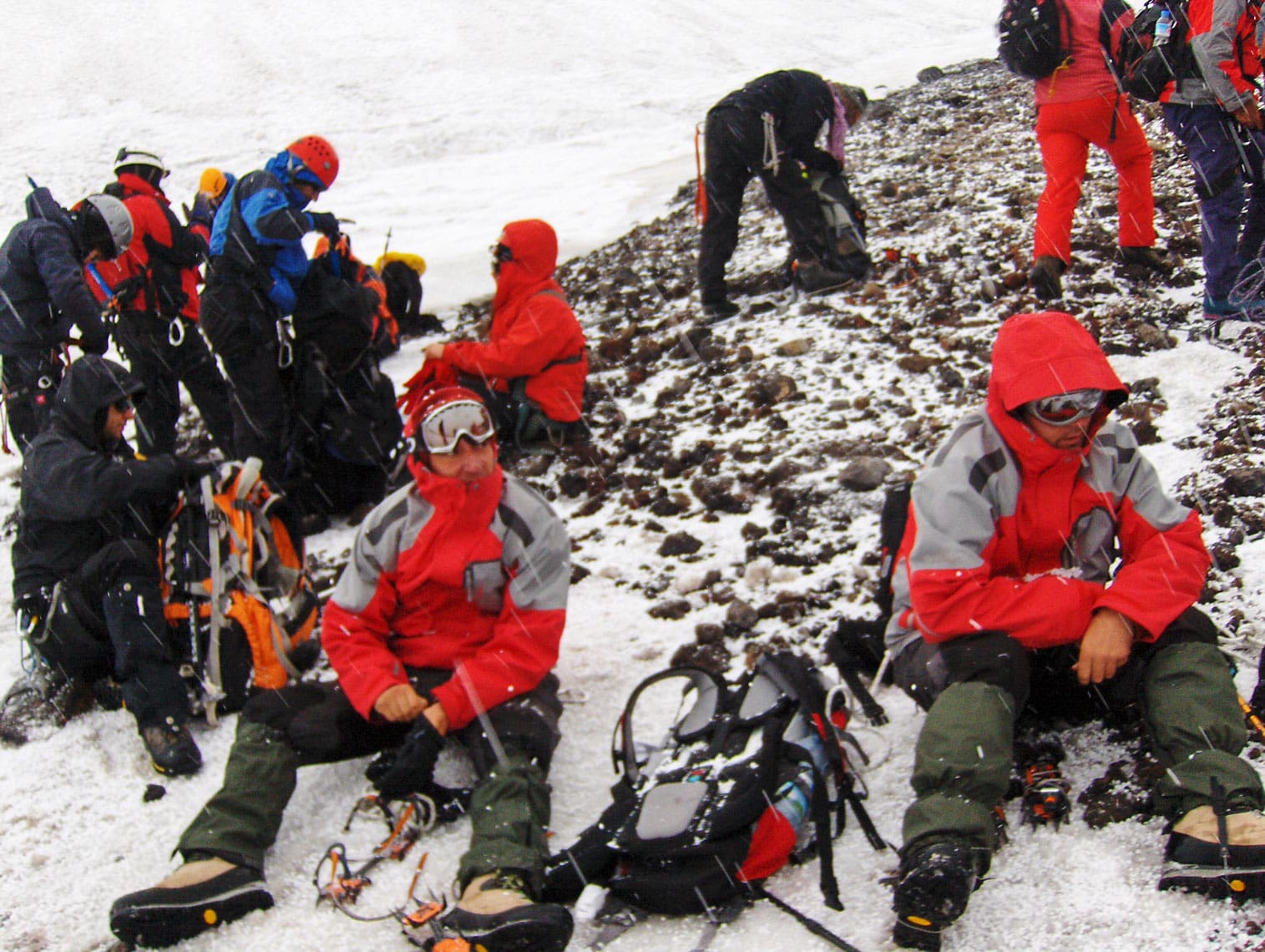
We wake up at 07:00 AM. Ramiz and Zoran complain of a poor night's sleep and headaches—clear signs of the altitude. They jokingly envy me for sleeping soundly and “sawing logs” all night, though I assure them I heard nothing! After breakfast, we prepare for the move to Camp 3. From today, everyone must carry their own weight. Tents, sleeping bags, ice climbing gear, winter clothing, and food for two days are all packed into our large backpacks; any excess gear is left behind at Camp 2.
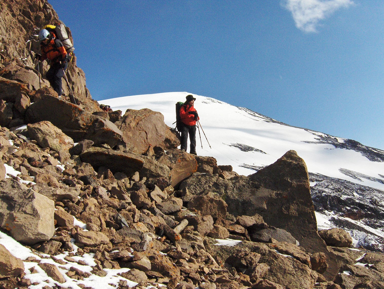
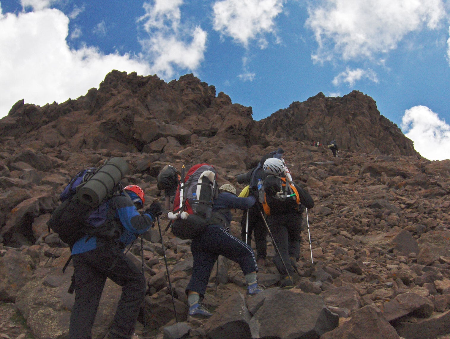
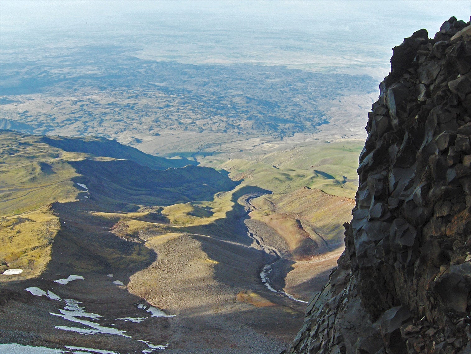
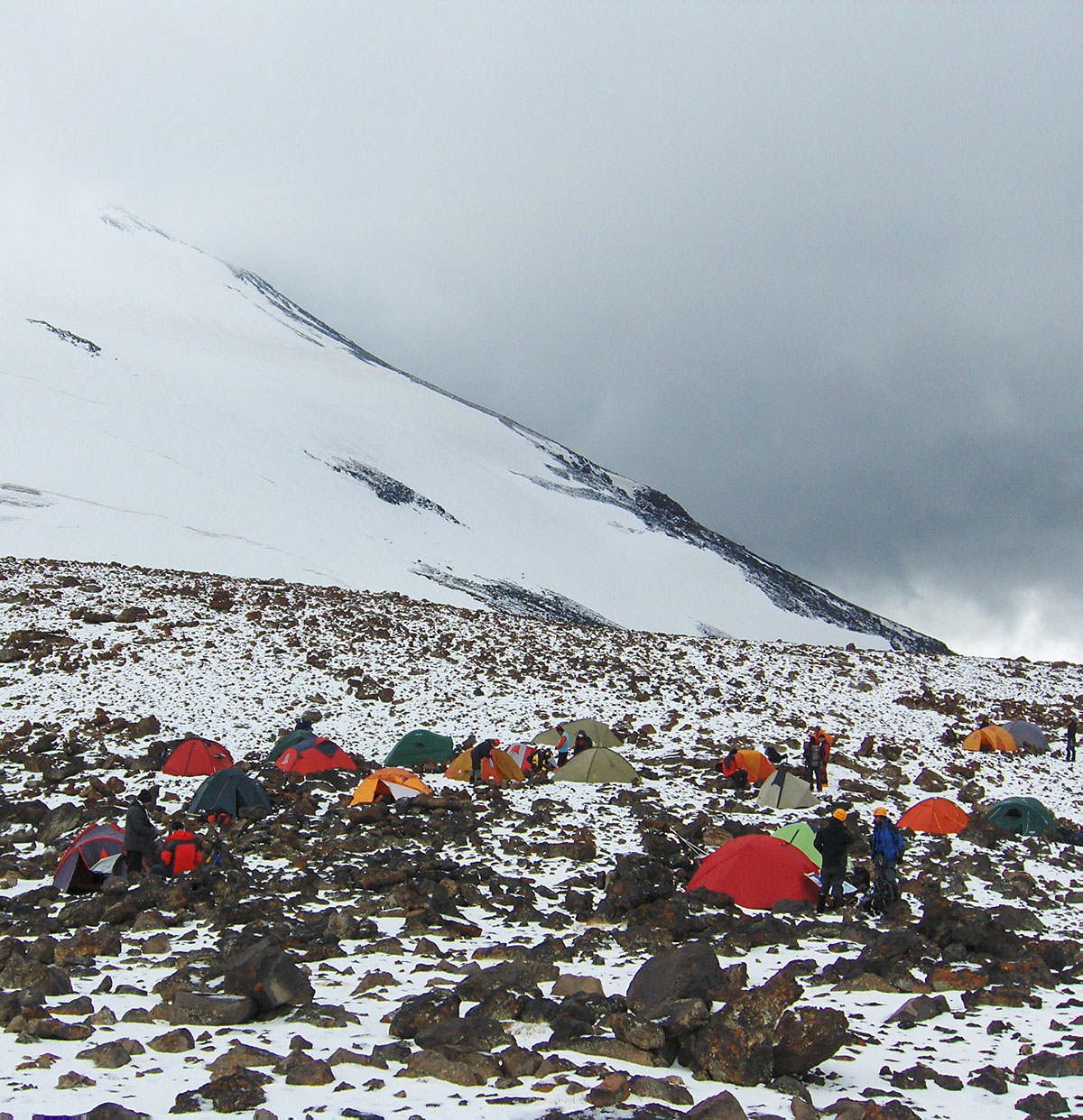
We set off at 09:00 AM. Due to the heavy loads, we climb at our own individual paces, dictated by our physical stamina. The route requires us to overcome a 750-meter elevation gain over approximately 4 hours. The terrain is demanding, consisting of rugged karst with massive boulders broken off from the cliffs that loom above us throughout the ascent. We move with caution to avoid triggering any rockfalls. At 01:00 PM, we emerge onto the crest of a near-vertical cliff where a small, flat plateau awaits. On this ledge, like an “eagle's nest,” we establish Camp 3 (4,150 m a.s.l.). From this vantage point, a wide view stretches across the borderlands of Türkiye and Armenia.
Just as we finish pitching our tents, a storm hits—initially marked by loud thunder and flashes of lightning, followed by a heavy snow squall. We quickly retreat into our tents to wait it out. Fortunately, it lasts only about half an hour before the sky clears and the sun breaks through the clouds again. After lunch and some rest, we head to a nearby stream formed by melting snow to collect enough water for the rest of the day and tomorrow's summit push.
At 04:30 PM, we head out for an acclimatization hike, reaching an elevation of 4,300 m a.s.l., returning to Camp 3 by 06:00 PM. In total, we spent 5 hours and 30 minutes hiking today, with a 900-meter total ascent and a 150-meter descent.
After dinner, we pack our bags for tomorrow’s final push. The stars and gentle moonlight illuminate the sky above our camp—a reliable sign that fair weather awaits us for the summit. Joyful at this turn of events, we head to bed early, knowing a grueling day lies ahead.
August 30, 2009
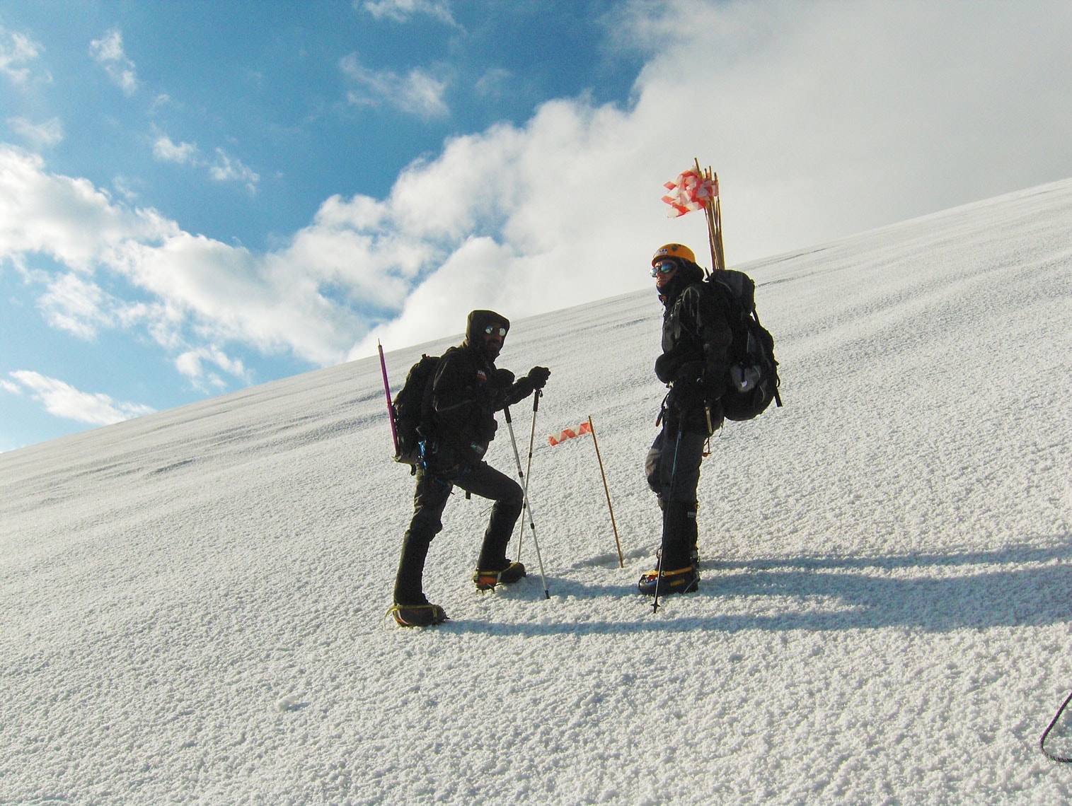
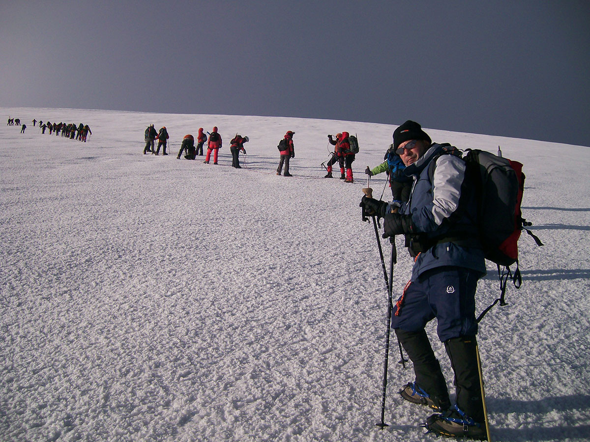
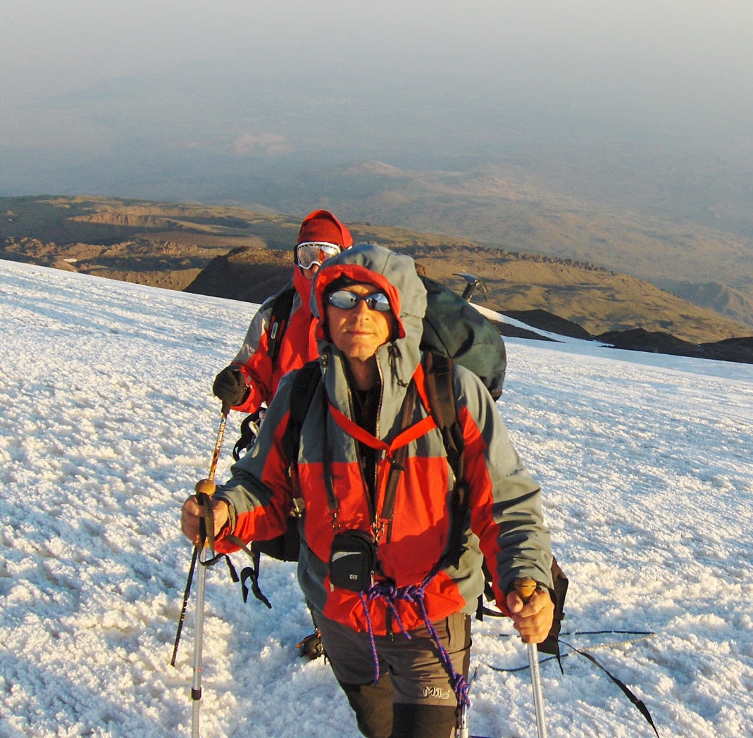
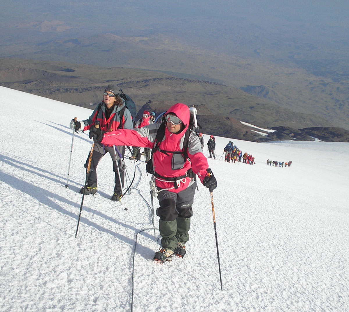
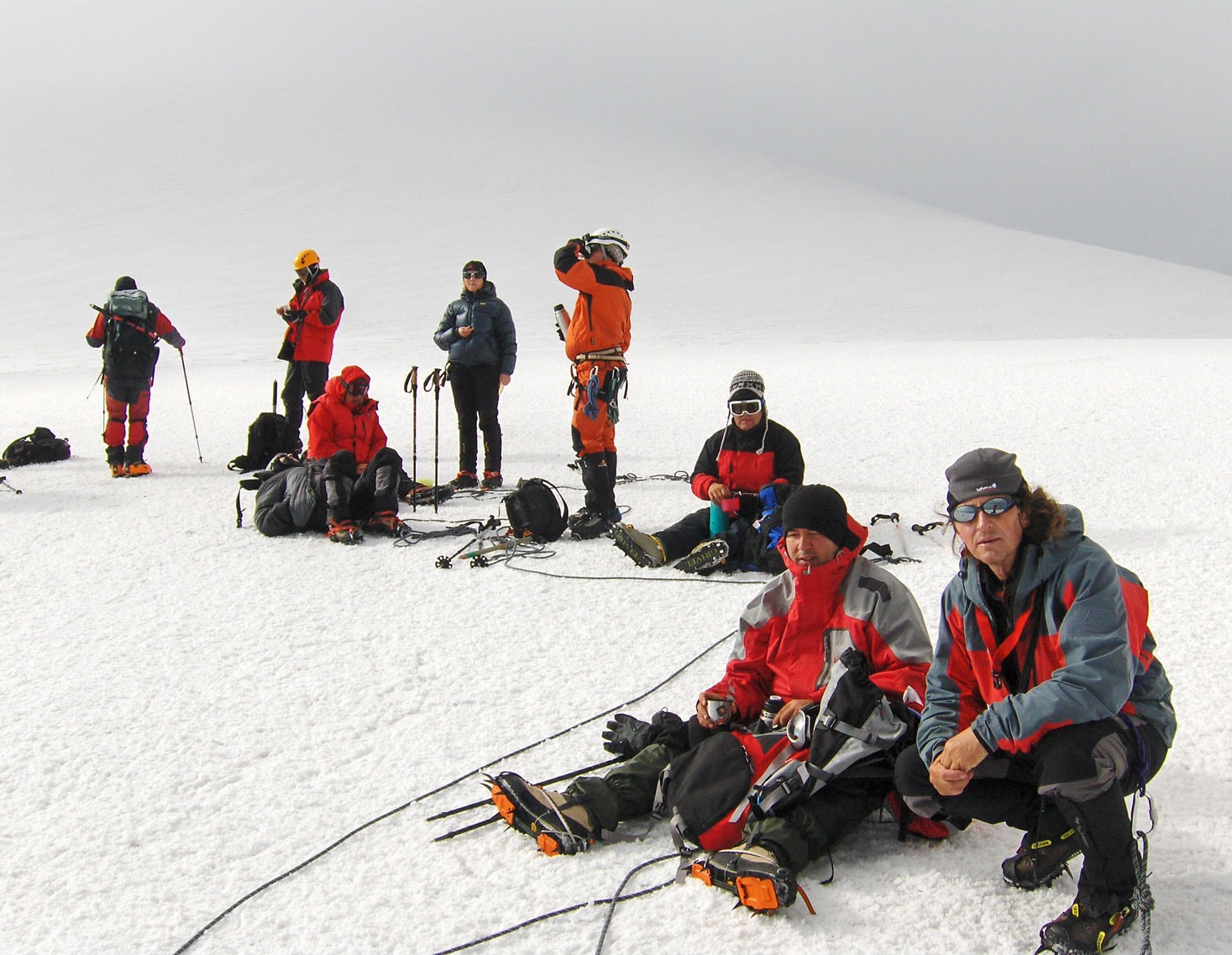
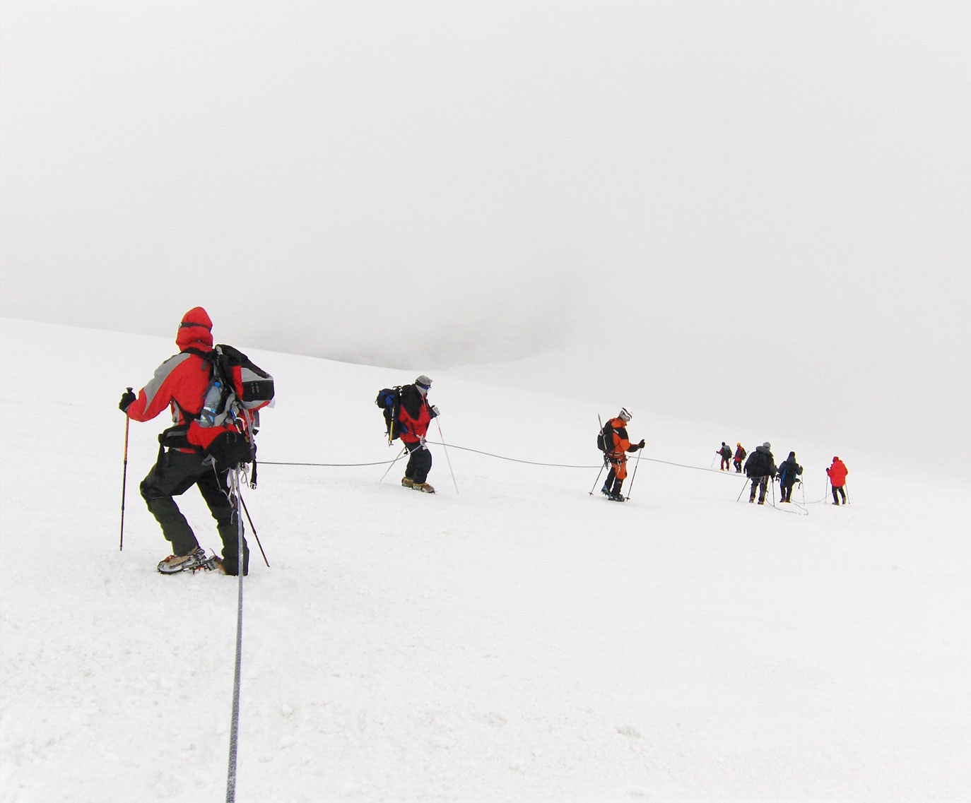
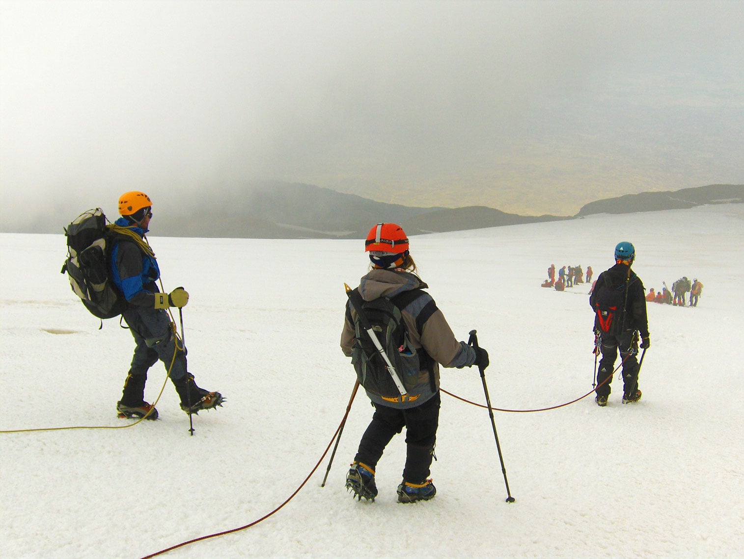
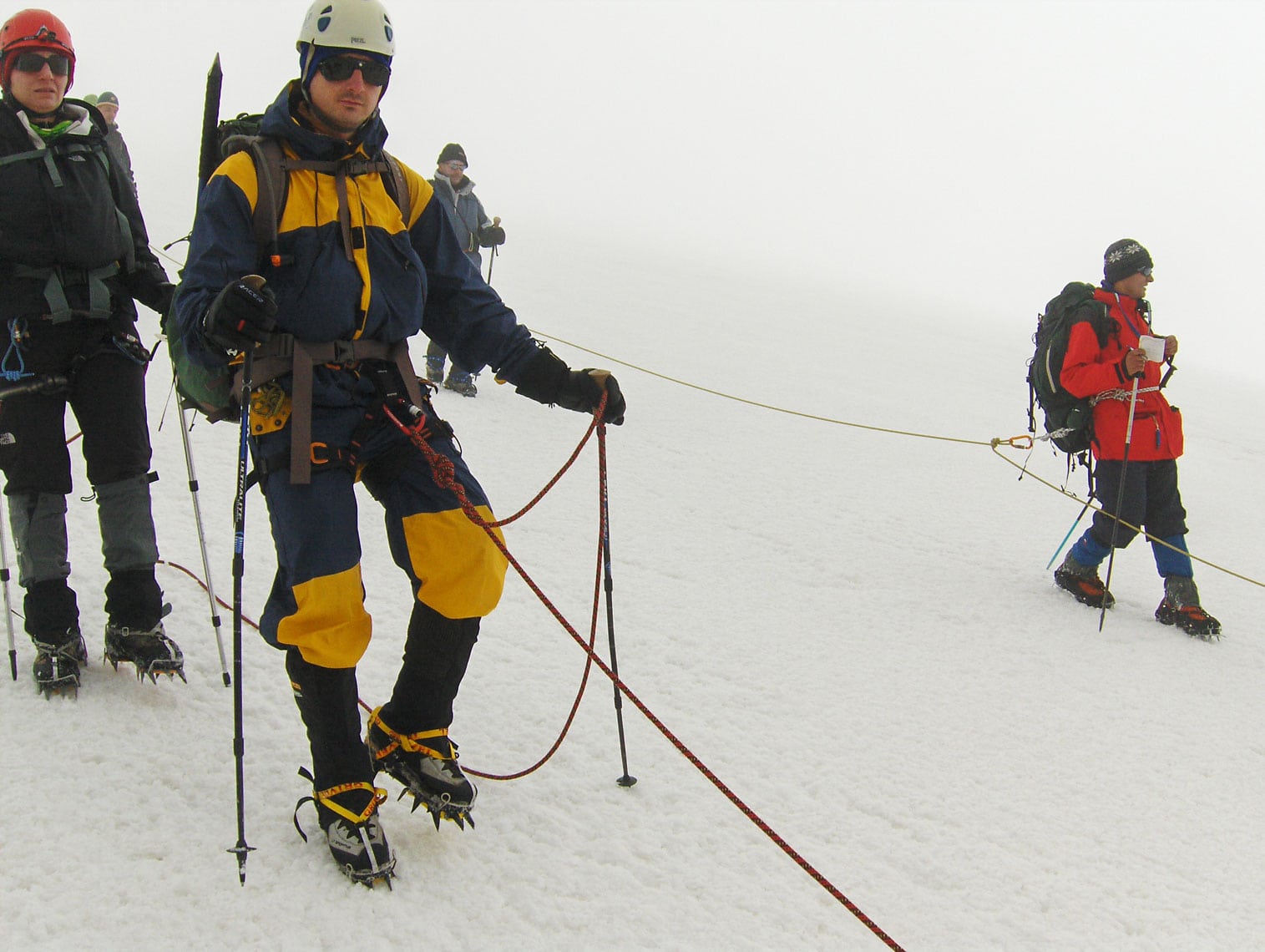
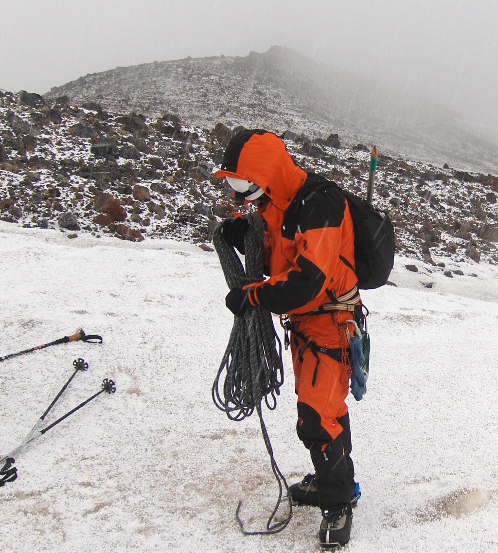
We wake up at 03:00 AM. After a final gear check to ensure our ice climbing equipment is ready, we set off at exactly 04:00 AM. Moving in a single-file line, the silence is broken only by the rhythmic sound of our footsteps. The moonlight is so intense that our headlamps are almost unnecessary. We soon reach the lower edge of the glacier at 4,200 m a.s.l., where we fix our crampons and rope up. I am joined in the rope team by a group from Macedonia: Živko Temelkovski (Skopje), Artan Luma, and Memet Memeti (Tetovo).
As we emerge onto the northwestern ridge at 4,500 m a.s.l., the morning sun greets us. To protect ourselves from the high-altitude rays, we apply high-factor sunscreen and put on our protective eyewear and hats. Everyone feels strong; we make only two brief 15-minute breaks on our way to the summit. It is warm and calm—conditions that often signal an incoming change in weather. Sure enough, at 5,000 m a.s.l., a thick fog rolls in and stays with us until the peak.
The Summit of Ararat
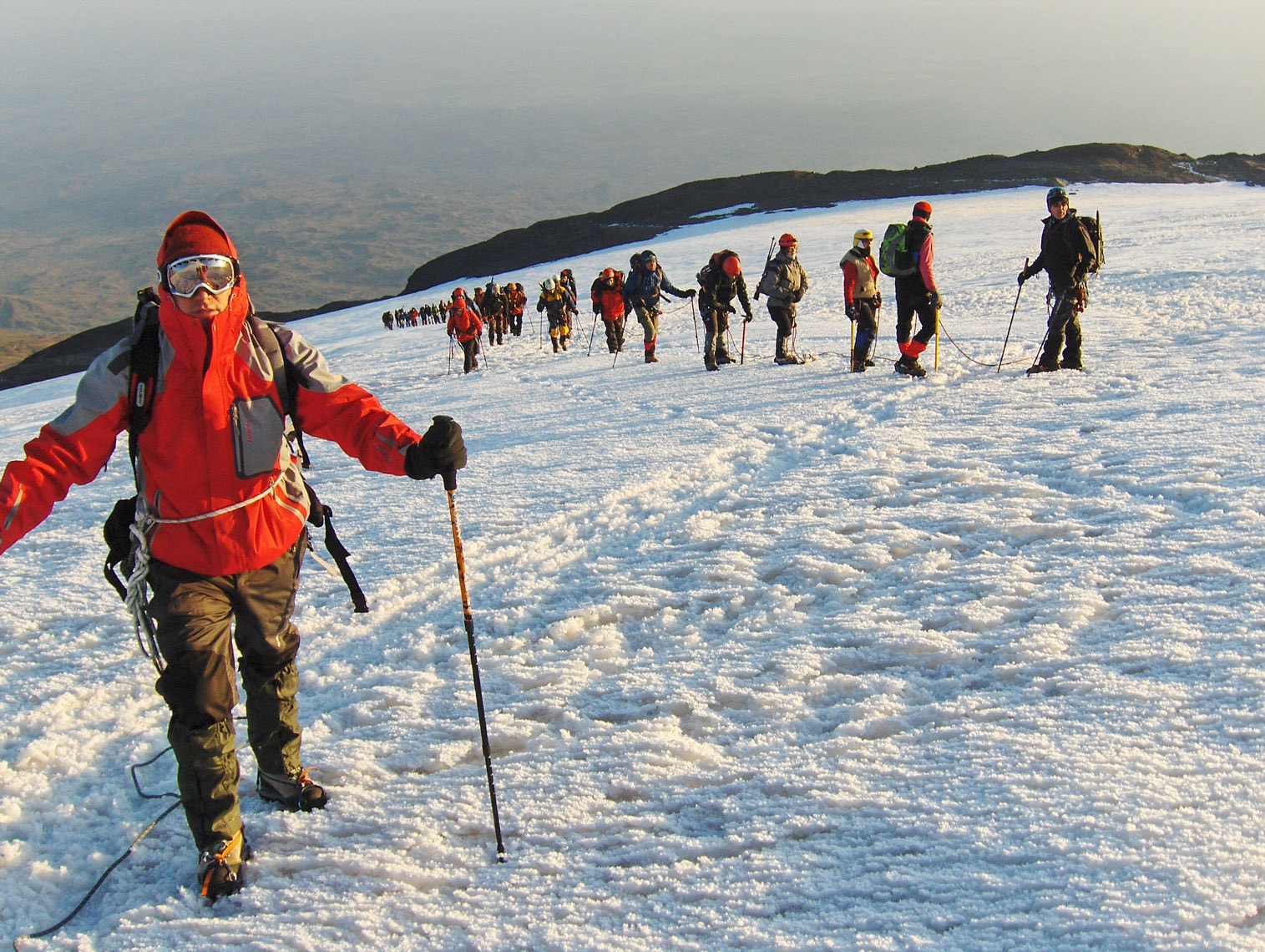
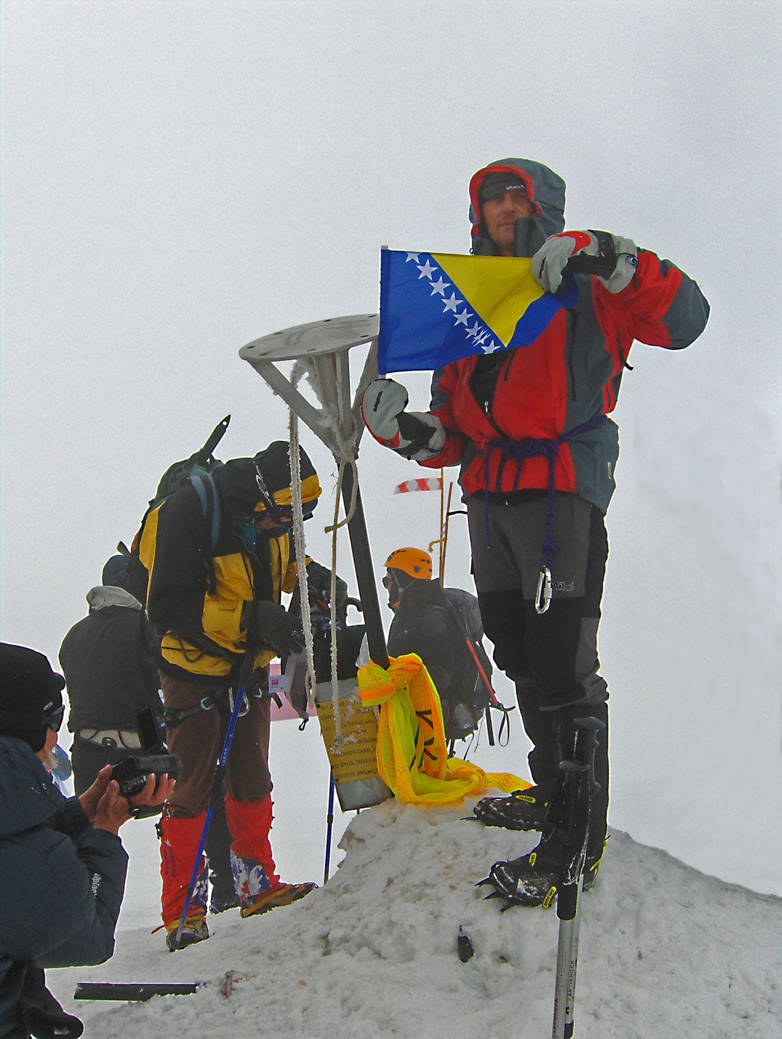
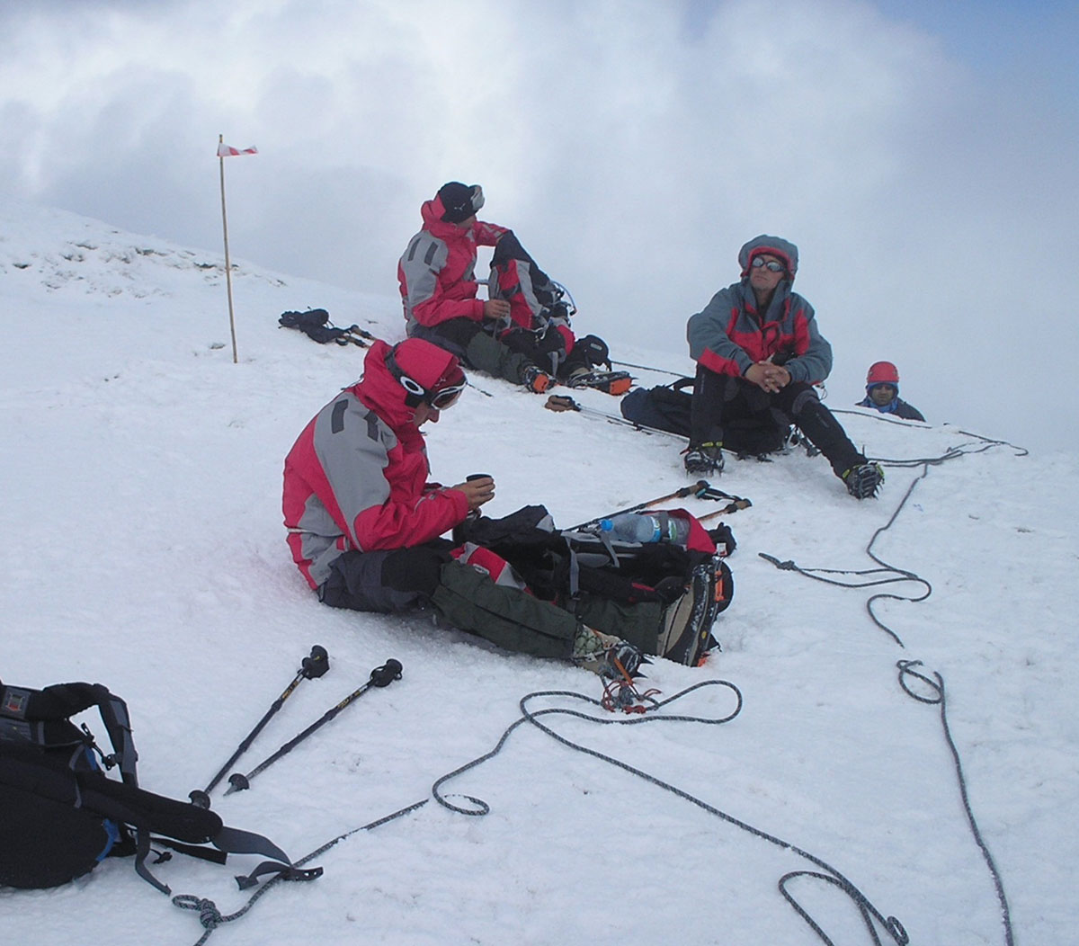
At 10:30 AM, after 6.5 hours of hiking and an elevation gain of 1,015 meters, we finally reach the highest point of Mount Ararat. Standing by the summit marker, our rope leader Živko simply says: “To je to” (That’s it). Congratulations and photos with national flags follow. Each of us has a reason to celebrate: for Živko, this is his tenth consecutive ascent; for Artan, Memet, and myself, it is our first time standing above 5,000 meters. A total of 51 mountaineers from 10 countries reached the summit today—a perfect success rate. As the Turks would say: Aferim! (Bravo!).
We stay at the summit for only 30 minutes. At 11:00 AM, we begin our descent back to Camp 3. Our guides’ decision to move early due to the shifting weather proves wise; as soon as we step off the glacier and remove our crampons, thunder roars and a heavy snowstorm begins. Within minutes, ten centimeters of fresh snow covers the ground.
We arrive at Camp 3 at 2:00 PM after a three-hour descent. After a short rest to regain our strength, we pack our heavy tents and gear for the long trek down to Camp 2. We reach Camp 2 at 7:00 PM after another three hours of hiking. Exhausted and with little appetite, we quickly prepare some tea and soup before heading to bed. It was a grueling day: 11.5 hours of trekking with a 987-meter ascent and a massive 1,737-meter descent.
August 31, 2009
We wake up at 07:00 AM, still feeling the fatigue from yesterday’s triumph. However, the pressure is gone; we no longer have to scan the sky or worry about the weather—the summit is “in the bag.” After breakfast, we pack our tents and gear into transport bags for the donkeys. As we suspected, the negotiation for the transport fee takes a turn; the price agreed upon four days ago has suddenly doubled. After some persistent bargaining, we reach a mutual agreement: 45.00 EUR per piece of luggage for the round trip. We set off at 09:45 AM and arrive back at Camp 1 by 01:45 PM. The descent took 4 hours, covering a vertical drop of 1,450 meters.
At the entrance to the gendarmerie barracks, we encounter the eldest son of our host, Ahmet Nas. He has come on horseback specifically to say goodbye. As a parting gift, we give him our remaining food and a gas burner with canisters. We are then treated to a final meal in the military mess hall—warm pita bread and cold, refreshing drinks.
By 05:00 PM, we are back in Iğdir. After days on the mountain, the simple luxuries of civilization—soap, shampoo, and a hot shower—feel incredible. At 08:00 PM, a formal ceremony is held at the Culture House, where each participant is personally awarded a certificate for the successful ascent of Ararat. To celebrate, nine of us from the former Yugoslav republics (Montenegro, Macedonia, Serbia, and Bosnia and Herzegovina) head to a local restaurant to toast our shared achievement.
Expedition Summary
The journey to Türkiye lasted 11 days (August 25 – September 4, 2009). The ascent via the northwestern ridge from the Korhan Plateau included:
- Duration: 4 days and 4 nights across 3 camps.
- Camps: K1 (1,950 m a.s.l.), K2 (3,400 m a.s.l.), and K3 (4,150 m a.s.l.).
- Trekking Time: 28 hours in total.
- Elevation Gain/Loss: 3,687 meters of total ascent and descent.
Following the climb, we spent the next four days exploring the cultural riches of Doğubayazit, Kars, the medieval Armenian city of Ani, and the magnificent city of Istanbul.


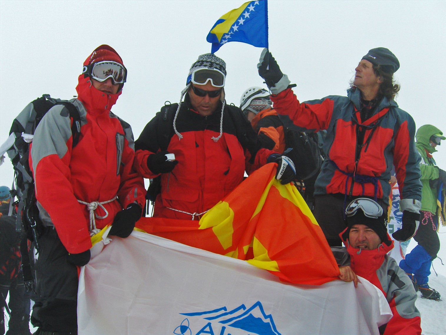


Cover Photo: At the summit of Greater Ararat / Büyük Ağrı Dağı (5,137 m a.s.l.): Živko Temelkovski, Artan Luma, Memet Memeti (Macedonia), and Braco Babić (Bosnia and Herzegovina).

